Wichita, Kansas
Weather Forecast Office
July 8th Landspouts
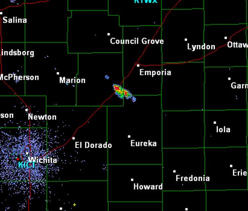
| A small thunderstorm developed over Barton County between 600pm and 630pm on July 8th and tracked slowly south. This storm developed in an environment with abundant low level instability along a surface boundary. These two conditions are favorable for the development of landspout tornadoes, which are weak tornadoes that are not formed through typical supercell processes. Instead of the thunderstorm having deep persistent rotation which may eventually form a tornado, a landspout producing storm encounters pre-existing low level rotation which its updraft stretches into a weak tornado. This small storm eventually produced a landspout tornado near the town of Seward. |
Radar image from around 630 pm showing the small storm which produced the landspout. |
|
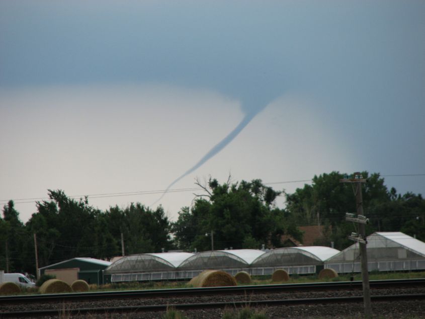
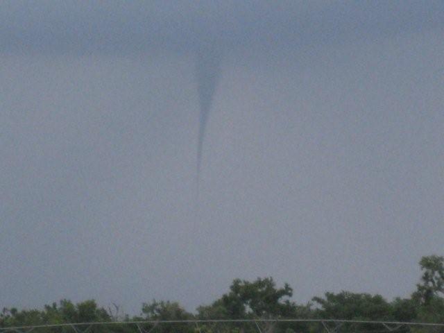
Picture of landspout near Seward. Picture taken by Kent and Paula Rixon and courtesy of KSN |
Picture of landspout near Seward. Picture taken by Kent and Paula Rixon and courtesy of KSN |
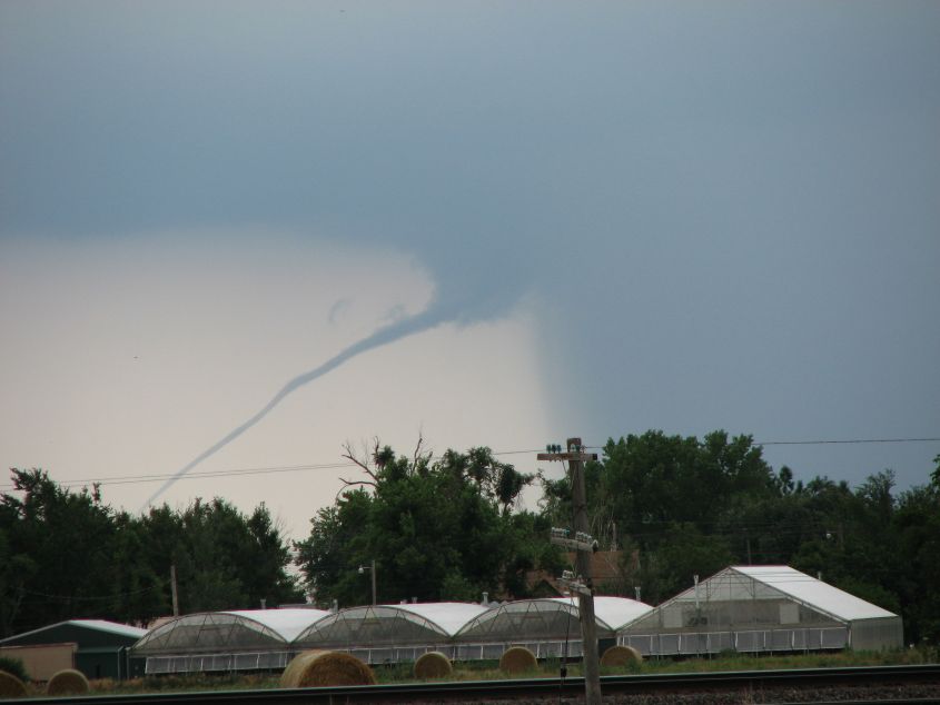
Picture of the landspout near Seward. Picture taken by Karen Loving and courtesy of KSN |
Picture of the landspout near Seward. Picture taken by Karen Loving and courtesy of KSN |
July 9th Landspouts
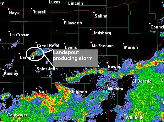
| The following day, July 9th, conditions were again favorable for thunderstorms producing landspout tornadoes. One small storm developed along the turnpike southwest of Emporia around 4 pm. This lone storm produced several funnels and a landspout. |
|
Radar image from around 4 pm on July 9th showing the small storm that produced a landspout tornado |
|
|
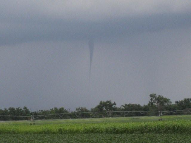
Photo taken by Jeff Sass and courtesy of KSN |
Photo taken by Jeff Sass and courtesy of KSN |
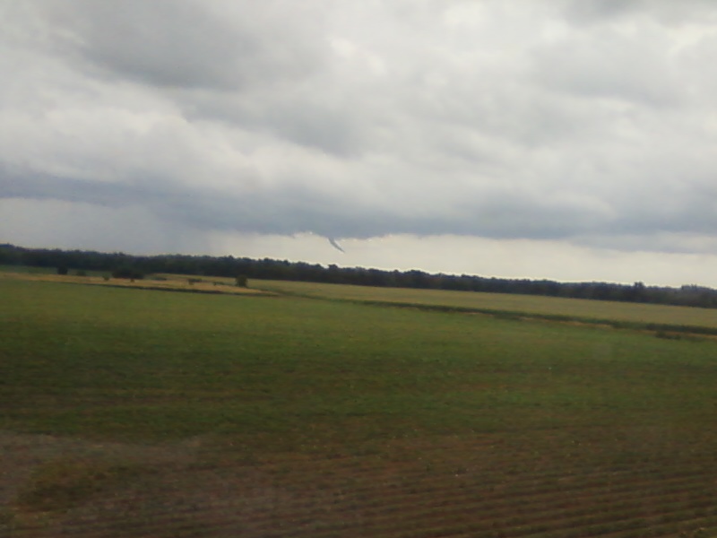
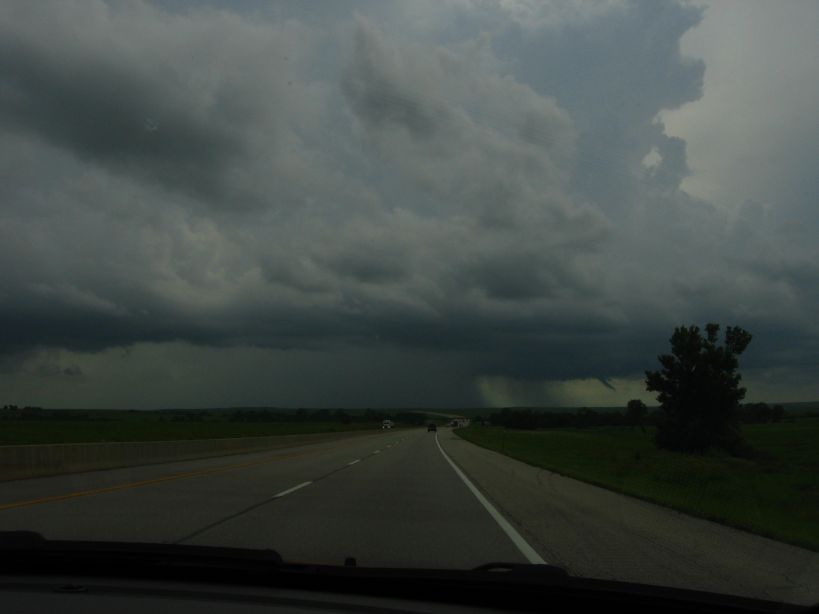
Photo taken by Curtis Wells near Bazaar, KS. |
|
Hazards
Briefing pages
Local weather story
Submit a storm report
Storm Prediction Center
Enhanced Hazardous Weather Outlook
Current Conditions
Local Radar
National Radar
Satellite
Hourly weather(text)
Precip Analysis
Snowfall analysis
This day in weather history
7 Day Lightning Archive
Forecasts
Forecast Discussion
Weather Story
Fire Weather
Activity Planner
Aviation Weather
Soaring Forecast
Hurricane Center
Graphical Forecasts
Regional Weather Summary
Probabilistic Snow
Probabilistic QPF
Wet Bulb Globe temp
Climate
Local Climate Page
Daily/Monthly data(F6)
Daily Records
Climate Normals
Local drought page
Latest Climate Report(ICT)
Latest Climate Report(SLN)
Latest Climate Report(CNU)
CoCoRaHS
7 Day Lightning Archive
US Dept of Commerce
National Oceanic and Atmospheric Administration
National Weather Service
Wichita, Kansas
2142 S. Tyler Road
Wichita, KS 67209-3016
316-942-3102
Comments? Questions? Please Contact Us.