Wichita, Kansas
Weather Forecast Office
During the evening of June 3rd, a strong bow echo entered Harper county about 8pm. This bow echo continued to move eastward with some new storms developing on the north side. These storms impacted a large portion of south central and southeastern Kansas.
Wind speeds reached upwards to 70 to 80 MPH as it moved eastward. Many communities had trees and power lines down from the winds and were without power. A school in Mulvane had roof damage and there was significant roof damage to the terminal building at Strother Field Airport near Winfield.
As the bow echo exited the area another storm developed over Cowley County dropping golf ball sized hail.
Radar images
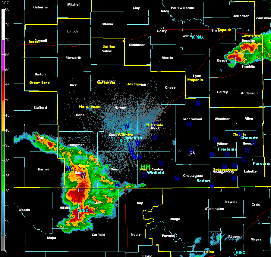 Radar Reflectivity showing the bow echo as it's moving through Harper County around 820pm. |
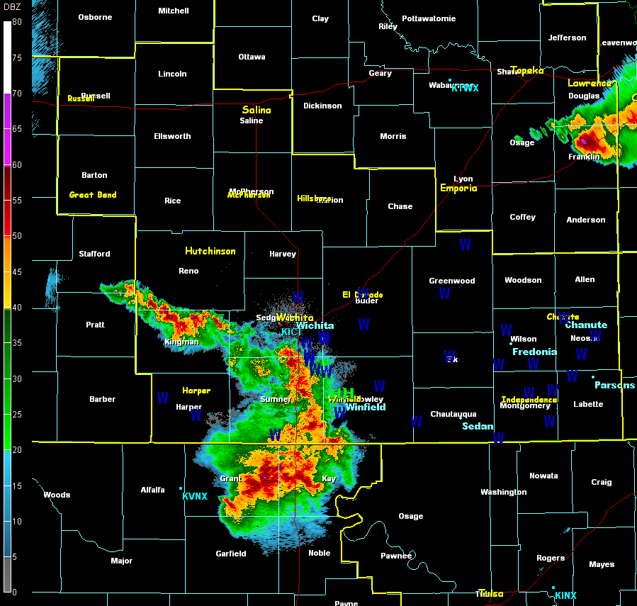 Radar Reflectivity around 9pm showing the bow echo as it's moving through Sumner County and just about to enter Cowley County. |
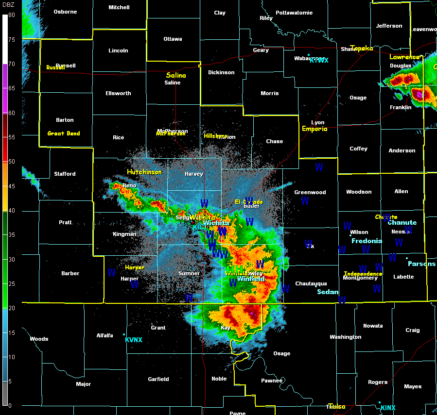 Radar Reflectivity around 9:30pm showing the bow echo as it's moving through Cowley County. |
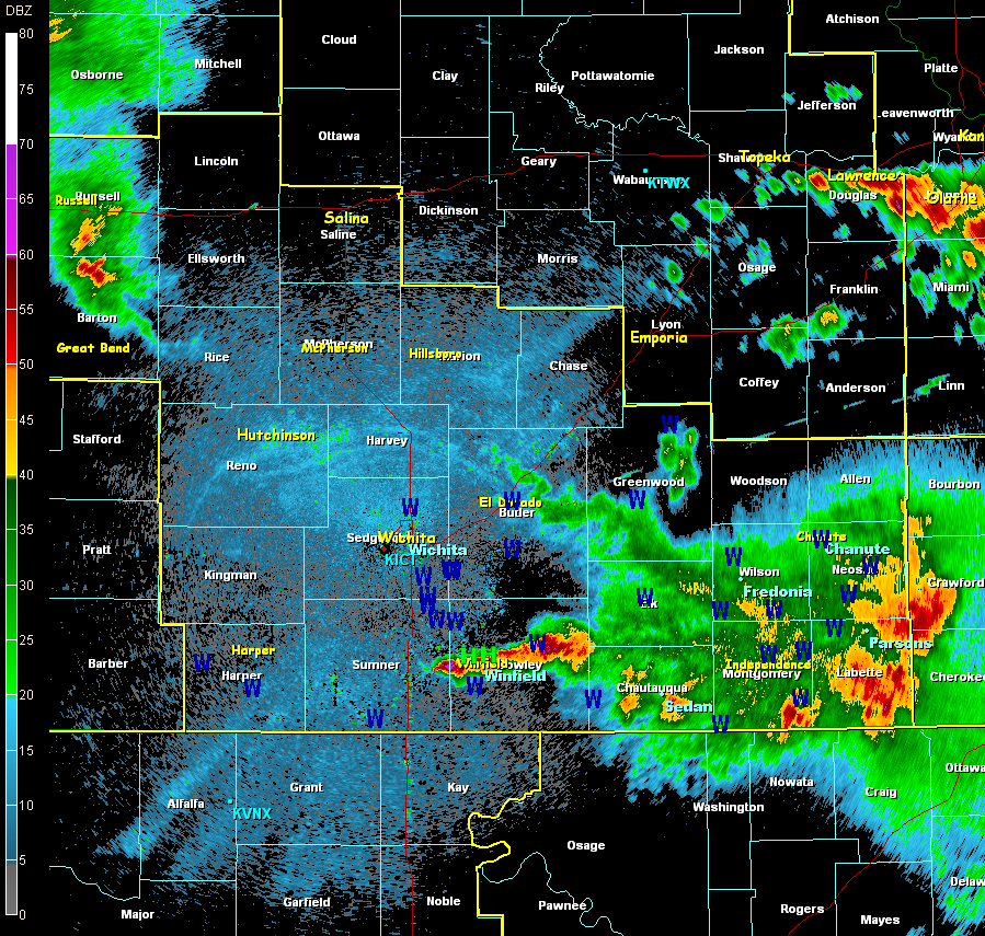 Radar Reflectivity around 11pm showing the storm over Cowley that produced golf ball sized hail. |
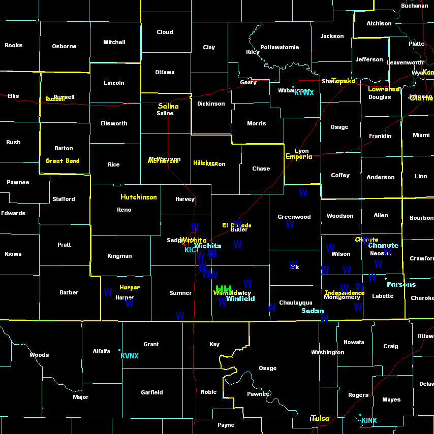
Storm reports
|
Storm reports over southern Kansas. Blue W's show severe wind reports and green H's show severe hail reports. |
Damage pictures
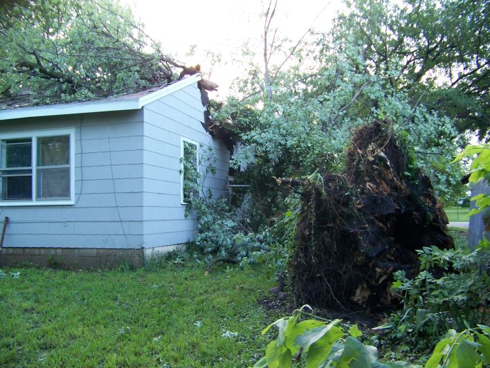 Straight line wind damage in Burden. Photo taken by Brian Stone. |
 Straight line wind damage in downtown Winfield. Photo taken by Brian Stone. |
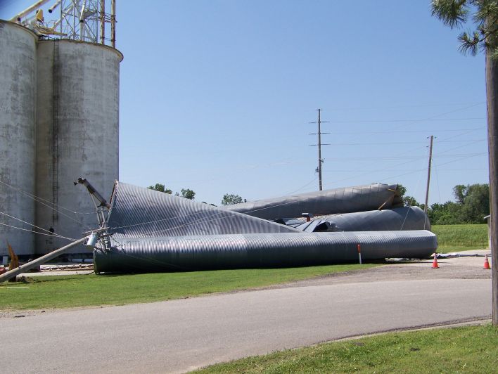 Straight line wind damage in Winfield. Photo taken by Brian Stone |
|
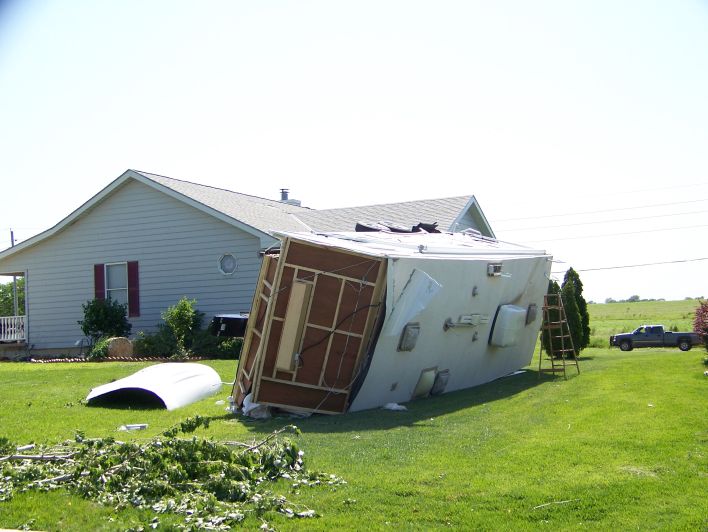 Straight line wind damage on the west side of Winfield. Photo taken by Brian Stone. |
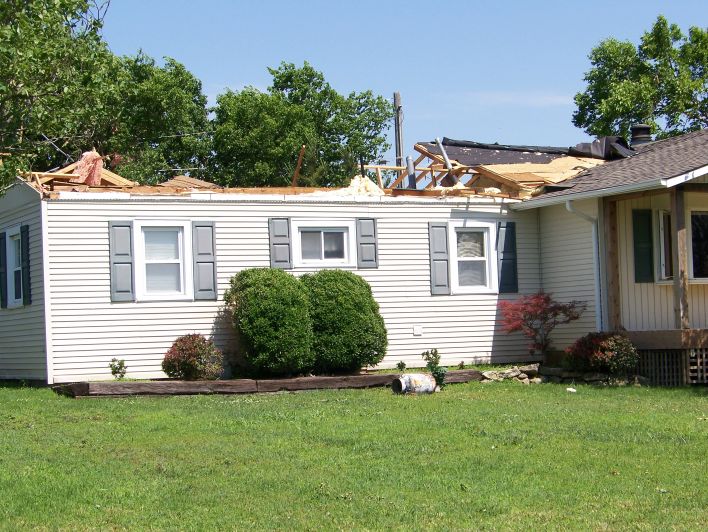
Straight line wind damage west of Winfield. Photo taken by Brian Stone. |
||
Hazards
Briefing pages
Local weather story
Submit a storm report
Storm Prediction Center
Enhanced Hazardous Weather Outlook
Current Conditions
Local Radar
National Radar
Satellite
Hourly weather(text)
Precip Analysis
Snowfall analysis
This day in weather history
7 Day Lightning Archive
Forecasts
Forecast Discussion
Weather Story
Fire Weather
Activity Planner
Aviation Weather
Soaring Forecast
Hurricane Center
Graphical Forecasts
Regional Weather Summary
Probabilistic Snow
Probabilistic QPF
Wet Bulb Globe temp
Climate
Local Climate Page
Daily/Monthly data(F6)
Daily Records
Climate Normals
Local drought page
Latest Climate Report(ICT)
Latest Climate Report(SLN)
Latest Climate Report(CNU)
CoCoRaHS
7 Day Lightning Archive
US Dept of Commerce
National Oceanic and Atmospheric Administration
National Weather Service
Wichita, Kansas
2142 S. Tyler Road
Wichita, KS 67209-3016
316-942-3102
Comments? Questions? Please Contact Us.