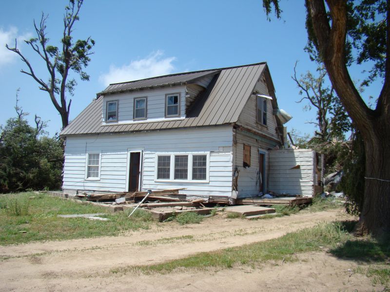
A second evening of rough weather crept across western Kansas before moving into the far western sections of NWS Wichita's forecast area. In all, three tornadoes touched down, 2 in Barton County and one in Reno county. The first tornado in Barton County struck a home just inside the county line off of SE 70 Rd. The home pretty much stayed intact, however, the winds were strong enough to push the home off of its foundation. We call this type of damage a "slider". Basically, the home is not secured to its foundation and when strong enough winds hit the home, it will slide off of the foundation and render it virtually useless. To go along with the home damage, a barn was completely destroyed.
Here are some images depicting the radar imagery
 Animated gif depicting the storm structure according to radar. |
 Animated gif depicted the winds within the storm. Areas where red and green are next to each other implies rotation. |
Tornado damage
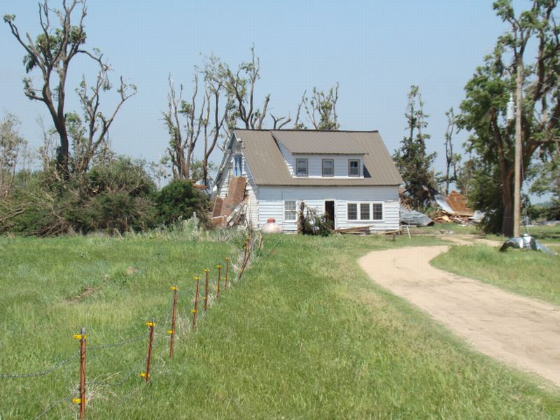 Homestead in southern Barton County. Image courtesy Barton County Emergency Management. |
 Side view of home. Image courtesy Barton County Emergency Management. |
 Damage to barn. Image courtesy Barton County Emergency Management. |
 Closer view of damage to barn. Image courtesy Barton County Emergency Management. |
A second tornado occurred about two miles north of this location and produced some minor damage to trees and power poles. The third and final tornado touched down near Partridge in Reno county. No damage occurred as the tornado touched down in an open field.
Impressive radar imagery of the supercell that moved across the county.
 Animated gif depicting the storm structure according to radar. Note the impressive hook echo, which implies very strong rotation. |
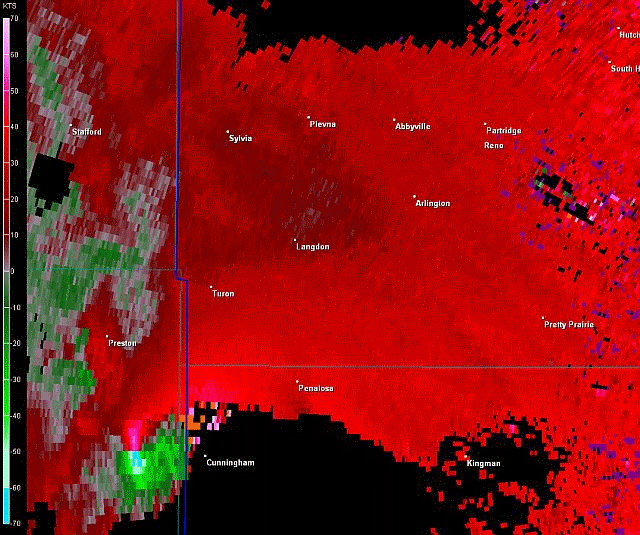 Animated gif depicted the winds within the storm. Areas where red and green are next to each other implies rotation. |
After the supercells had their way with the far western sections of Wichita's forecast area, a nice squall line moved across the southern sections of the area and produced small hail and winds less than 50 mph. However, plenty of rain fell, as amounts between 1 and 1.5 inches were common.

