During the evening of Monday April 7th, 2008 and the early morning hours of Tuesday, April 8th, thunderstorms developed and moved across much of Kansas, some of them becoming severe. A severe thunderstorm bow echo produced damaging straight line winds up to 90 - 100 MPH between midnight and 1am in Butler and Harvey counties. Images below are radar images of this small but powerful bow echo.
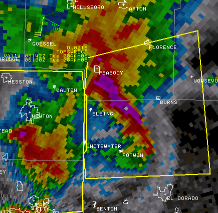 1257 AM CDT Radar image showing the bow echo as it moves through northen Butler County producing 90-100 MPH winds. |
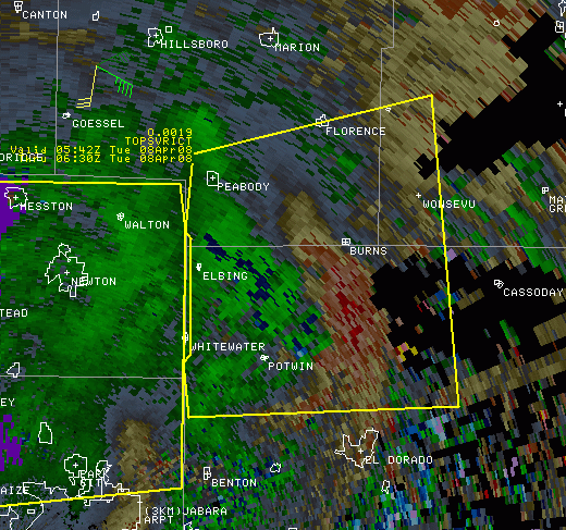 1256 AM CDT Radar Velocity image. The red colors show the damaging surface winds moving northeast through northern Butler County. |
Straight line damaging winds followed the I-35 turnpike in a line from 5 north of El Dorado to 1 north of Cassoday. The winds blew tractor trailers off of the turnpike, some with injuries. The wind damage also included numerous downed power lines, damage to numerous outbuildings, and some homes and manufactured homes.
 Radar animation from 1240 to 130 AM CDT showing the evolution of the bow echo (storm that is over Newton at the beginning of the loop). This bow echo caused major straight line wind damage in north central Butler county. Local Storm Wind Reports (blue W) are plotted for the entire event. |
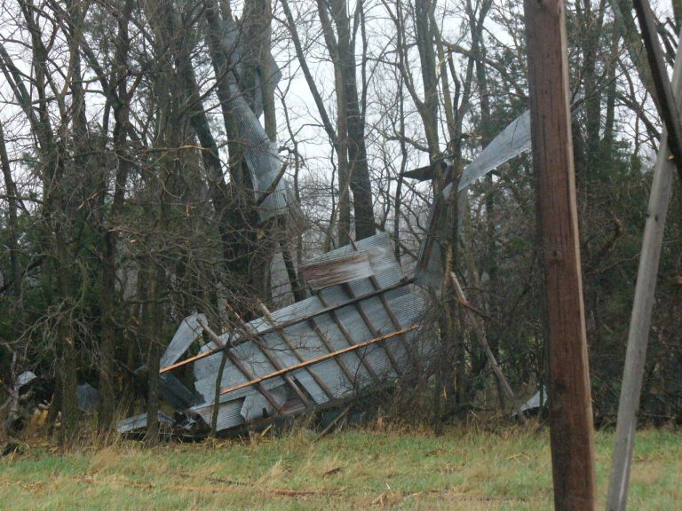
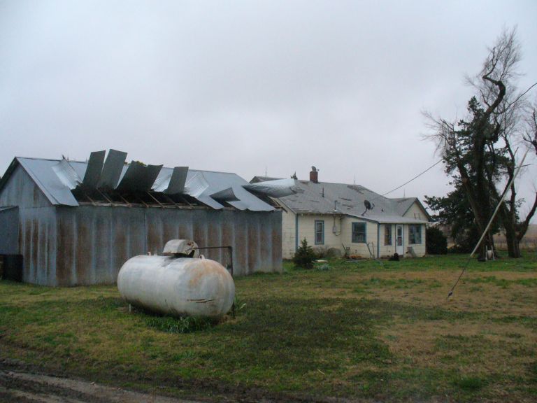
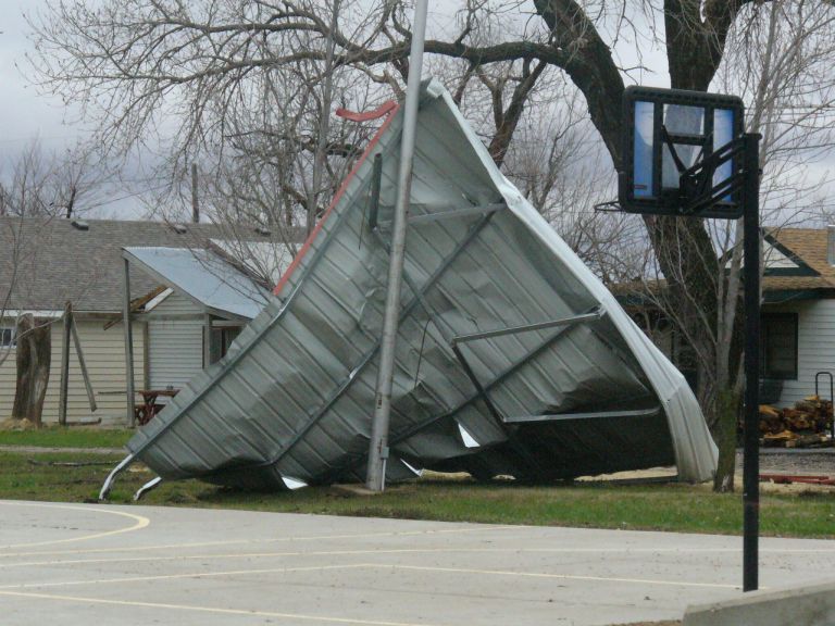
The following images are of damage across Northern Butler County.
 Straight line wind damage about 4 miles north of El Dorado near the intersection of NW 75th and Highway 77. |
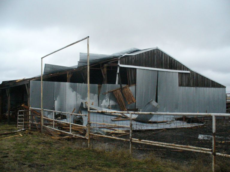
 Straight line wind damage about 7 miles north of El Dorado along NW Pickerell. |
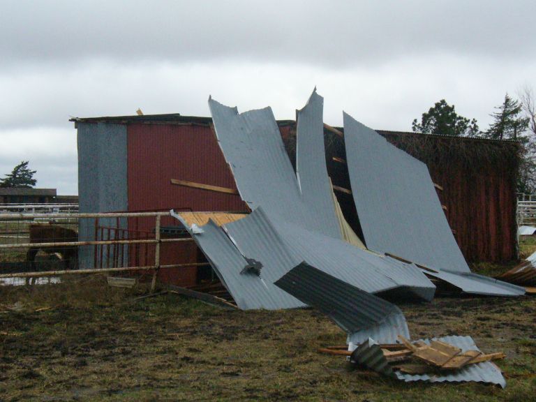
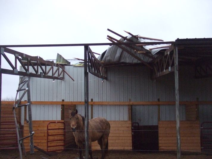
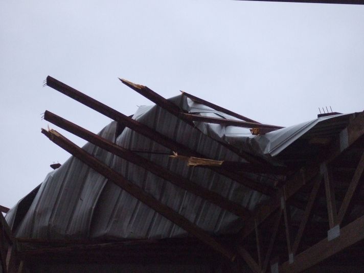
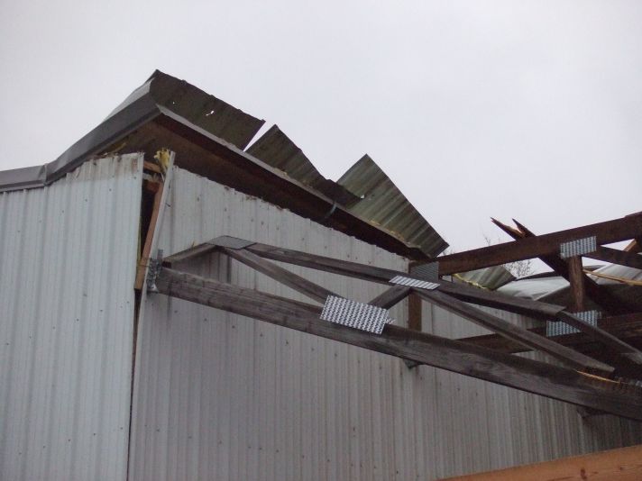
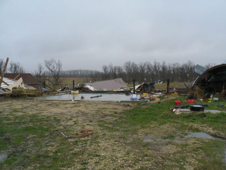 Straight line wind damage about 3 miles southeast of Burns |
|
 Straight line wind damage about 3 miles southeast of Burns |
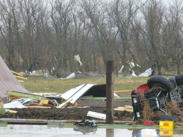
 Straight line wind damage about 3 miles southeast of Burns |
 Straight line wind damage about 3 miles southeast of Burns |
|
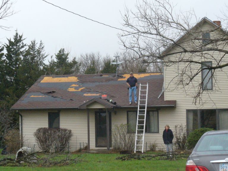
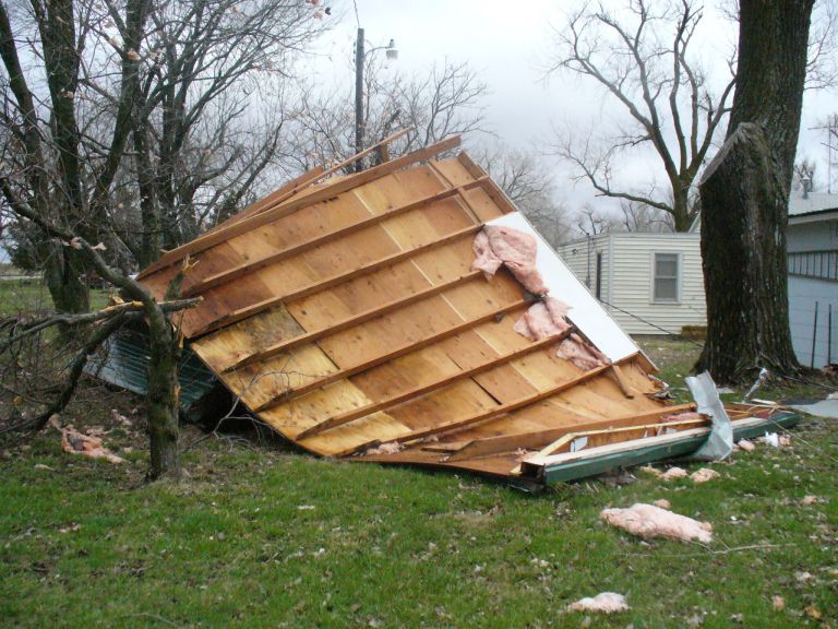
 Straight line wind damage about 2 1/2 miles north of Cassoday. |
 Straight line wind damage about 2 1/2 miles north of Cassoday. |
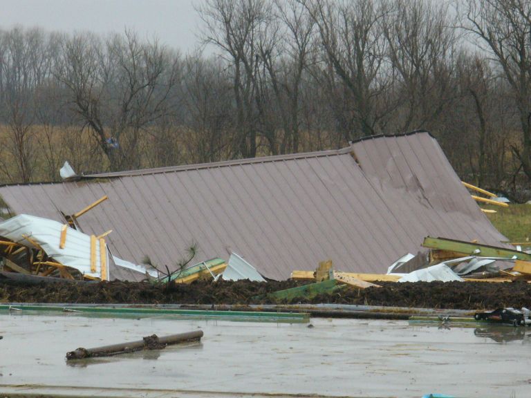
 Straight line wind damage 1 miles east of Cassoday at Fox Lake. |
|
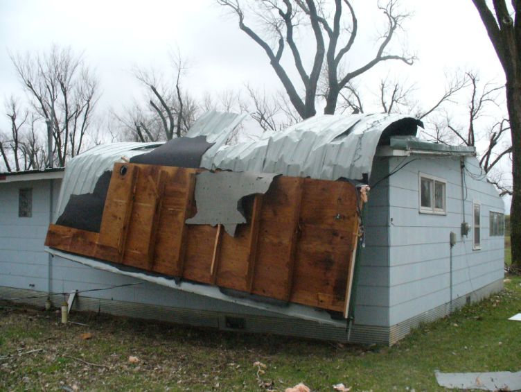 Straight line wind damage 1 miles east of Cassoday at Fox Lake. |
 Straight line wind damage 1 miles east of Cassoday at Fox Lake. |
||
The images below are from damage in northern Sedgwick County:
 Straight line wind damage from just east of Bentley. |
 Straight line wind damage from just east of Bentley. |
 Straight line wind damage from just east of Bentley. |
Click here to view the Local Storm Reports from this event.

