Wichita, Kansas
Weather Forecast Office
An intense supercell developed southwest of Greensburg Kansas around sunset on May 4th. After causing extreme damage in Greensburg Kansas, the storm tracked slowly northeast and eventually affected Barton, Rice and Ellsworth Counties after midnight. This storm produced tornadoes across Barton and Rice counties which caused major damage to trees and a minor damage to a few homes.
 |
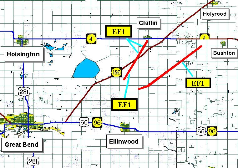 |
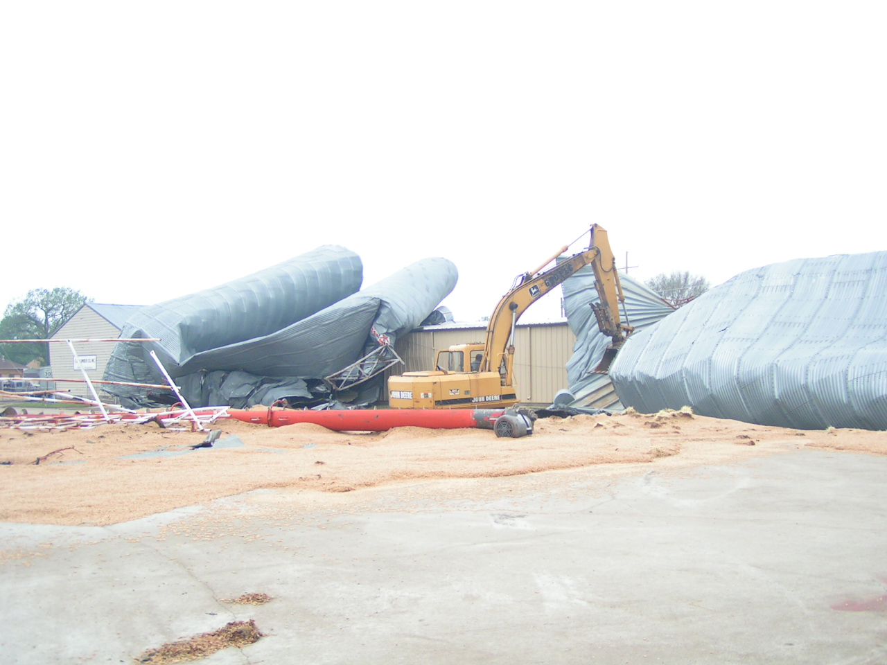
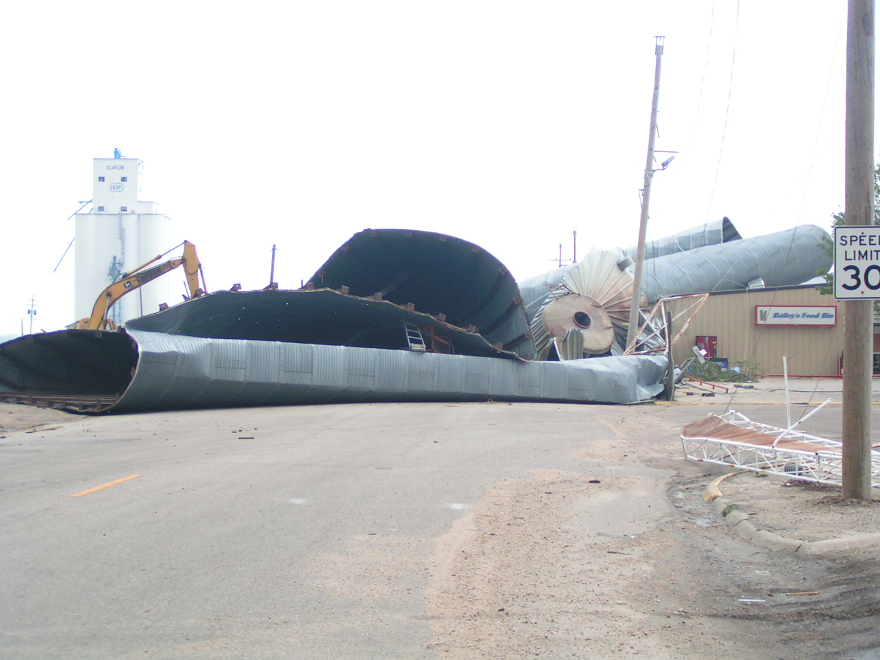
Radar imagery showed a pair of storm relative velocity couplets (inbound winds right next to outbound winds) as they moved northeast across the county. Fortunately, the tornado that was bearing down on Main St. in Claflin lifted just outside of town. The damage to the grain bins and trees across the small community were due straight line winds produced from the rear flank downdraft.
 |
 |
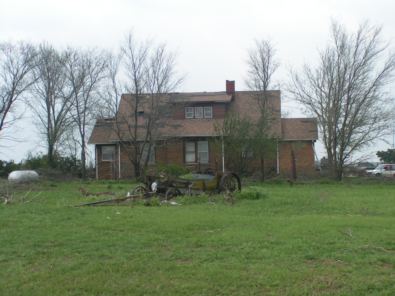
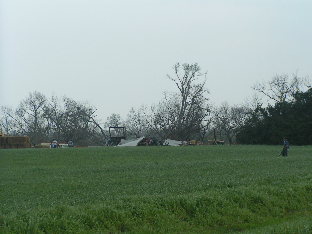
However, homesteads to the southwest of Claflin did not fair quite as well. Images below are of a house approximately 1 1/2 miles SW of Claflin that received some minor damage to the roof. The barn that was situated just to the west sustained major damage. Image 6 shows a barn that was completely destroyed by the tornado. This location was about 2.5 miles SW of Claflin.
|
|
 |
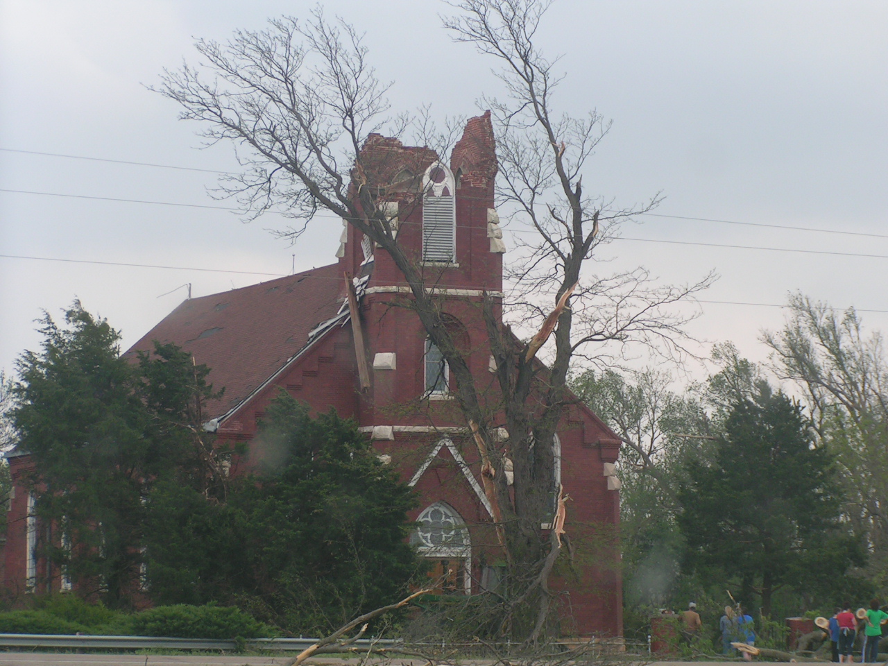 What is left of a church steeple located about 6 miles SSW of Claflin. This was the easternmost tornado and seemed to almost move due east at the beginning as it cycled up, before moving on to the northeast into Rice county. |
Both tornadoes were given the rating of EF1 on the new Enhanced FujitaScale.
Hazards
Briefing pages
Local weather story
Submit a storm report
Storm Prediction Center
Enhanced Hazardous Weather Outlook
Current Conditions
Local Radar
National Radar
Satellite
Hourly weather(text)
Precip Analysis
Snowfall analysis
This day in weather history
7 Day Lightning Archive
Forecasts
Forecast Discussion
Weather Story
Fire Weather
Activity Planner
Aviation Weather
Soaring Forecast
Hurricane Center
Graphical Forecasts
Regional Weather Summary
Probabilistic Snow
Probabilistic QPF
Wet Bulb Globe temp
Climate
Local Climate Page
Daily/Monthly data(F6)
Daily Records
Climate Normals
Local drought page
Latest Climate Report(ICT)
Latest Climate Report(SLN)
Latest Climate Report(CNU)
CoCoRaHS
7 Day Lightning Archive
US Dept of Commerce
National Oceanic and Atmospheric Administration
National Weather Service
Wichita, Kansas
2142 S. Tyler Road
Wichita, KS 67209-3016
316-942-3102
Comments? Questions? Please Contact Us.