Wichita, Kansas
Weather Forecast Office
Yes, they are rare, but Thursday was proof that April snowstorms do occur in Kansas now and then.
A fast moving storm system produced a heavy, late season snowfall across portions of central, south-central and southeast Kansas during the afternoon hours of Thursday, April 5th. To the naked eye, the storm system did not appear all that impressive. However, a closer inspection of the data revealed a narrow zone of intense lift that produced 6 to 8 inches of snow from western Saline County, through eastern McPherson County, and into southwest Marion County.
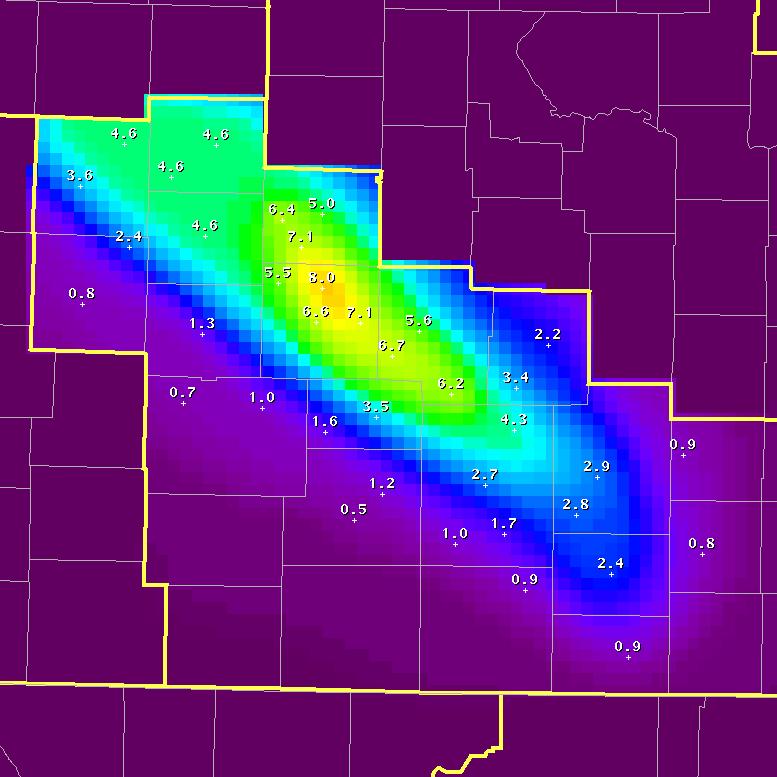 Storm accumulation map of Central, South-Central and Southeast Kansas. |
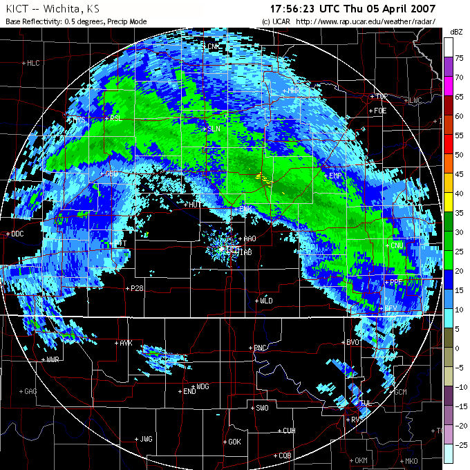 1 pm radar image. |
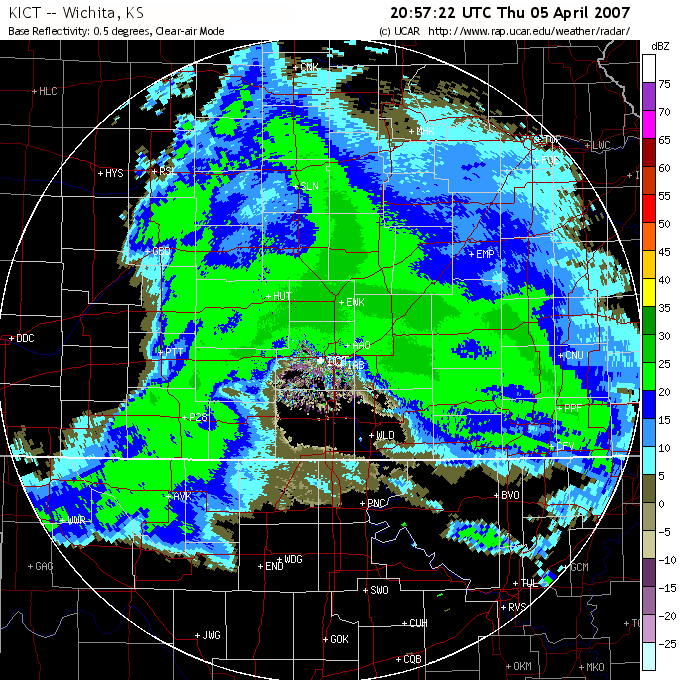 4 pm radar image. |
Snow storms of this magnitude across Central, South-Central and Southeast Kansas are fairly rare this late in the season, and have occurred only handful of times over the past several decades. For example, the 8 inches that fell at Lindsborg was the 2nd highest April daily snowfall total since 1905 (8.5 inches occurred on 4/8/1938). Similar results occurred at Salina. The 5 inches that accumulated was the 2nd highest April daily total since 1949 (7 inches occurred on 4/1/1970). Even Howard down in Elk County got into the action, with 2 inches accumulating. This tied the 4th highest April daily total set on 4/4/1979.
Hazards
Briefing pages
Local weather story
Submit a storm report
Storm Prediction Center
Enhanced Hazardous Weather Outlook
Current Conditions
Local Radar
National Radar
Satellite
Hourly weather(text)
Precip Analysis
Snowfall analysis
This day in weather history
7 Day Lightning Archive
Forecasts
Forecast Discussion
Weather Story
Fire Weather
Activity Planner
Aviation Weather
Soaring Forecast
Hurricane Center
Graphical Forecasts
Regional Weather Summary
Probabilistic Snow
Probabilistic QPF
Wet Bulb Globe temp
Climate
Local Climate Page
Daily/Monthly data(F6)
Daily Records
Climate Normals
Local drought page
Latest Climate Report(ICT)
Latest Climate Report(SLN)
Latest Climate Report(CNU)
CoCoRaHS
7 Day Lightning Archive
US Dept of Commerce
National Oceanic and Atmospheric Administration
National Weather Service
Wichita, Kansas
2142 S. Tyler Road
Wichita, KS 67209-3016
316-942-3102
Comments? Questions? Please Contact Us.

