Wichita, Kansas
Weather Forecast Office
|
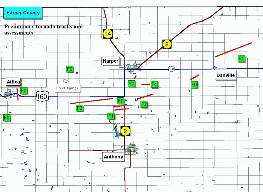
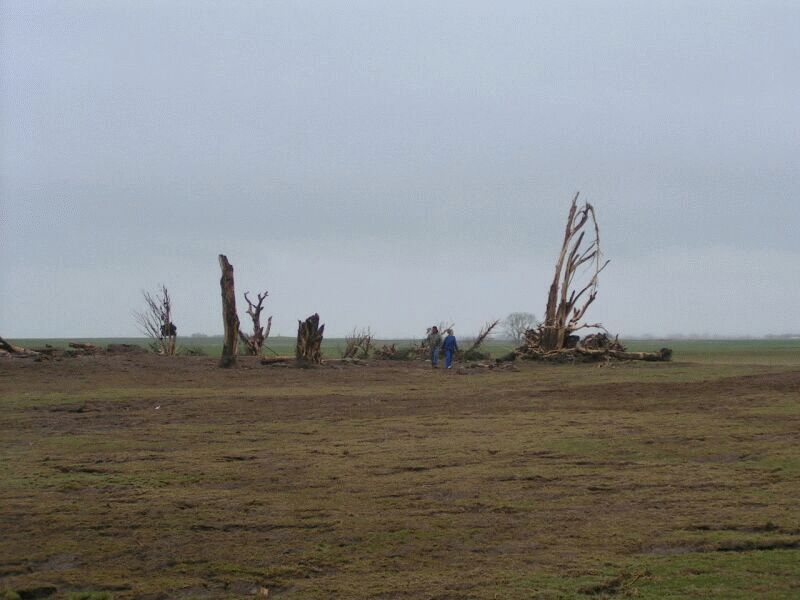
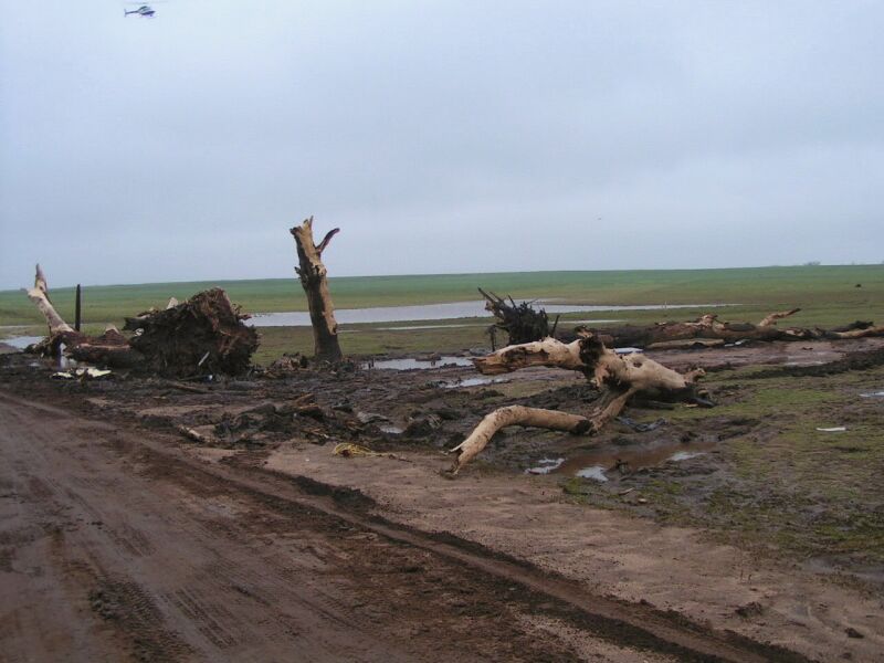
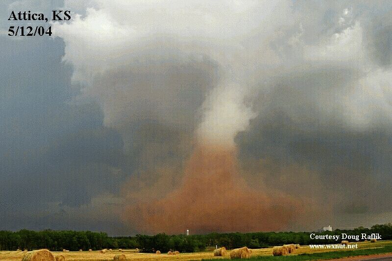
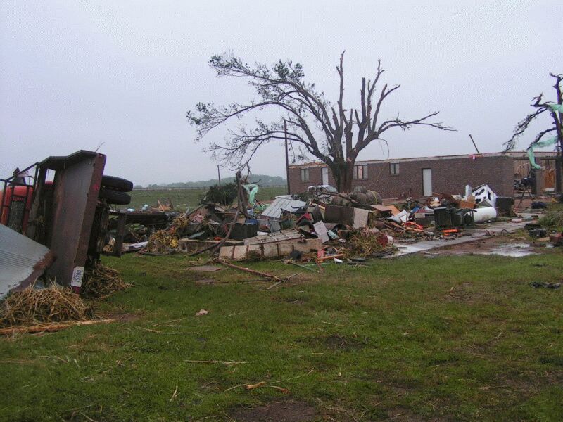
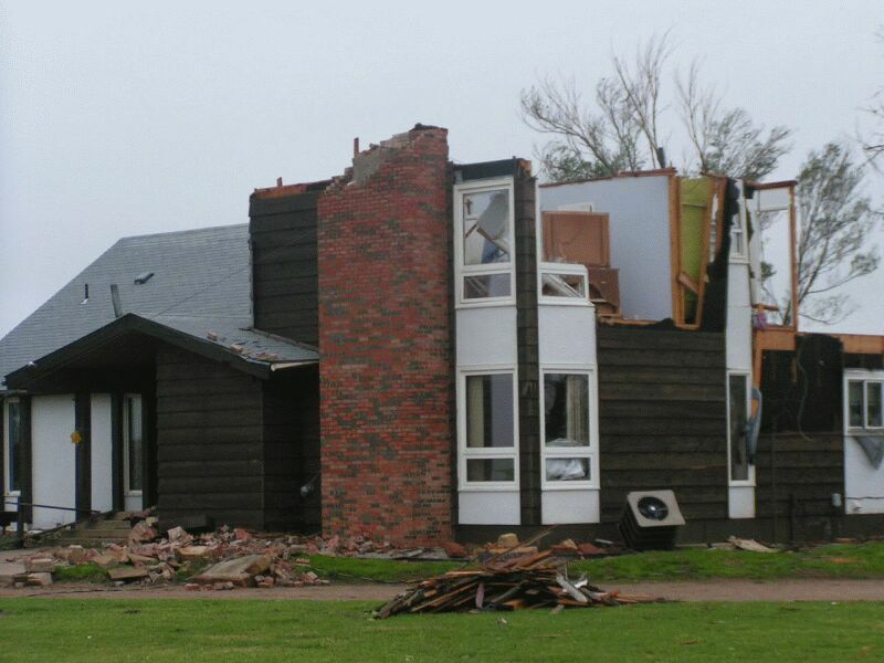
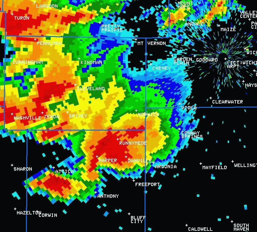
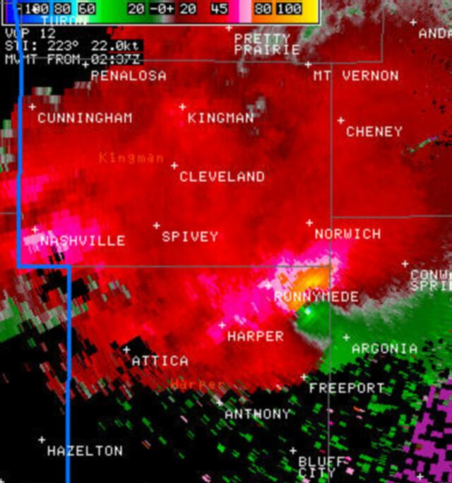
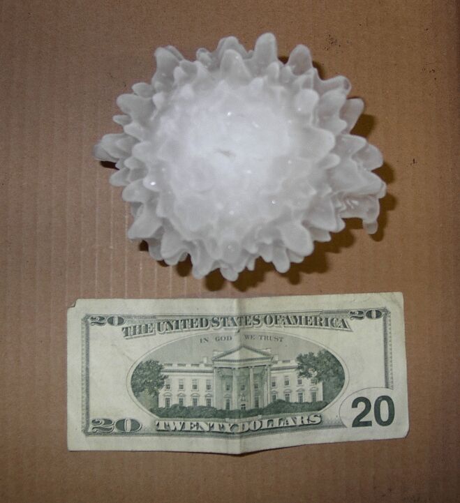
May 12th, 2004 may become one of the more memorable days for several people across Kansas and across the nation. The National Weather Service in Wichita, KS has officially documented, assessed, and tracked 11 tornadoes across the central portions of Harper County. The two residents of the home were seeking refuge in their basement at the time the tornado ravaged their home. After looking at all of the debris that had collected in the basement, it was a miracle that only a minor injury was sustained. The basement had filled with copious amounts of debris that included two debarked trees, an automobile engine, a refrigerator, and several other unidentifiable objects. More F2 damage occurred just about one mile south of the location that received F4 damage.
|
|||||||||||||||||||
Hazards
Briefing pages
Local weather story
Submit a storm report
Storm Prediction Center
Enhanced Hazardous Weather Outlook
Current Conditions
Local Radar
National Radar
Satellite
Hourly weather(text)
Precip Analysis
Snowfall analysis
This day in weather history
Forecasts
Forecast Discussion
Weather Story
Fire Weather
Activity Planner
Aviation Weather
Soaring Forecast
Hurricane Center
Graphical Forecasts
Regional Weather Summary
Probabilistic Snow
Probabilistic QPF
Wet Bulb Globe temp
Climate
Local Climate Page
Daily/Monthly data(F6)
Daily Records
Climate Normals
Local drought page
Latest Climate Report(ICT)
Latest Climate Report(SLN)
Latest Climate Report(CNU)
CoCoRaHS
US Dept of Commerce
National Oceanic and Atmospheric Administration
National Weather Service
Wichita, Kansas
2142 S. Tyler Road
Wichita, KS 67209-3016
316-942-3102
Comments? Questions? Please Contact Us.