May 8th 2003 Flint Hills tornadoes
|
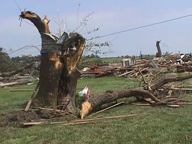
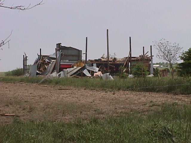
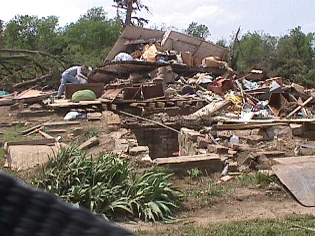
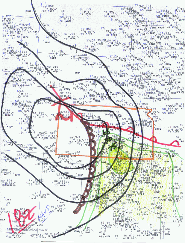
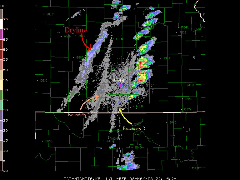
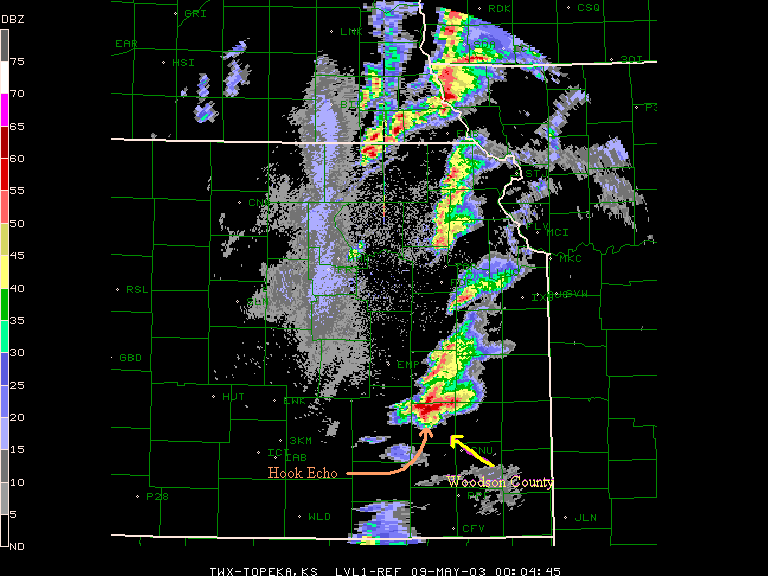
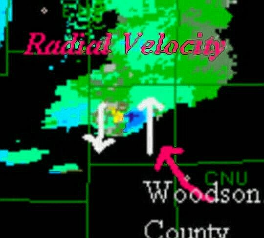
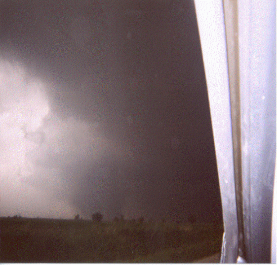
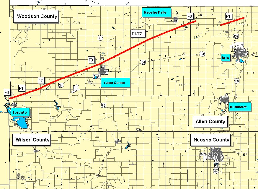
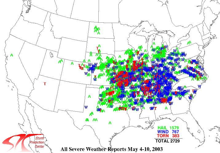
One of the most violent weeks in recorded severe weather history was capped off by a quarter-mile wide F3 tornado in Southeast Kansas. On the weather map that day, a center of low pressure was positioned near Goodland. Extending southward from that center of low pressure was a well defined dryline. A warm front extended in a east to west manner across Central Kansas. Dewpoint readings of 65F to 75F in the warm sector helped to create a very unstable atmosphere, where CAPE values approached or exceeded 4000 J/Kg. Several other subtle surface boundaries were present east of the dryline. These boundaries were easily observed via Radar. It was on one of these subtle boundaries that the first significant convection of the day erupted. Several supercells formed in a broken north to south line as the activity moved off the boundary. However, it was one storm in Central Butler County that began to take over at about 5:30 pm. After this time, the storm steadily strengthened and the rotation increased. Eventually, the mid-level rotation in the storm began to extend toward the ground in Western Greenwood county. This was confirmed by the EOC, as a brief tornado touched down 3 miles Northeast of Beaumont. Another tornado touched down as the strengthening storm entered extreme Western Woodson County. The exact location was about 1 mile North of Toronto. It was from this point on where the tornado would remain on the ground for 26 continuous miles, and strengthen while doing so. The tornado was at its strongest and widest as it passed 1 mile Northwest of Yates Center in Woodson County around 7:05 pm. The tornado achieved maximum intensity and width at this time. It was about a quarter mile wide, and was rated F3. At this time, the radar showed a hook-echo reflectivity structure to the storm, as well as a strong gate to gate velocity couplet. A storm chaser photographed the tornado as it was departing the Yates Center area. His picture confirmed what our Radar was suggesting all along...that a large tornado was on the ground. The tornado would eventually travel into Allen County...where it briefly lifted. Another weak tornado quickly formed from the parent storm in Allen County, and touched down about 5 miles north of Iola. The tornado then continued into Anderson and Linn Counties, where it strengthened and did substantial damage. A National Weather Service damage survey was conducted the next day, and revealed quite a bit of damage...especially just Northeast of Yates Center. Several Barns were destroyed, along with a few houses. Trees were stripped bare or just blown away. Automobiles were rolled as well. May 4th through May 10th brought more severe weather to the plains and midwest than any other week in recorded history. During this time frame, 383 tornadoes were reported. |
 |
 |
 |
 |
 |
 |
|
Damage northeast of Yates Center |
Damage northeast of Yates Center |
Damage northeast of Yates Center |
|
Damage northeast of Yates Center |
 |