June 16th, 2011 Severe Weather Event
|
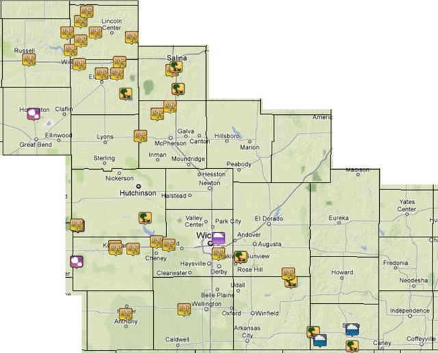
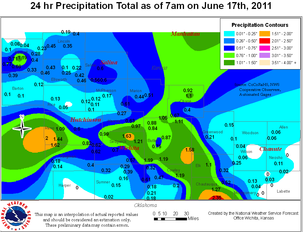
Scattered showers and thunderstorms first developed in western Kansas on June 16th, 2011 where a dryline an a warm front intersected. These storm continued to move eastward into Central and South Central Kansas where the better instability and moisture was located. As these storms moved eastward, they grew in intensity and brought 1-2.50 inches of rainfall and an intense lightning show for much of South Central Kansas. Many of these storms packed a punch, producing hail and wind damage. An interesting part of this event was the prolonged severe wind speeds that accompanied relatively light rain, or no rain. This occurred across central Kansas as these storms began to collapse. Initially the storms collapsed and produced 60-70 mph winds, which is not uncommon. However, after most of the radar reflectivity had decreased indicating light showers, strong - severe winds continued for a few hours. Much of Lincoln, Ellsworth, McPherson, and Saline counties experienced these strong winds. The cause of these strong winds was a wake low that formed as the storms collapsed. The wake low developed a strong pressure gradient over a small area. This caused 60 - 70 mph to persist at some locations over an hour. In Saline County they experienced near 80 mph winds causing a great deal of damage in and around the city of Salina. A measured gust of 77 mph was recorded at the Salina Airport. An other area of wind damage occurred as severe thunderstorms moved eastward from Pratt county into Reno and Kingman counties. Severe hail and wind gusts were observed. Some locations received 70 mph or greater mph winds. Some times these strong winds occurred ahead of any rain or thunder as the gust front surged out ahead of the line of thunderstorms. |
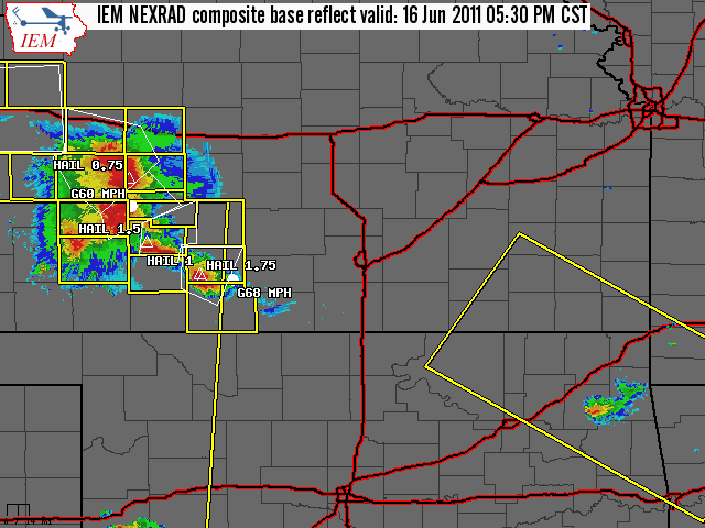
Radar
|
The radar loop starting around 5:30 pm on June 16th and ending around 2:00 am on June 18th. It shows storms moving across South Central Kansas and the collapsing storms in Central Kansas. |
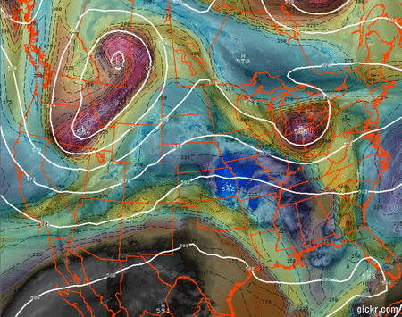
The upper level pattern for June 16th shows a trough across the Great Basin ejecting a shortwave towards the Central Plains which help aid in development for storms. |
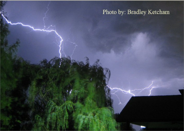
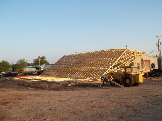
Pictures
|
Lightning in West Wichita. Photo by Bradley Ketcham. |
Building collapse due to storms that moved through. Picture by Kingman Co EM. |
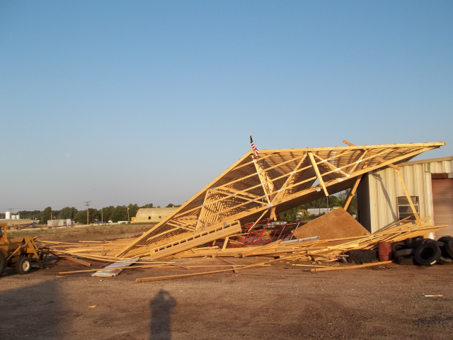
Collapsed building south of US-54. Picture by Kingman Co EM. |
Storm Reports & Precip Map
 |
 |