April 10th, 2013
|
A strong upper level disturbance developed and moved into the inter-mountain west. Ahead of this wave, a surface low pressure set up in the lee of the Rockies. This surface low pressure system had a strong warm sector over southern and eastern Kansas where temperatures were in the upper 60s and low 70s with 50 to 60 degree dewpoint temperatures. Also associated with this surface low was a very strong cold front. As the upper wave moved eastward the surface cold front moved southeast. This cold front was cold polar arctic air, but was very shallow, only extended a few thousand feet above ground. What does this mean? Well the mid and upper portions of the atmosphere over Nebraska, Kansas and Oklahoma were relatively warm, while the shallow cold air at the surface was plunging temperatures into the 20s and 30s. The front moved through during the afternoon of April 9th, causing winds to instantly switch 180 degrees and temperatures to drop nearly 20 degrees in 10 to 15 minutes. The cold air behind this front was so strong, the shallow surface front pushed into Oklahoma and Arkansas. The combination of the shallow cold air and the warm mid and upper levels causes precipiation to fall as rain while surface temperatures are at or well below 32 degrees. The rain that fell accumulated on elevated surfaces and froze. Ice accumulations of a quarter of an inch up to a half of an inch were reported across Central and South Central Kansas. The ground temperatures had been so warm that the non-elevated roadways were not as slick as elevated overpasses. Reports of car accidents and tree damage as well as power outages were reported and a few pictures are displayed below. |
|
|
|
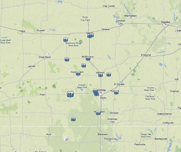
Ice reports across the area
 |
Pictures of the Freezing Rain and
Ice Accumulations and Damage
|
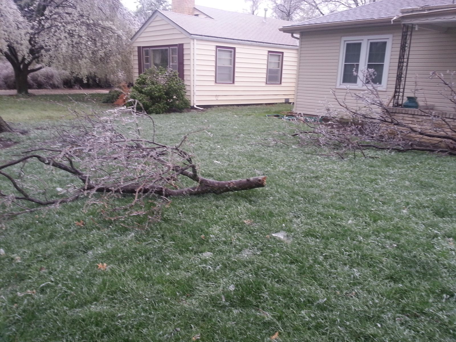
Picture of Tree Damage to a Bradford Pear. Photo courtesy of Janet Spurgeon |
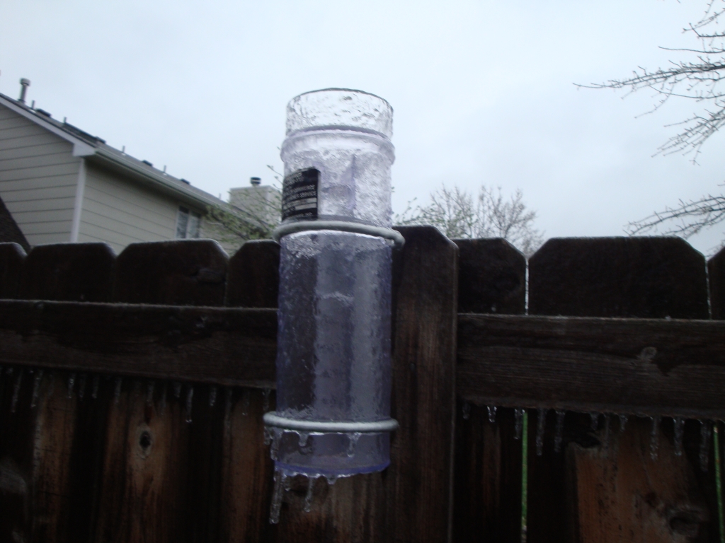
Ice Frozen to Rain Gauge. Photo courtesy of Janet Spurgeon. |
|
Ice accumulations in McPherson. Photo courtesy of Jeremy Cate. |
Large Branch of Bradford Pear Tree Damaged due to Ice Accumulations. Photo courtesy of Julie Darmofal. |
|
Tree Damage in McPherson. Photo courtesy of Jeremy Cate. |
Ice accumulations on a Magnolia Tree. Photo courtesy of Janet Spurgeon. |
|
Ice accumulation at the NWS office in southwest Wichita. Picture taken by Kevin Darmofal. |
Ice accumulation in northwest Wichita. Picture taken by Brad Ketcham |