|
April 4th, 2012 |
||
|
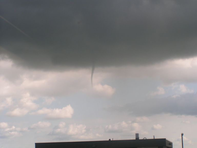
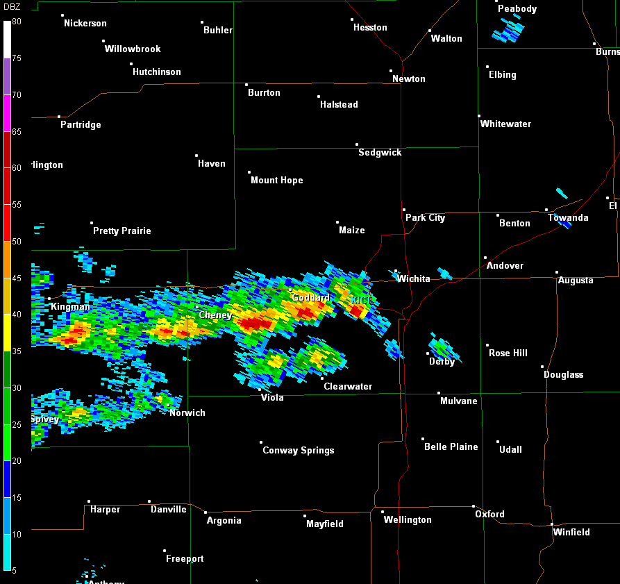
Several funnel clouds (images 1 and 2) were sighted in the Wichita area during the late afternoon of April 4th, 2012. These funnels were quite small and did not touchdown, though some persisted for as long as 15 minutes. At a brief point, as many as three separate funnels were viewed at one time just southwest of the city limits of Wichita. While funnel clouds and tornadoes are not rare across Wichita and tornado alley, the type of funnel clouds that hovered over Wichita and other parts of south central Kansas on Wednesday posed a very low risk of touching down and causing significant damage. So what is the difference between these funnel clouds and funnel clouds that eventually become destructive tornadoes? Well the difference is how they are formed. As described above, these funnel clouds are formed with some relatively weak background spin in the atmosphere while funnel clouds that eventually become destructive tornadoes usually form from supercell thunderstorms that have a large rotating updraft called a mesocyclone. Why does this matter? Think of the funnel clouds that were visible on April 4th as having the energy/power of an old large drill with only 5-7 volts. This larger old drill is about as effective as a thumbtack at putting a hole in wood or drywall. The power of this drill is like the energy or background spin in the environment that could produce the funnels that occurred on April 4th. If these funnel clouds would have touched down becoming a tornado, they would have relatively little energy which could cause minor damage, but do not pose a large risk to life and property. Supercell thunderstorms are more like a small compact 18-volt drill. This compact drill has more power on a smaller scale (like a supercell thunderstorm). The funnel clouds that develop from these storms can touch the ground, becoming tornadoes. These tornadoes have the ability to cause more damage from the greater energy they contain from their parent system, the supercell thunderstorm, ultimately posing a greater risk to life and property. |
||
|
|
|
|
|
|
|
|
|
(Fig. 3) Radar animation starting around 5 pm, showing the storms that produced the funnels. |
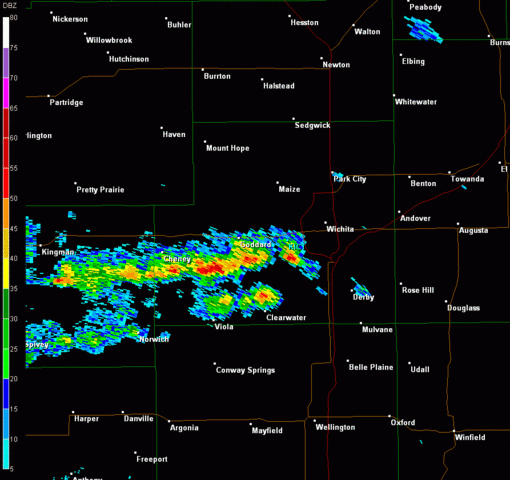
(Fig. 4) Radar image from around 515pm showing the storms over the southwest portion of Sedgwick County which produced the funnel clouds. |
|