February 28th, 2012
|
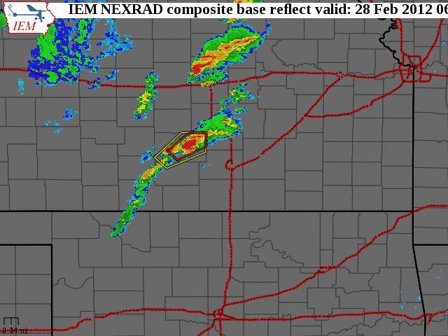
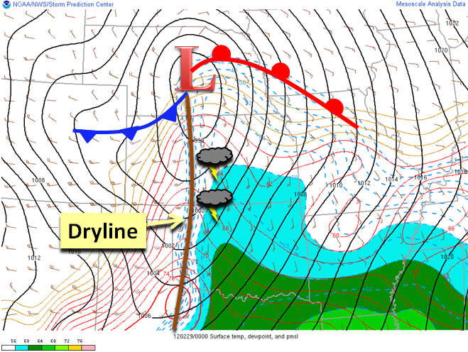
What happened: A vigorous upper level system brought unusually rich gulf moisture northward into Kansas during the day on Tuesday. A line of thunderstorms developed along a dryline over central and south central Kansas around 5pm once it encountered the deeper moisture. Severe weather began to break out over the region shortly thereafter with a tornado briefly observed in Reno County. The line of storms continued to race eastward producing damaging wind speeds of 60 to 110 mph and large hail ranging from walnut to baseball size. There were even a few storm related injuries reported in Labette County as the line of severe storms pushed through that area after 10pm. |
|
|
|
|
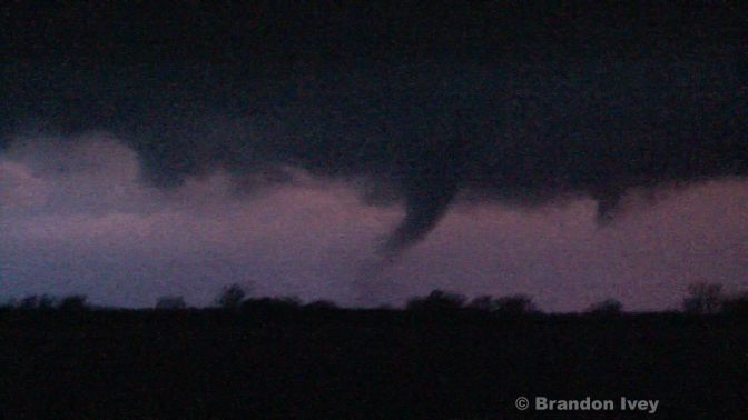
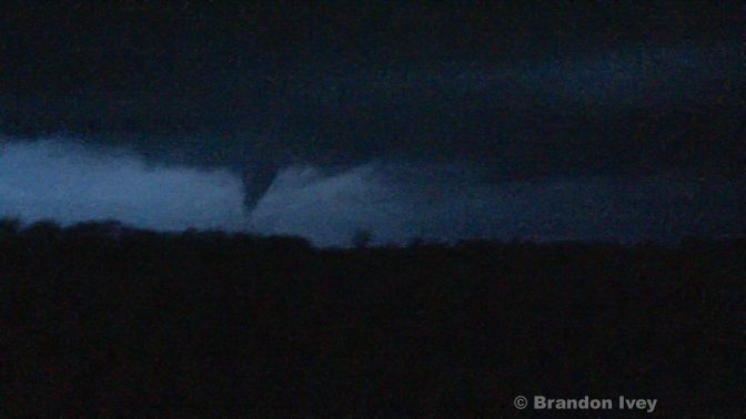
A supercell thunderstorm tracked into Reno County around 6:30pm and produced a weak tornado 6 miles south-southwest of Hutchinson around 6:45pm.
|
|
Tornado southwest of Hutchinson. Picture courtesy Brandon Ivey |
Tornado southwest of Hutchinson. Picture courtesy Brandon Ivey |
|
|
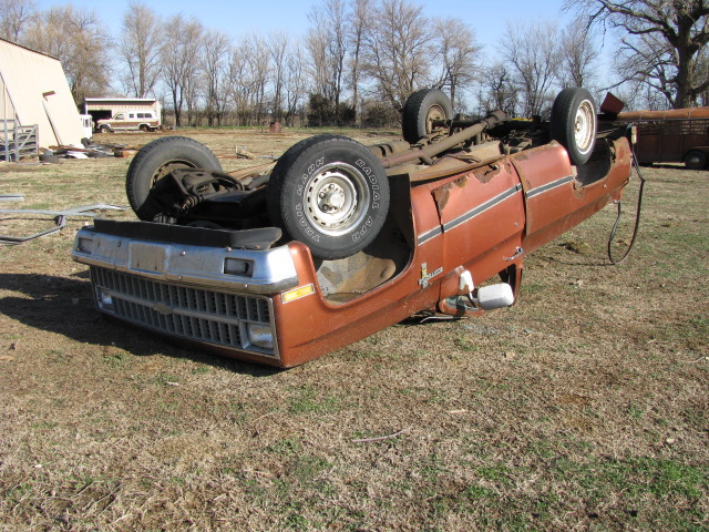
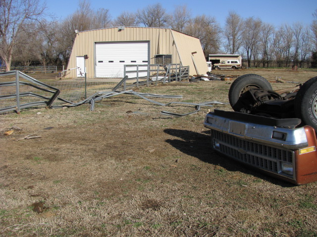
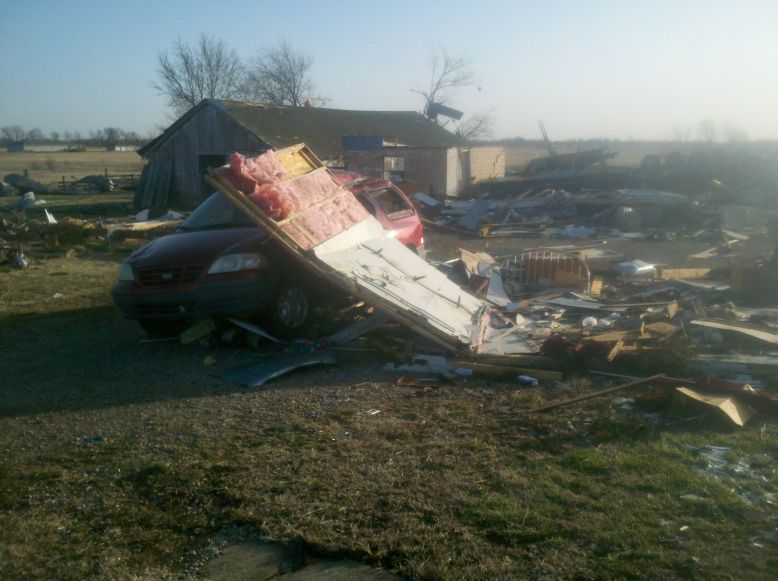
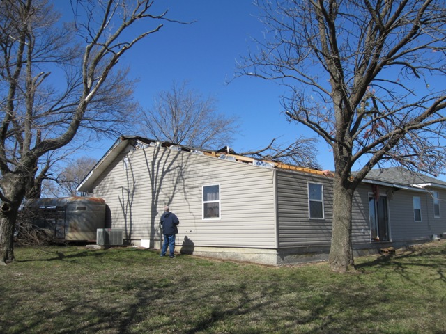
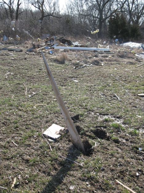
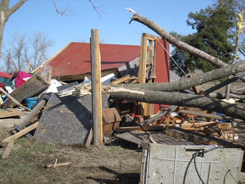
Tornado damage 5-6 miles SW of Hutchinson. Picture courtesy of Bill Guy |
Tornado damage 5-6 miles SW of Hutchinson. Picture courtesy of Bill Guy |
Tornado damage 5-6 miles SW of Hutchinson. Picture courtesy of Bill Guy |
Labette County Wind Damage
|
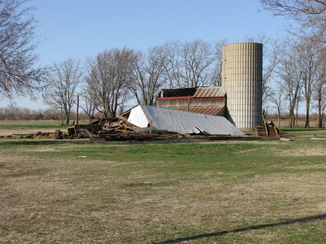
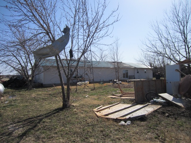
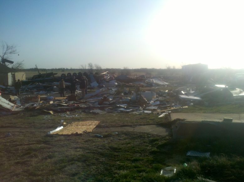
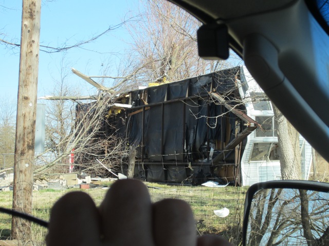
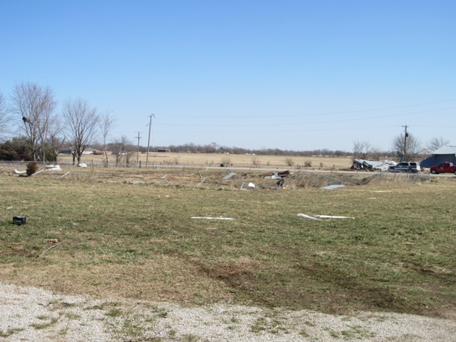
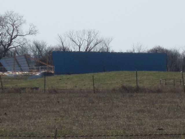
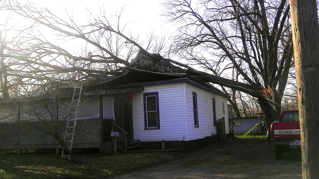
Around 10:20pm a severe thunderstorm blew through Labette County causing significant downburst wind damage as well as a few injuries. Winds with this storm were estimated between 90 and 110 mph. The most significant damage occurred about 2 miles northwest of the town of Labette.
|
|
90-110 mph microburst wind damage northwest of Labette. |
90-110 mph microburst wind damage northwest of Labette. Picture courtesy of Chris Way |
90-110 mph microburst wind damage northwest of Labette. Picture courtesy of Chris Way |
|
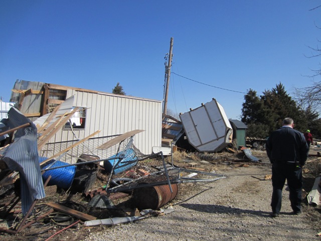
90-110 mph microburst wind damage northwest of Labette. |
90-110 mph microburst wind damage northwest of Labette. |
90-110 mph microburst wind damage northwest of Labette. |
|
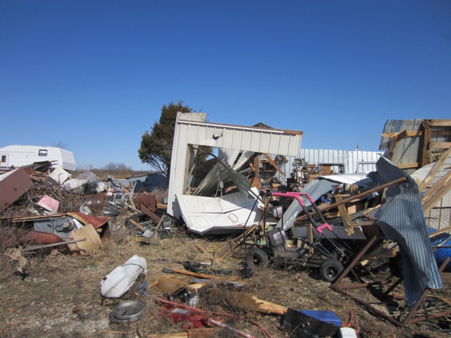
90-110 mph microburst wind damage northwest of Labette. |
90-110 mph microburst wind damage northwest of Labette. |
90-110 mph microburst wind damage northwest of Labette. |
Additional Damage Pictures
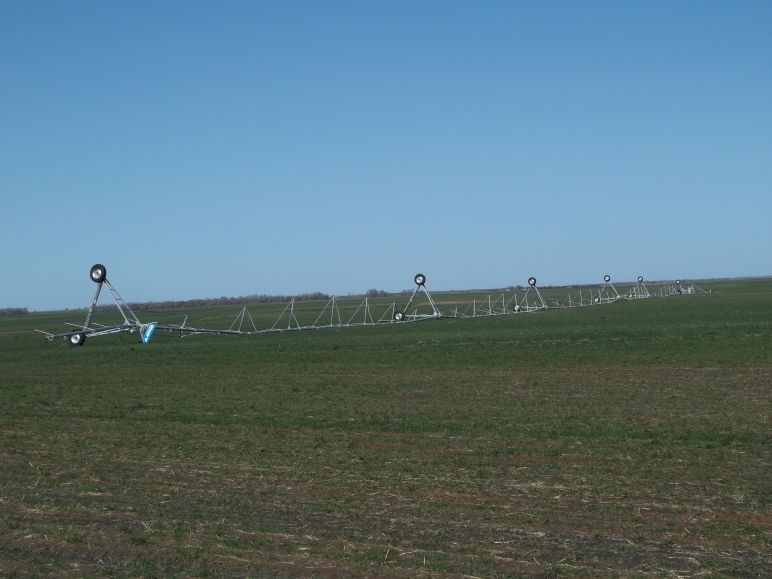 Wind damage in center pivot around 7 miles southwest of Kingman. Picture courtesy Fred Simon |
||||
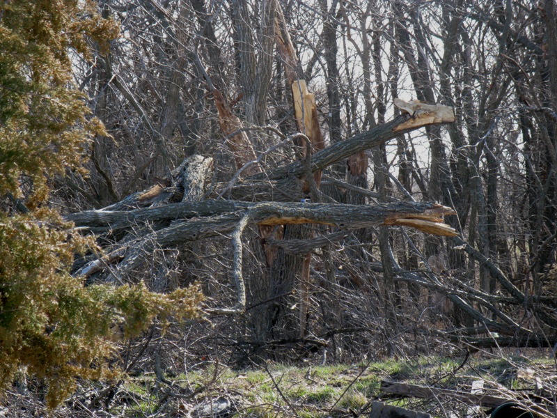 Wind damage about 7 miles east of Leon. Picture courtesy Buter County Emergency Management |
 Wind damage about 7 miles east of Leon. Picture courtesy Buter County Emergency Management |
 Wind damage about 7 miles east of Leon. Picture courtesy Buter County Emergency Management |
||
|
|
||||
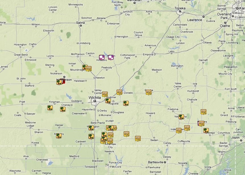
Reports
 |