Overview
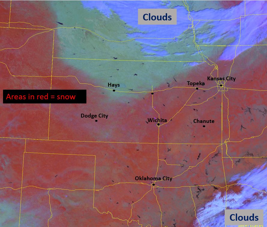
A strong cold front ushered in much colder air ahead of an incoming storm system allowing rain to transition to a wintry mix before becoming all snow across the region. Moderate to heavy snow resulted in widespread 6 to 8 inches with locally higher amounts across south central and southeast Kansas while much of the state was impacted with accumulating snow.
Snow/Ice
An estimate of snowfall amounts from our winter storm, including a list of some of the higher totals we have received. The highest snowfall totals were received across southern Kansas, especially over south central and southeast Kansas.

Day snow/fog RGB satellite product showing where snow is located.
Photos & Video
|
Southwest side of Wichita. Picture by Roger Martin |
Northwest side of Wichita. Picture by Kevin Darmofal |
West side of Wichita. Picture by Kelly Butler |
|
|
|
|
|
|
|
|
|
Radar
|
KICT WSR-88D Feb 1st at 9:30 am CST through the evening of Feb 2nd. (click for large image) |
 |
Media use of NWS Web News Stories is encouraged! Please acknowledge the NWS as the source of any news information accessed from this site. |
 |