Wichita, Kansas
Weather Forecast Office
Rare December Flooding
|
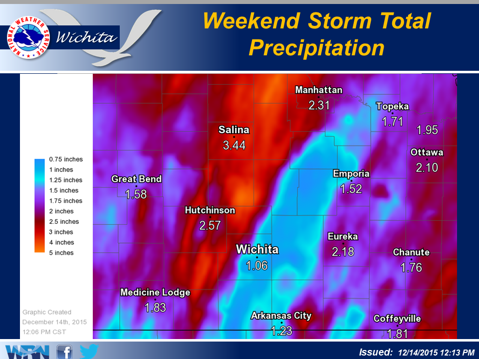
An intense low pressure system lifted out of the desert southwest and moved into the High Plains on the weekend of December 12th. This storm system pulled rich Gulf moisture into the Plains causing rare December flooding for much of central and eastern Kansas. In addition, this storm also brought heavy snow to parts of western Kansas.
|
Meteorology images
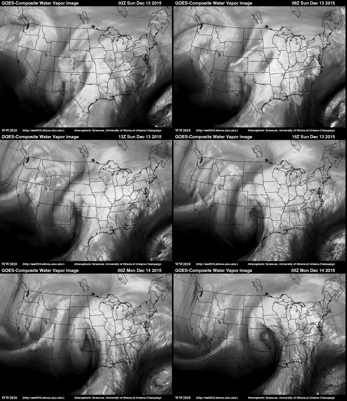 Water vapor satellite loop |
.gif) Regional radar animation |
Flooding pictures
|
|
|
|
||
|
|
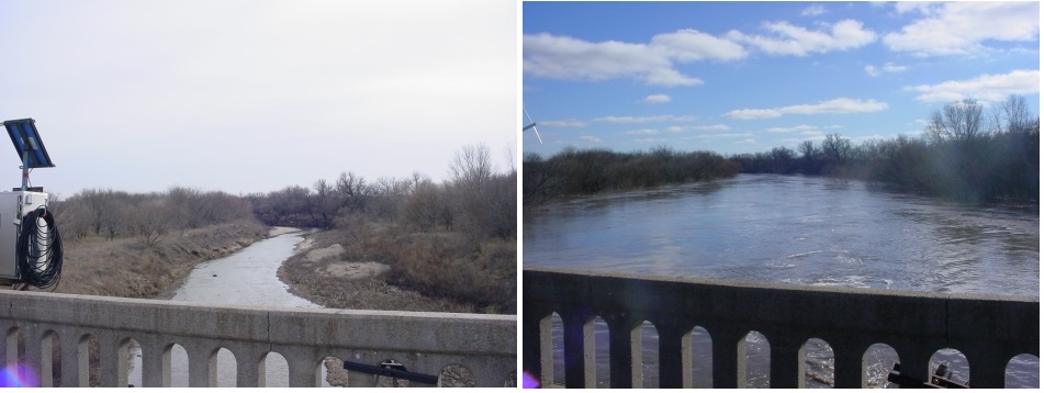
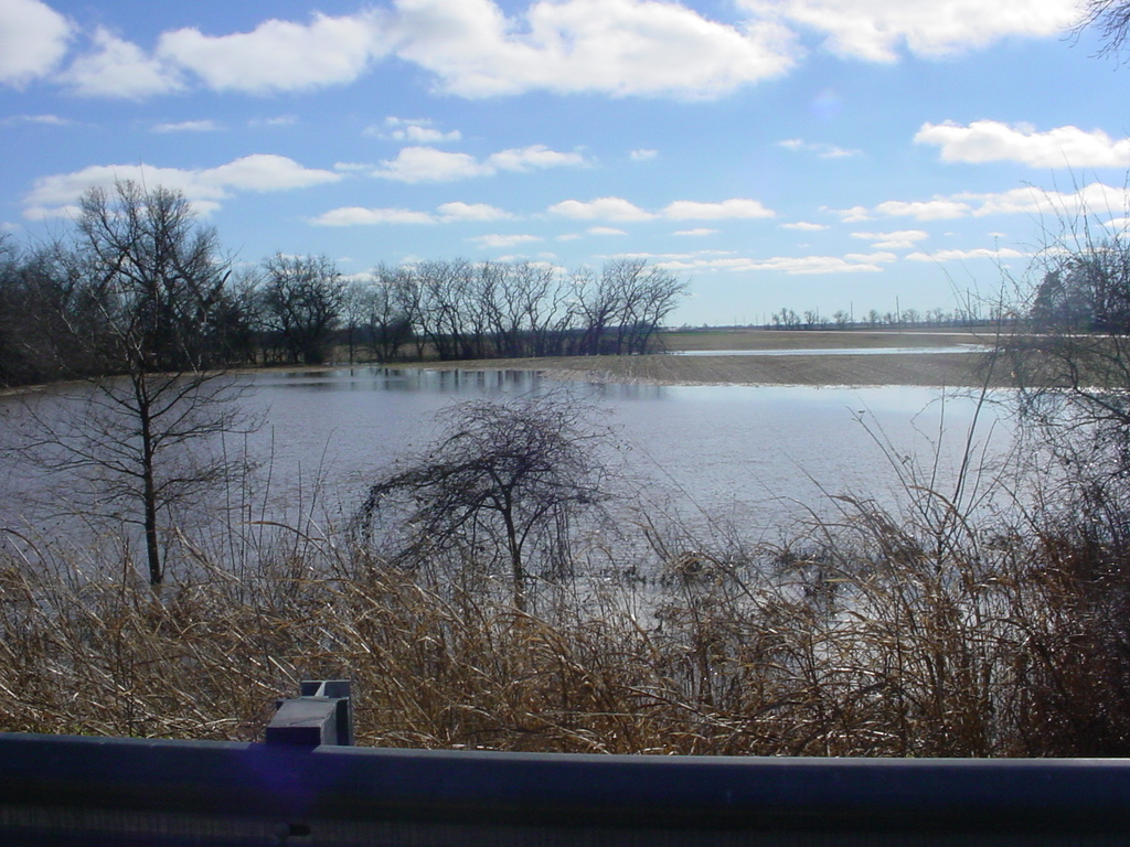
Comparison of low flow on the Little Arkansas at Sedgwick with how it looked on Dec 14th 2015.
|
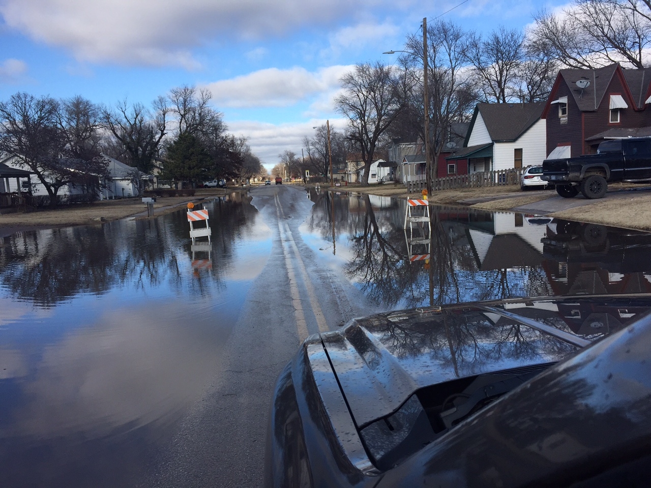
Along Ridge Road in the town of Sedgwick. |
||
|
Arkansas River along Ridge Road near 53rd St. |
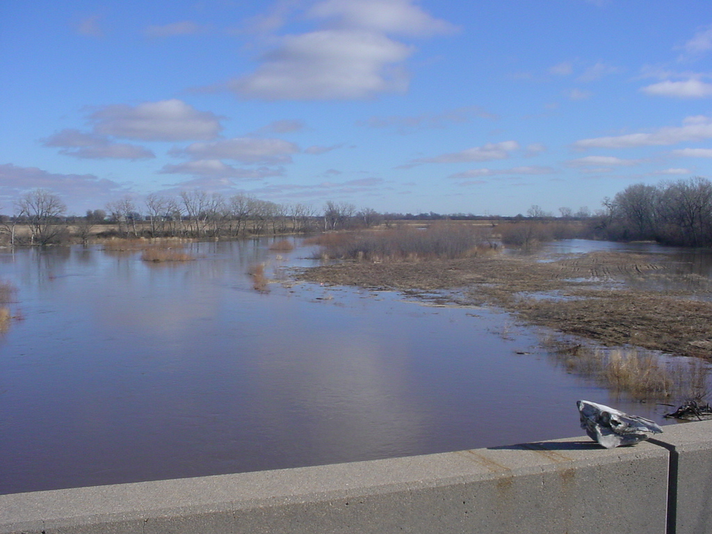
West bank of the Little Arkansas near Sedgwick. |
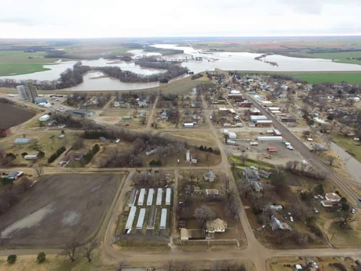
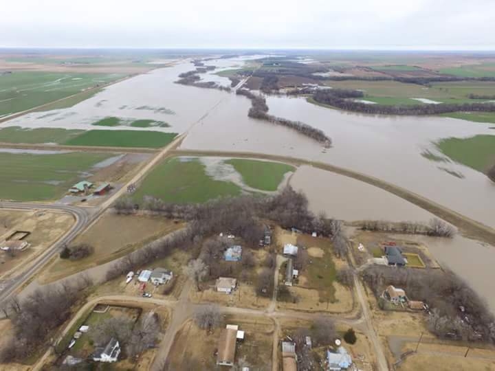
City of Gypsum looking at the north end of town. |
||
|
Close-up of the northeast end of Gypsum. |
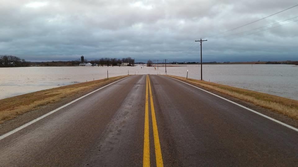
Looking south from Gypsum on Highway K4, Dec 13th, 2015
|
|||
Video
| Flooding along Emma Creek. December 14th 2015. | Flooding along Little Arkansas River near Sedgwick. December 14th 2015. |
Area hydrographs
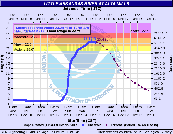 |
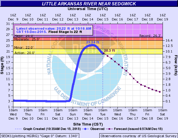 |
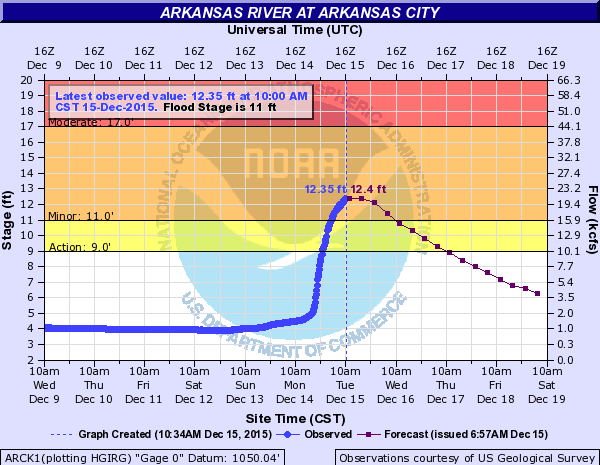 |
||
.png) 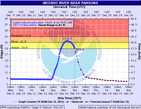 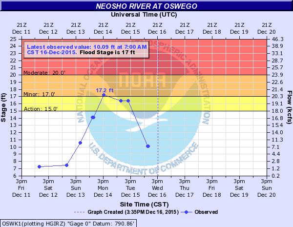 |
||||
Hazards
Briefing pages
Local weather story
Submit a storm report
Storm Prediction Center
Enhanced Hazardous Weather Outlook
Current Conditions
Local Radar
National Radar
Satellite
Hourly weather(text)
Precip Analysis
Snowfall analysis
This day in weather history
7 Day Lightning Archive
Forecasts
Forecast Discussion
Weather Story
Fire Weather
Activity Planner
Aviation Weather
Soaring Forecast
Hurricane Center
Graphical Forecasts
Regional Weather Summary
Probabilistic Snow
Probabilistic QPF
Wet Bulb Globe temp
Climate
Local Climate Page
Daily/Monthly data(F6)
Daily Records
Climate Normals
Local drought page
Latest Climate Report(ICT)
Latest Climate Report(SLN)
Latest Climate Report(CNU)
CoCoRaHS
7 Day Lightning Archive
US Dept of Commerce
National Oceanic and Atmospheric Administration
National Weather Service
Wichita, Kansas
2142 S. Tyler Road
Wichita, KS 67209-3016
316-942-3102
Comments? Questions? Please Contact Us.


