Late June early July 2007 historic flooding across southeast Kansas
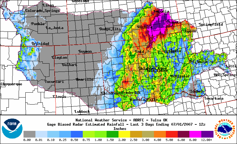
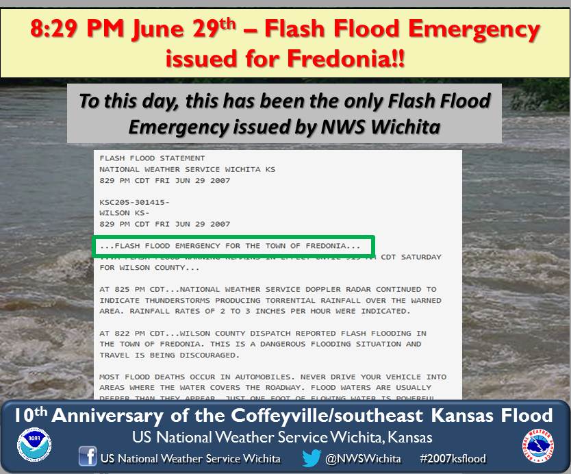
An upper level disturbance sat over areas along and east of the Kansas Turnpike beginning Thursday and continuing through Sunday. This disturbance was a very efficient rain maker and produced rainfall amounts as high as 2 to 3 inches per hour at times especially Friday night and Saturday in Southeast Kansas.
|
Radar estimated rainfall map |
 |
|
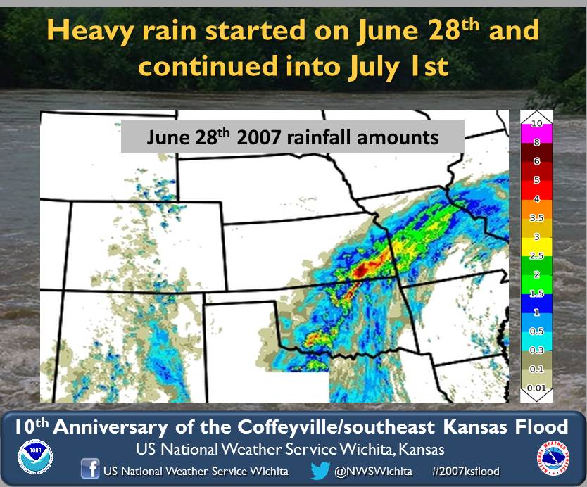
June 28th rainfall |
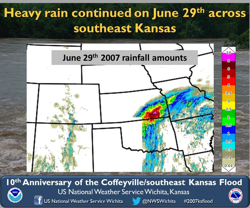
June 29th rainfall |
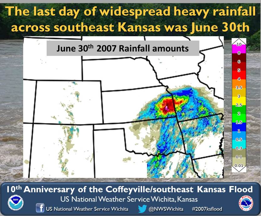
June 30th rainfall |
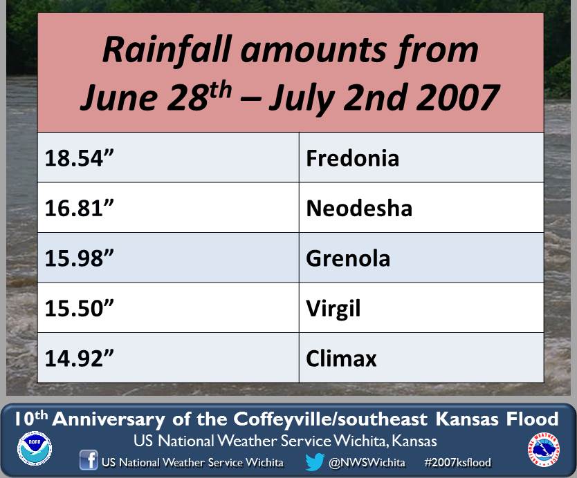
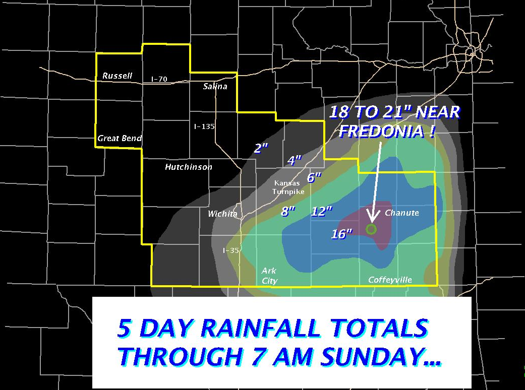
Event rainfall totals |
|
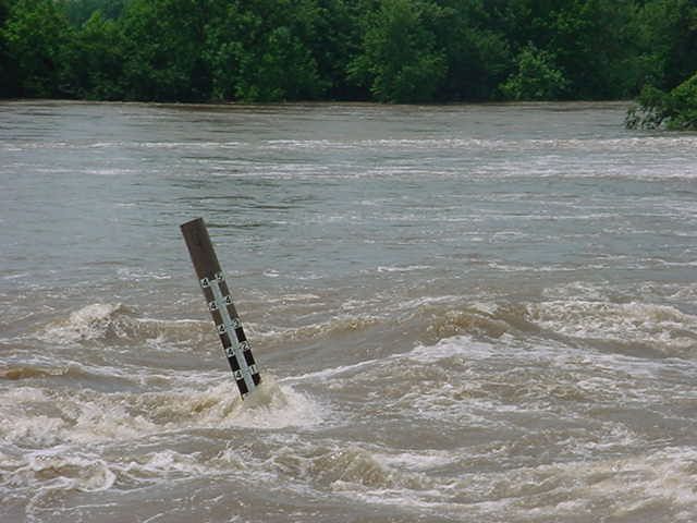
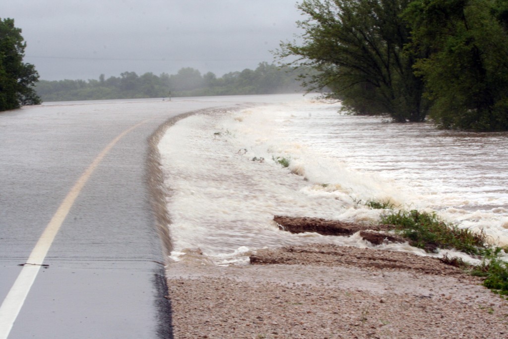
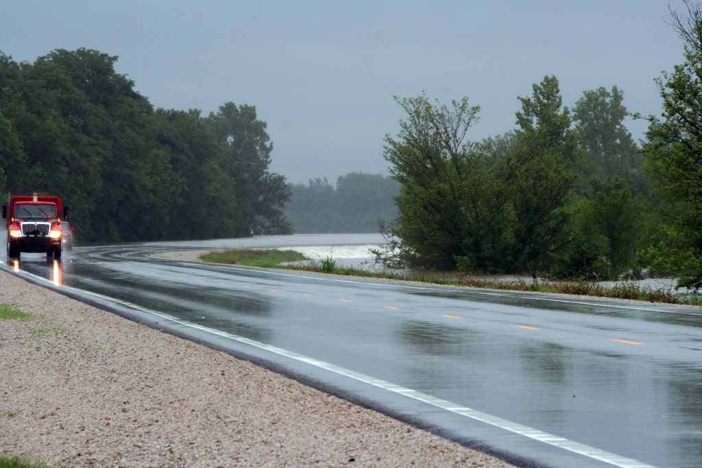
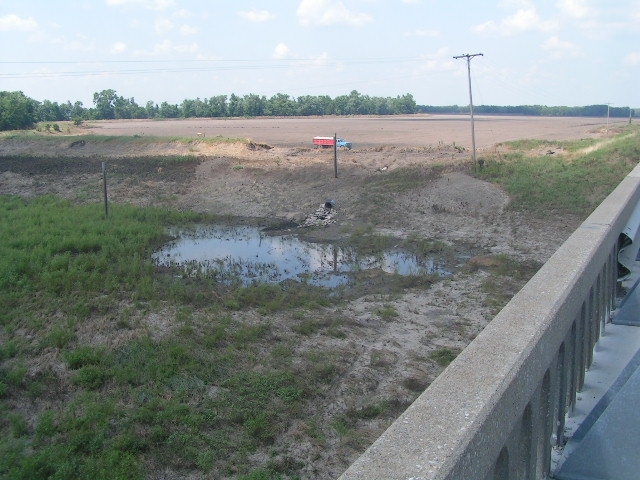
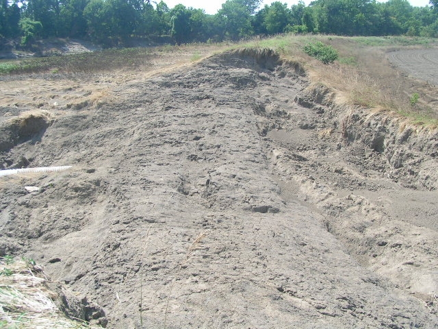
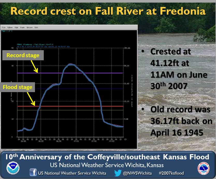
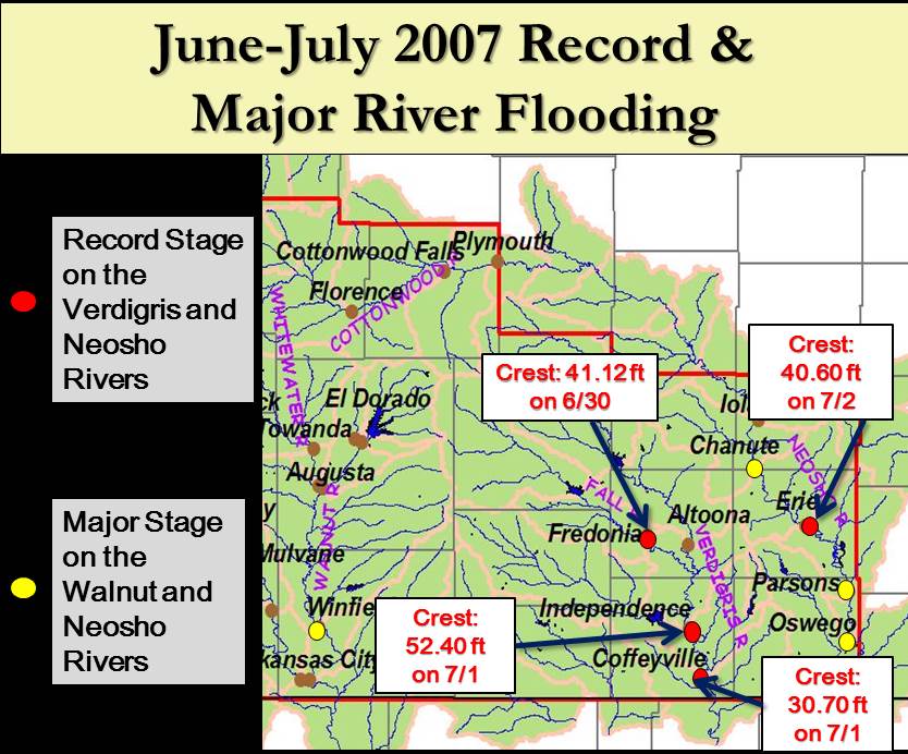
Record flooding along many southeast Kansas rivers The new record crest on the Fall River at Fredonia literally blew the old record out of the water. On June 30th at 11 AM, the river crested at 41.12ft with a corresponding flow near 91,465 cfs. This flow is almost double the flow of 49,000 cfs that corresponded to the previous crest of 36.17 ft on 4/16/1945. Here are a few pictures taken by the USGS at the height of the flood and a few the day after the crest.
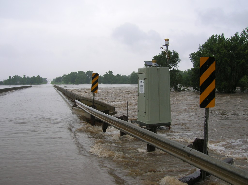
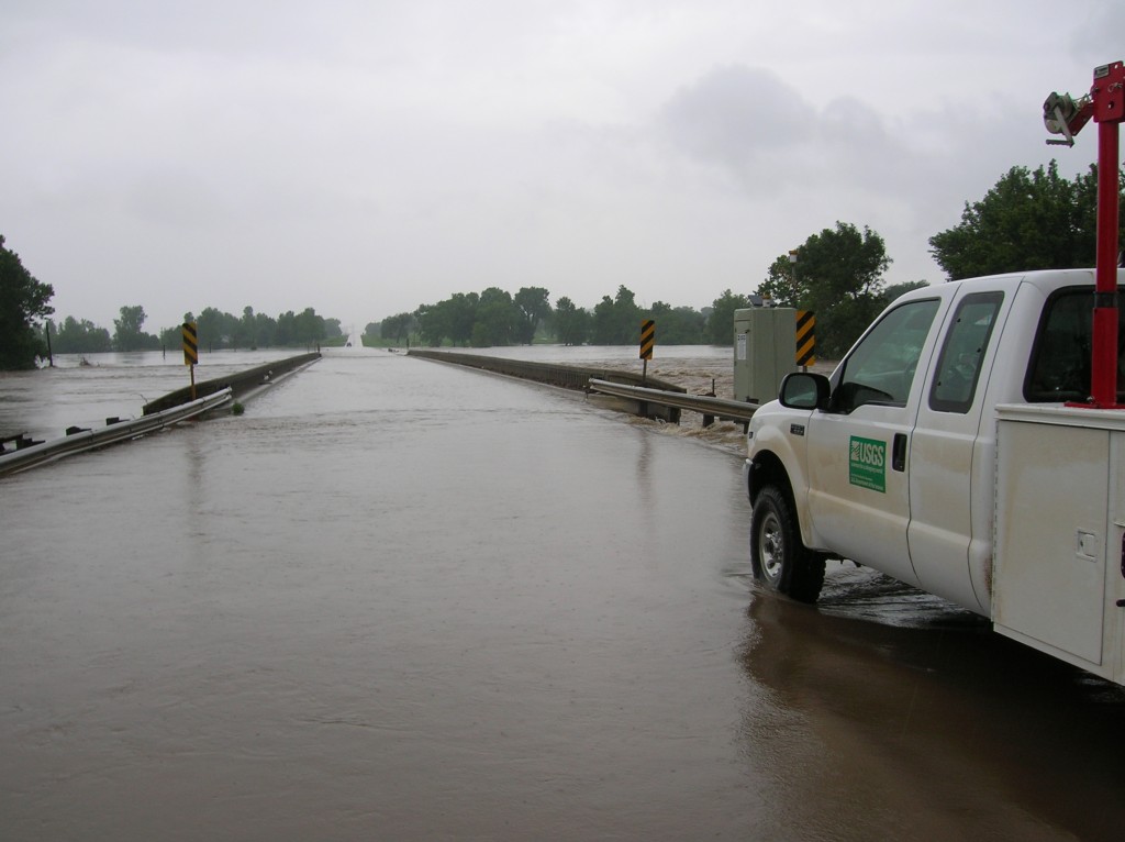
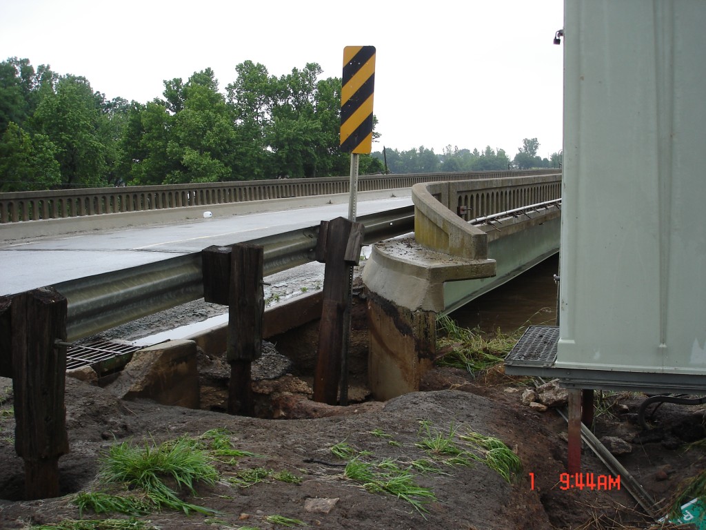
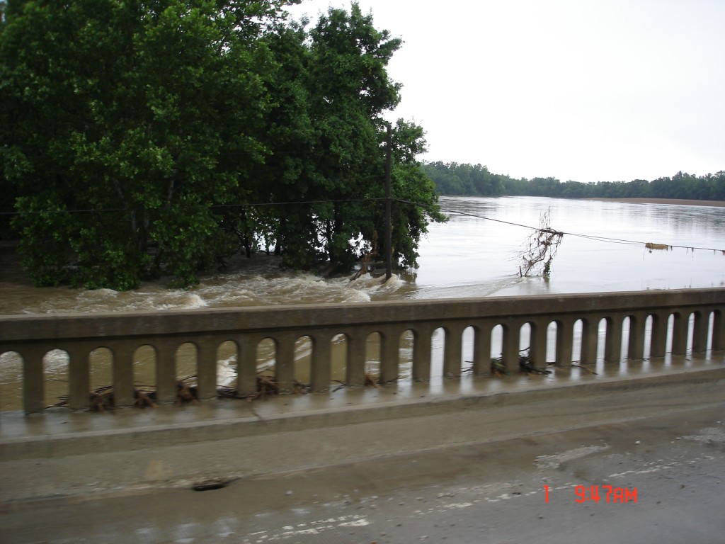
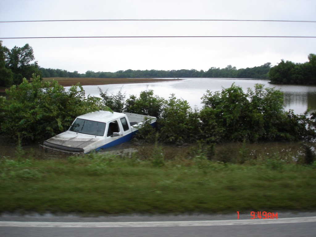
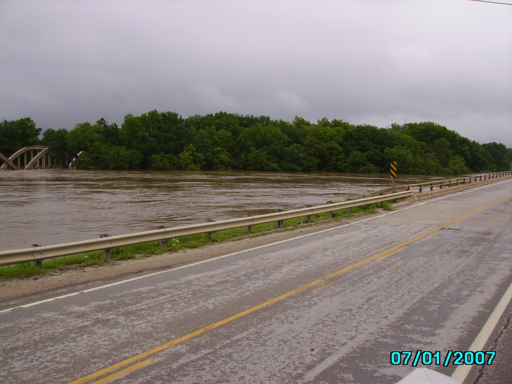
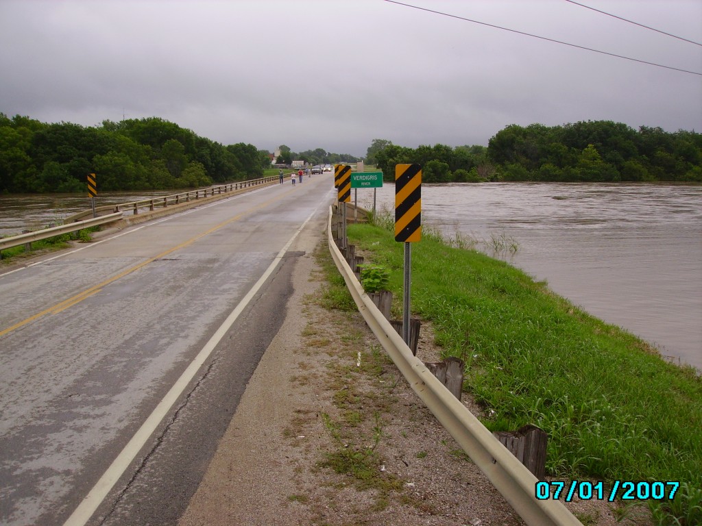
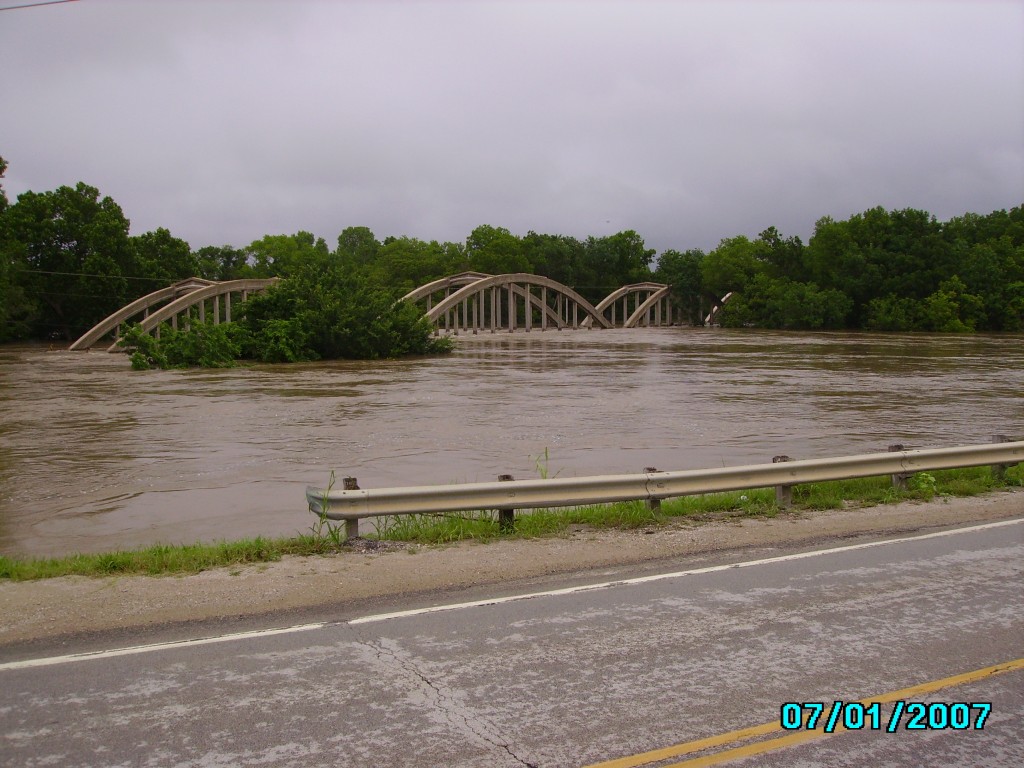
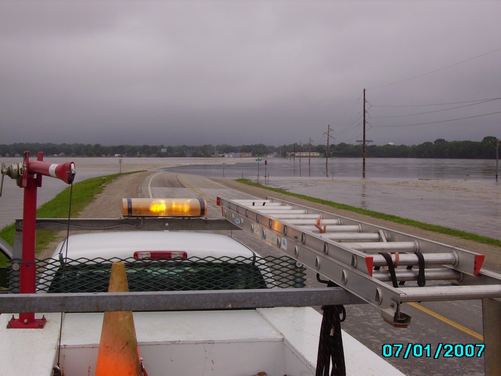
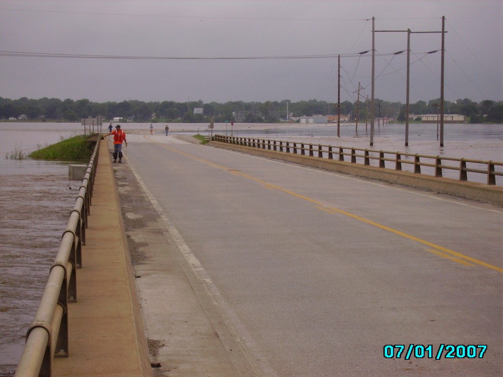
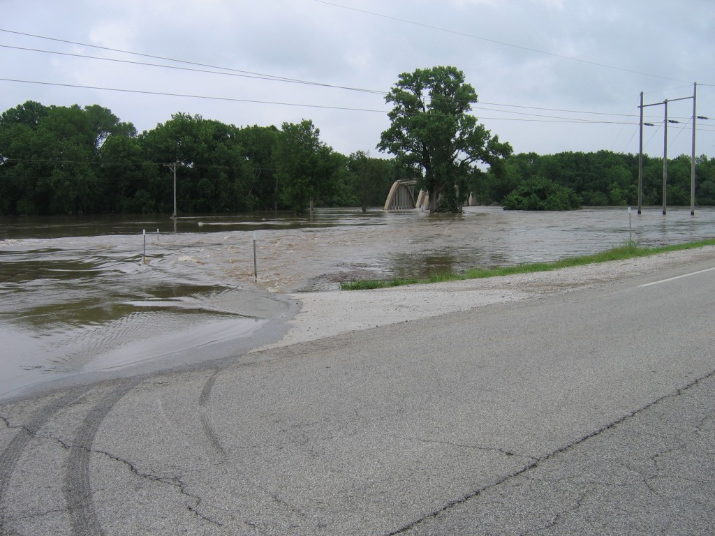
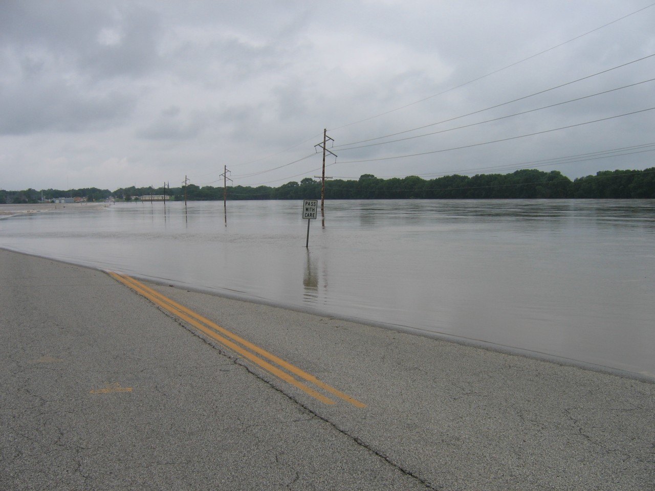
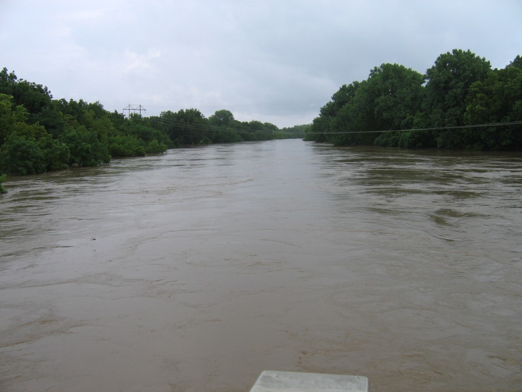
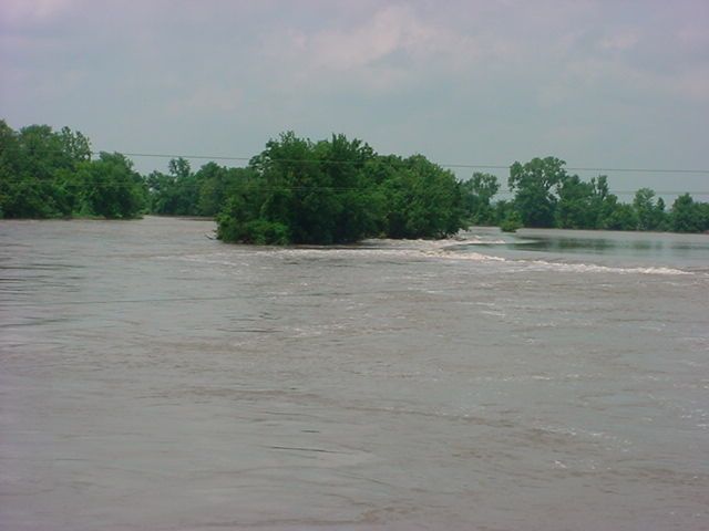
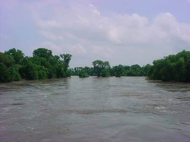
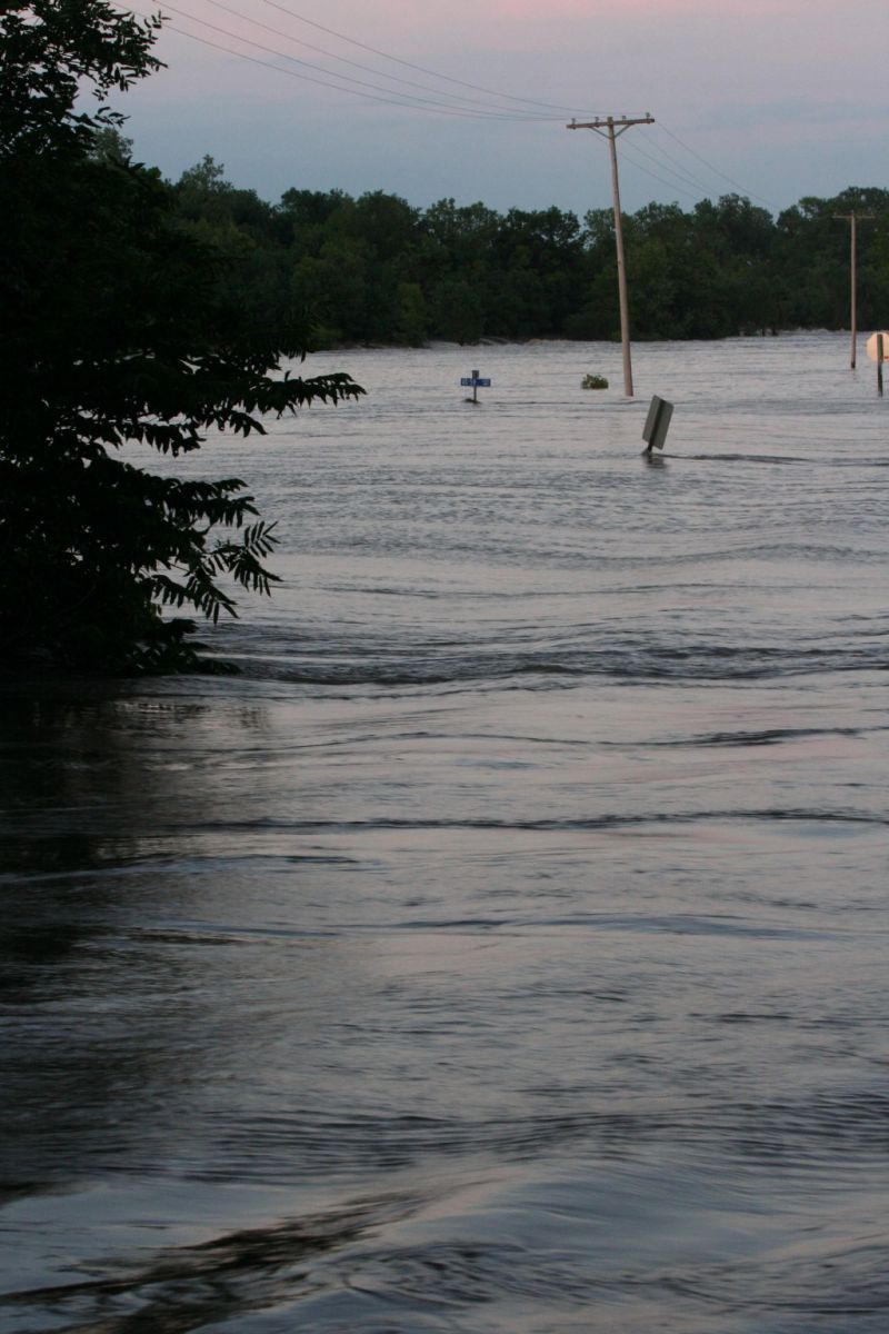
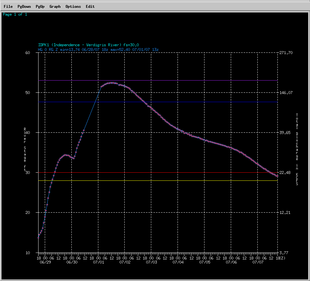
At Independece on the Verdigris river, the new record crest of 52.40 ft occurred on July 1st at 8 AM. This is nearly 22 ft above flood stage! As the flood stage here is 30 ft. The previous record of 47.60 ft was on 5/19/1943. With this much volume of water, the river remained above flood stage for 9 days. The next set of pictures were taken by the USGS. These pictures were taken just east of Independence at the Highway 160 Bridge over the Verdigris River.
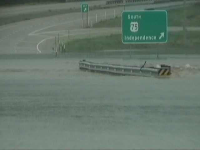
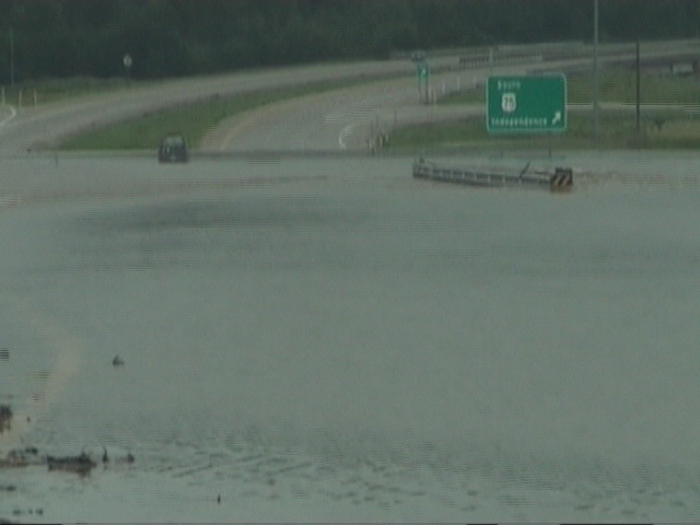
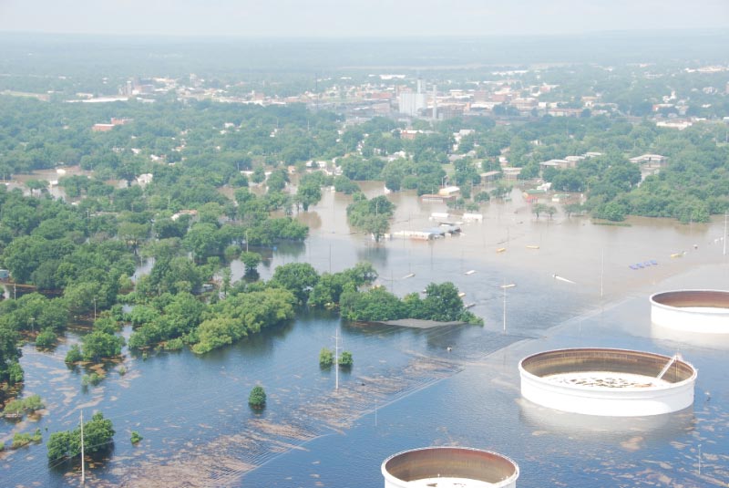
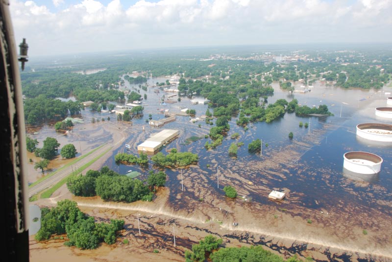
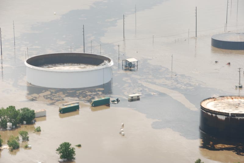
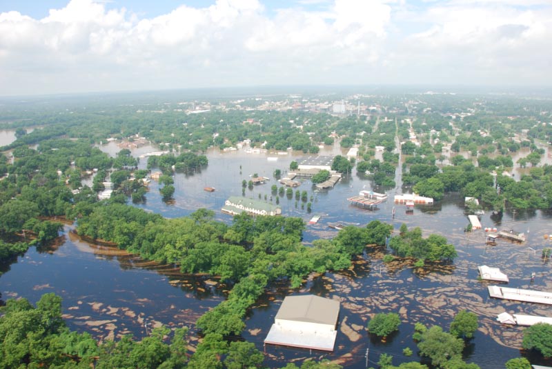
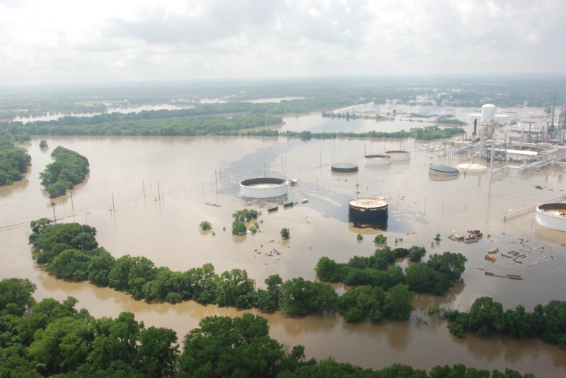
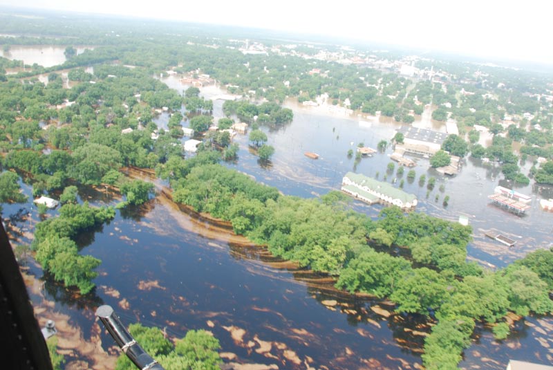
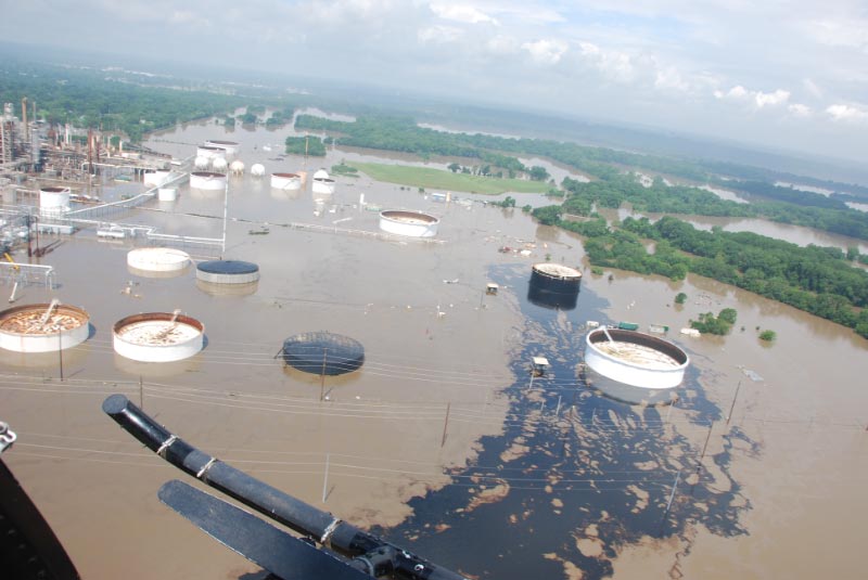
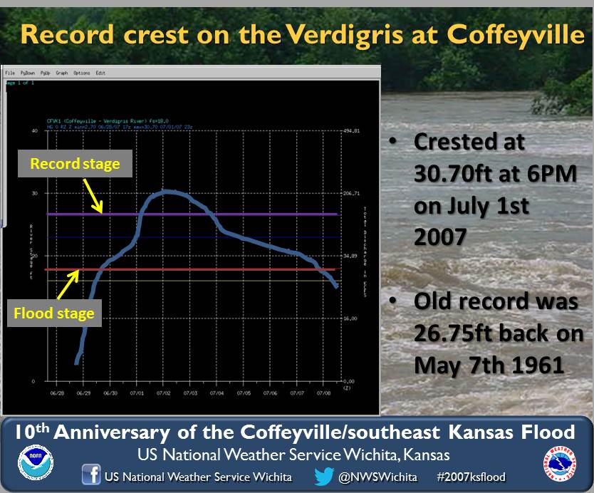
Downstream from Independence, Coffeyville also broke their previous crest record of 26.75 ft set on 5/7/1961. The new record crest of 30.7 ft occurred on the evening of July 1st at 6 PM. As like Independence, the river remained above flood stage for 9 days. The following images are from a flooded refinery near Coffeyville where thousands of gallons of oil were spilled in to Verdigris River
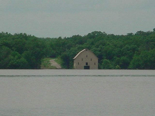
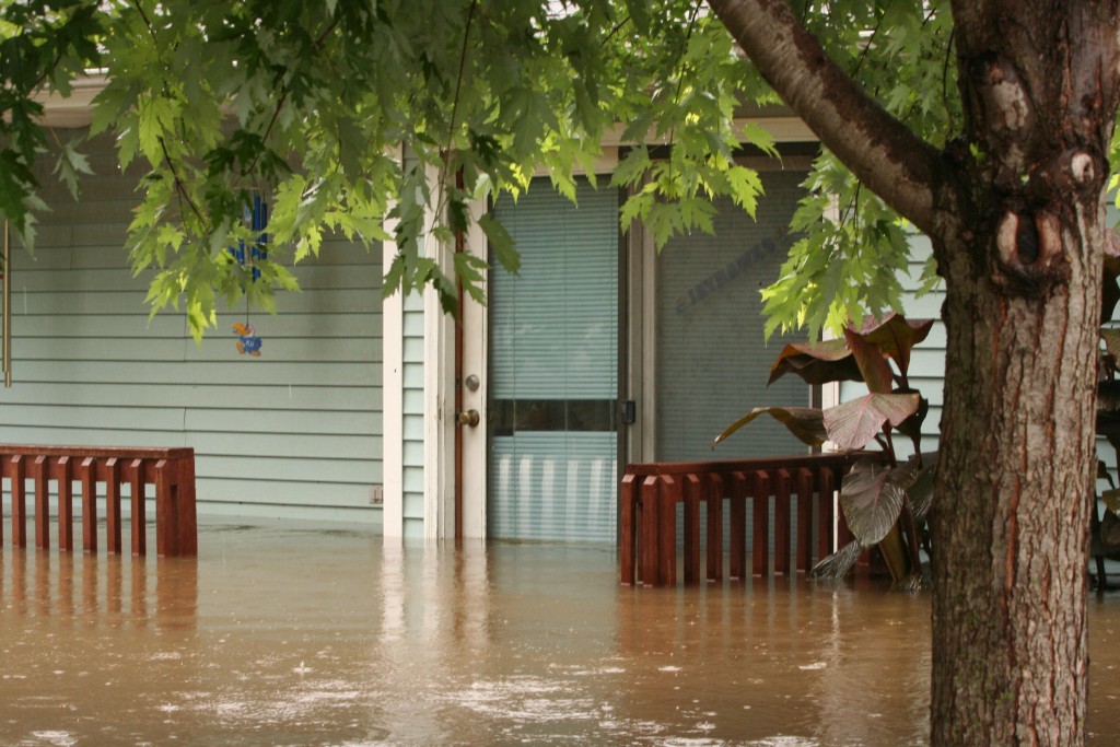
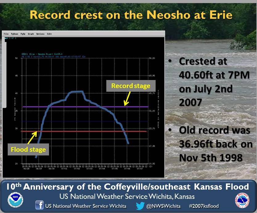
On the Neosho River at Erie, the highest crest that could be obtained from our river observer was 40.60 ft on July 2nd at 7 AM. For a time, the gage could not safely be reached as the roads were inundated to reach the staff gages. The old record of 36.96 ft was on 11/05/1998. The next 4 photos were taken by our NWS river observer at the river gaging site 2 miles southwest of Erie on Hwy 59.
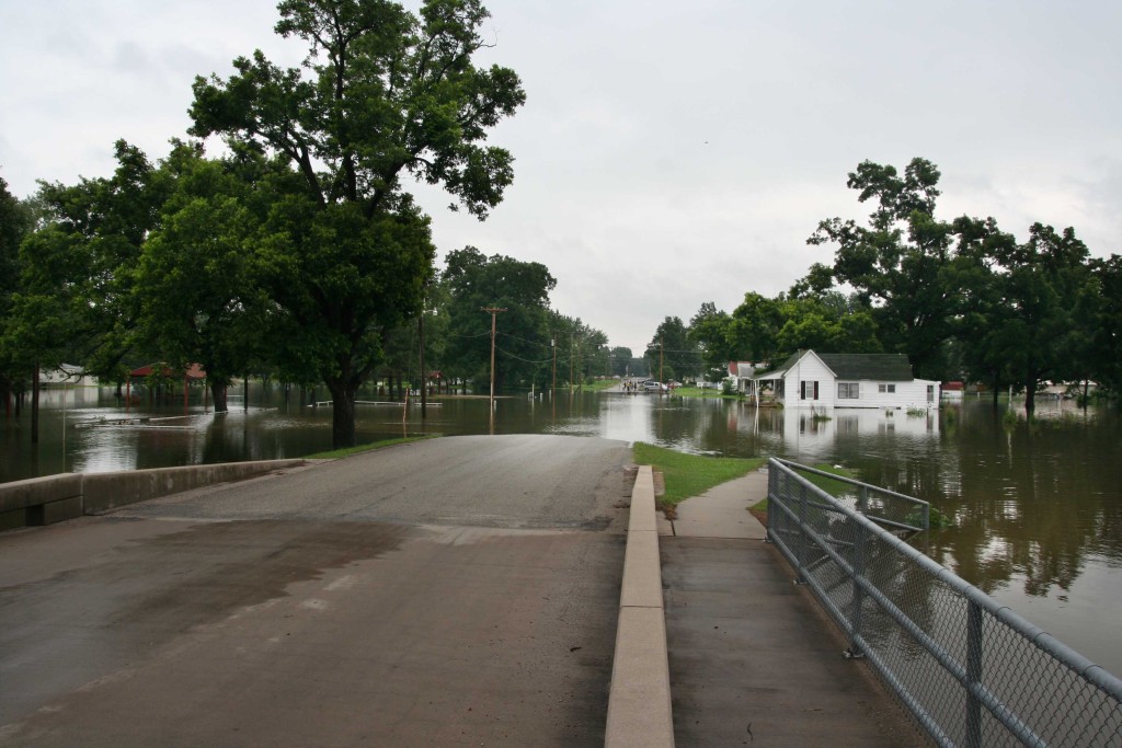
The remaining photos were taken from a local photographer, Greg Hunn in Erie.
Hydrographs
|