November 2020 Climate Summary and Highlights
|
WICHITA SALINA CHANUTE |
November Temperatures
| Kansas Monthly Average Temperature | Kansas Monthly Departure from Normal |
 |
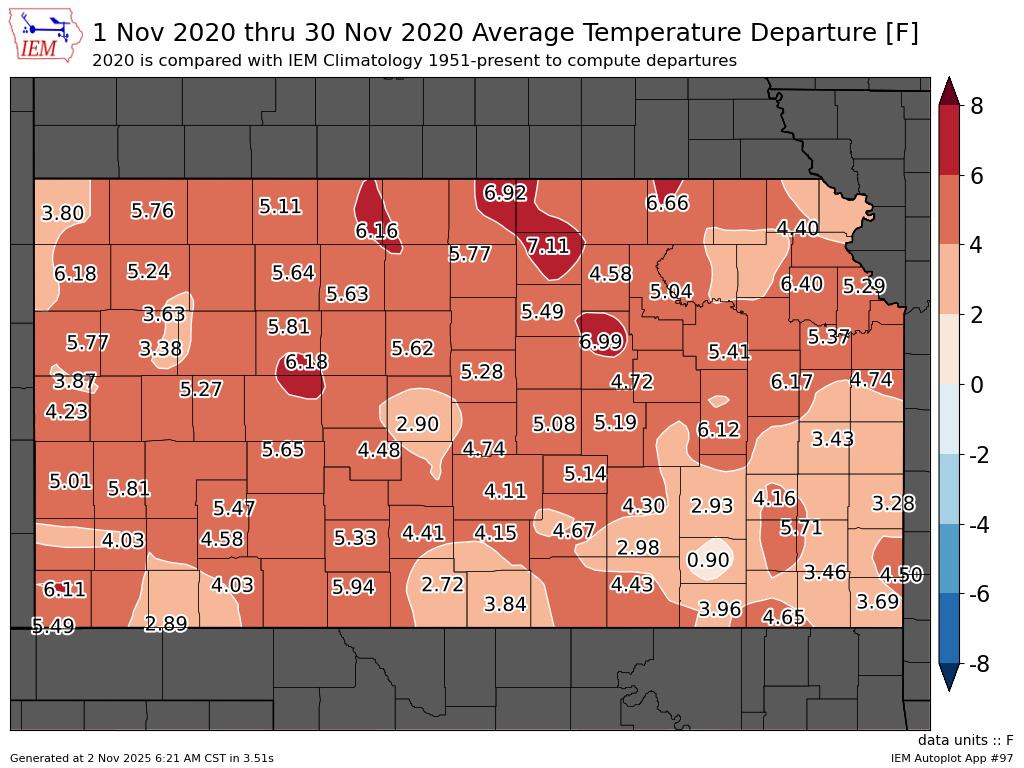 |
| Kansas November 2020 average temperatures (the average of each daily high and low temperature). | Kansas November 2020 average temperature departures. The entire state was much warmer than normal. |
| Kansas November Temperature Rankings |
 |
| Kansas November 2020 temperature rankings by division. One denotes the warmest November on record (since 1893), 128 denotes the coolest. All divisions were much warmer than normal, with central and western portions in the top-ten warmest. |
November Precipitation
| Kansas Monthly Precipitation | Kansas Monthly Precipitation Percent of Normal |
 |
 |
| Kansas November 2020 precipitation. This map constitutes a mix of observations and radar estimates. | Kansas November 2020 precipitation percent of normal. Much of the state was drier than normal, although above normal precipitation occurred in a swath from southwest, central, and northeast Kansas. |
|
Kansas November Precipitation Rankings |
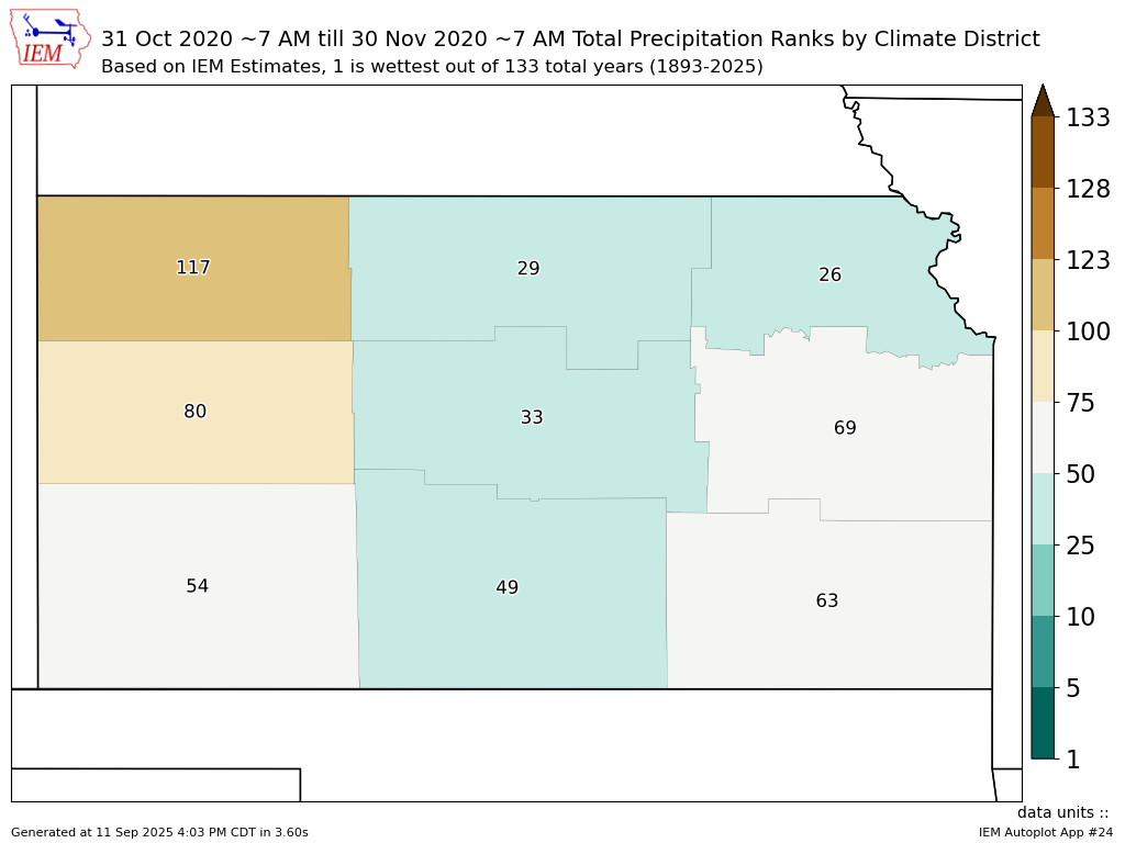 |
| Kansas November 2020 precipitation rankings by division. One denotes the wettest November on record (since 1893), 128 denotes the driest. Central, north-central, and northeast divisions were wetter than normal, while west-central and northwest divisions were drier than normal. |
Miscellaneous Climate Information
| Kansas November Red Flag Warnings | Kansas November Severe T-Storm Warnings |
 |
 |
| The map above shows the number of Kansas red flag warnings issued in November. Fire danger concerns were most frequent across western and northwest portions of the state, due to continued below normal precipitation. | The above map shows the number of Kansas severe thunderstorm warnings issued in November. It was the most since November 2015. |
|
Kansas November Winter Weather Advisories |
 |
| The above map displays the number of Kansas winter weather advisories issued in November. With the exception of north-central and northwest portions of the state, winter weather concerns were rather quiet across most of the state. |
 |
Media use of NWS Web News Stories is encouraged! Please acknowledge the NWS as the source of any news information accessed from this site. |
|

