Overview of ice event
|
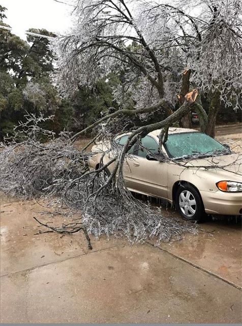
A significant ice storm impacted much of Kansas over the weekend of January 13-16th, 2017. This storm brought as much as 0.75" of ice in Great Bend to even higher amounts around Dodge City which led to damage to trees and power lines. Approximately 4,000 homes were without power in Barton, Harper, Kingman and Rice counties. Roads become slick with the freezing rain causing several accidents. South central and southeast Kansas had closer to 0.25" ice accumulations which was confined mainly to elevated surfaces. |
 Ice storm putting stress on branches but leaves a beautiful scenery in south Wichita today. Courtesy of Rich Williams |
Photos & Video:
|
|
|
|
|
|
|
|
 |
 |
||
| Damage from 1/2 inch of ice accumulation in Zenda. Courtesy Jodi Davis |
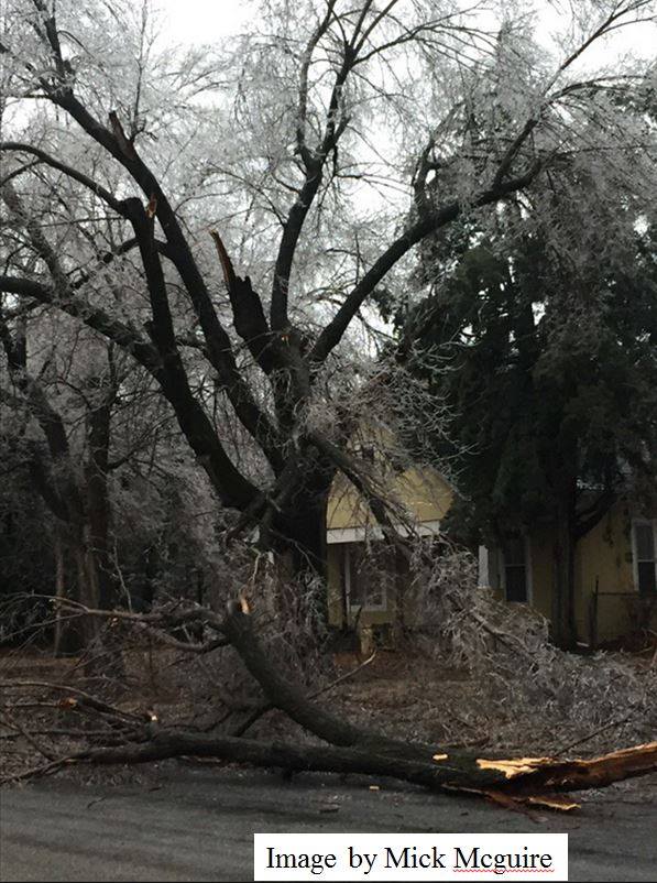
Tree damage in Clearwater Courtesy of Mick McGuire |
 |
 |
 |
|
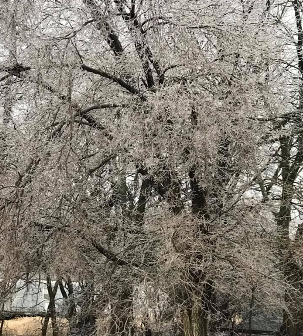
| A quarter inch of ice on trees in Elk Falls, KS. Courtesy of Samantha Mueller | Ice accumulation in Rose Hill. Courtesy of Julie Kutz | Ice on trees in Moran, KS. Courtesy of Chelle Stewart |
Rain Reports
 |
 |
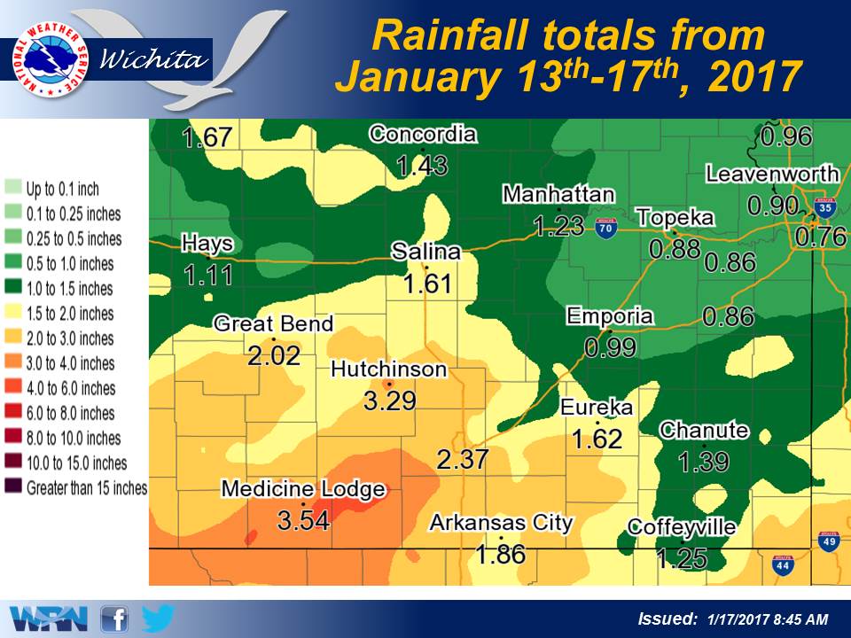
| 24 hour rainfall totals from January 15-16th at 7am | 4 day total rainfall from January 13-17th |
|
Environment
Significant icing events for the Central Plains typically come in stages and span over three or more days, and this event followed that blue print. The first stage was all started with the entrance of shallow cold arctic air spreading southward across the northern and central plains on Wednesday, January 11th. The next stage was a strong upper level weather system digging itself in over the southwestern states on Thursday, January 12th which moved very slowly to the northeast towards the heartland by Sunday, January 15th. Consequently as the shallow cold air remained locked in place across the region, warm moist air begin to stream northward and over top of the sub-freezing air mass. This generated several episodes of rain and freezing rain across Kansas which with the precipitation type predicated on the surface temperatures. The first episode of freezing rain began early Friday morning across southeast Kansas and continued into the evening hours. Meanwhile a second area of light freezing rain developed over south central Kansas on Friday evening and moved northward across the Wichita metro area during the rush hour commute home. Surface temperatures were in the upper 20s which caused this light rain to freeze on impact and created icy road conditions especially for untreated and elevated roadways. Numerous accidents occurred in a short period of time across the region, and a twenty-two car pile-up occurred on the exit ramp from Kellogg onto the Central Business District.
There was a lull in the precipitation for much of the night on Friday into Saturday morning before the next wave hit southern Kansas on Saturday afternoon and continued through the overnight hours. Ice begin to accumulate over the area but was mainly confined to elevated surfaces, trees, and power lines with temperatures hovering around the freezing mark; however, locations that had temperatures at 30 degrees or colder witnessed more efficient ice accretion. A third wave of precipitation began late Saturday night and continued all day Sunday across the entire region; however, the freezing line begin to shift west which stopped the rain from freezing across portions of southern Kansas. Some of the worst ice accumulation began to affect locations along and west of a line from Anthony to Hutchinson to Lincoln. Several tree limbs and some power lines were knocked down by the higher ice accumulation. Ice accumulations for much of south central and southeast Kansas were confined to mainly elevated surfaces and objects with amounts around a quarter of an inch.
 |
Media use of NWS Web News Stories is encouraged! Please acknowledge the NWS as the source of any news information accessed from this site. |
 |