Overview
|
A low pressure system moving across the central United States with an associated cold front and dry line initiated thunderstorms in southern Nebraska, the eastern half of Kansas and central Oklahoma. These storms produced swaths of wind damage and large hail. |
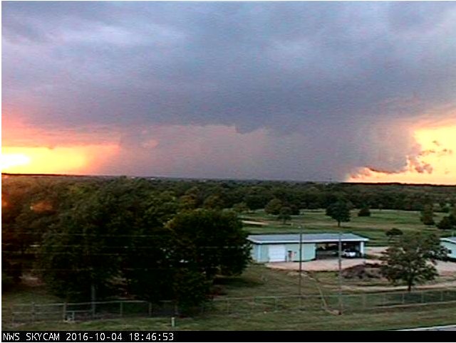 Westward facing NWS skycam at 6:45pm |
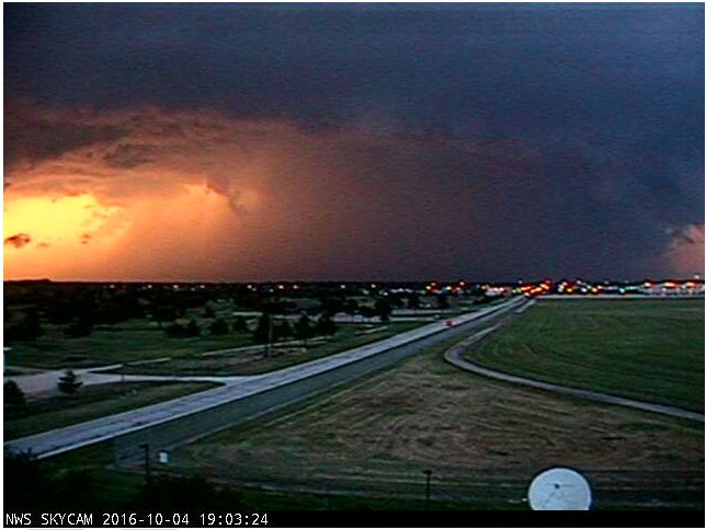 NWS skycam pointed towards the NNW at 7:02pm |
Wind & Hail:
Wind
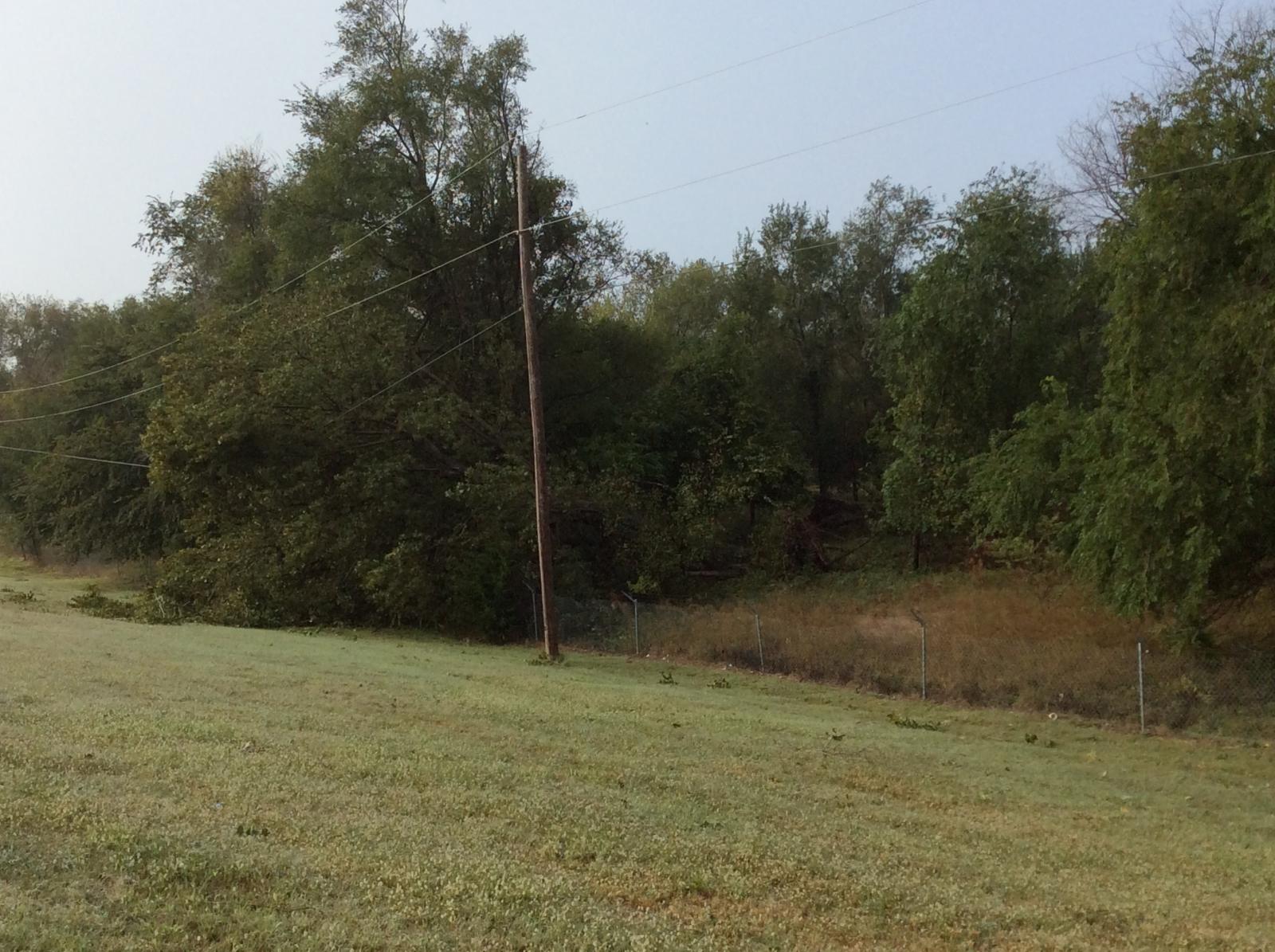
Winds howled with some of the storms which caused tree damage in the west and northern portions of Sedgwick County. The highest measured wind speed was 72 mph at Maize High School. There were a couple of 70 mph reports in Lincoln County near Beverly and in Goddard.
 |
 |
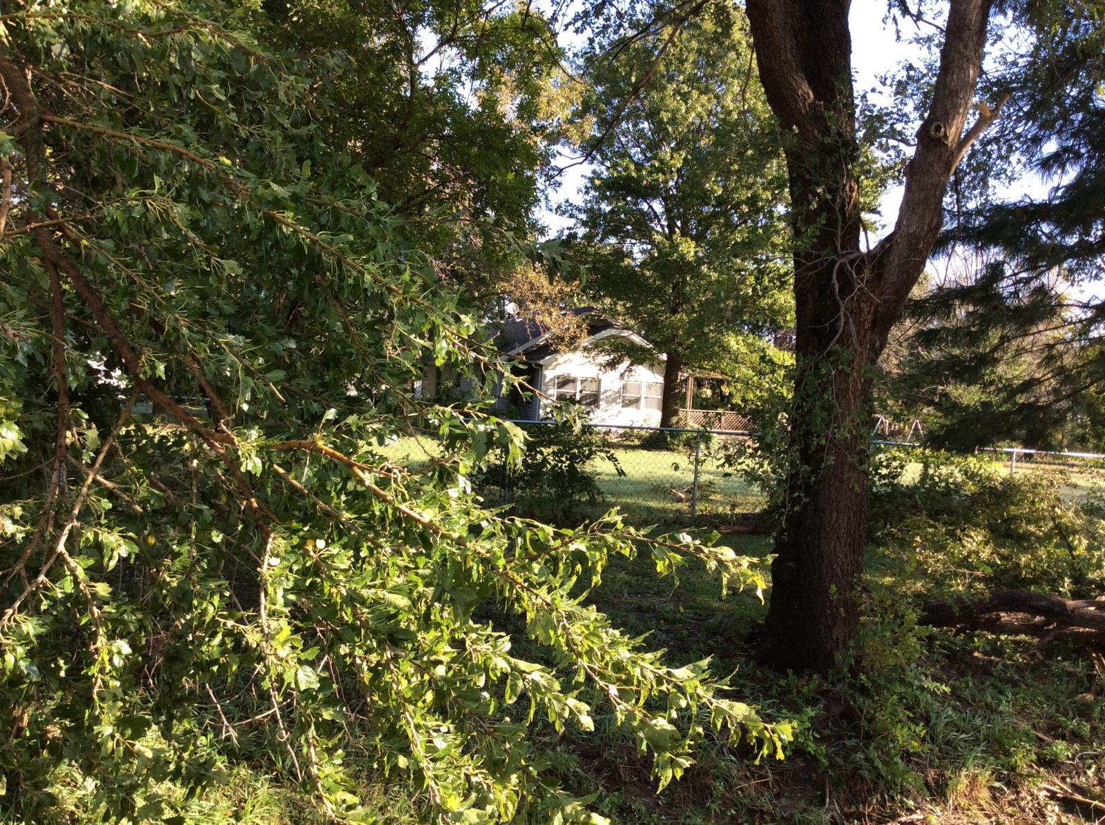 |
| Tree damage on power line about 2NE Maize just south Arkansas River found on NWS damage survey | Tree damage in a field 2SW Valley Center on 69th Street found on NWS damage survey | Tree damage at a home 2SSW Valley Center on 69th Street found on NWS damage survey |
|
Hail
A range of hail was reported with the largest values of 2" or egg sized hail in Cheney and 3 SW of Goddard in Sedgwick County. Central Kansas did have reports of golf ball sized hail (1.75") at two locations: 3 SW Beverly and 3 S Lincoln on Kansas Highway 14.
|
|
|
Photos & Video:
Storm shots
|
|
|
|
|
|
|
|
Shelf cloud approaching Cassoday. Picture by Cheryl Ball |
Supercell over western Sedgwick county. Taken from the NWS office by Kevin Darmofal. |
Supercell over northwest Sedgwick county. Taken from NWS office by Jaclyn Ritzman |
Radar:
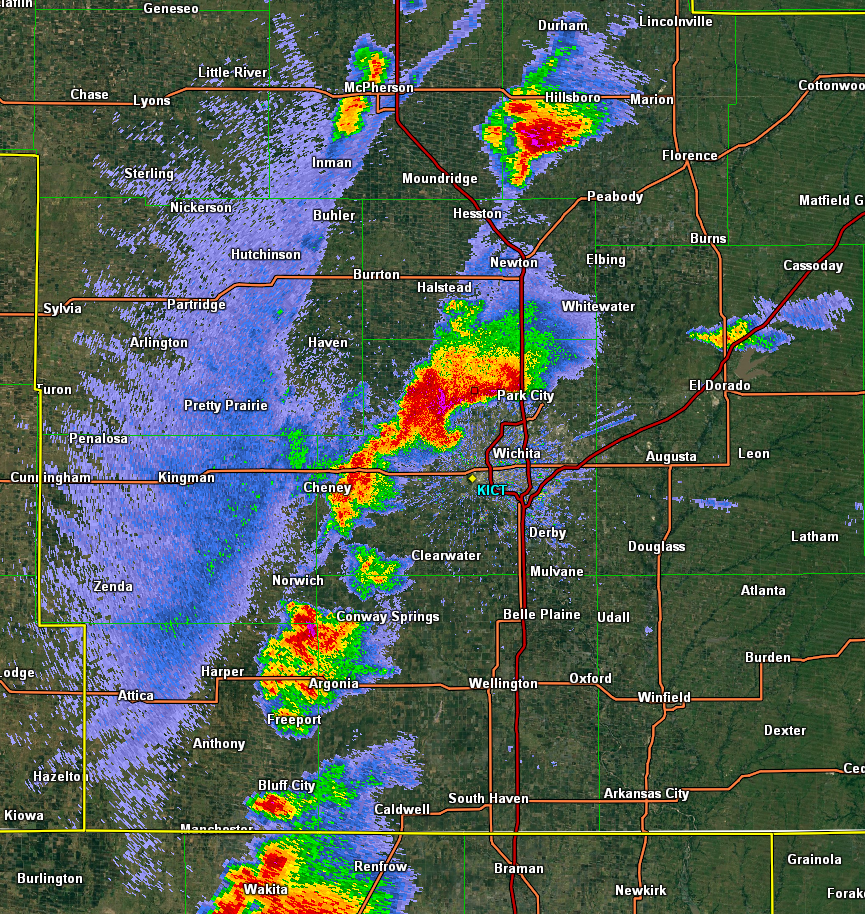
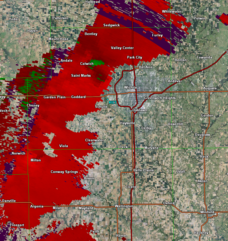
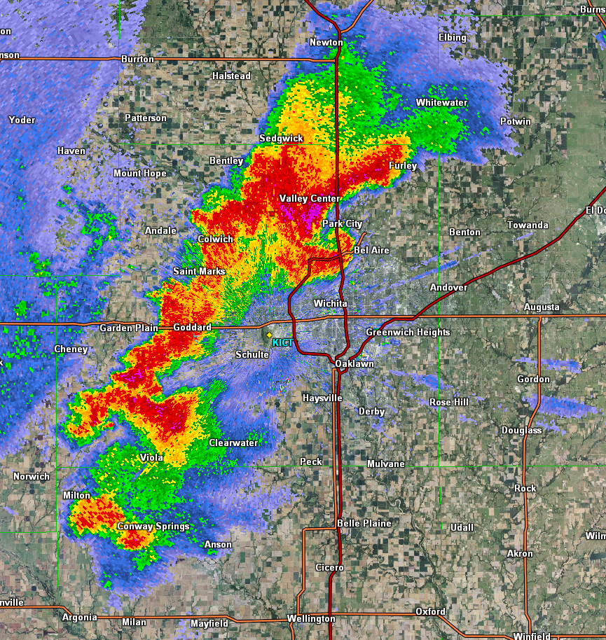
There were radar features including a comma and hook that could be found on the base reflectivity of the KICT radar. Since this storm was very close to the radar, a secondary radar called KVNX out of Oklahoma was utilized to better fully assess the storm. KVNX showed an inflow notch feature instead which is common with High Precipitation (HP) storms. The assessment of velocity showed broad rotation which would suggest strong winds versus tornadic activity.
 |
 |
 |
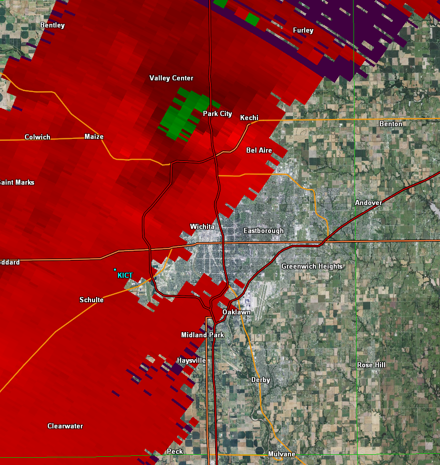 |
| Comma shaped storm in NW Sedgwick County at 6:57pm. | This velocity image from the KVNX radar shows broad rotation at 6:57pm. | A zoomed in version of the reflectivity in Sedgwick County at 7:13pm. | A zoomed in velocity image from the KVNX radar once again shows broad rotation at 7:13pm. |
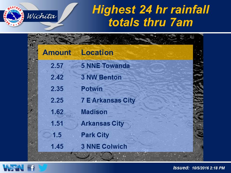
Rain Reports
 |
Media use of NWS Web News Stories is encouraged! Please acknowledge the NWS as the source of any news information accessed from this site. |
 |