Insight and Review of December 26-28th Kansas Winter Storm
|
The National Weather Service forecast a significant winter storm to affect Kansas during the weekend of December 26th through the 28th. This was a very difficult storm to forecast. A review of the event follows, with some insight into why our snowfall forecast was inaccurate. Please know that we take forecast misses very seriously and continue to research, develop, and train on new science and technology that improves our service to you. Event Summary: Ice accumulations: Up to 1/2 inch over south-central and southeast Kansas. Snow/sleet accumulations: Up to 1 inch. Flooding: Minor low-land flooding in Labette, Montgomery and Neosho counties. Impacts:
|
|
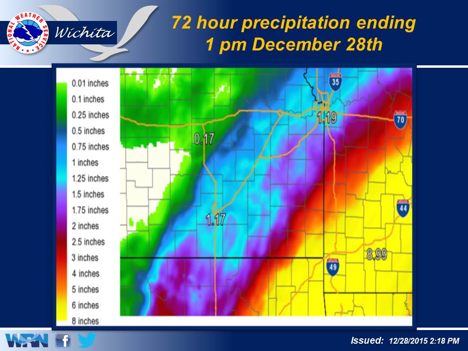
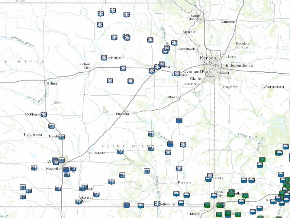
Storm-Total Liquid-Equivalent Precipitation Ending 1pm December 28th
|
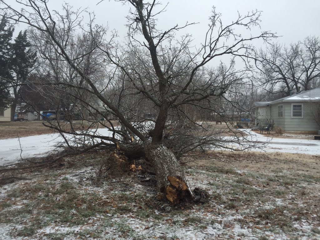
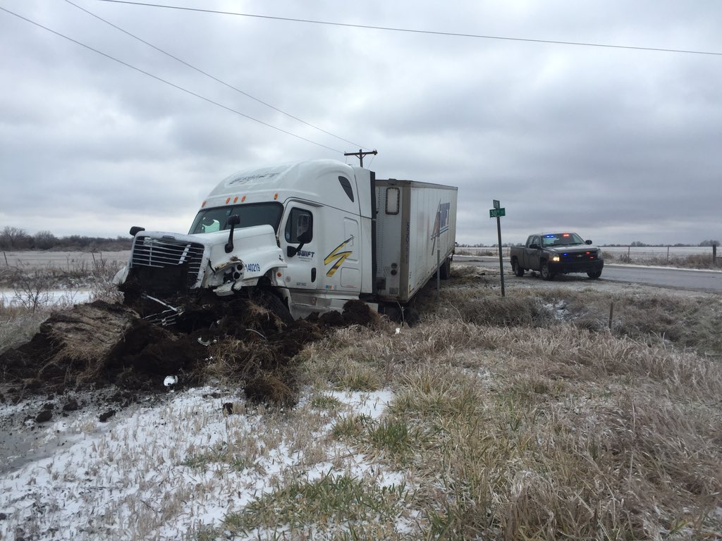
Storm Photos
|
|
|
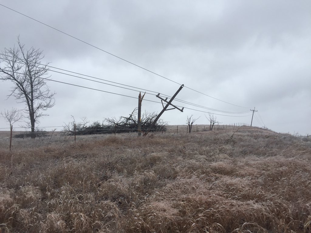 Power line damage in Greenwood County. Photo courtesy Greenwood County Emergency Manager. |
|
|
Tree damage in Severy, KS. Photo courtesy Greenwood County Emergency Management via twitter. |
Damage to semi truck in Greenwood County. Photo courtesy Greenwood County Emergency Management via Twitter. |
|
|
Reports
Click on image below for a list of reports from this event
Forecast Insights
 |
 |
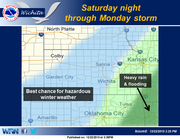
| So what went well? Here is a forecast graphic we issued in the afternoon of Tuesday, December 22nd. We did well forecasting the overall flooding and winter weather threat. | Here is a forecast graphic we issued in the evening of Saturday, December 26th. Once again, the overall threat of hazardous winter weather (minus the heavy snow) was anticipated fairly well, along with the heavy rain and associated flooding threat over southeast KS. |
 |
 |
| What did not go well was the snow forecast. There were several factors that reduced the amount of snow significantly. The first problem was the slower and further east progression of the upper low (noted by the yellow "L" over the Texas Panhandle). Because of this, the system's lifting mechanisms which cause widespread heavy precipitation weakened. Also, the moisture that was available (green/blue areas) decreased, and the amount of dry air being pulled into the storm increased (orange/red areas). Here is a picture of water vapor in the atmosphere. This tells us how much moisture was in the 10,000 foot to 35,000 foot range at 8:15 pm Sunday evening. |
By 2 am early Monday morning, the amount of moisture (blue colors) was drastically reduced over the region, with plenty of dry air being pulled into the system. Meanwhile, the upper level disturbance was still moving east and not northeast. All these factors came into play to drastically reduce heavy snowfall potential across the region. Like anything in life, lessons are learned by failures. |