
A prolonged, dangerous heat wave will persist through the Independence Day weekend across the Ohio Valley, Mid-South, and East Coast. Severe thunderstorms are expected to produce damaging wind gusts from the Upper Ohio Valley into the Mid Atlantic, and across the central Great Plains this afternoon and evening. Large hail and heavy rain is also possible across the Great Plains. Read More >
Iowa Forecast Grassland Fire Danger Index |
|
d
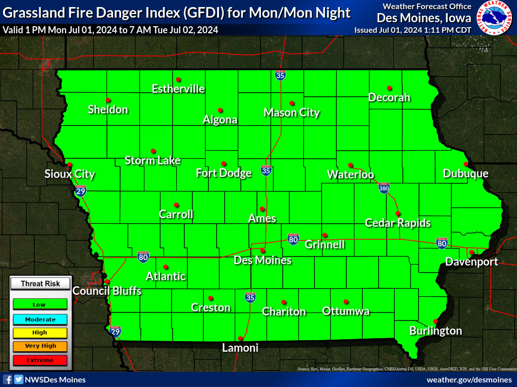 Click image above for a larger image
|
|
The Grassland Fire Danger Index indicates the potential for grassland fires to experience extreme fire behavior, which in turn, can lead to a potential threat to life and property. The GFDI accounts for the curing of the fuel (grasses), temperature, relative humidity and the average sustained wind. In addition, the State of Iowa Fire Marshal's Office provides the current list of burn bans by county (click here) |
|
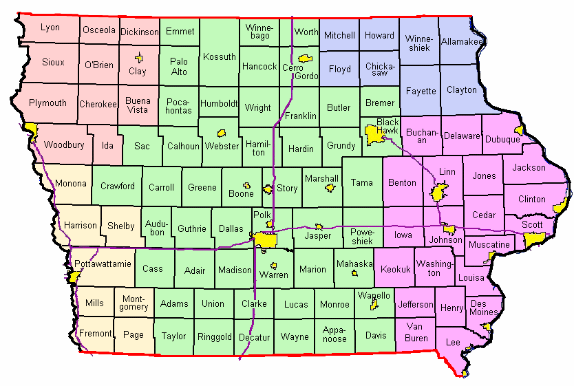
Click on the map below for that county's Fire Weather Forecast
From NWS Offices in Des Moines, Sioux Falls, Omaha, La Crosse, and Quad Cities
BACKUP LINKS TO FIRE WEATHER FORECASTS
| Des Moines | Sioux Falls | Omaha | La Crosse | Quad Cities |

