Overview
This is a page placeholder for the Iowa derechos section, which can appear as a tabs on a derecho event summary webpage such as the August 2020 and December 2021 derecho summary webpages. This page placeholder can be used to keep track of additional derechos that impact at least some portion of Iowa, not necessarily WFO Des Moines' CWA.
Ensure you update the Derechos Facts/FAQs to be representative for the event.
Iowa's Past Derechos
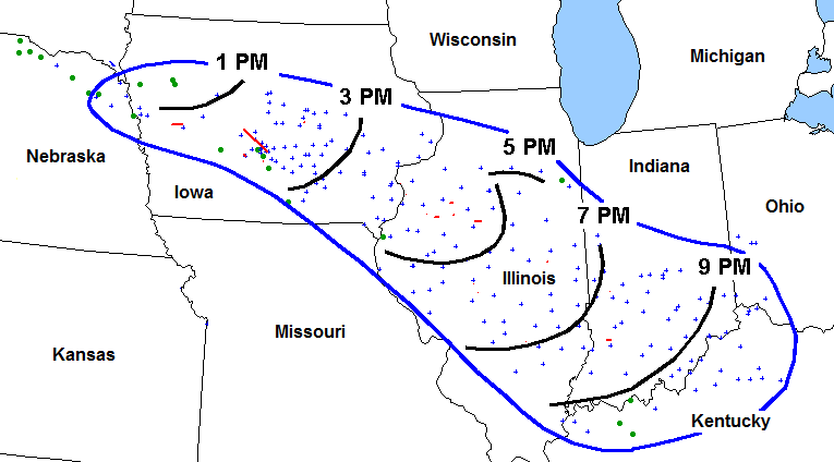
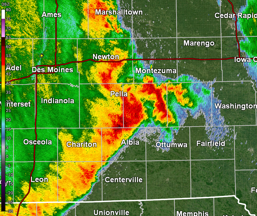
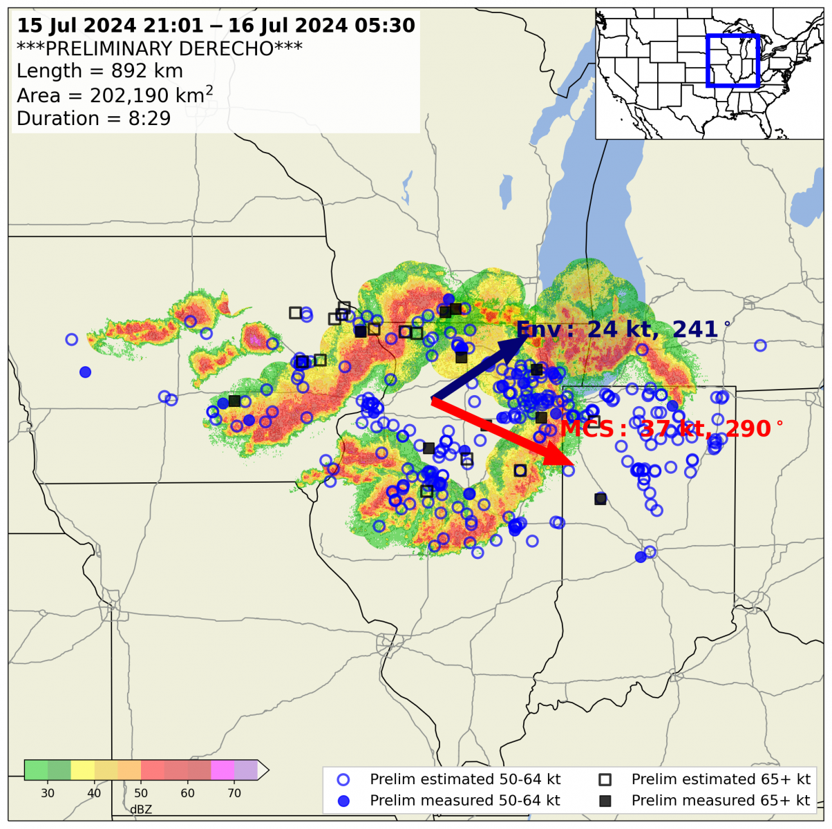
A listing of past derechos that have impacted at least some portion of Iowa since mainly 1980. The name in quotes is taken from the "Noteworthy Events" from the Storm Prediction Center's "About Derechos" webpage with the exception of the 1877 and derechos from 2020 onward. Click on the link(s) below the image for additional details from the Storm Prediction Center's summary, an event webpage, and/or a journal article.
 |
|
|
| July 31, 1877 - "The Original Derecho" Image by Hinrichs (1888) |
July 4-5, 1980 Derecho - "The 'More Trees Down' Derecho" Image courtesy of Storm Prediction Center |
July 19, 1983 Derecho - "The I-94 Derecho" Image courtesy of Storm Prediction Center |
|
|
|
 |
| July 28-29, 1986 Derecho - "The Supercell Transition Derecho" Image courtesy of Storm Prediction Center |
July 7-8, 1991 Derecho - "The Southern Great Lakes Derecho of 1991" Image courtesy of Storm Prediction Center |
July 8-9, 1993 Derecho - "The Great Plains Derecho" Image by Bentley and Cooper (1997) |
|
|
 |
 |
| May 30-31, 1998 Derecho - "The Southern Great Lakes Derecho of 1998" Image courtesy of Storm Prediction Center |
June 29, 1998 - "The Corn Belt Derecho" Image courtesy of Storm Prediction Center June 29, 1998 Central Iowa Tornado/Derecho Event - WFO Des Moines Summary |
July 20, 2008 WFO Quad Cities Summary |
|
|
 |
 |
| July 11, 2011 - "The Cross Country Derecho of July 2011" Image courtesy of Storm Prediction Center July 11, 2011 East Central Iowa Derecho - WFO Des Moines Event Summary Webpage |
June 30, 2014 - "The One-Two Punch Derechos" Image courtesy of Storm Prediction Center June 30, 2014 Severe Weather Outbreak - WFO Des Moines Event Summary Webpage |
August 10, 2020 - "The August 2020 Midwest Derecho" August 10, 2020 Derecho - WFO Des Moines Event Summary Webpage |
 |
 |
 |
| December 15, 2021 - "December Serial Derecho" December 15, 2021 - WFO Des Moines Event Summary Webpage |
May 12, 2022 - "May 2022 Midwest Derecho" WFO Sioux Falls Summary Webpage |
July 5, 2022 - "July 2022 Derecho" WFO Sioux Falls Summary Webpage |
 |
 |
 |
| June 29, 2023 WFO Quad Cities Summary Webpage |
May 24, 2024 WFO Des Moines Summary WFO Quad Cities Summary Webpage |
July 15, 2024 WFO Des Moines Summary WFO Quad Cities Summary Webpage |
Derechos Facts & FAQs
|
Derecho Facts
Derecho FAQs The December 15, 2021 derecho was the first derecho in December anywhere in the United States since known records. Compared to the August 10, 2020 derecho, the impacts were not as severe in large part due to the lack of vegetation on trees. In addition, this derecho was a "serial derecho", which is characterized by a strong, migratory low pressure with strong low level winds and a squall line, or line of storms, with multiple embedded bow echoes. In contrast, a progressive derecho like the August 2020 derecho is characterized by a short line of storms with the damaging winds driven by the thunderstorm's cold pool. More information about progressive and serial derechos can be found on the Storm Prediction Center's derechos page. While not as common with this derecho, the August 2020 derecho was often compared to an inland hurricane or hurricanes in general. While this does help people relate to the type of wind damage, this is where the comparisons between derechos and hurricanes end.
Finally, while the damage from a derecho can look like tornado damage, a key distinction between a derecho and a tornado is the widespread damage swath. A tornado's width is generally less than a mile with the widest tornado width around 2.5 miles. A derecho on the other hand produces damage over a much larger width of many miles. |
|
 |
Media use of NWS Web News Stories is encouraged! Please acknowledge the NWS as the source of any news information accessed from this site. |
 |