Overview
On the afternoon of November 11, 2015, a line of storms produced a series of tornadoes across the southern half of Iowa. Tornadoes were reported from as far west as Avoca to the Davenport area. These storms, moving at speeds of 50 to 60 mph at times, produced AT LEAST 10 tornadoes in central Iowa, with this number all but certain to increase in the coming days as additional information is collected. One small, short-lived tornado grazed the Des Moines International Airport and caused damage to some equipment at the airport and to the neighborhood to the north. Tornadoes also struck Knoxville, Barnes City, and around Rathbun Lake. Please note that the statistics below are very preliminary, and this page will be updated as new information arrives.
Additional areas of interest that will be evaluated for tornadoes in the coming days include:
Tornado Statistics
|
Tornado #1 - 4.8 miles SW of Yale
|
Track Map 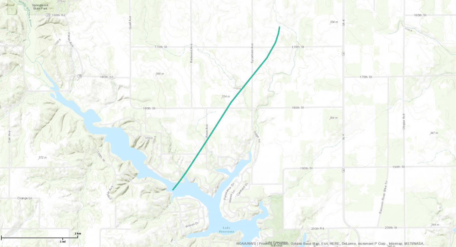 
Click Map for Larger Image |
||||||||||||||||
|
Tornado #2 - 7.3 miles NNW of Plano
|
Track Map 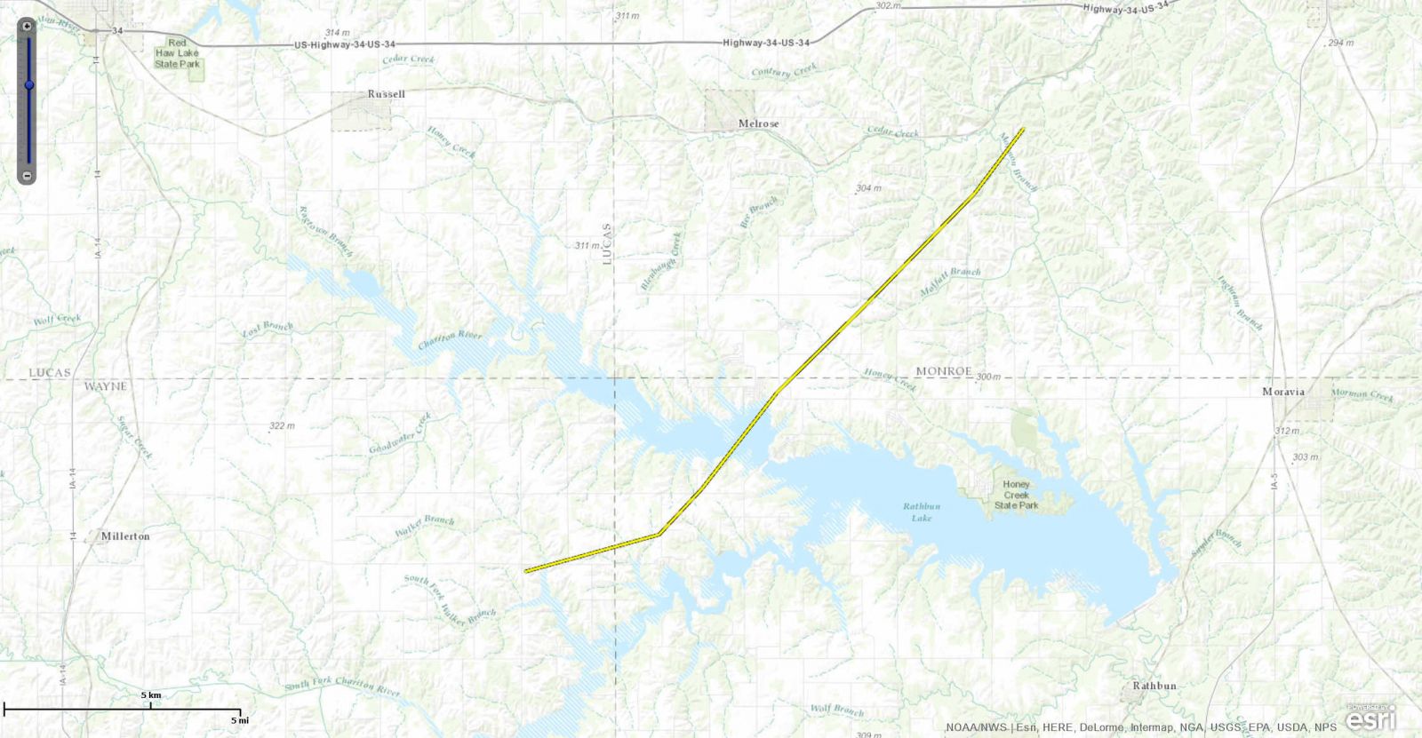
Click Map for Larger Image |
||||||||||||||||
|
Tornado #3 - Des Moines Airport
|
Track Map 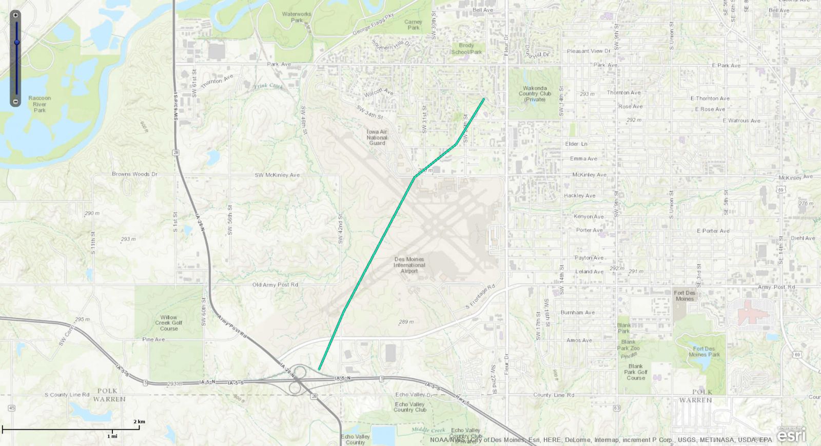
Click Map for Larger Image |
||||||||||||||||
|
Tornado #4 - Knoxville
|
Track Map 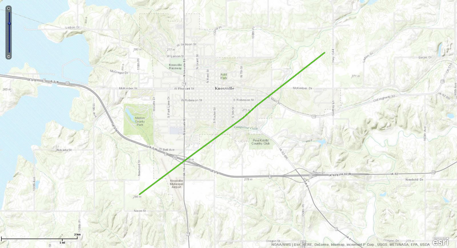
Click Map for Larger Image |
||||||||||||||||
|
Tornado #5 - 3 miles SSW of Barnes City
|
Track Map 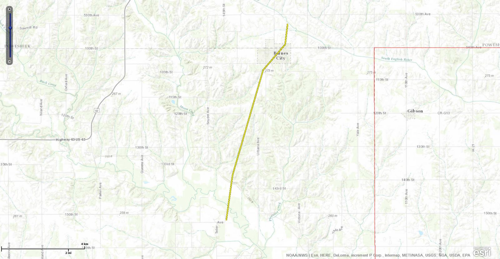
Click Map for Larger Image |
||||||||||||||||
|
Northwest of Adel
|
Track Map 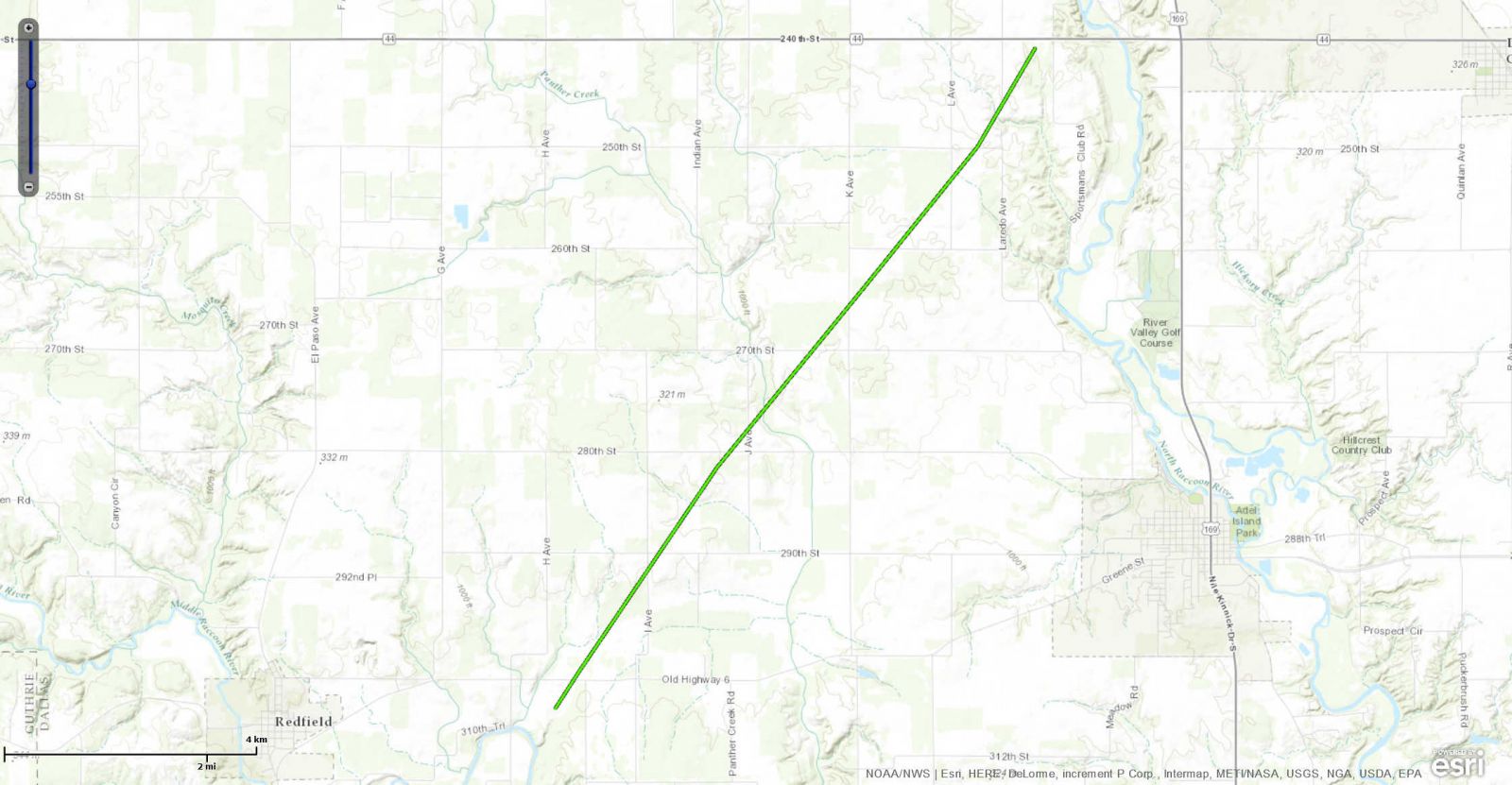
Click Map for Larger Image |
||||||||||||||||
|
West of Winterset
|
Track Map 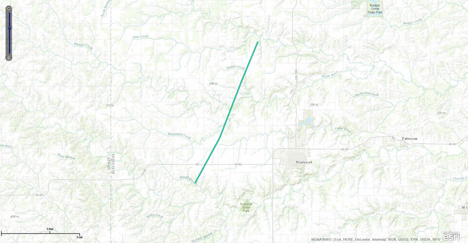
Click Map for Larger Image |
||||||||||||||||
|
Southeast of Macksburg
|
Track Map 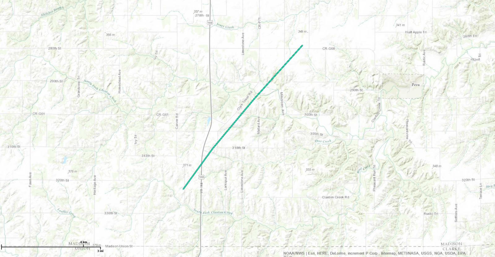
Click Map for Larger Image |
||||||||||||||||
|
North of Grand River
|
Track Map 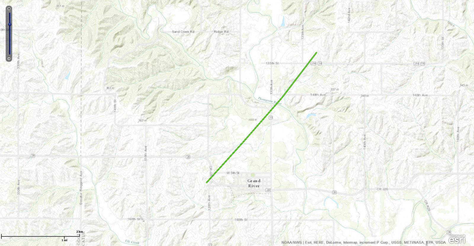
Click Map for Larger Image |
||||||||||||||||
|
Southeast of Allerton
|
Track Map 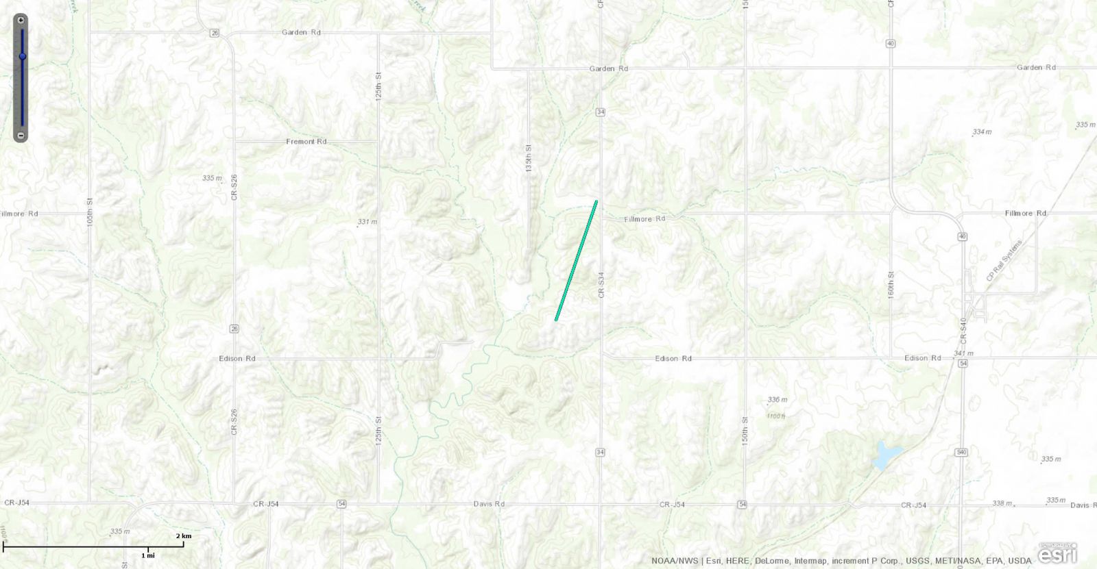
Click Map for Larger Image |
||||||||||||||||
The Enhanced Fujita (EF) Scale classifies tornadoes into the following categories:
| EF0 Weak 65-85 mph |
EF1 Moderate 86-110 mph |
EF2 Significant 111-135 mph |
EF3 Severe 136-165 mph |
EF4 Extreme 166-200 mph |
EF5 Catastrophic Over 200 mph |
 |
|||||
Photos & Video
Tornado #2 - Around Lake Rathbun (Appanoose and Monroe Counties)
| A house lost its roof just north of Lake Rathbun (NWS Storm Survey) |
A house lost part of its roof north of Lake Rathbun, with the garage completely gone (NWS Storm Survey) |
Many trees sustained heavy damage along the path (NWS Storm Survey) |
Tornado #4 - Knoxville (Marion County)
| Damaged roofing inside the Wal Mart in Knoxville (NWS Storm Survey) |
A home lost its roof on the east side of Knoxville (NWS Storm Survey) |
Tree damage on the east side of Knoxville (NWS Storm Survey) |
Tornado #5 - Barnes City (Mahaska & Poweshiek Counties)
| Debris strewn about southwest of Barnes City (NWS Storm Survey) |
Outbuildings destroyed in Barnes City (NWS Storm Survey) |
Additional damage in Barnes City (NWS Storm Survey) |
Radar Data
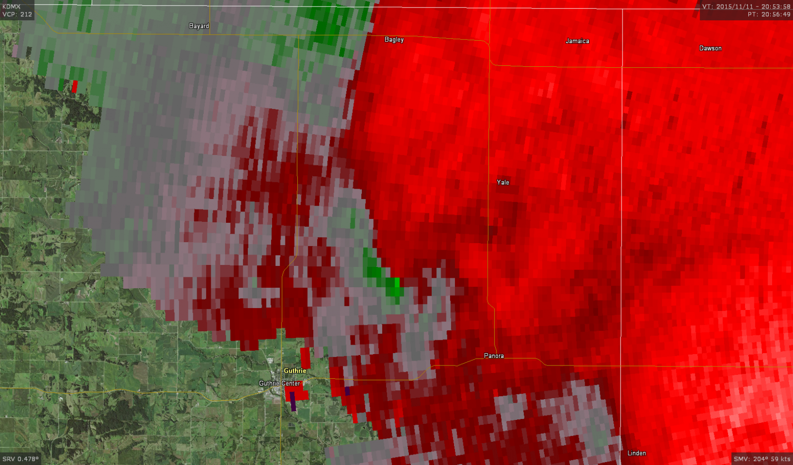
Tornado #1 - 4.8 miles SW of Yale (Guthrie County)
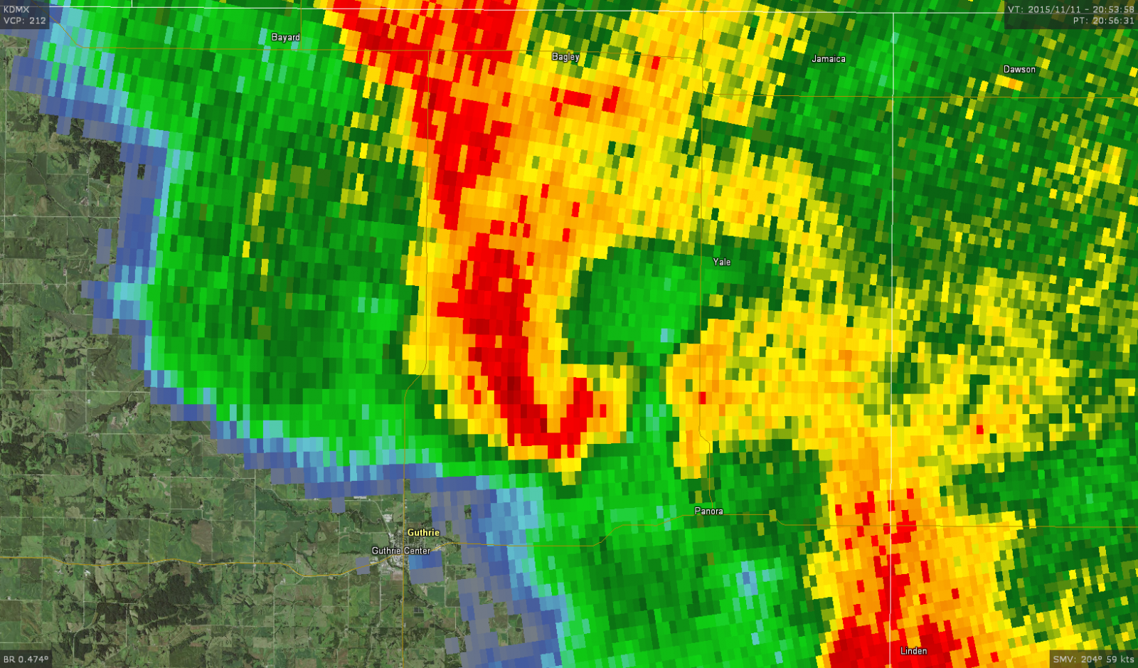 |
 |
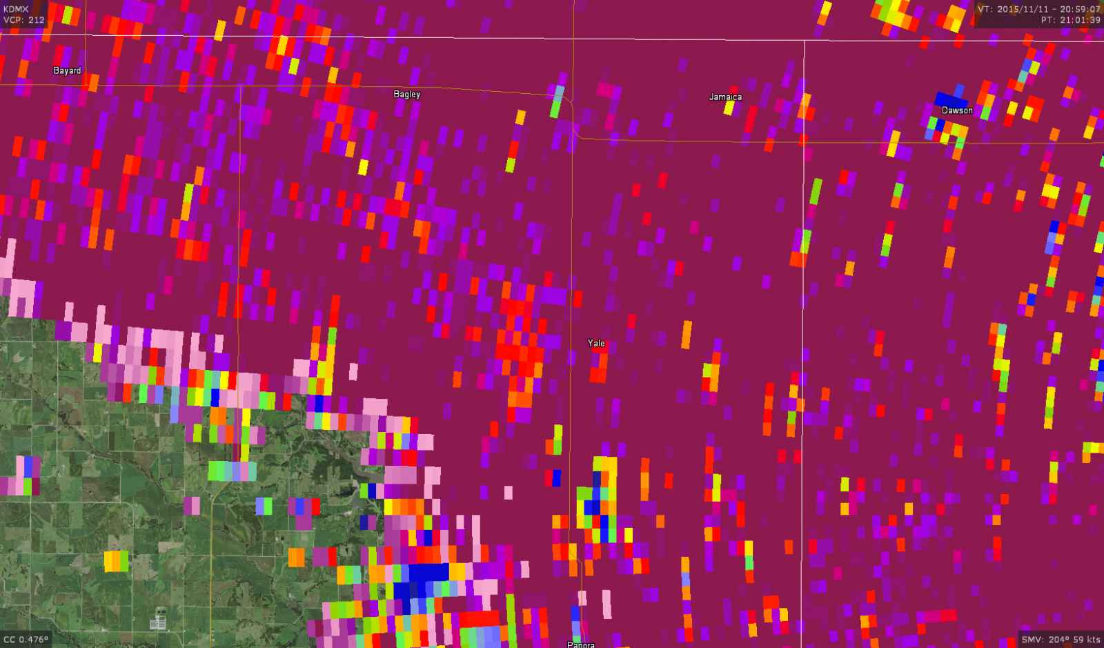 |
| The classic hook shape appears in reflectivity around the time of touchdown. | A very weak couplet on storm-relative velocity SW of Yale indicates the very narrow nature of the tornado. | Shortly after lifting off, a faint depression appears in the correlation coefficient image (orange area west of Yale), signally the presence of dirt being lifted up by the tornado. |
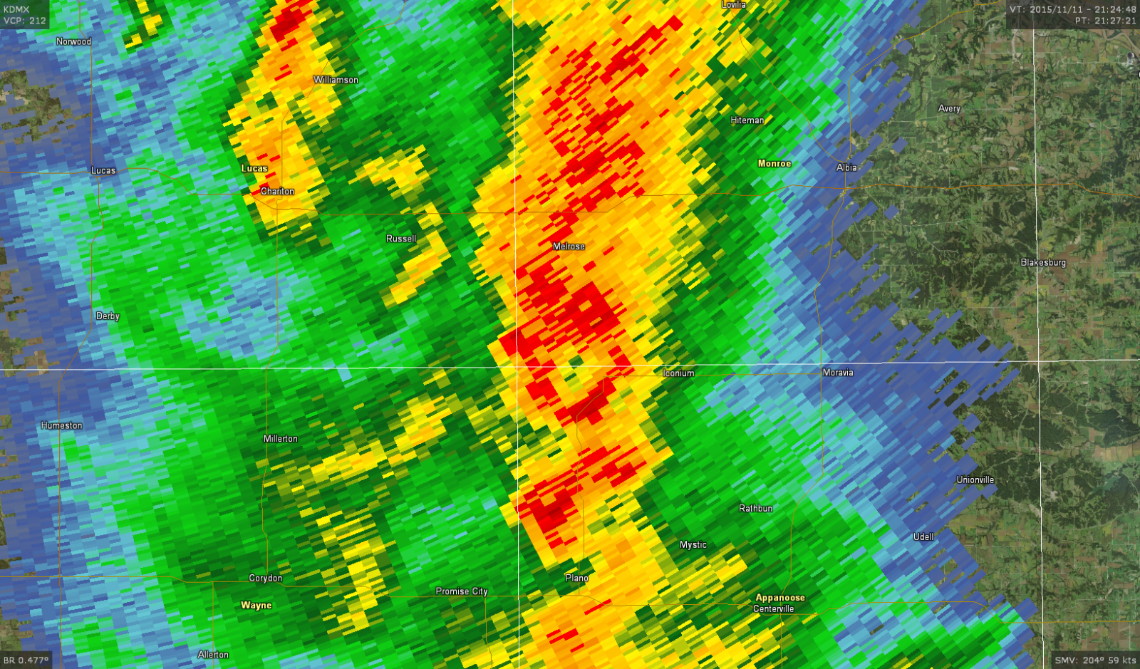
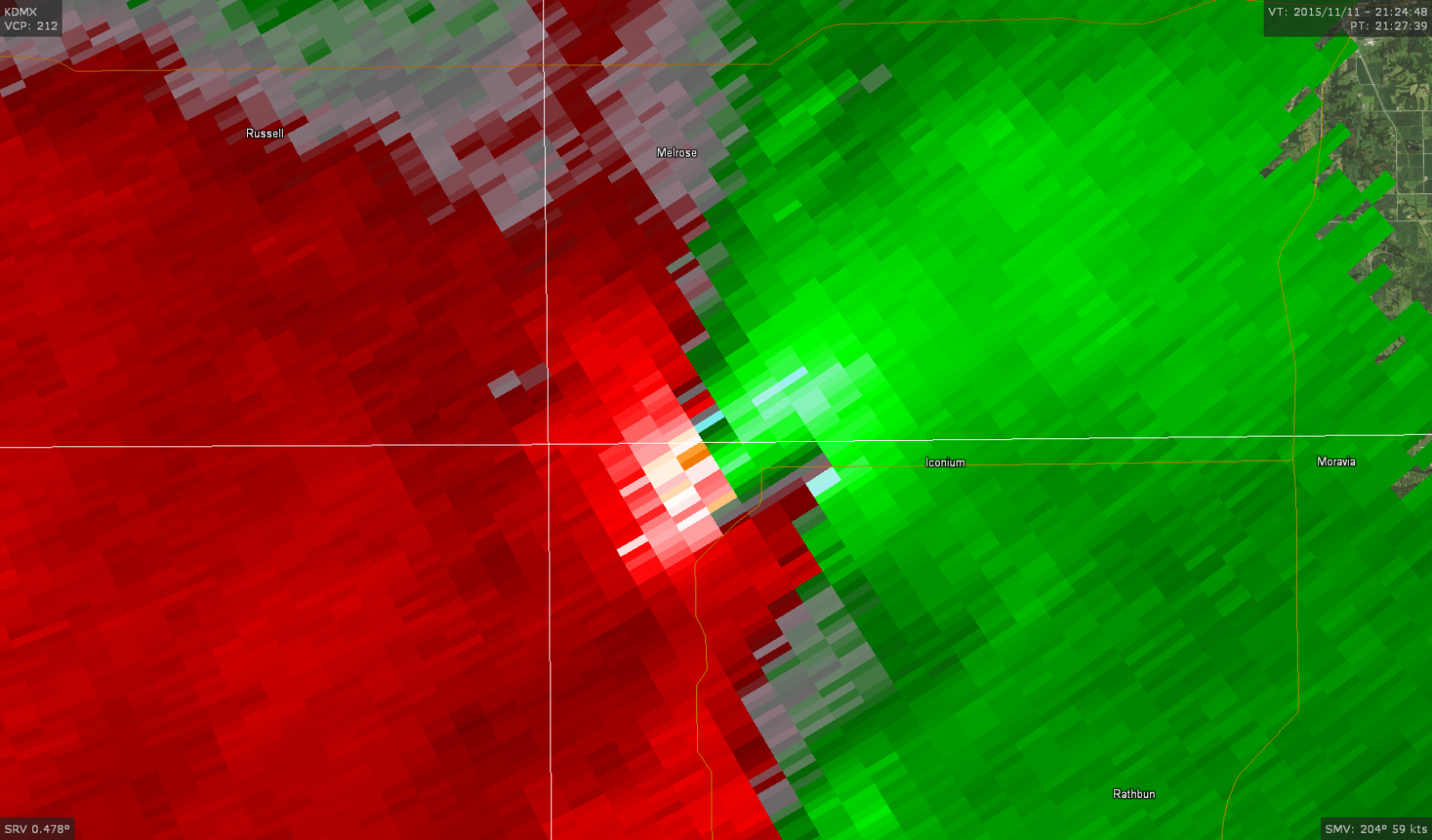
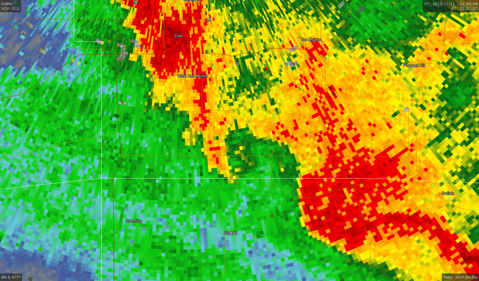
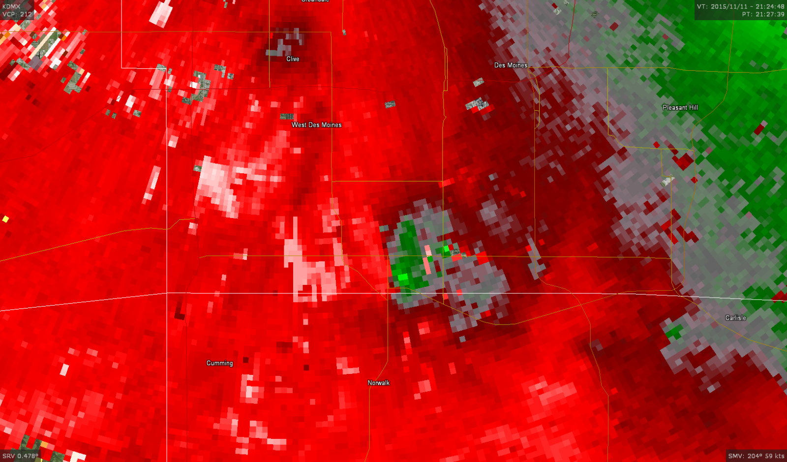
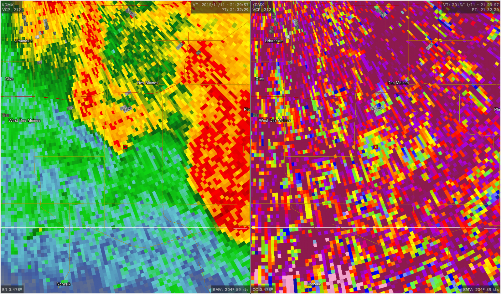
Tornado #2 - 6.5 miles NNW of Plano (Appanoose & Monroe Counties)
 |
 |
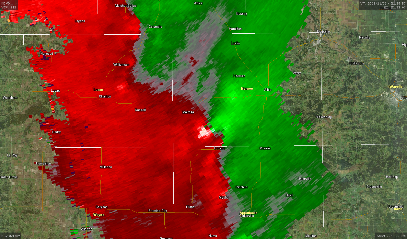 |
| Reflectivity image during the tornado, showing the storm embedded in a line of other thunderstorms. | Intense rotation during the peak of the tornado, as it was producing EF-2 damage. Maybe a satellite tornado to the SE? | The tornado weakens later on its life, with the rotational couplet also becoming less pronounced. |
Tornado #3 - Des Moines Airport (Polk County)
 |
 |
 |
| A hook echo appears on the backside of the line of thunderstorms, denoting the tornado as it hits the airport. | A small couplet also marks the spot of the tornado over the Des Moines airport. | As the tornado lifted, a depression in the correlation coefficient also appeared in the location of the hook (center of both split screen images), a tipoff that debris was being lofted upwards. |
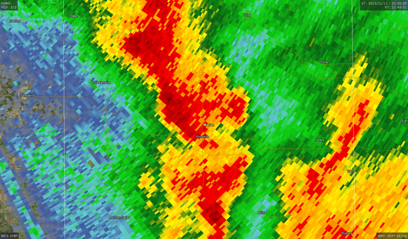
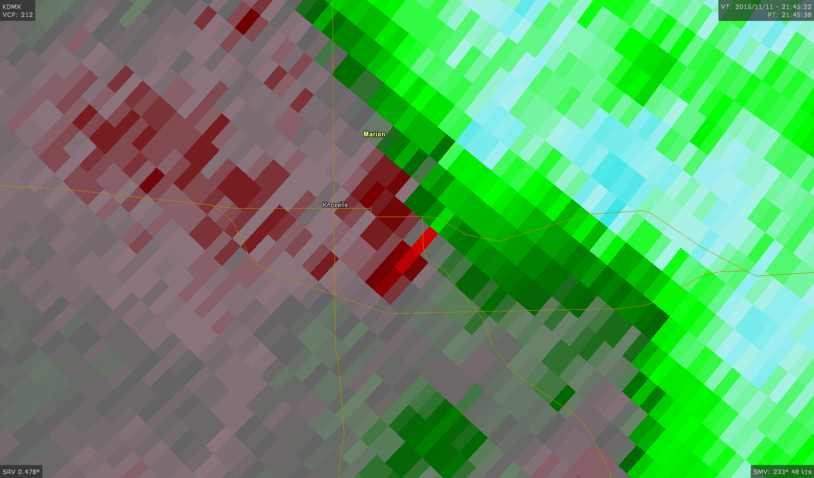
Tornado #4 - Knoxville (Marion County)
 |
 |
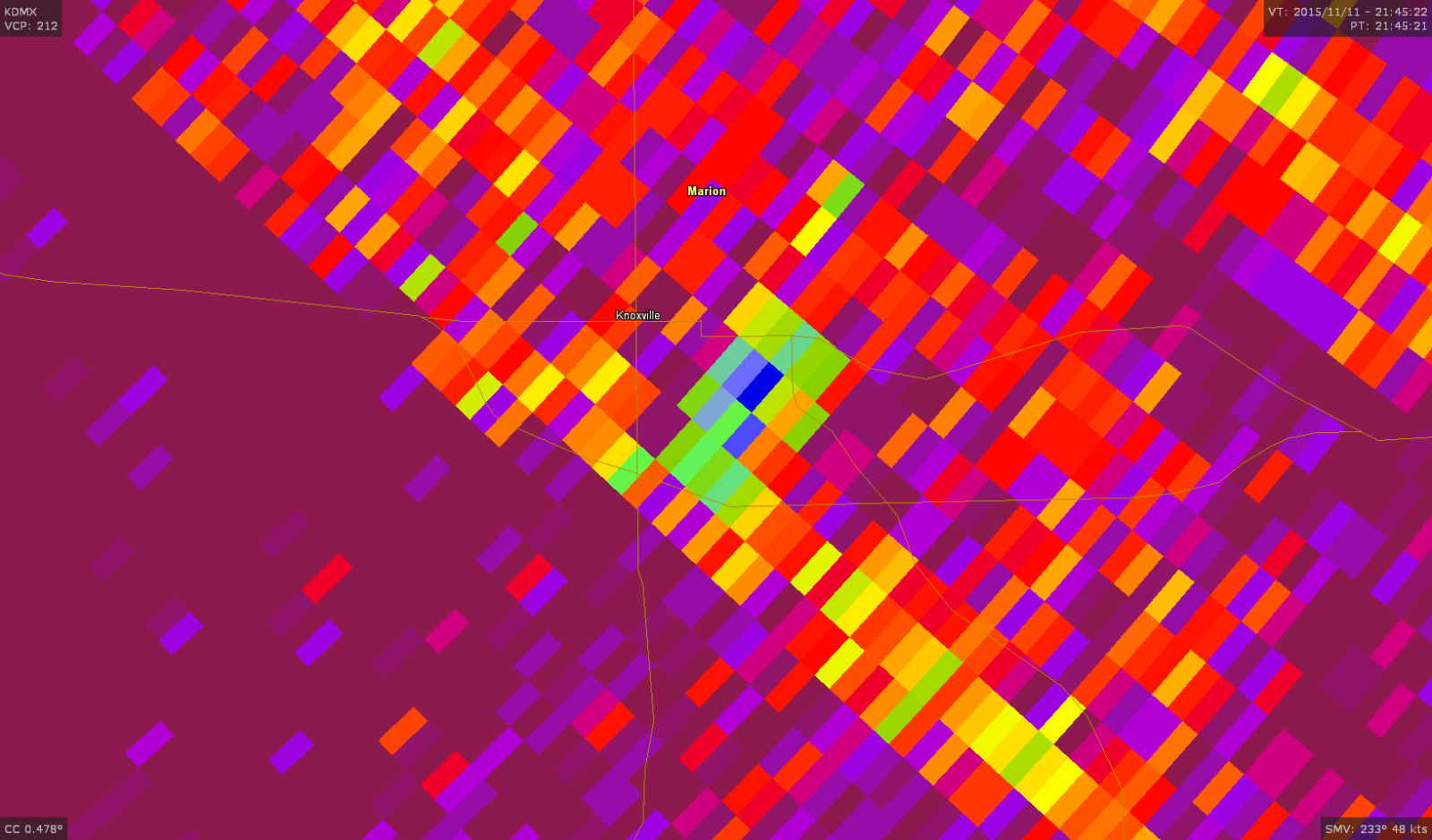 |
| Reflectivity image during the tornado, showing the storm embedded in a line of other thunderstorms. | A VERY narrow couplet near Knoxville is shows how narrow the tornado was. | While a bit hard to see in the data noise, a tornadic debris signature shows up (green and blue colors) as the tornado hits Knoxville. |
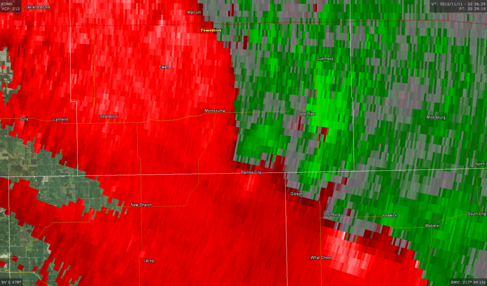
Tornado #5 - 2 miles SSW of Barnes City (Mahaska & Poweshiek Counties)
 |
 |
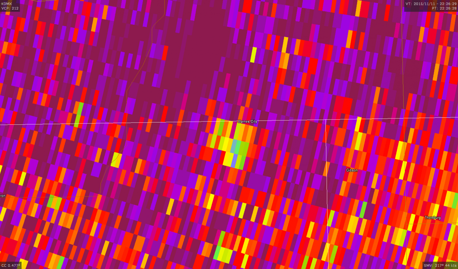 |
| Reflectivity image during the tornado, showing the storm embedded in a line of other thunderstorms. | A broad area of rotation was the only indication on velocity that a tornado might be present. | However, correlation coefficient revealed a stark TDS, proof that a tornado was occurring. |
Wind Damage
Pockets of downburst wind damage were also found along the path of the storms. The NWS surveyed areas south of Knoxville and around the Prairie City area, finding only wind damage in these areas. Additional photos will be posted here in the coming days.
| Damage to the Casey's in Prairie City (NWS Storm Survey) |
Tree Damage in Prairie City (NWS Storm Survey) |
Roof Panel Damage in Prairie City (NWS Storm Survey) |
Additional Information
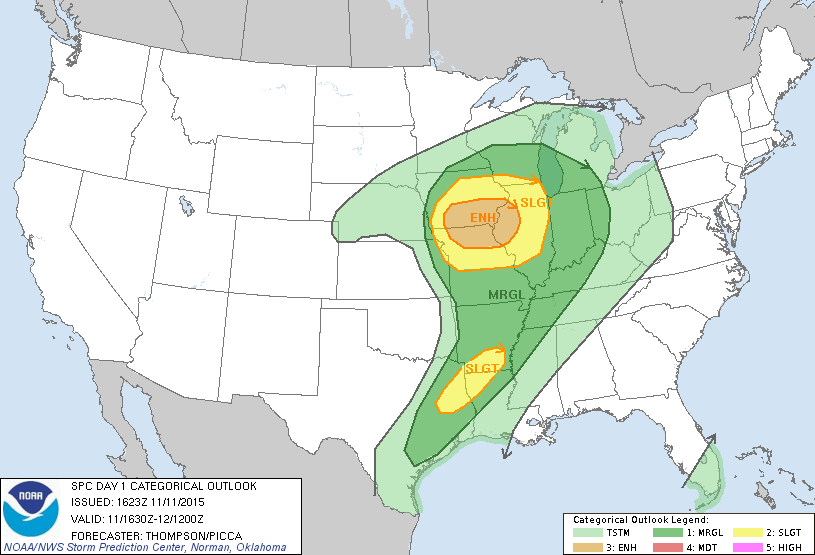
The Forecast
Summaries from other NWS Offices
 |
Media use of NWS Web News Stories is encouraged! Please acknowledge the NWS as the source of any news information accessed from this site. |
|