Overview
|
After an unseasonably warm December to end 2023, the beginning of 2024 reminded Iowans what winter can really feel like as an upper level low pressure system brought heavy snow, blizzard conditions, and frigid cold to the state. This onslaught of wintry weather came in waves, starting with heavy snowfall on the night of January 11th and lasting through January 12th. Accumulations were highest over southern and southeastern Iowa where amounts ranged from 10 to 14 inches, then steadily tapered off further north and west where 6 to 8 inches was more common. The heavier snowfall rates moved out of the area by midday Friday, January 12th, In addition to the heavy snow and blizzard conditions, this system brought down an Arctic air mass which plummeted temperatures well below zero. Wind chills during the blizzard dropped to the -10s to -20s on Friday, then -30s to -40s by Saturday evening, creating life-threatening danger with this winter storm. |
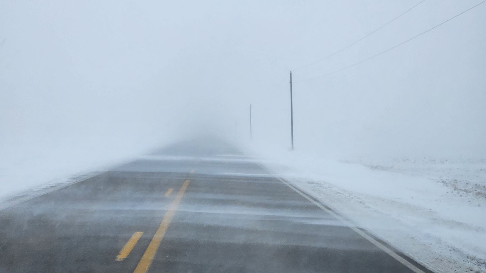
 Photo taken on CR R38 near Slater. Photo courtesy of Rod Donavon. |
 |
 |
 |
| Total snowfall amounts from January 11th through January 13th. Image courtesy of the Iowa Environmental Mesonet. | Semis stuck on I-80 eastbound near Victor. Photo courtesy of the Iowa DOT. | Iowa road conditions throughout the course of the event. Images courtesy of the Iowa Environmental Mesonet. |
Winds
| Location | Peak Gust (MPH) | Time | Source |
| Ogden | 53 | 0926 AM 01/12 | CWOP |
| Ames Airport | 53 | 0232 PM 01/12 | ASOS |
| 3.4 SW Sheffield (UPR) | 52 | 0650 PM 01/12 | MESOWEST |
| Holland | 51 | 0705 PM 01/12 | DAVIS |
| Webster City Airport | 49 | 0515 PM 01/12 | AWOS |
| Des Moines International Air | 48 | 0333 PM 01/13 | ASOS |
| Algona | 48 | 0440 PM 01/12 | MESOWEST |
| Grimes | 48 | 1050 PM 01/12 | MESOWEST |
| Iowa Falls Airport | 47 | 0655 PM 01/12 | AWOS |
| Mason City Airport | 46 | 0245 AM 01/13 | ASOS |
| Iowa State University | 46 | 0220 PM 01/12 | MESOWEST |
| Boone Airport | 46 | 0255 PM 01/12 | AWOS |
| Clarion Airport | 46 | 0555 PM 01/12 | AWOS |
| Estherville Airport | 46 | 0307 AM 01/13 | ASOS |
| Marshalltown Airport | 46 | 0353 PM 01/12 | ASOS |
| Hubbard | 45 | 1058 PM 01/12 | CWOP |
| Algona Airport | 45 | 0235 AM 01/13 | AWOS |
| Carroll | 45 | 0450 PM 01/13 | MESOWEST |
| Denison | 45 | 0430 AM 01/13 | MESOWEST |
Snow
Click the image below to view an interactive map with all the snowfall reports from this event.
Wind Chills
| Location | Source | Wind Chill (°F) | Temperature (°F) |
Wind Speed (MPH) |
| 3.4 SW Sheffield (UPR) | MESOWEST | -52 | -20 | 28 |
| Pocahontas | DAVIS | -51 | -19 | 28 |
| West Bend | DAVIS | -51 | -18 | 32 |
| Williams | MESOWEST | -51 | -18 | 31 |
| Pocahontas | DAVIS | -50 | -19 | 26 |
| Pomeroy | DAVIS | -50 | -19 | 26 |
| Rockwell City | MESOWEST | -50 | -18 | 30 |
| Rockwell City | DAVIS | -49 | -19 | 25 |
| Newell | DAVIS | -49 | -19 | 23 |
| Pomeroy | DAVIS | -49 | -19 | 25 |
| New Providence | DAVIS | -49 | -17 | 29 |
| Williams | DAVIS | -49 | -18 | 28 |
| Buffalo Center | DAVIS | -49 | -16 | 33 |
| Hubbard | DAVIS | -49 | -18 | 26 |
| Bagley | DAVIS | -49 | -18 | 27 |
| Clarion Airport | AWOS | -49 | -17 | 29 |
| Webster City Airport | AWOS | -49 | -17 | 29 |
| Algona | MESOWEST | -49 | -18 | 27 |
| Adair | MESOWEST | -49 | -18 | 26 |
| Mason City | MESOWEST | -49 | -17 | 31 |
Photos & Video
Header
 |
 |
 |
 |
| Blizzard conditions seen in Grimes, IA on January 13th, 2024. Photo courtesy of Adam Orgler. | Snow drifts collecting in front of NWS DMX on January 12th, 2024. | Snow collected on a railing in Des Moines, IA. Photo courtesy of Ashley Bury. | Heavy snow falling on Iowa State University campus in Ames, IA. Photo courtesy of Jacob Vos. |
 |
 |
| Light snow continues to fall as snow drifts form at the Iowa State University campus on January 12th, 2024. Photo courtesy of Jacob Vos. | Low visibility and drifting snow on US 30 near Boone on January 12th, 2024. Image courtesy of Iowa DOT. |
Radar
|
|
| Radar animation beginning late Thursday night and lasting through Friday evening. Courtesy of Iowa Environmental Mesonet (https://mesonet.agron.iastate.edu/) |
Environment
Observations and Analysis.
 |
 |
|
Figure 1: Loop of surface map Thu eve - Fri eve |
Figure 2: Loop of RAP 700mb Frontogenesis initialization Thu eve into Fri morning leading to enhanced snowfall rates |
Model data
 |
 |
| Figure 4: 00Z 12 Jan HREF 1hr snowfall >1" ensemble probability highlighting 60-90% probabilities across southern Iowa | Figure 5: 19z 11 Jan NBM 48hr Snow Probabilities of 6+" Ending 00z 14 Jan |
 |
Media use of NWS Web News Stories is encouraged! Please acknowledge the NWS as the source of any news information accessed from this site. |
 |