
Hurricane Erin continues to track westward with its outer bands bringing heavy rainfall and gusty winds for Puerto Rico and US Virgin Islands. Life-threatening surf and rip currents are occurring and will spread across the Atlantic coasts this week. Meanwhile, heavy rainfall and possible flooding are in the forecast for upper Midwest through Monday. Heatrisk continues for the Mississippi Valley. Read More >
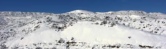
Photo Courtesy of NWS Glasgow - Hills south of Fort Peck Lake - March 25, 2008.
The National Weather Service (NWS) offices in Montana are sponsoring the winter weather awareness week. This information is provided in order to inform you on the different types of winter weather we have in Montana and also to provide safety information related to each type. Click on each of the above tabs to learn more!
Short You Tube video "Outdoor Winter Weather Safety".
Montana has four National Weather Service offices that serve the state. We issue watches and warnings for the protection of life and property. For additional information, contact your local NWS office:
| Billings | Glasgow | Great Falls | Missoula |
| 406-652-0851 | 406-228-4042 | 406-453-2081 | 406-329-4840 |

Photo Courtesy of Don Moore - Billings, MT, October 4-5, 2005.
Short You Tube Video "Understanding Our Winter Weather Terminology"
Hazardous Weather Outlook: Winter storm conditions are possible in the next 7 days. Stay tuned to the National Weather Service and local media for updates.
Watch: The potential exists for hazardous winter weather to occur within the next 12 to 48 hours but the exact location and timing is not known. Actions can be taken to stock up on needed supplies such as water and food and to make sure you have a plan to protect pets and livestock.
Warning: Hazardous winter weather either is occurring or will be shortly. Immediate action should be taken to protect yourself as well as your pets and livestock. Only travel outside of your home if you absolutely have to.
Advisory: Winter weather conditions are expected to cause significant inconveniences and may be hazardous. If you are cautious, these situations should not be life threatening.
Stay tuned to these products throughout the winter storm for specific details on impacts expected.
Terminology
Blizzard: Winds of 35 mph or more with snow and blowing snow reducing visibility to less than 1/4 mile for at least 3 hours.
Winter Storm: A variety of winter conditions may be possible including heavy snow, blizzard conditions, significant accumulations of freezing rain or sleet and dangerous wind chills.
Wind Chill: A measure of how cold the atmosphere feels, taking not just actual temperature into account, but also wind, which can make the air considerably colder.
Ice Storm: A type of winter storm characterized by significant amounts of freezing rain. Heavy accumulations of ice can bring down trees and topple utility poles.
The following table outlines specific guidance our meteorologists in Montana use for issuing various winter weather bulletins.
|
Watches |
|
|
|
Conditions are favorable for hazardous winter weather conditions including heavy snow, blizzard conditions, or significant accumulations of freezing rain or sleet in the next 12 to 48 hours. It may also include wind chills if they are expected with the above listed events. |
|
|
Conditions favorable for severe wind gusts in the next 12 to 48 hours. |
|
|
Conditions are favorable for dangerous wind chills in the next 12 to 48 hours. |
|
Warnings |
|
|
|
Any one or a combination of the following (the elevations are generalized in this criteria, some areas may have more specific criteria): Eastern Montana and Western Montana Valleys: 6 inches or more in 12 hours or 8 inches or more in 24 hours. Mountain Areas: 8 inches or more in 12 hours, 12 inches or more in 24 hours. Sustained winds of less than 34 mph causing blowing snow (with or without snowfall occurring) reducing visibility to more than a 1/4 mile for 3 hours or more. -Ice accumulations under a 1/4" that last for three hours or more and occurs on 50% of a significant public use area on roadways and sidewalks. -Sleet accumulations of a 1/2" or more. -Wind chills of ≤ -40 degrees (east of the divide) or ≤ -20 degrees (west of the divide) with winds of ≥ 10 mph occurring with any of the above criteria. |
|
|
Sustained or frequent gusts of 35 mph or more, frequent visibilities of ≤ 1/4 mile, falling and/or blowing snow for 3 hours or more. |
| High Wind Warning | Wind gusts exceeding 58 mph for most areas. Exception along the Front Range; where wind gusts must exceed 75 mph. |
|
|
Issued when significant and damaging accumulations of ice are expected, generally a 1/4" accumulation or more. |
|
|
East of the Divide: Wind chills of ≤ -40 degrees with winds ≥ 10 mph, no precipitation occurring. West of the Divide: Wind chills of ≤ -20 degrees with winds ≥ 10 mph, no precipitation occurring. |
|
Advisories |
|
|
Advisory |
Any one or a combination of the following: -2 to 5 inches of snow in 12 hours below 6000 feet. Some mountainous areas may have other criteria, generally 4-7 inches. -Wind driven snow that occasionally reduces visibilities down to a 1/4 mile. -Wind chill advisory criteria along with 2-5 inches of snow and/or blowing snow reducing visibility down to a 1/4 mile, or 4-7 inches of snow in mountainous areas. -Sleet accumulations of less than a 1/2". -An event that transitions to or from freezing rain into any of the above criteria. |
|
|
East of the Divide: Wind chills of -20 degrees to -39 degrees with winds of ≥ 10 mph, no precipitation occurring. West of the Divide: Wind chills of -10 degrees to -19 degrees with winds of ≥ 10 mph, no precipitation occurring. |
| Wind Advisory | Only issued for wind prone areas along the Front Range. Wind gusts 58 mph to 74 mph. |
|
Advisory |
Glazing of freezing drizzle or freezing rain for a few hours with accumulations of less than 1/4 inch. It generally covers less than 50% of the area. |

Photo Courtesy of Carter County - Highway 7 - Carter County, January 24, 2010.
Every year, winter claims dozens of lives and causes millions of dollars in damage across the United States. A significant higher number of injuries occur; seventy percent of which are the result of vehicle accidents. Just in Montana since 2000, 27 people have lost their lives in extreme winter weather conditions with many more injuries. Avalanches, automobile accidents and cold weather exposure are the main causes of winter weather related deaths in Montana. Livestock injuries and deaths can also be quite common during the more hazardous events. The following are some of the causes of both direct and indirect deaths and injuries in Montana as well as causes of damage:

Livestock covered in snow over southeast Montana during the April 4, 2009 Winter Storm
You should take steps to prepare for winter storms before they strike instead of waiting until the storm arrives. Use the guidelines below to help you get started.
Short You Tube Video "Winter Weather Survival Kit"
Short You Tube Video "Traveling in Montana in the Winter"
At Home and Work
The primary concerns during a winter storm are loss of heat, power and telephone service and a shortage of supplies if storm conditions continue for more than a day. Have these items available:
|
|
In Vehicles
Plan your travel and check the latest weather reports to avoid the storm. Fully check and winterize your vehicle before the winter season begins. Carry a winter storm survival kit with these items:
|
|
On the Farm/Pets
Take these steps before the storm hits to ensure the safety of your pets and animals:

Photo Courtesy of NWS Glasgow - Up to five inches of snow fell in and around Fort Peck after a rare lake effect snow event on 4 December 2002.
Additional Information
Some of the pages listed below are in a PDF format. To view these files Download Adobe Reader
Get Your Vehicle and Survival Kit Ready Now
National Winter Weather Safety
Red Cross Checklists: Winter Storm | Power Outage
If you are caught in a winter storm, follow these safety tips to help you stay safe:
Outside
Find Shelter: Try to stay dry. Cover all exposed body parts.
If No Shelter: Build a lean-to, windbreak or snow cave for protection from the wind. Build a fire for heat and to attract attention. Place rocks around the fire to absorb and reflect heat.
Stay Hydrated: Melt snow for drinking water. Avoid eating snow. Eating snow will lower your body temperature
In a Vehicle
Stay In Vehicle: You will become quickly disoriented in wind-driven snow and cold. Run the motor about 10 minutes each hour for heat. Open the window a little for fresh air to avoid carbon monoxide poisoning. Make sure the exhaust pipe is not blocked.
Be Visible To Rescuers: Turn on the dome light at night when running the engine. Tie a colored cloth, preferably red, to your antenna or door. After snow stops falling, raise the hood to indicate you need help.
Exercise: From time to time, move arms, legs, fingers and toes vigorously to keep blood circulating and to keep warm.
Inside
Stay Inside: When using alternate heat from a fireplace, wood stove, space heater, etc., use fire safeguards and properly ventilate.
No Heat: Close off unneeded rooms. Cover windows at night. Eat and drink plenty. Food provides the body with energy for producing its own heat. Keep the body replenished with fluids to prevent dehydration. Wear layers of loose-fitting, lightweight, warm clothing. Remove layers to avoid overheating, perspiration and subsequent chill.
Additional Information
Some of the pages listed below are in a PDF format. To view these files Download Adobe Reader
National Winter Weather Safety
Red Cross Checklists: Winter Storm | Pets and Disasters | Power Outage
With changing technologies, there are many ways to receive weather information. Here are some of the ways you can keep up to date with the latest weather watches and warnings.
Internet / Social Media / TV / Radio / Wireless Sources
Internet: The National Weather Service's webpage at https://weather.gov allows you a fast and easy look at where the hazards are occurring for the current day. To find out information for your local area, just click on the map in your general area.
Facebook: Follow us on Facebook for updates on the latest weather concerns, climate information and other interesting tidbits.
Twitter: Follow us on Twitter for updates on the latest weather concerns, climate information and other interesting tidbits.
You Tube: Follow us on You Tube.
Broadcast TV and Radio Stations: Most local radio and television stations across the state automatically receive hazardous watches and warnings and help disseminate that information over the air. They have local knowledge and want to be able to provide their viewers and listeners with the best information they can.
Wireless / Cell Phone technologies: Many cell phone providers are including an option of getting warnings on your cell phone through text messaging or other means. Check with your provider to see if they offer a service like this. There are also some NWS programs that allow you to get alerts on your mobile device. For more information see: https://www.srh.noaa.gov/cte.htm.
NOAA Weather Radio All-Hazards - Popular Features
NOAA Weather Radio All-Hazards provides non-stop weather forecasts, along with watch and warning information that may be affecting you. There are many various types of radios and models available including portable units to take on trips. For more information on the various types and models, visit the NOAA Weather Radio Receiver Information Page.
|
Tone Alarm: Some winter weather warnings may be broadcast with a tone alarm. The tone will activate all the weather radio receivers which are equipped to receive it, even if the audio is turned off. During the winter, tone alarms are only used to alert people of the greatest of winter threats. SAME: Specific Area Message Encoding (SAME) allows a user to specify the particular area for which you wish to receive alerts. This minimizes the number of "false alarms" for events which might not be impacting your area. To locate the SAME code for your area, go to SAME Codes Selectable Alerting of Events: Some receivers allow a user to turn off the alarm for certain events which might not be important to you. Battery Backup: Since power outages often occur during storms, having a receiver with battery backup can be crucial. External Antenna Jack: While most receivers come with a whip antenna which can usually be extended out from the unit, a user may need an external antenna to get a good reception. Some receivers come with an external antenna jack (normally in the back of the unit) which will allow a user to connect to a larger antenna (indoors or outdoors). Strobe Light: A strobe light accessory provides a visual alert. It's ideal for the hearing-impaired and for use in noisy production environments like metal working facilities to alert personnel of a warning. |
  |
Weather Radio Sites Across The Region

All Frequencies in MHz
| Montana Baker Belgian Hill Billings Bozeman Broadus Browning Butte Circle Dillon Ekalaka Forsyth Glasgow Glendive Glentana Great Falls Hardin Havre Helena Jordan |
162.550 162.500 162.550 162.500 162.425 162.525 162.550 162.550 162.475 162.475 162.525 162.400 162.475 162.525 162.550 162.450 162.400 162.400 162.500 |
Kalispell Lewistown Livingston Malta Miles City Missoula Plentywood Poplar Ryegate Scobey Winnett North Dakota Dickinson Scranton Williston |
162.550 162.500 162.525 162.475 162.400 162.400 162.475 162.425 162.450 162.450 162.400 162.400 162.525 162.550 |
South Dakota Lead Wyoming Cody Gillette Grant Village Jackson Kaycee Mammoth Newcastle Sheridan Worland Idaho Bonners Ferry Driggs Pocatello Salmon |
162.525 162.400 162.500 162.450 162.525 162.550 162.425 162.475 162.475 162.525 162.500 162.450 162.550 162.500 |
Additional Information

