
An outbreak of severe thunderstorms is expected across portions of Illinois and Indiana tonight. Intense tornadoes, swaths of damaging gusts, and hail in excess of 2 inches in diameter possible. Tropical Storm Arthur will continue to produce strong winds across coastal Upper Texas and Louisiana tonight, as well as potentially life-threatening flooding across southern Louisiana into Mississippi. Read More >

Photo Courtesy of Sean Heavey - June 16, 2007; $35 Million Hailstorm Impacting Glasgow To Nashua.
This information regarding severe weather is provided in order to inform you on the different types of severe weather we have in Montana and also to provide safety information related to each type. Click on one of the tabs above to learn more.
Montana has four National Weather Service offices that serve the state. We issue watches and warnings for the protection of life and property. For additional information, contact your local NWS office:
| Billings | Glasgow | Great Falls | Missoula |
| 406-652-0851 | 406-228-4042 | 406-453-2081 | 406-329-4840 |

Promoting Weather Safety Amongst Our Spotters!
Ready, Set, Go: This is the mindset we want people to be in when it comes to being prepared for hazardous weather.
Ready: At this stage, the National Weather Service sees something on the horizon that may end up being a widespread severe weather event in the future. The Hazardous Weather Outlook issued by the local NWS offices will give you this information. Also, the Storm Prediction Center issues thunderstorm outlooks that give an idea of where severe thunderstorms may develop in the next 8 days.
Set: In this stage, we are confident that a hazardous weather event will occur, but are not sure of the exact timing, location, or impact of the event. For severe thunderstorms and tornadoes, a Watch is issued to give the public a heads up that they need to be prepared for the possibility of severe weather within the next 8 hours.
Go: When we hit this stage, we are confident that a thunderstorm is producing severe weather and we issue a Warning. The lead time can be just precious minutes out to an hour. At this stage, you should take action by seeking shelter.
Terminology
Funnel Cloud: A funnel-shaped cloud, extended outward or downward from a thunderstorm, that corresponds to a rotating column of air. If the rotation is violent and reaches the ground, the funnel cloud is associated with a tornado.
Tornado: A violently rotating column of air, in contact with the ground, that extends from the base of a thunderstorm to the ground. This is often visible as a funnel cloud with swirling dust or debris near the surface.
Severe Thunderstorm: A thunderstorm that produces hail of 1 inch or larger (quarter size) and/or a wind gust to 58 mph or higher.
Microburst: A convective downdraft with an affected outflow area of less than 2.5 miles wide and peak winds lasting less than 5 minutes. Microbursts may induce dangerous horizontal/vertical wind shears, which can adversely affect aircraft performance and cause property damage.
Straight-line Winds: Generally, any wind that is not associated with rotation, used mainly to differentiate them from tornadic winds.
Flash Flood: A sudden inundation of water in low-lying areas, usually brought on by heavy rain, dam break, rapid snowmelt or ice jams.
Watch: The potential exists for severe weather to occur within the next 8 hours but the exact location and timing is not known. Action can be taken to protect property such as putting your vehicle in the garage, putting away patio furniture, etc.
Warning: Severe weather either is occurring or will be shortly. Immediate action should be taken to protect yourself by going to the lowest portion of a sturdy building, or into a closet, hallway or room without windows.
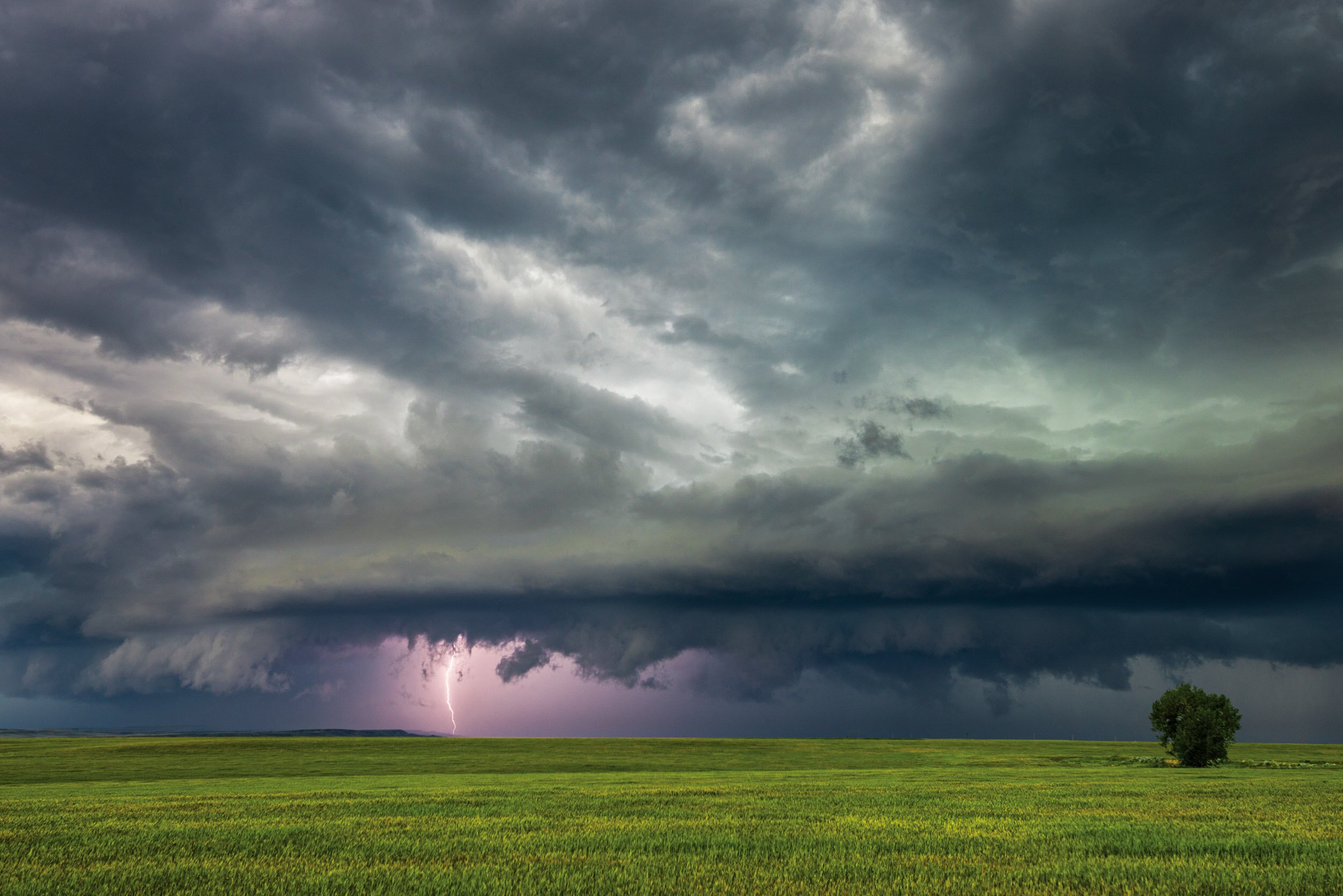
Photo Courtesy of Cory Mottice - West of Glasgow, Summer 2019.
Montana experiences a full range of weather related hazards, resulting in significant damage and injuries. The following graphics help show the impacts severe weather has on Montana. Severe Thunderstorms can and will happen in any part of the state.
The following graphic shows the average number of severe thunderstorm watches issued on an annual basis. Note the relatively high numbers into the eastern portion of Montana.

The following graphic shows the average number of tornado watches issued on an annual basis. Note the relatively high numbers into the eastern portion of Montana.

The following graphic shows the average number of severe thunderstorm days with severe weather reports within 25 miles of the particular point. Severe weather reports include tornadoes, high winds, and/or large hail.

The following graphic shows the average number of tornadoes per state from 1984 to 2014.

Tornado and High Wind Safety Information
|
Outdoors: If possible, seek shelter in a basement, shelter or sturdy building. If you cannot quickly walk to shelter; Immediately get into a vehicle, buckle your seat belt and try to drive to the closest shelter. If caught in flying debris and unable to reach shelter, lie flat and face-down on low ground, preferably in a ditch or coulee, protecting the back of your head with your hands. Get as far away from trees and cars as you can as they may be blown onto you in a tornado or from high winds. Indoors: Go to the lowest floor, small center room (like a bathroom or closet), under a stairwell, or in an interior hallway with no windows. Crouch as low as possible to the floor, facing down; and cover your head with your hands or something soft like a mattress. Vehicle: If possible, park your car and get into a sturdy shelter. If the tornado is visible and far away, you may be able to drive out of it's path. If caught in high winds or flying debris, park your vehicle as quickly and safely as possible; stay in your vehicle with the seat belt on; cover your head and duck below the windows. If you can get safely to a low lying area, leave your vehicle and lie flat and face-down; protecting the back of your head with your hands. Avoid seeking shelter under bridges, which can create deadly traffic hazards while offering little protection against flying debris. |
 Tornado near Bridger, MT - June 1991. |
Hail Safety Information
 Baseball size hail in Roundup, June 24, 2007. |
Outdoors: Seek shelter immediately. If you cannot find something to protect your entire body, at least find something to protect your head. Indoors: Stay inside until the hail stops. Large hail can cause serious or even fatal injuries. Stay away from windows, especially those being struck by hail. Vehicle: Stop driving. If you can see a safe place close-by to drive to (like inside a garage, under a highway overpass, or under a service station awning), do so as soon as you can. Do NOT leave the vehicle until it stops hailing. Stay away from car windows. Cover your eyes with something (like a piece of clothing). If possible, get onto the floor face down, or lay down on the seat with your back to the windows. |
Flash Flood Safety Information
Flash floods are the #1 severe weather killer in the United States.
|
Outdoors: Get to higher ground as quickly as possible. Leave places likely to flood (e.g., canyons, ditches, dry stream beds) as quickly as possible. Do NOT try to cross flood water, it is flowing more quickly than you think. Vehicle: Turn around and drive away from the flood area. DO NOT try to drive through the flooding area. Roads under the water could be washed out. A car that stalls in just two feet of water can be washed away. If your car stalls, exit the car immediately and get to higher ground. |
 |
Additional Information
Some of the pages listed below are in a PDF format. To view these files Download Adobe Reader
Thunderstorms, Tornadoes and Lightning: Natures Most Violent Storms Brochure
Lightning Safety: National Website | Lightning Safety for You and Your Family
Floods: National Website | Brochure
Turn Around Don't Drown: National Website | Brochure
Lightning is the #2 severe weather killer in the United States behind flash floods.
Safety Information
Short You Tube Video "Lightning Safety Tips"
Plan: Plan outdoor activities to avoid thunderstorms. Listen to NOAA Weather Radio All-Hazards for the latest weather forecast before heading out.
Safe Places: Fully enclosed large building provide good lightning protection. Vehicles with a solid metal top and sides give good protection.
Indoors: Don't use corded telephones. Keep away from electrical appliances, wiring, plumbing, and windows.
Outdoors: When Thunder Roars, Go Indoors! Stop all outdoor activities. Avoid elevated places and open spaces. Stay away from water and tall isolated objects. Do NOT go under trees! Allow time to reach safety. Don't seek refuge in open structures. If in the water or out in a boat, return to shore and seek shelter immediately.
First Aid: Call 911. All lightning deaths are from cardiac/respitory arrest. Use an AED, CPR or rescue breathing.

Photo Courtesy of Mike Umscheid - Between Forsyth and Miles City, June 24, 2007.
Additional Information
Some of the pages listed below are in a PDF format. To view these files Download Adobe Reader
Thunderstorms, Tornadoes and Lightning: Natures Most Violent Storms Brochure
Lightning Safety: National Website | Lightning Safety for You and Your Family
With changing technologies, there are many ways to receive weather information. Here are some of the ways you can keep up to date with the latest weather watches and warnings.
Internet / Social Media / TV / Radio / Wireless Sources
Internet: The National Weather Service's webpage at https://weather.gov allows you a fast and easy look at where the hazards are occurring for the current day. To find out information for your local area, just click on the map in your general area.
Facebook: Follow us on Facebook for updates on the latest weather concerns, climate information and other interesting tidbits.
Twitter: Follow us on Twitter for updates on the latest weather concerns, climate information and other interesting tidbits.
You Tube: Follow us on You Tube.
Broadcast TV and Radio Stations: Most local radio and television stations across the state automatically receive hazardous watches and warnings and help disseminate that information over the air. They have local knowledge and want to be able to provide their viewers and listeners with the best information they can.
Wireless / Cell Phone technologies: Many cell phone providers are including an option of getting warnings on your cell phone through text messaging or other means. Check with your provider to see if they offer a service like this. There are also some NWS programs that allow you to get alerts on your mobile device. For more information see: https://www.srh.noaa.gov/cte.htm.
NOAA Weather Radio All-Hazards - Popular Features
NOAA Weather Radio All-Hazards provides non-stop weather forecasts, along with watch and warning information that may be affecting you. There are many various types of radios and models available including portable units to take on trips. For more information on the various types and models, visit the NOAA Weather Radio Receiver Information Page.
|
Tone Alarm: Some winter weather warnings may be broadcast with a tone alarm. The tone will activate all the weather radio receivers which are equipped to receive it, even if the audio is turned off. During the winter, tone alarms are only used to alert people of the greatest of winter threats. SAME: Specific Area Message Encoding (SAME) allows a user to specify the particular area for which you wish to receive alerts. This minimizes the number of "false alarms" for events which might not be impacting your area. To locate the SAME code for your area, go to SAME Codes Selectable Alerting of Events: Some receivers allow a user to turn off the alarm for certain events which might not be important to you. Battery Backup: Since power outages often occur during storms, having a receiver with battery backup can be crucial. External Antenna Jack: While most receivers come with a whip antenna which can usually be extended out from the unit, a user may need an external antenna to get a good reception. Some receivers come with an external antenna jack (normally in the back of the unit) which will allow a user to connect to a larger antenna (indoors or outdoors). Strobe Light: A strobe light accessory provides a visual alert. It's ideal for the hearing-impaired and for use in noisy production environments like metal working facilities to alert personnel of a warning. |
  |
Weather Radio Sites Across The Region

All Frequencies in MHz
| Montana Baker Belgian Hill Billings Bozeman Broadus Browning Butte Circle Dillon Ekalaka Forsyth Glasgow Glendive Glentana Great Falls Hardin Havre Helena Jordan |
162.550 162.500 162.550 162.500 162.425 162.525 162.550 162.550 162.475 162.475 162.525 162.400 162.475 162.525 162.550 162.450 162.400 162.400 162.500 |
Kalispell Lewistown Livingston Malta Miles City Missoula Plentywood Poplar Ryegate Scobey Winnett North Dakota Dickinson Scranton Williston |
162.550 162.500 162.525 162.475 162.400 162.400 162.475 162.425 162.450 162.450 162.400 162.400 162.525 162.550 |
South Dakota Lead Wyoming Cody Gillette Grant Village Jackson Kaycee Mammoth Newcastle Sheridan Worland Idaho Bonners Ferry Driggs Pocatello Salmon |
162.525 162.400 162.500 162.450 162.525 162.550 162.425 162.475 162.475 162.525 162.500 162.450 162.550 162.500 |
Additional Information

