
A heat wave over the Southwest will intensify late week, peaking and expanding into the Intermountain West and northern High Plains this weekend. Severe thunderstorms and heavy rain are expected over portions of the Plains and Mississippi Valley tonight, which will shift to parts of the Upper Midwest and mid-Mississippi Valley Friday. Monsoonal showers and flooding persist in the Desert Southwest. Read More >
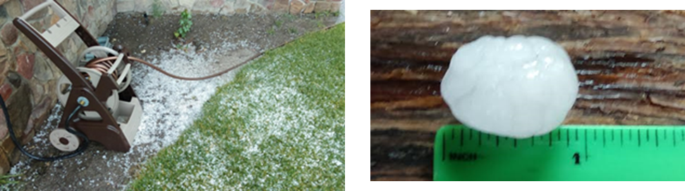
A one inch hail report on 12 July 2016
By Aviva Braun
National Weather Service Boise, Idaho
Collaborators: David Groenert and Josh Smith
On July 12th, an upper level trough skirted the northern tier of the Boise CWA, producing some expected sub-severe thunderstorms, and an unexpected severe report. The bigger concerns for the day had been precipitation accumulation potential, especially over the Cornet-Windy Ridge burn scar, and the amount of potential lightning with LALs of 4 in the forecast.
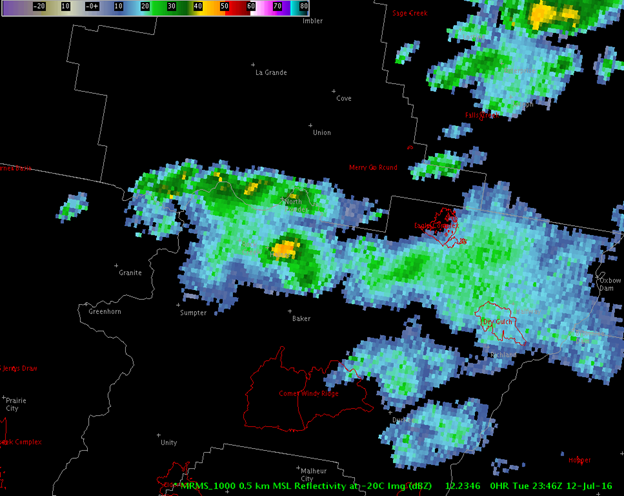
At 2:54 PM and again at 4:44 PM, SPSs were issued for storms that looked well organized and had high reflectivities on radar, but seemed sub-severe. Both SPSs cautioned the public about the potential for half inch to dime sized hail and winds around 40 mph. The few spotters the office was able to get a hold of reported small hail and abundant rain, with no mention of significant wind speeds. In terms of precipitation amounts, we had several reports of 0.11 inches of rain within a 10 to 15 minute period at both the Cornet RAWS site (which is below the Cornet-Windy Ridge burn scar threshold laid out by Troy and the BAER Team); we also received 0.28 inches at the Baker ASOS.
The 12th did not seem like it had severe potential; instead, it was likely to be an active weather day, which is still exciting for WFO Boise. At about 6 PM we received a spotter report of one inch hail produced by a storm east-southeast of Haines in Baker County. Some other details from the report: most of the hail was described as between ¼ to ¾ inches, with some one inch hail thrown in there. Heavy rain was also reported. We had been tracking the storm, which had looked promising for 2 volume scans, then promptly came down in intensity. It is likely that this storm report is a classic collapsing storm case; the fact that the spotter reported several different size hail with only a few reaching an inch supports this idea, as does its short flirtation with severe.
A few radar scans and model output images to aid in visualization of storm environment and structure are included below.
The NAM output for the evening time period showed heightened CAPE and negative LI values (top left), bulk shear values around 30 kts (top right), and an 80 kt jet overhead (bottom right).
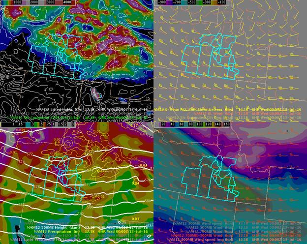
A SREF procedure, much like the SPC calibrated thunderstorm potential procedure, showing overlap between heightened bulk shear values and the probability of CAPE values > 500 J/kg, hinted that the CWA’s northern tier may see action.

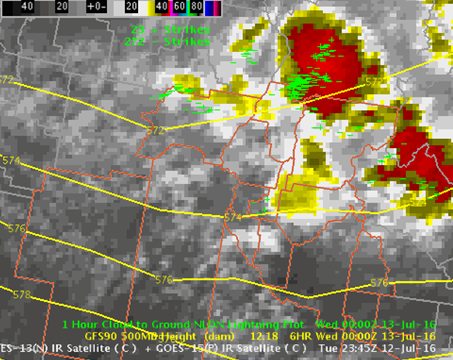
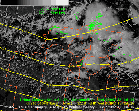
What we saw on the satellite that evening spoke to what we were seeing develop, as well as the areas in which they developed. While the West Central Mountains looked promising as well on the SREF procedure, the amount of cloud cover (as well as previous activity during the afternoon) was likely suppressing any development. As for Baker County, the development aligns with what the SREF indicated to us earlier.
MRMS indicated that reflectivities were 48 dBz at -20C.
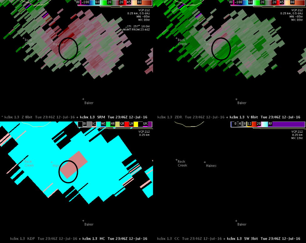
On the 1.3 degree radar cut, we saw 51.5 dBz at 23197 ft AGL, well above the day’s office accepted 50 dBz core height warning threshold in AGL (we were looking for heights between 19-21k ft AGL). ZDR was also indicating hail with values near 0. However, the CC scan indicated rain with echoes near 1, meaning homogeneous in size, type and shape. Also, CC indicated no hail spike.
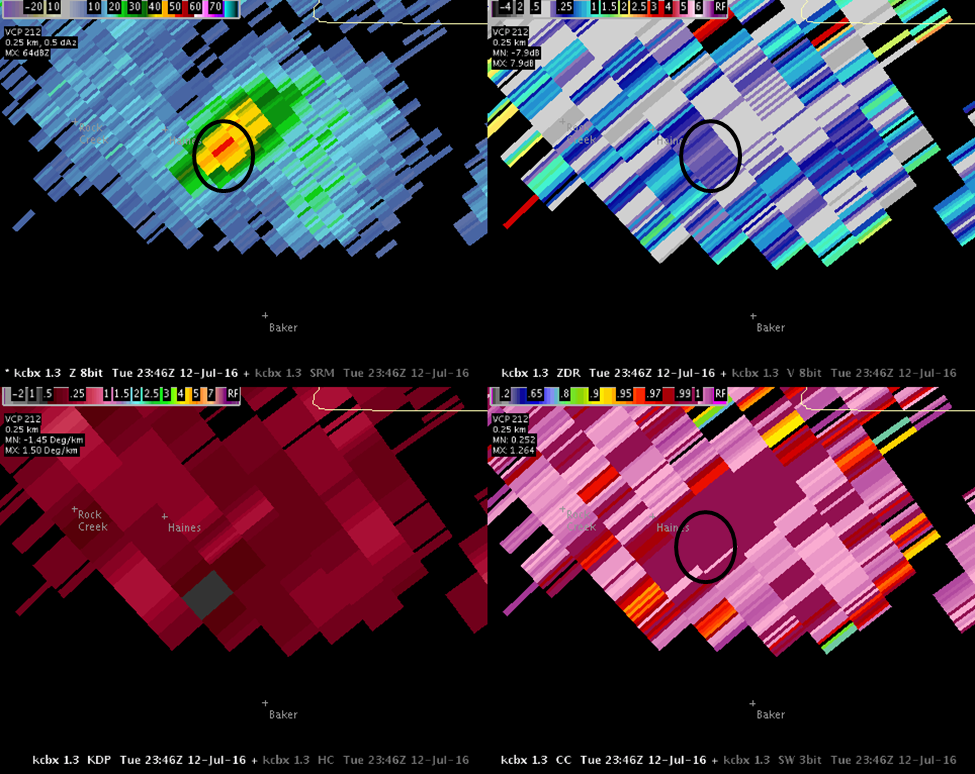
The SRM scan showed divergence since we are looking near the top of the storm. A healthy updraft indicates a strong storm. The readings in either direction are 16 kts outbound and 10 kts inbound, respectively, aka not as strong as we would have liked to see for a severe hail event. The V scan also showed divergence near the storm’s top. The HC scan indicated graupel.
It should be mentioned here that the CIMSS probability severe model indicated that the storm had a 3% chance that it would become severe.
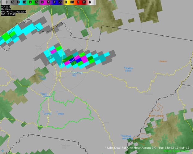
In terms of the amount of precipitation indicated by the one hour accumulation scan, it registered about 0.3 inches per hour. We do know that they measured 0.1 inches in 10 mins as reported by the spotter, so OHP could be correct in what it was indicating. However, the echoes were likely contaminated by the hail we know to have occurred with this storm.
Was this a missed warning? Other storms in our CWA, even on this very same day, looked far more potent and went without a warning with no severe reports. One can argue that there is a lack of people, especially those that call us with reports, in our CWA. However, if we warned on the second volume scan of every storm that looked severe, we would have a very high false alarm rate. In this case, there happened to be a trained and enthusiastic spotter who lived at the exact location the storm decided to intensify. What were the chances?!

