|
A strong upper level disturbance moved across Central Alabama during the early morning hours of April 10, 2009. Severe thunderstorms developed in association with this feature. The storms produced large hail and damaging winds generally north of Interstate 20 through 630 am.
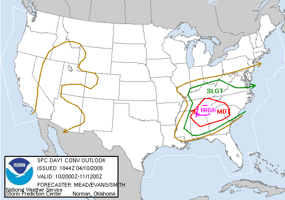
As the cloud cover from the previous nights storms partially cleared, very unstable conditions developed across much of Central Alabama by noon. Surface temperatures rose into the 70s and 80s while surface dew points were in the 60s. The pressure gradient between low pressure to the west and high pressure to the east produced strong winds at the surface through several thousand feet. These winds allowed even more moisture to stream northward from the Gulf of America. A strong upper level low and its associated surface cold front approached Central Alabama during the afternoon hours, providing a focus and lifting mechanism for severe thunderstorm development.
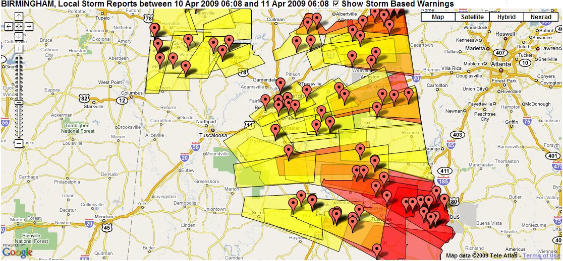
Central Alabama received severe thunderstorms and gradient winds from around 2 pm Friday afternoon through 10 pm Friday evening. Numerous persistently rotating thunderstorms, called supercells, developed in north central Alabama and moved roughly across the northeastern two thirds of the area. This type of thunderstorm can produce all types of severe weather including tornadoes and very large hail. In fact, that is exactly what these storms ended up doing. Numerous reports of very large hail, up to the size of softballs, were received. The hail even collected up to a depth of several feet and was on the ground for more than 18 hours. At least 8 tornadoes occurred. Straight line wind damage was reported in a few counties. Even before the storms arrived, gradient winds knocked some trees down. The strong cold front moved through Central Alabama Friday evening ending the severe weather threat.
The overall scope of this severe weather event was much larger. Tornadoes, large hail and damaging winds were reported in Kentucky, Tennessee, Mississippi, Alabama, Georgia, South Carolina, North Carolina and West Virginia. This system also brought severe weather and tornadoes on Thursday April to areas farther west. Our thoughts will be with all those whose lives were impacted by these storms.
The potential weather threat was first introduced into the Hazardous Weather Outlook on the afternoon of April 3, 2009.
Tornado Watch 130 was in effect from 140 am CDT until 900 am CDT for parts of west and north central Alabama.
Tornado Watch 132 was in effect from 1125 am CDT until 700 pm CDT for much of Central Alabama.
Tornado Watch 134 was in effect from 240 pm CDT until 900 pm CDT for much of east and south Central Alabama.
|