|
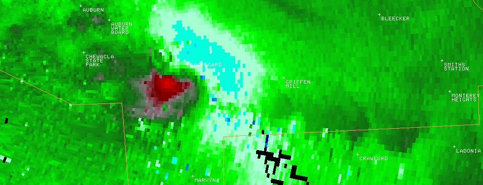
A National Weather Service Damage Assessment Team has surveyed the storm damage in Lee County. It has been determined the damage was the result of a tornado. The tornado has been rated an EF-1 on the Enhanced Fujita Scale. Damage estimates were consistent with winds around 95 mph.
This tornado dropped out of the same supercell thunderstorm that produced the Simmons Crossroads Tornado, the Loachapoka Tornado and the hail swath near Lake Martin. The tornado touched down south of Beauregard just west of State Highway 51. The tornado traveled southeast and lifted near Lee Road 42. The most significant damage occurred near Lee Road 758 where a mobile home received damage, a few other structures suffered roof damage and several trees and power lines were either snapped off or were uprooted. The tornado damage path was 2.25 miles long and was 100 yards wide at its widest point.
|