There are no watches, warnings, or advisories at this time.
Waterspouts possible this afternoon!
JULY 2026: Warmer/Drier
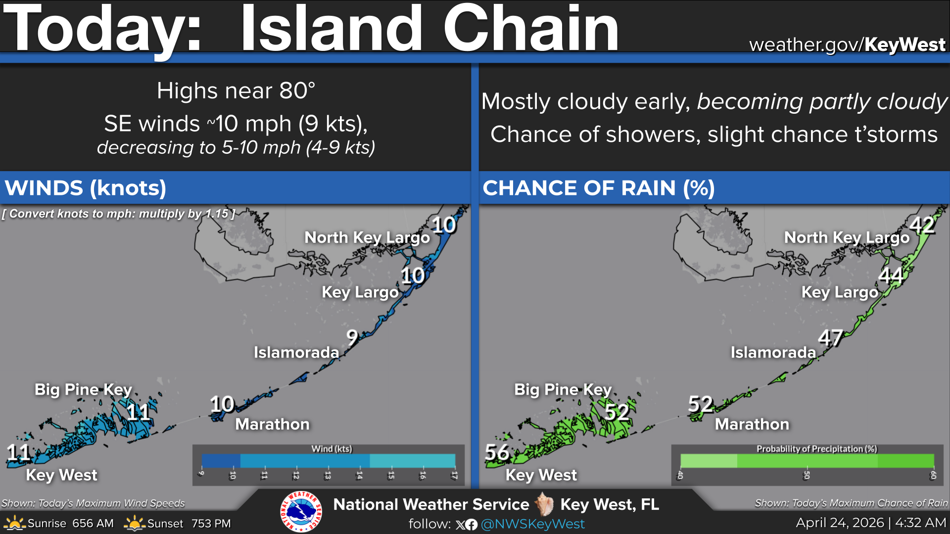
Island Chain
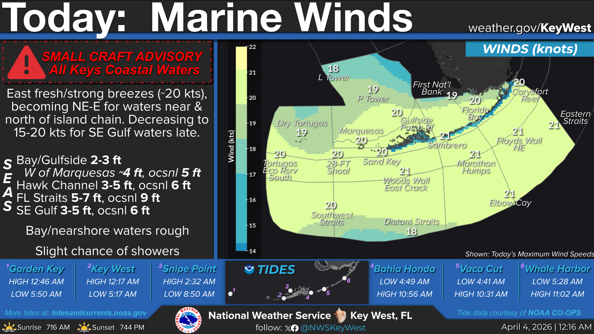
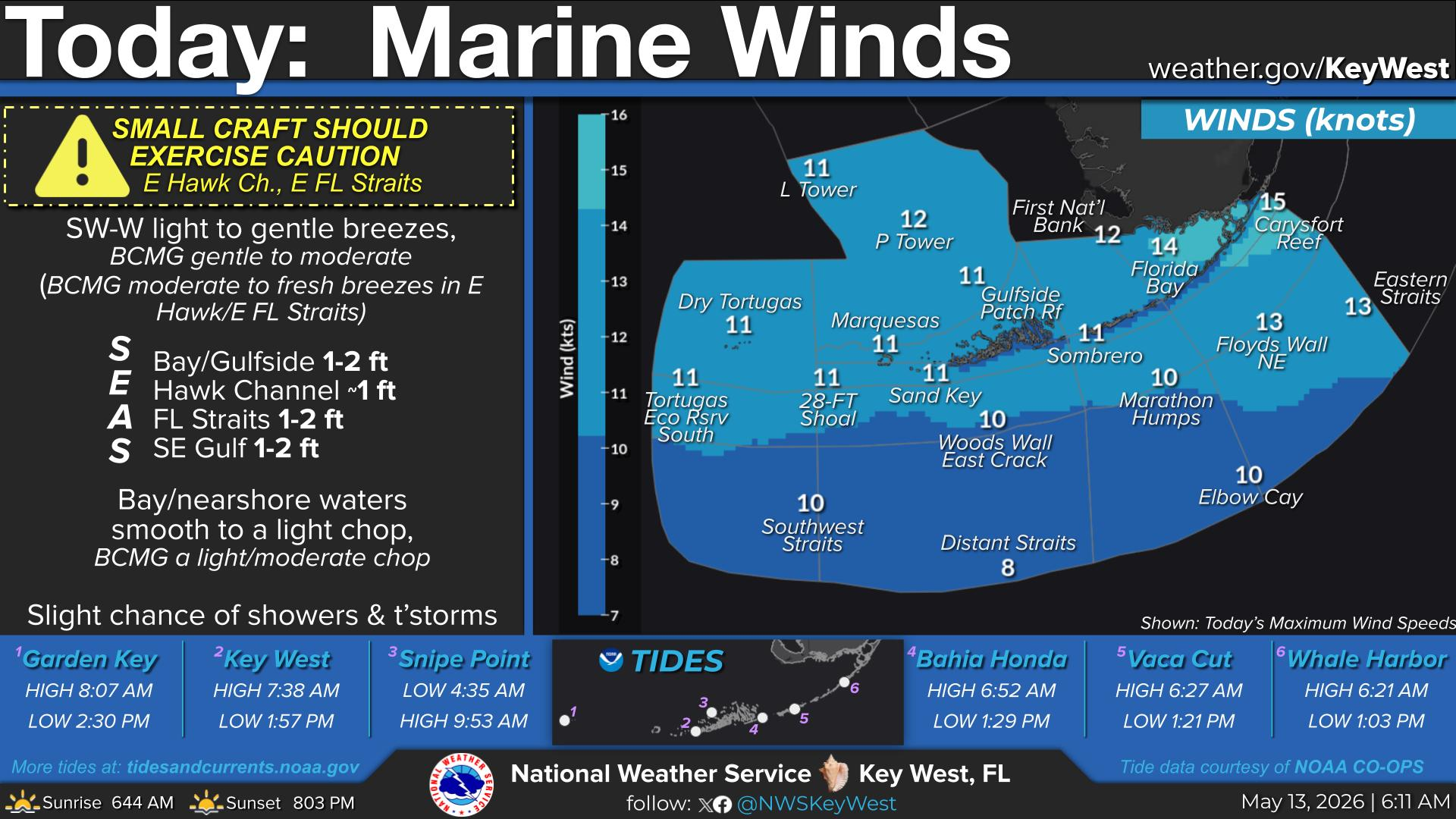
Marine Winds
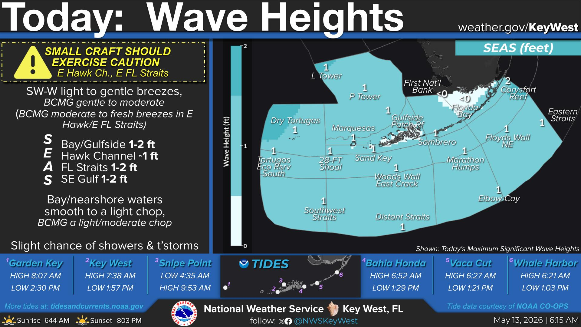
Wave Heights
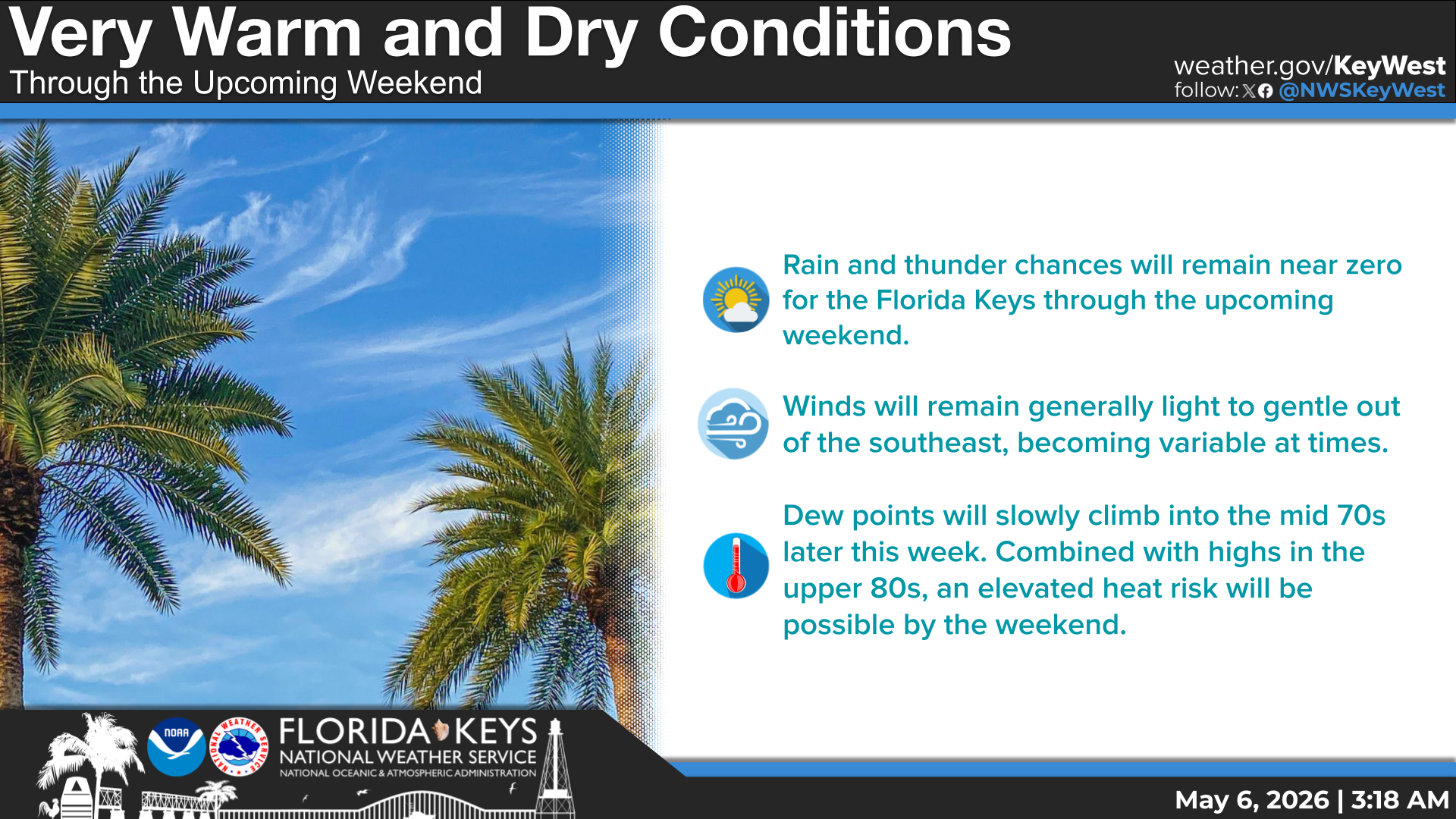
With southwest winds it is possible for the development of a cloud line which could produce a cloud line! Today's forecast: partly sunny, highs in the lower 90s, SW winds near 5 mph, becoming SE, chance of showers and slight chance of thunderstorms
Last month entered the record books as the 10th warmest (in a 3-way tie) July for Key West. Overall in the Keys, the month was warmer and drier than the 30-year average. Rainfall deficits ranged from half an inch at Key west to an inch at Marathon.
Today... Partly sunny with a chance of showers and a slight
chance of thunderstorms. Highs in the lower 90s. Southwest winds
near 5 mph. Chance of rain 30 percent.


 Local Radar
 Weather Map
 Graphical Forecast