| Snowstorm of February 12, 2010 |
On February 12th, 2010, measurable snowfall was reported across much of the Deep South, from Texas to the Florida Panhandle and into south central Georgia. Some of these amounts were rather heavy (by the South’s standards), with accumulations of 6 inches across portions of central Georgia and southern Alabama. Fortunately the road temperatures were generally warm enough to prevent major road closures, although several county roads were closed. The snow melted quickly during the next day or so. Figure 1 shows an analysis of snow totals that were measured across the region.
Figure 1. Snow totals measured across the Tallahassee, FL, County Warning Area and adjacent areas from the snow storm of February 12, 2010 (click figure for larger version).
A key feature in this event was a low pressure system that began as a weak, open wave (i.e. no closed isobars) along a stationary front off the Texas coast late in the day on February 11th. It had already been snowing in Dallas, Texas, that day. (The 24-hour total at the Dallas-Fort Worth Airport would reach a record 12.5 inches by the morning of February 12th). The Gulf low gradually intensified as it propagated eastward along the front in the Gulf of America during the night. As precipitation began to fall well in advance of this low, some stations along the Gulf Coast began to report sleet and snow despite fairly warm surface temperatures. Temperatures in the Florida Panhandle were generally in the upper 30s to around 40° F, but the layer between the 950 MB and 750 MB pressure surfaces was extremely dry, allowing pronounced cooling to take place as the precipitation evaporated into this layer. There was enough cooling for the precipitation to briefly change to sleet or snow, though no accumulations were measured. As this portion of the atmosphere moistened it also warmed, and the precipitation changed back to rain during the night. Tallahassee Regional Airport officially observed snow for a brief time that evening. This marked the first official observation of snow at TLH since January 3, 2002.
On the morning on February 12th, a cold rain was falling across north Florida, southern Alabama, and southern Georgia. The low had intensified and now had closed isobars, and was centered over the central Gulf of America. It had become strong enough to transport relatively warm air from the Gulf of America up and over a cold dome of air over the Florida Panhandle, causing warming at the 900 MB pressure level (approximately 3200 Ft AGL). This caused any ice falling through this relatively warm layer (3-4 degrees C) to melt before reaching the ground. However, the air was slowly cooling farther north and west of the low, and the rain changed to snow across portions of southern Mississippi and central Alabama. As the low pressure system intensified and moved into the northeast Gulf of America, the rain-snow line sank slowly southward, and by early afternoon snow was occurring in Dothan and Mobile. Figure 2 shows the position of the low and associated weather around midday on the 12th.
Figure 2. Weather map for 1800 UTC 12 February 2010 (click figure for larger version).
The low accelerated northeastward across the north Florida peninsula during the evening hours, and the precipitation quickly ended from west to east across Alabama, Georgia, and the Florida Panhandle. As the precipitation was ending, there was enough cooling to change the back edge of the precipitation to snow in some areas that had previously been too warm. There were reports of briefly heavy snow with very large flakes that rapidly accumulated on grass, automobiles, porches, etc. Snow amounts in southern Georgia were generally around an inch, but trace amounts were reported as far east as St. Simons Island. No snow was reported in Tallahassee during the day on February 12th, but trace amounts were observed in the Marianna area in Jackson County. Snow was reported as close as Gadsden County to the west and Thomas County to the north. As is usually the case in the Florida Big Bend, the precipitation ended just as the air became cold and sufficiently deep enough for snow.
Figure 3. Visible satellite image from 1515 UTC 13 February 2010 showing snow on the ground across parts of the Tallahassee County Warning Area (click figure for larger version).
An analysis of nearby measured snowfall amounts and their liquid equivalents showed that the snow-to-liquid ratio was about 4:1 along the rain-snow transition line (Dothan, Alabama), but was 10:1 farther back into the cold air at places like Troy, AL and Atlanta, GA. This snow-to-liquid ratio means that there is 10 inches of snow for every inch of rain. The 10:1 ratio is often used as a “first guess” for forecasting snow amounts, but several studies have shown it has significant limitations, as the ratio depends on multiple factors like the vertical profile of moisture and rising motion, instability, and the magnitude and depth of cold air. Higher ratios are usually associated with “dry, fluffy” snow while lower ratios are associated with “heavy, wet” snow.
This rare snowstorm across the deep south produced accumulating snow nearly down to the Gulf coast. By the time the system exited the southeastern U.S., 49 of the 50 states had snow on the ground at the same time, Hawaii being the only exception. Figure 4 shows a snow depth analysis done by the National Operational Hydrologic Remote Sensing Center (NOHRSC) for the morning of February 13, 2010. In some areas of the Northeast and Mid Atlantic states, new snow depth records were set.
Figure 4. Snow depth analysis from the National Operational Hydrologic remote Sensing Center valid 1200 UTC 13 February 2010 (click figure for larger version).
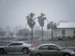
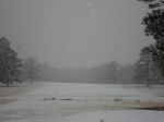
February 12th, 2010 Snowfall Images
(Click each image for larger version)
Dothan, AL
 |
 |
Coffee County, AL
 |
 |
 |
 |
 |
Defuniak Springs and Washington County, FL
 |
 |
 |
 |
Blakely, GA
 |
 |
 |
 |
 |
 |
 |
 |
 |
Thomasville and Cook County, GA
 |
 |
 |