|
Take a moment to learn more about severe weather preparedness!
|
|
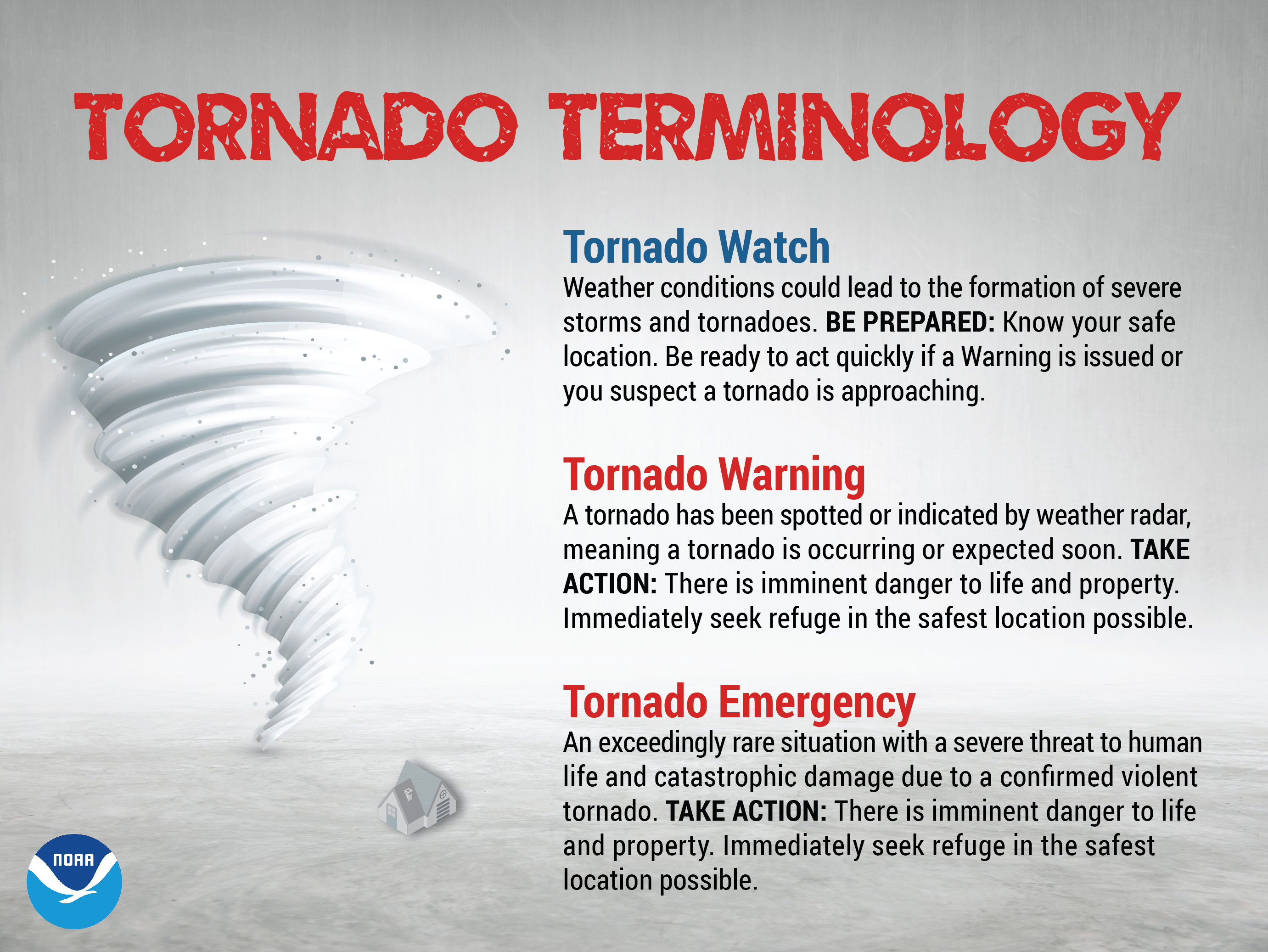
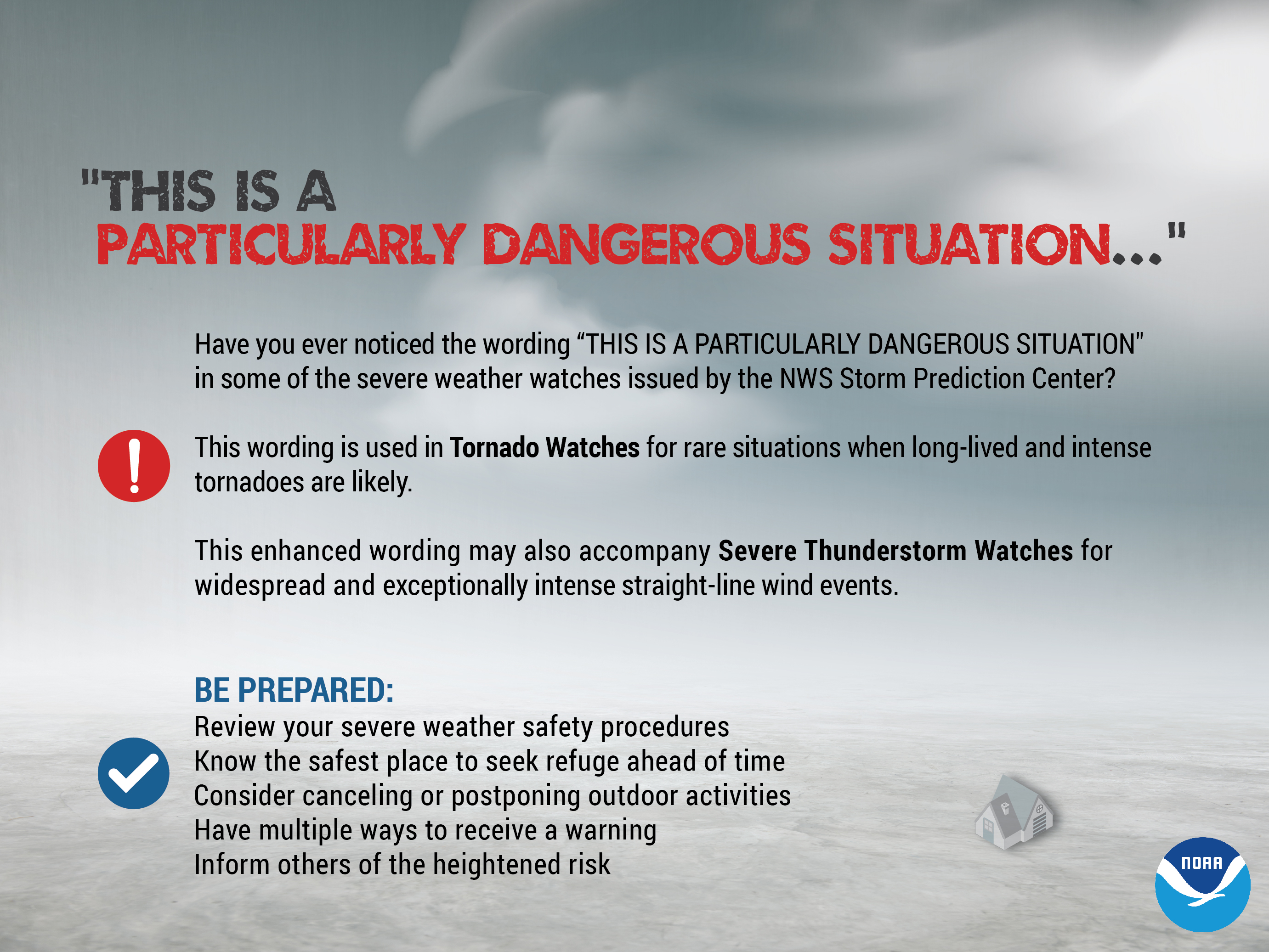
Outlooks, Watches, and Warnings
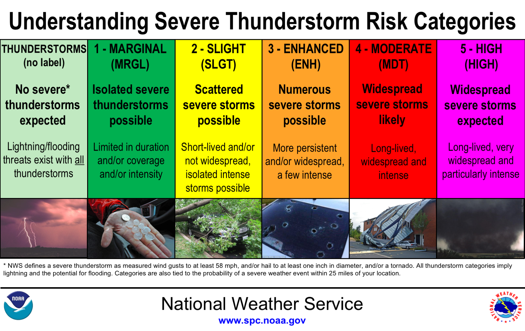
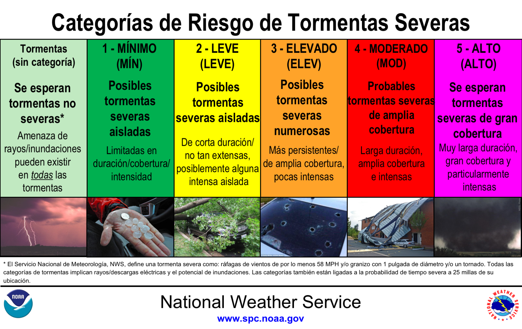
Outlooks:
 |
 |
||
| English | Spanish | ||
| NWS Storm Prediction Center Severe Thunderstorm Outlooks | |||
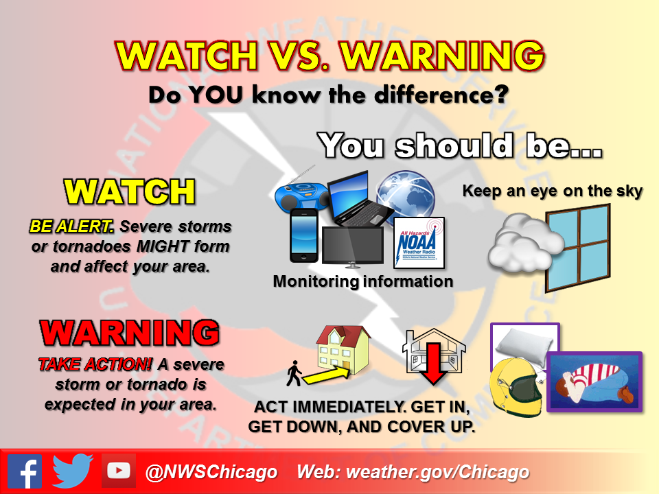
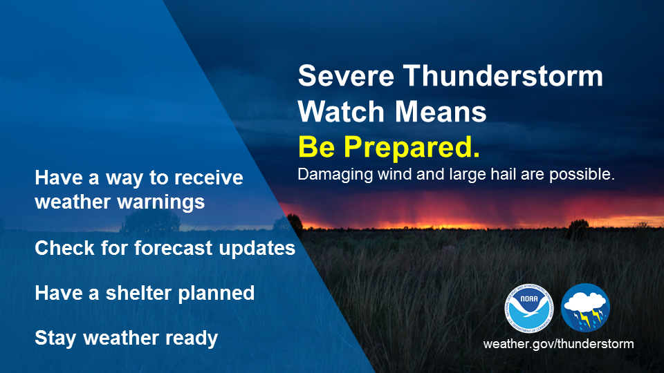
Watches & Warnings:
 |
 |
 |
 |
 |
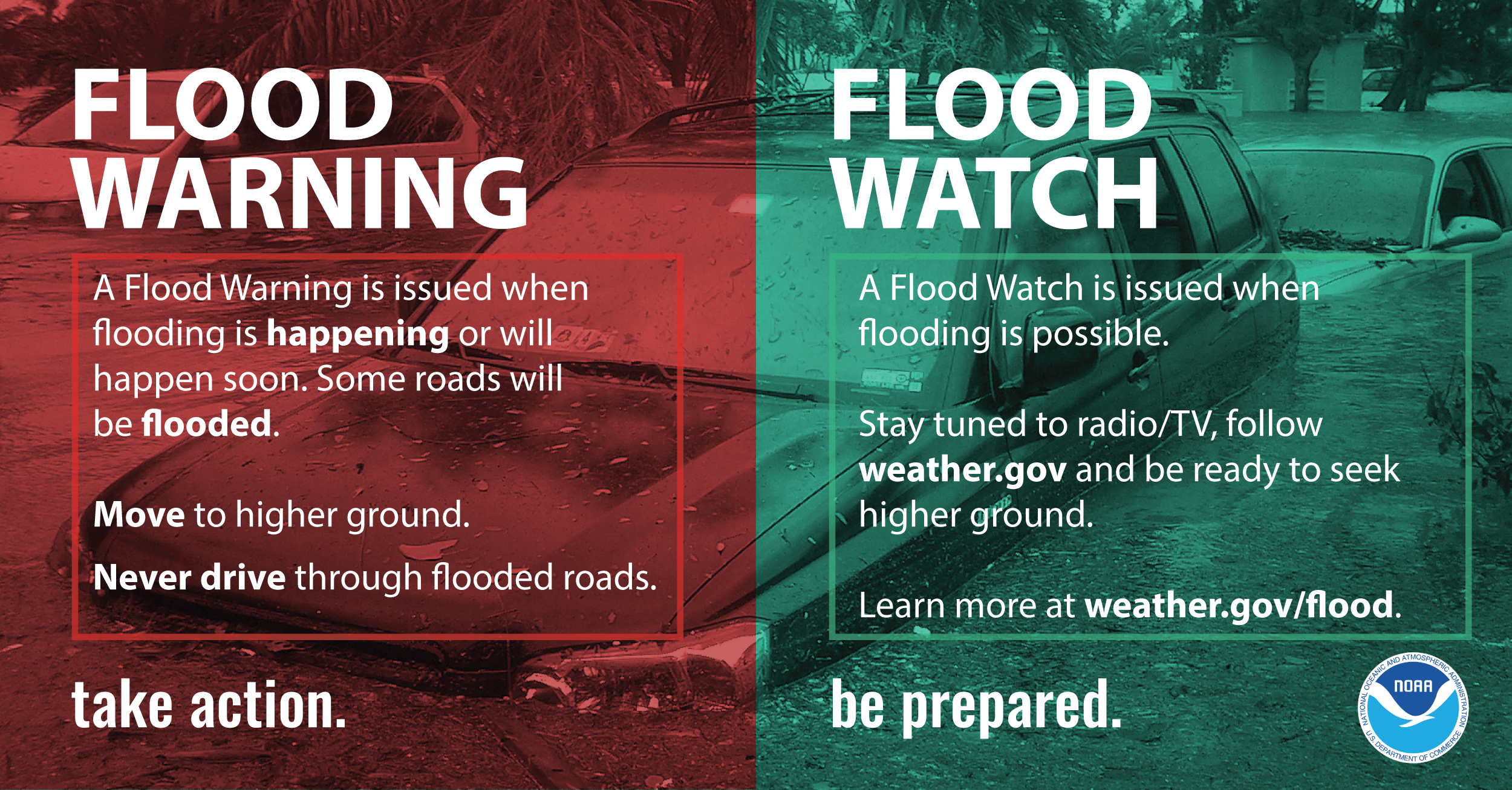 |
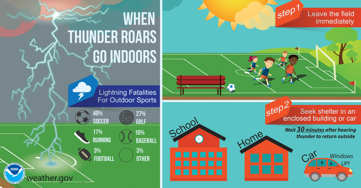
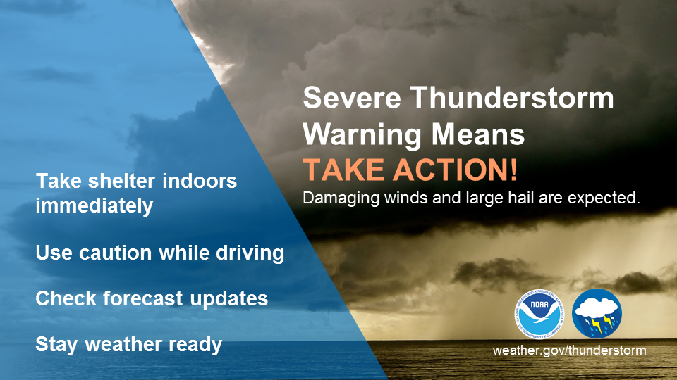
| Flood Safety |
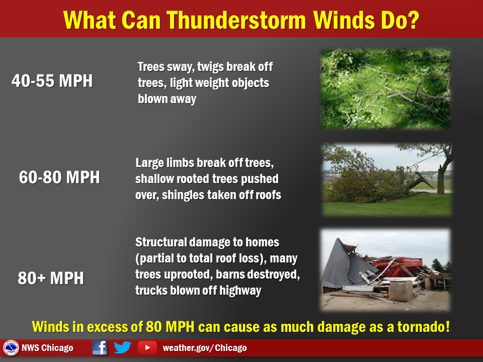
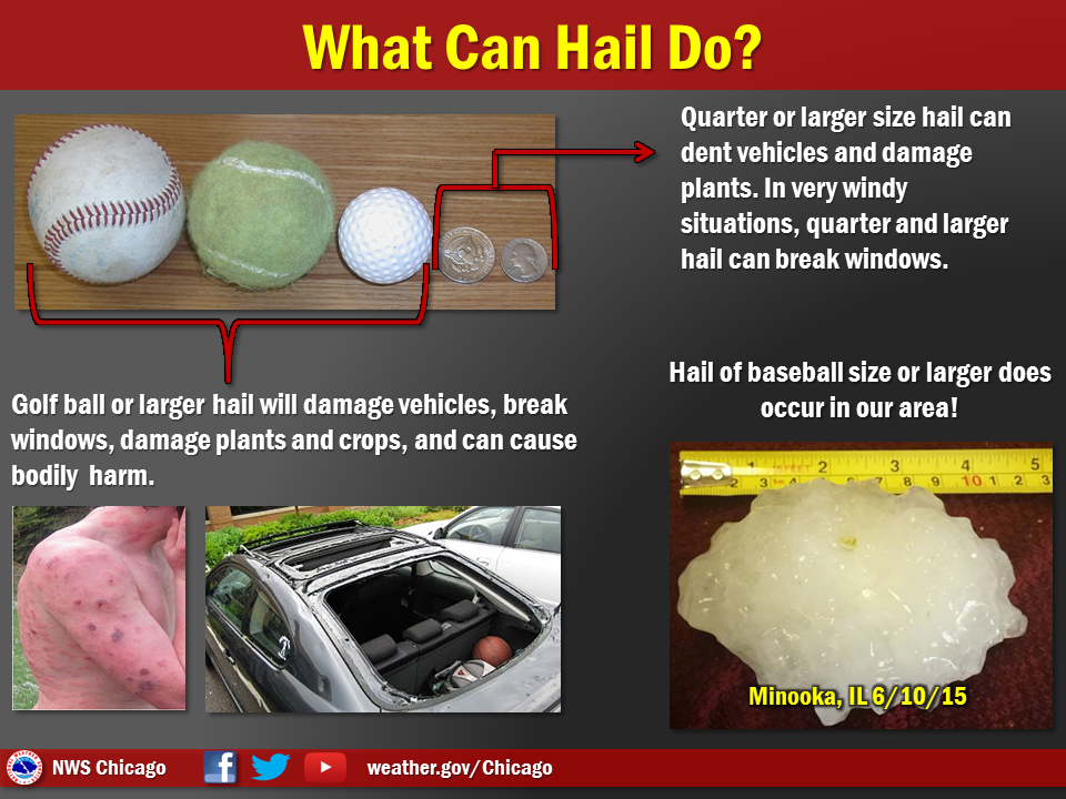
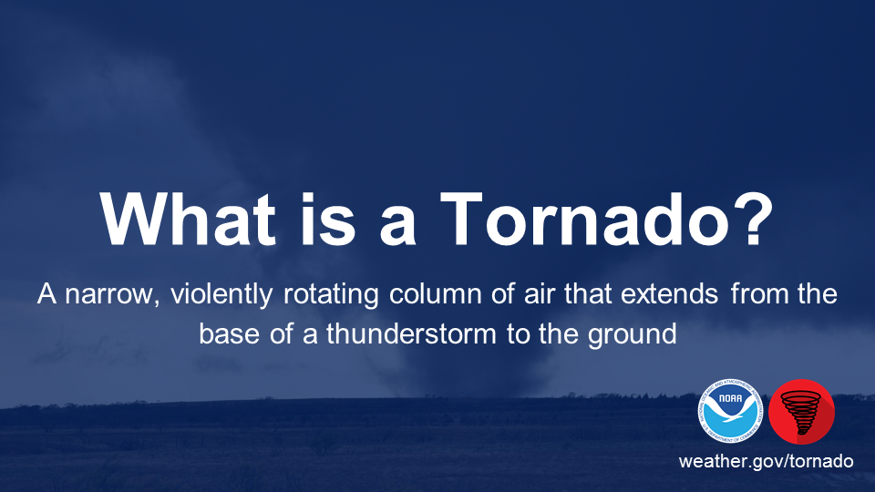
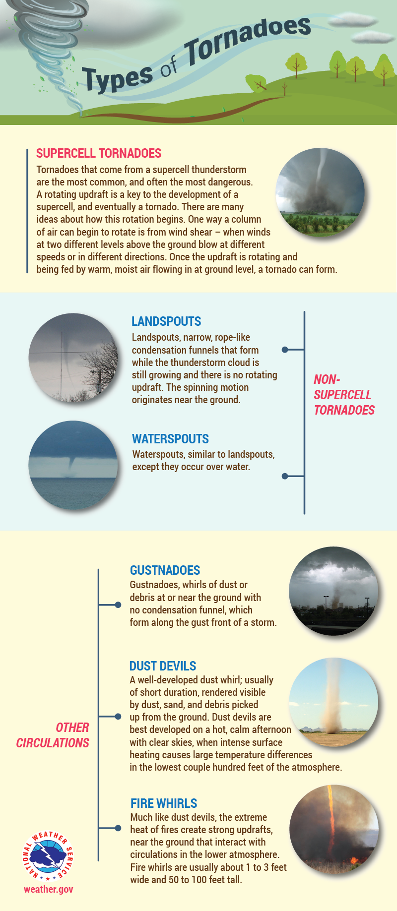
Severe Weather Hazards
.png) |
||
 |
 |
 |
 |
||
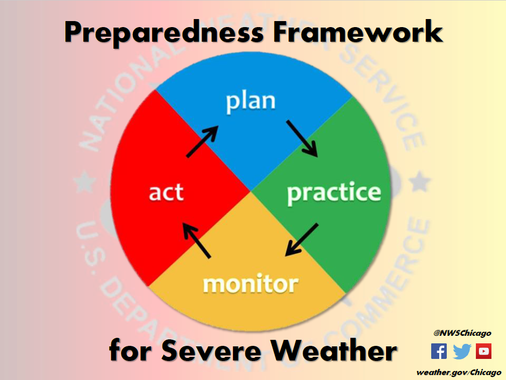
Preparedness & Safety Tips
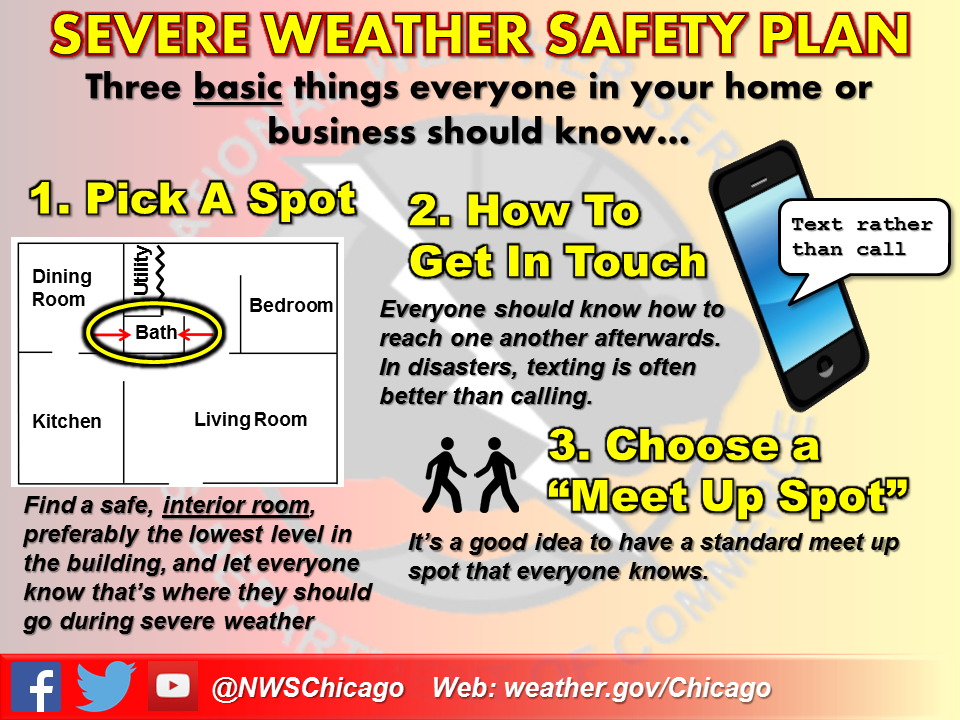
In Advance:
|
|
|
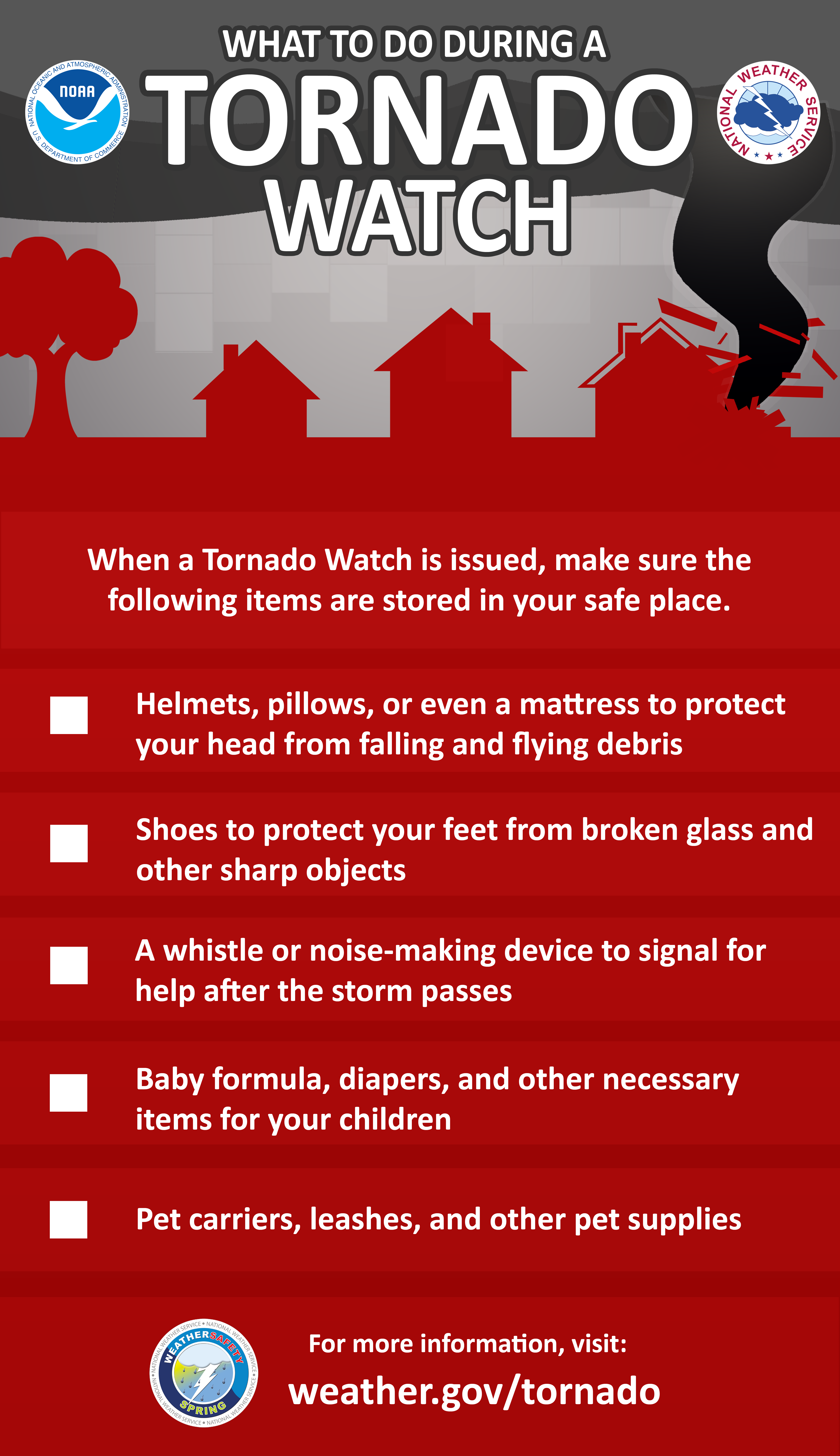
When Threat is Imminent:
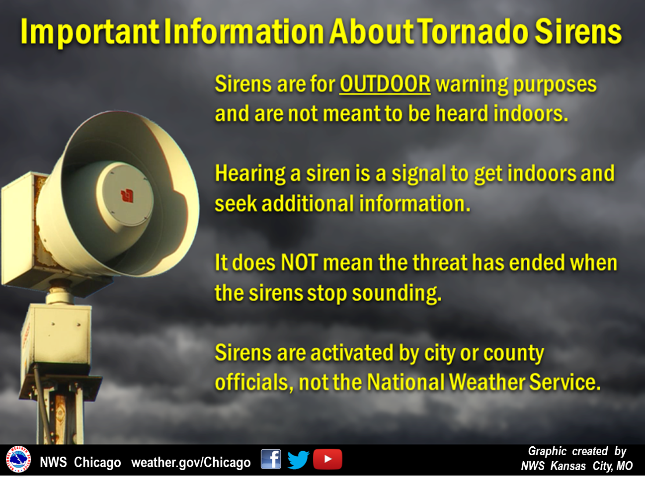 |
|
 |
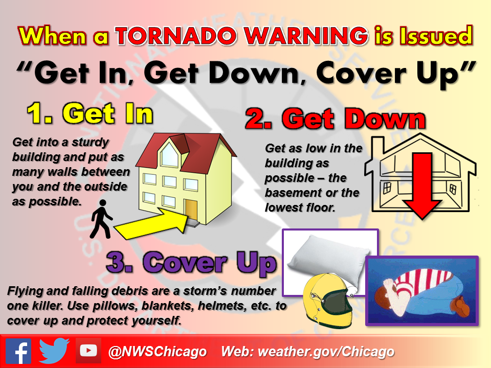 |
|
|||
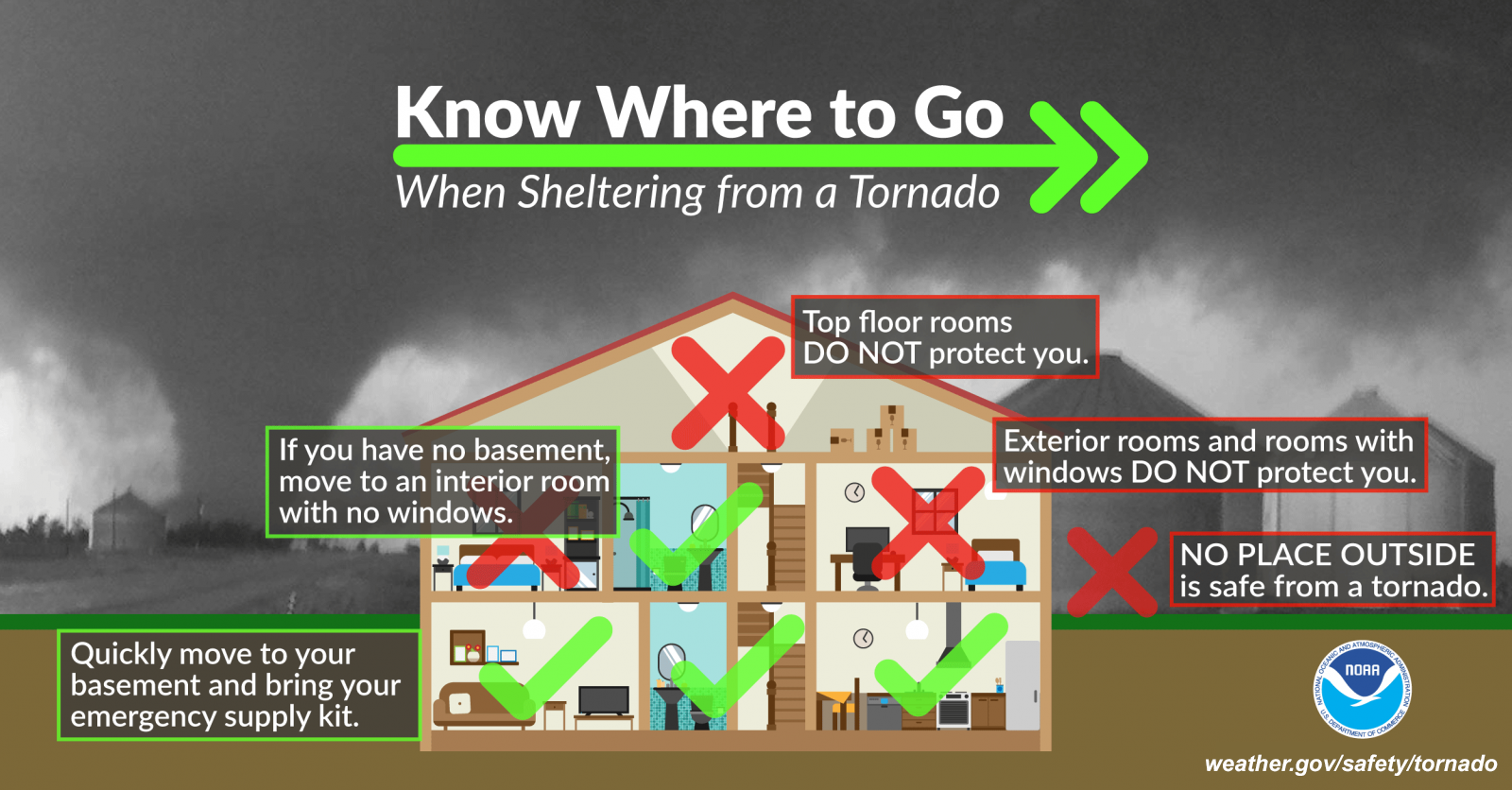
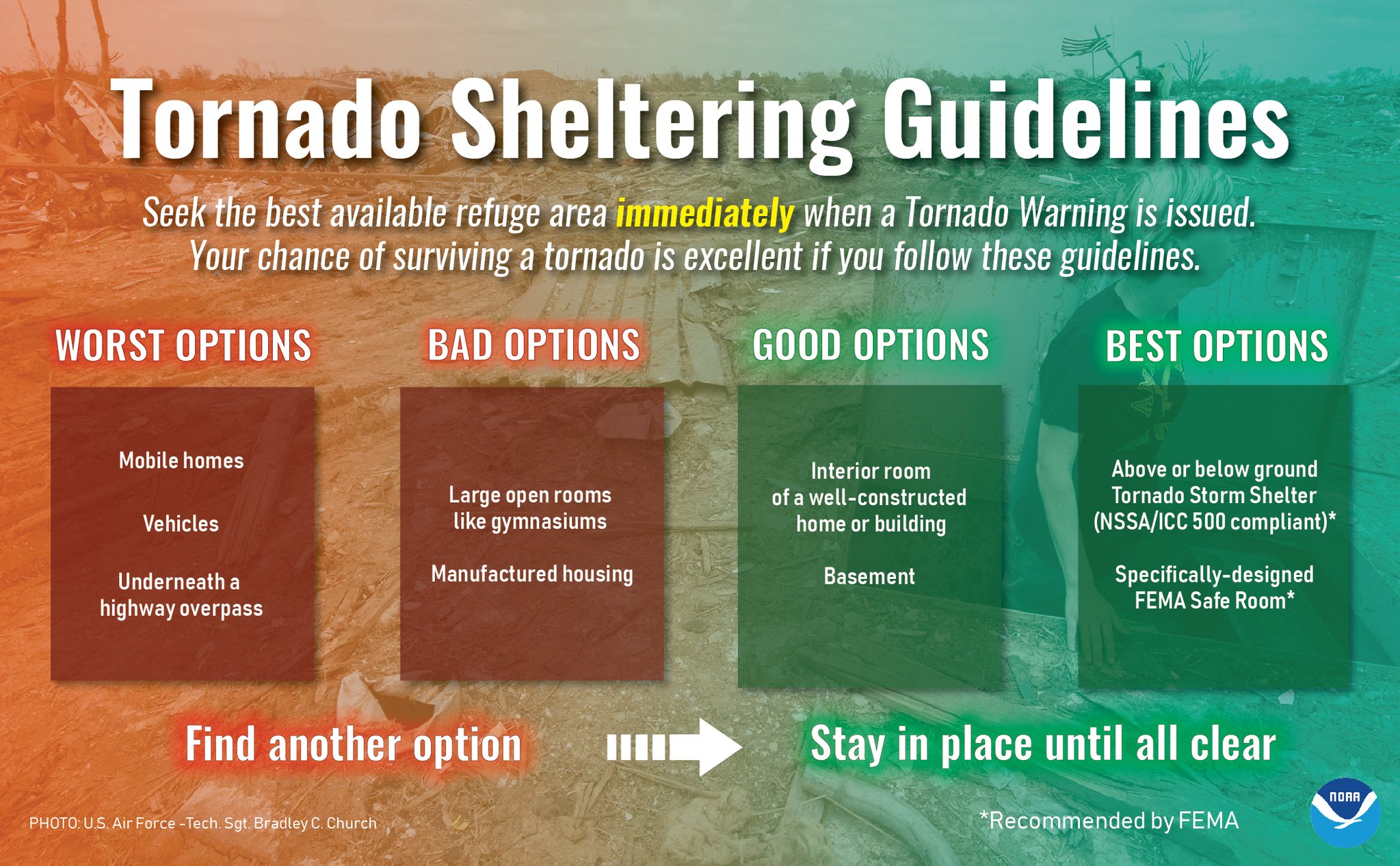
Tornadoes and Structures:
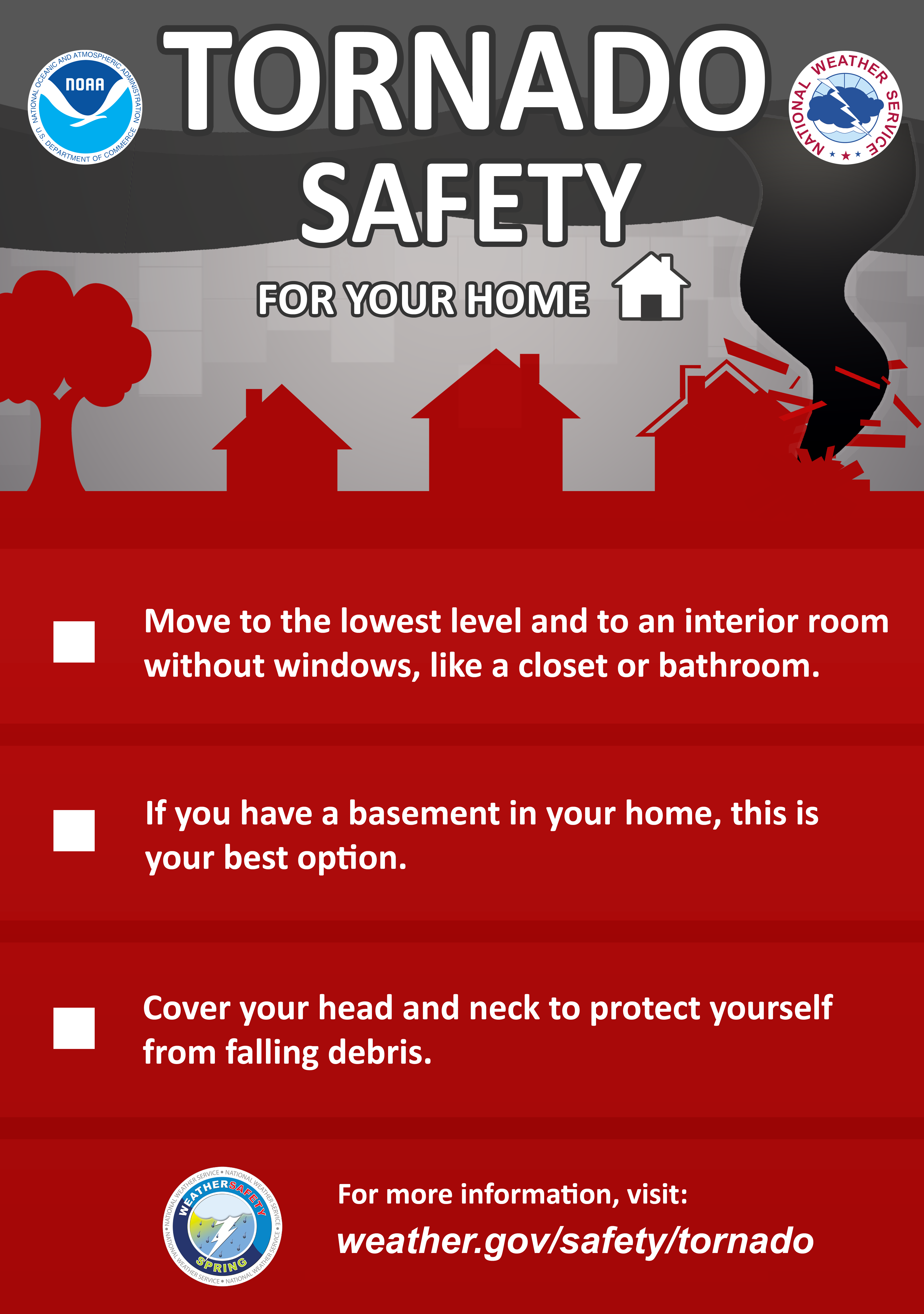 |
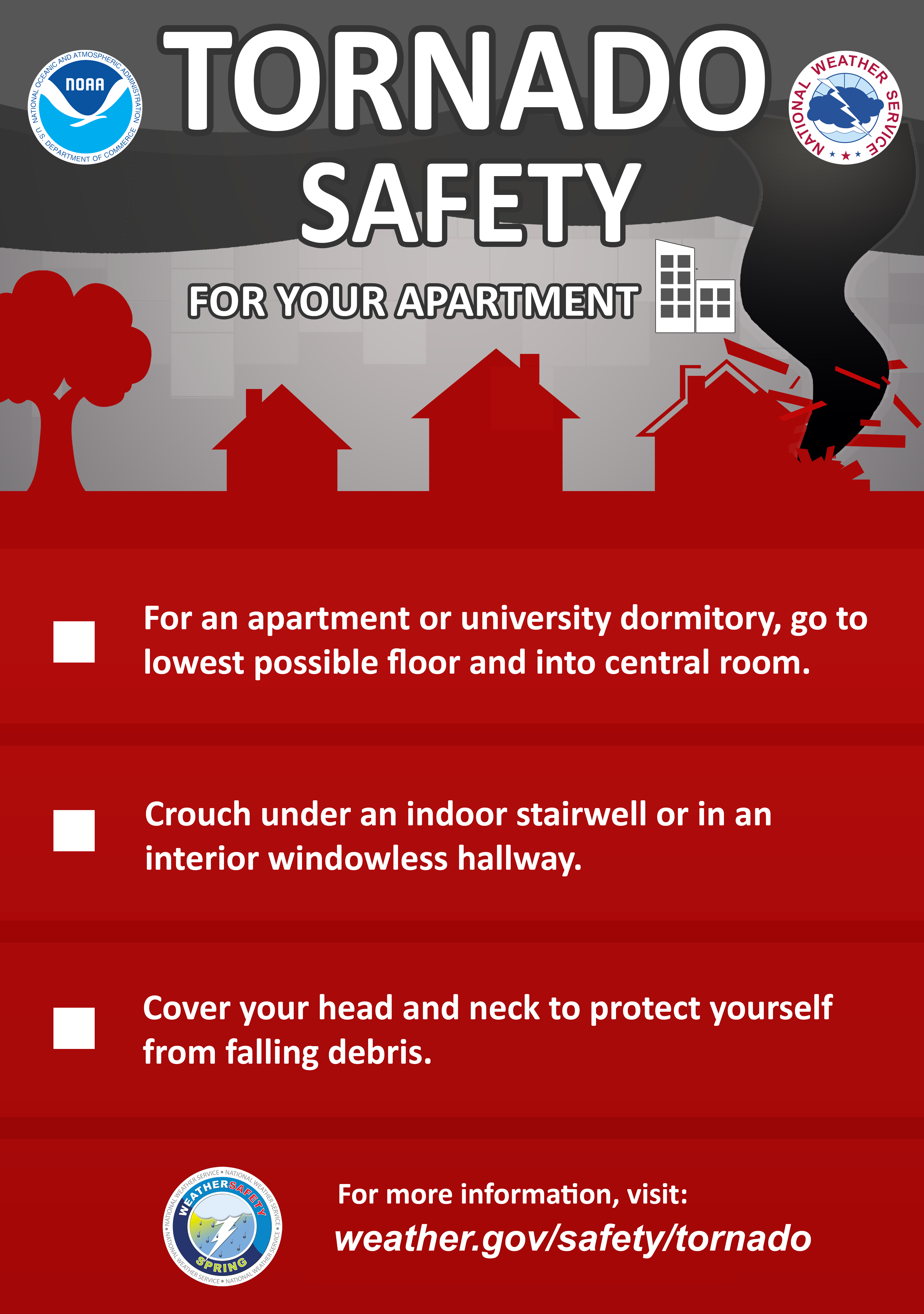 |
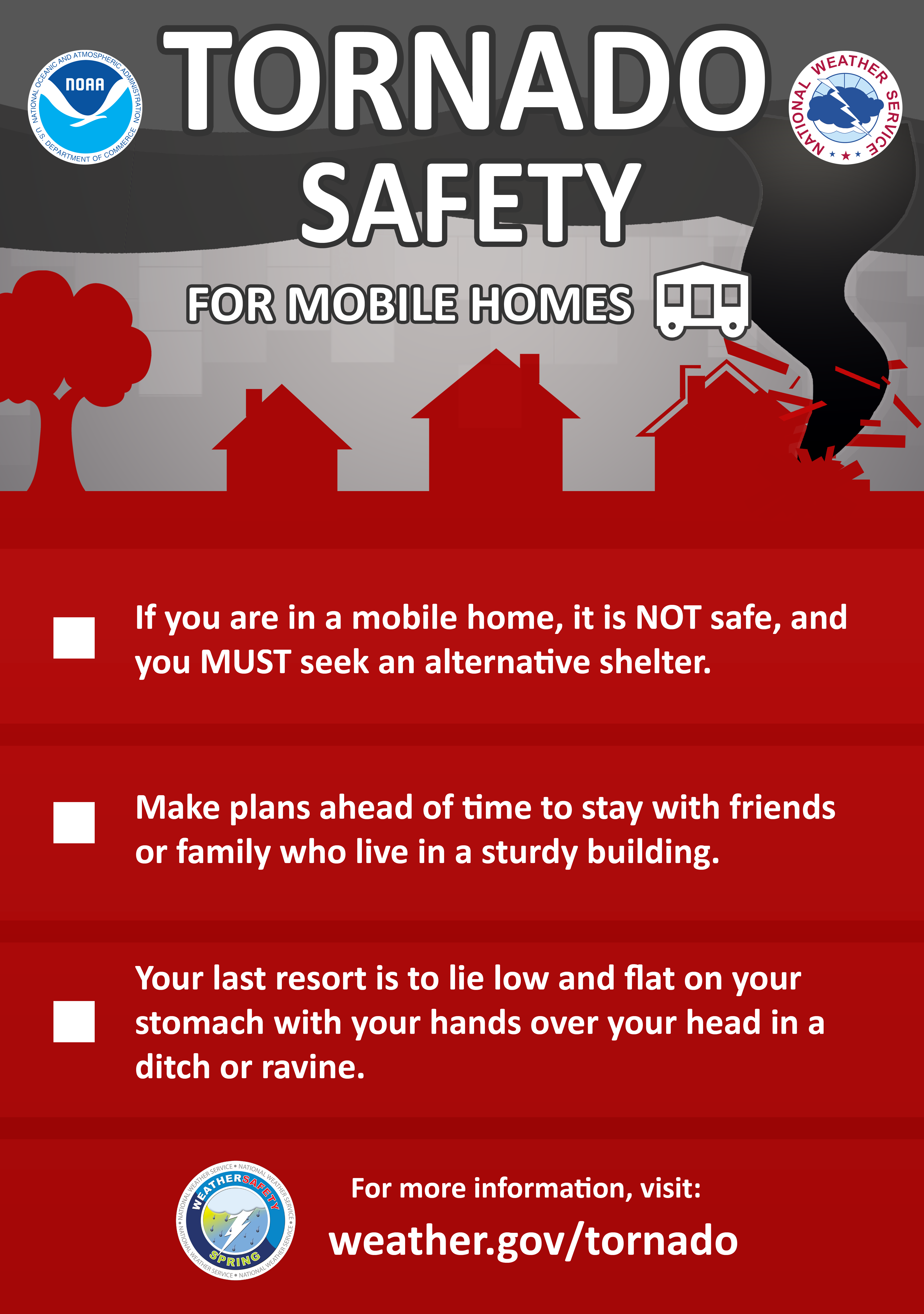 |
Tornadoes and Vehicles:
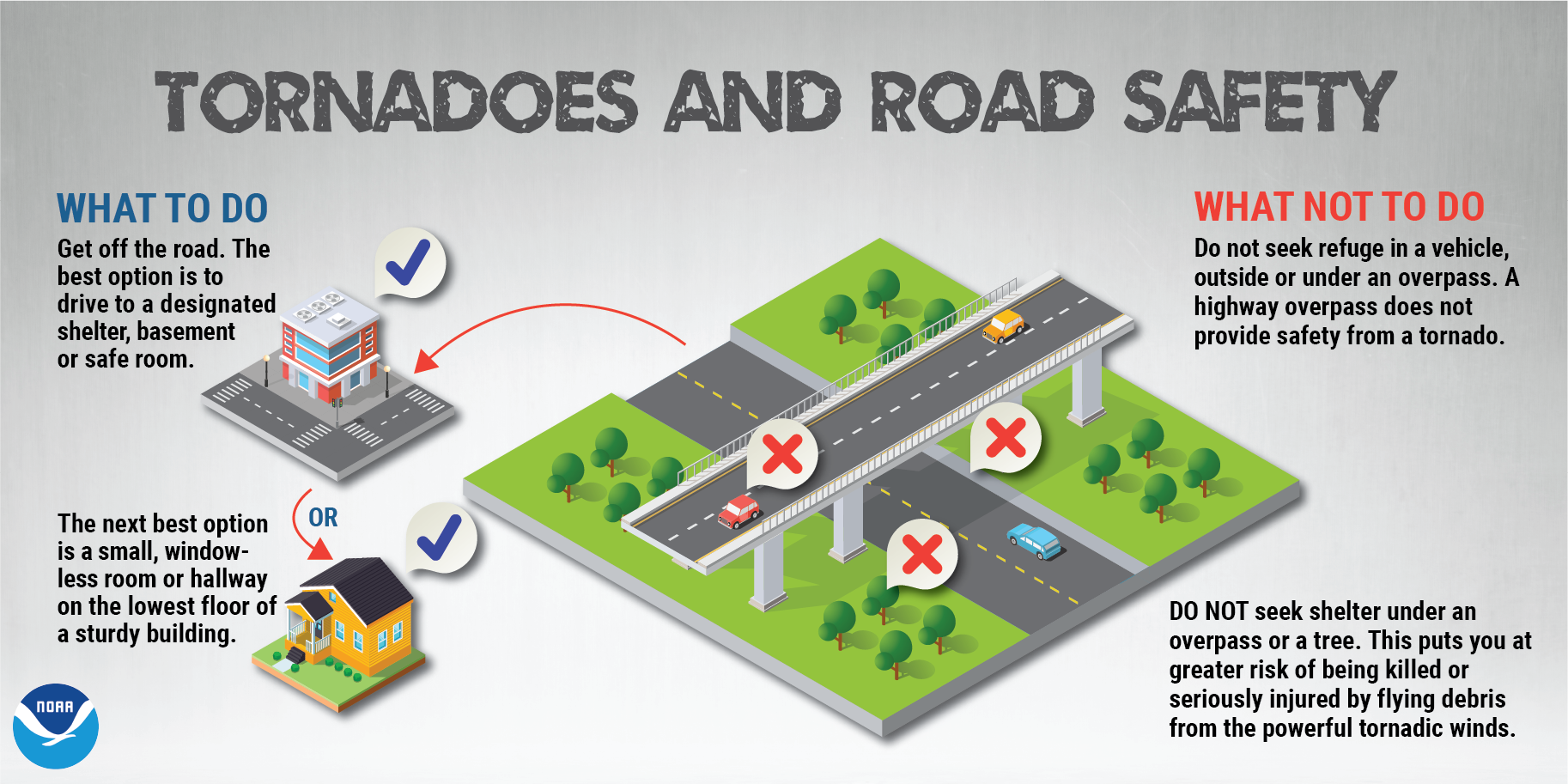 |
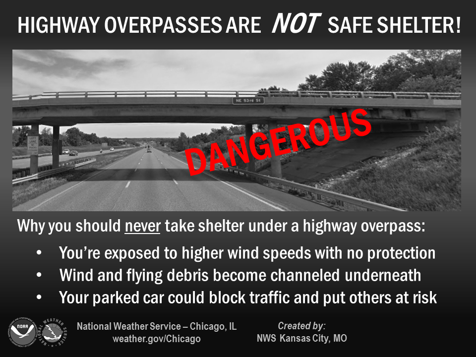 |
| NWS Spring Safety Resources |
Warning Reception
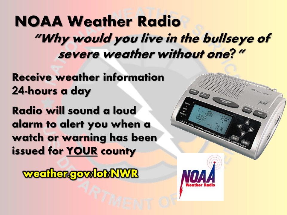 |
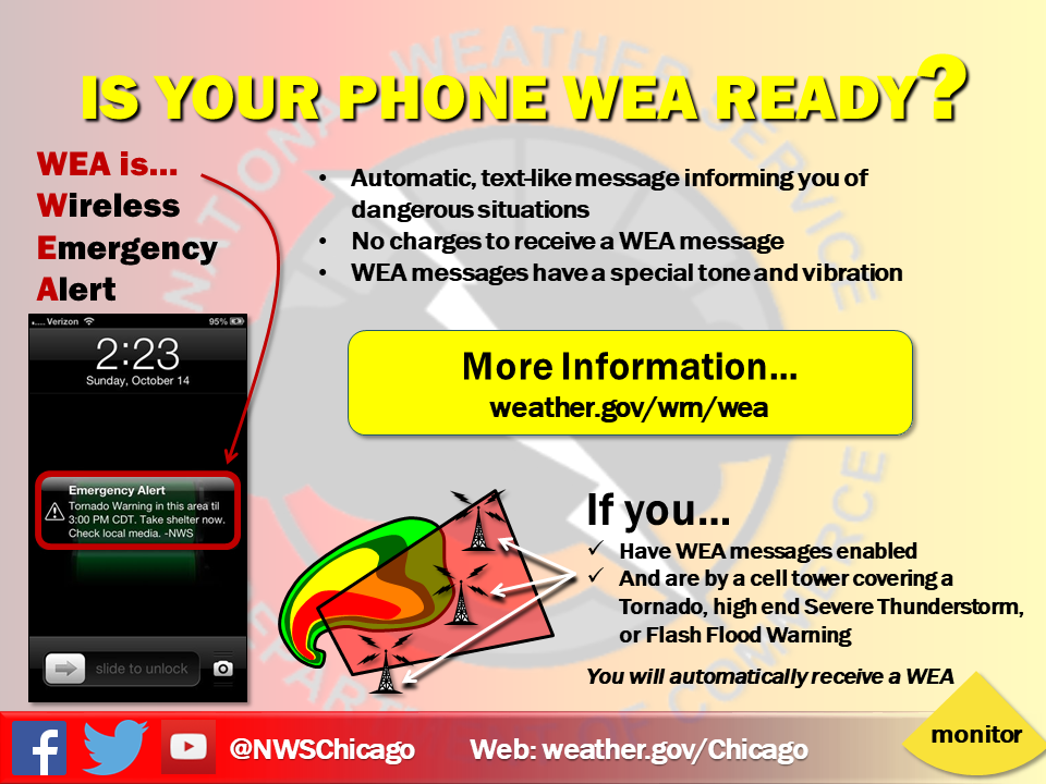 |
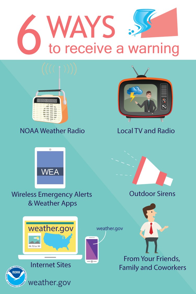 |
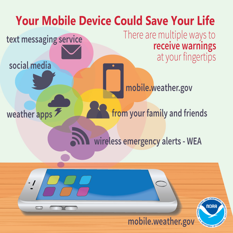 |
NWS Forecast Office Maps for Illinois and Indiana
.png)
Illinois NWS Offices
.png)
Indiana NWS Offices

Other Helpful Links
 |
Media use of NWS Web News Stories is encouraged! Please acknowledge the NWS as the source of any news information accessed from this site. |
|