About CoCoRaHS
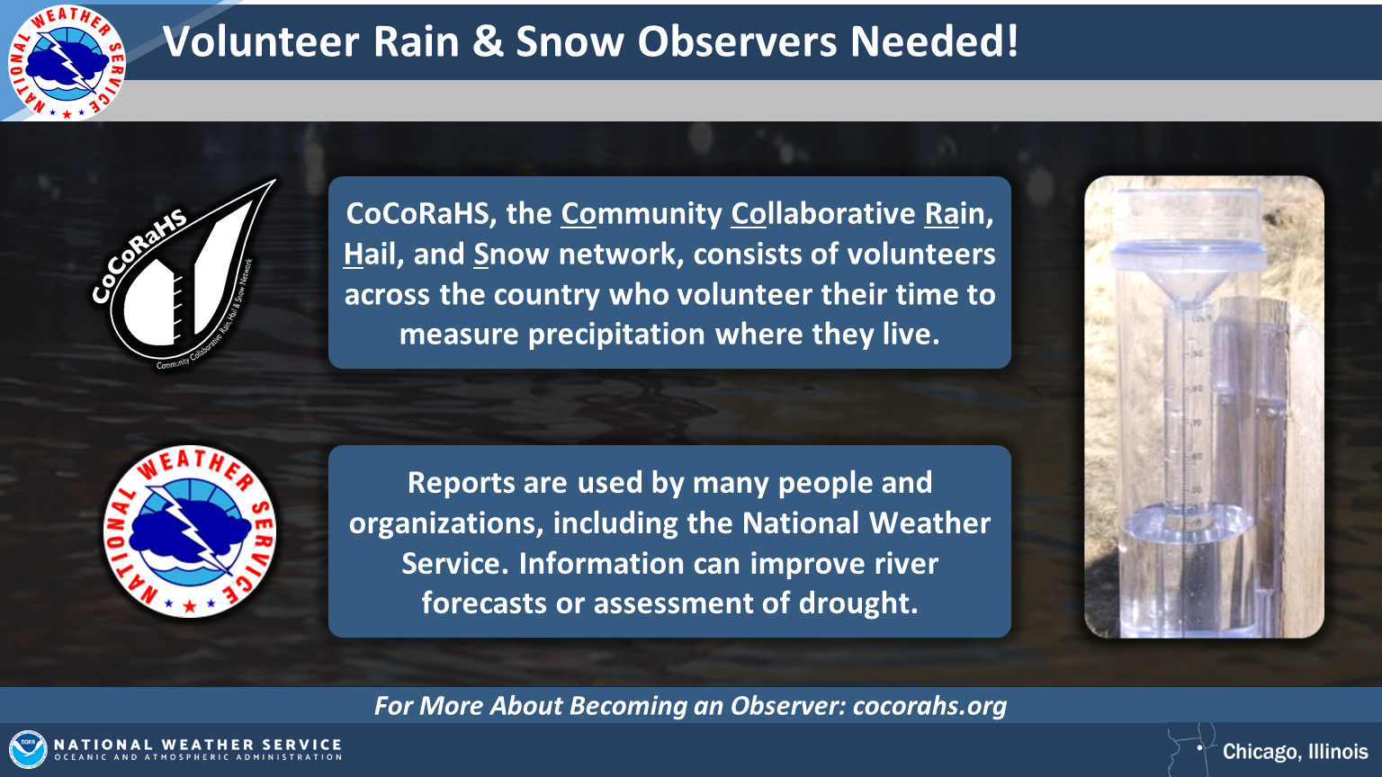
The Community Collaborative Rain, Hail & Snow network (CoCoRaHS) is a community-based network of volunteers who report rain and snow observations from their own backyards. Reports are used by many people and organizations, including the National Weather Service. Additional rain and snow information from volunteer observers has been used to improve river forecasts or assessment of drought.
|
|
|
|
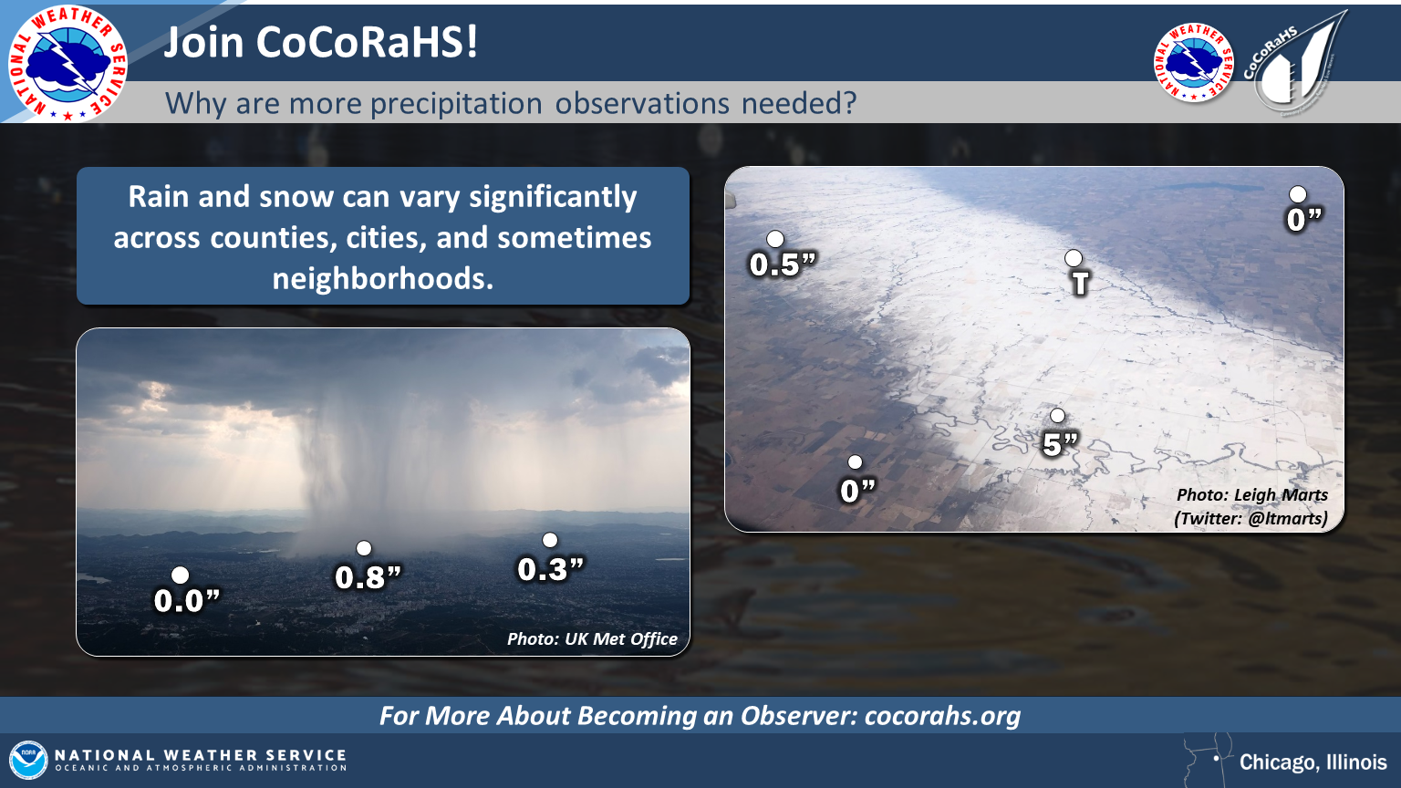
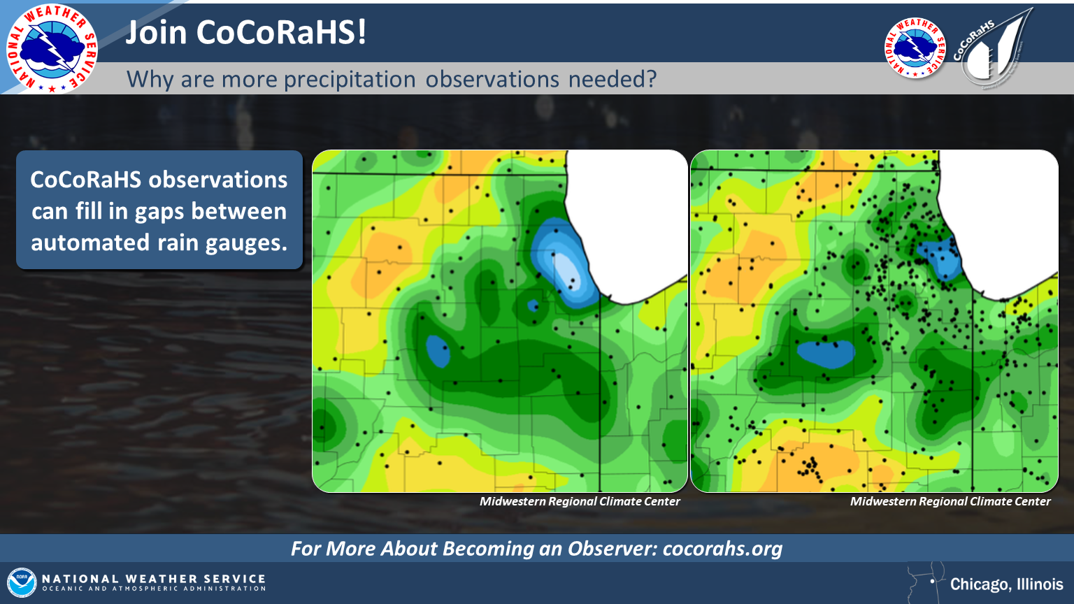
Precipitation can be highly variable over short distances. This was illustrated during a significant flash flood which occurred in Fort Collins, CO, in 1998. Researchers determined that the heaviest rainfall occurred away from official rain gauges, but some private rain gauges captured the heaviest rainfall. CoCoRaHS was formed after this event and has since spread across the country. |
|
|
|
Who Can Participate
|
Contact CoCoRaHS |
|
|
|
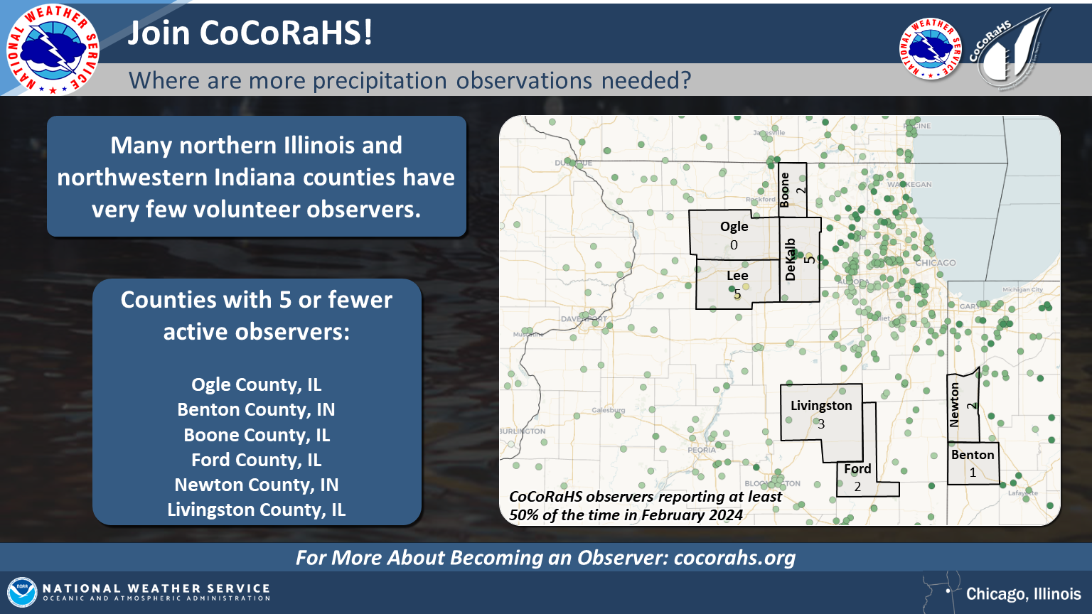
Where are Volunteer Observers Needed?
Observations from additional CoCoRaHS observers would be helpful anywhere, but some parts of northeastern Illinois and northwestern Indiana have few precipitation observations. Of particular note, Boone, DeKalb, Ogle, Lee, Livingston, Ford, Newton, and Benton counties have 5 or fewer observers. |
|