Decision Support page for Highway / Street Departments
Current Hazards
 |
 |
 |
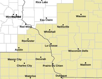
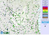
| Local Hazards Map (Click on map for details) |
Regional Hazards Map | National Hazards Map (Click on map for details) |
| (Click for SSEC Hazards Map) |
Current Conditions
 |
Regional Radar
 |
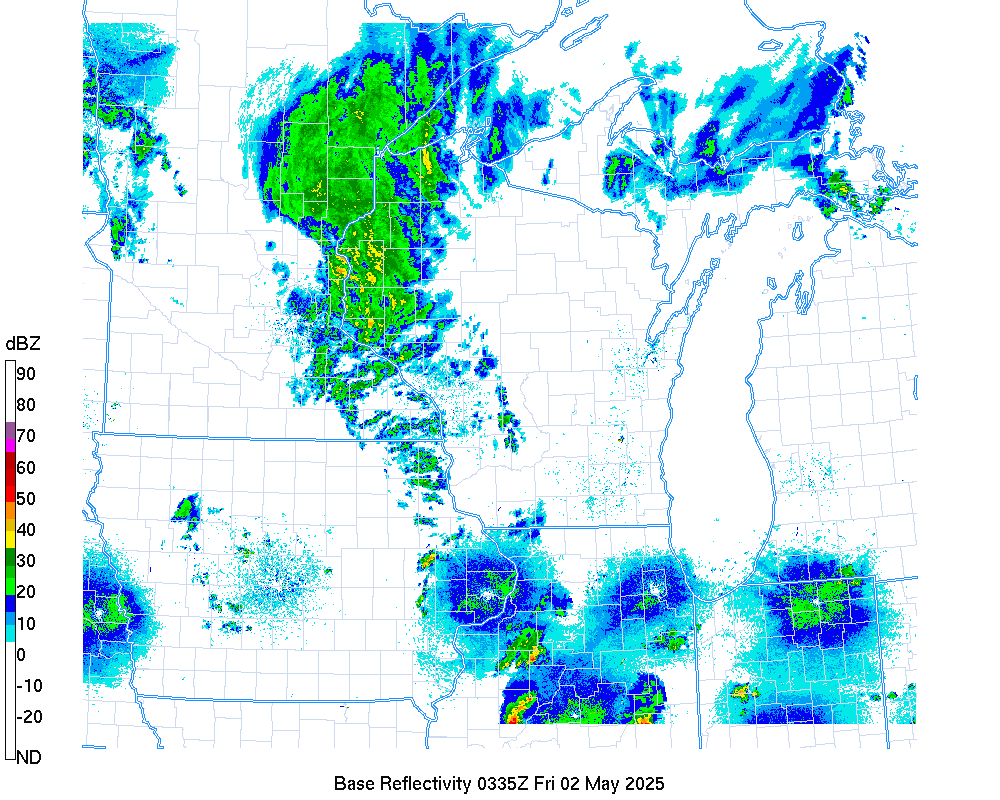 |
|
| National radar loop | Static Regional Radar View |
Local Radars
 |
 |
 |
| NWS La Crosse | NWS Twin Cities | NWS Des Moines |
 |
 |
 |
| NWS Quad Cities | NWS Milwaukee | NWS Green Bay |
Local Hazardous Weather Outlook - (Text)
Graphical Hazardous Weather Outlook - (Graphical)
|
Today |
 |
 |
 |
 |
 |
 |
|
| Snow & Ice |  |
 |
 |
 |
 |
 |
 |
| Flooding |  |
 |
 |
 |
 |
 |
 |
National Severe Weather Outlooks - (Risk Categories Explanation)
 |
 |
 |
| Day 1 Severe Weather Outlook | Day 2 Severe Weather Outlook | Day 3 Severe Weather Outlook |
 |
 |
 |
| Day 1 Tornado Probabilities | Day 1 Large Hail Probabilities | Day 1 Thunderstorm Wind Probabilities |
 |
 |
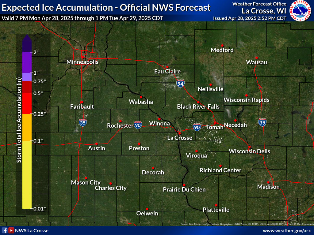 |
| Current Road Conditions | Snow Forecast | Ice Forecast |
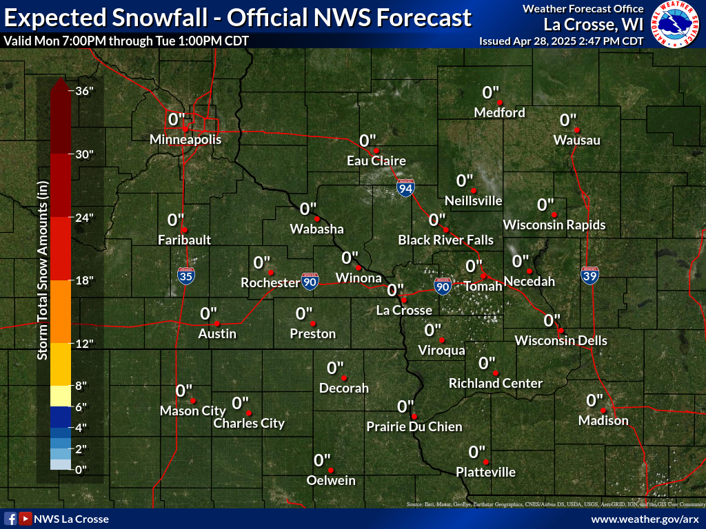
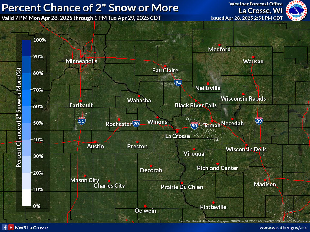
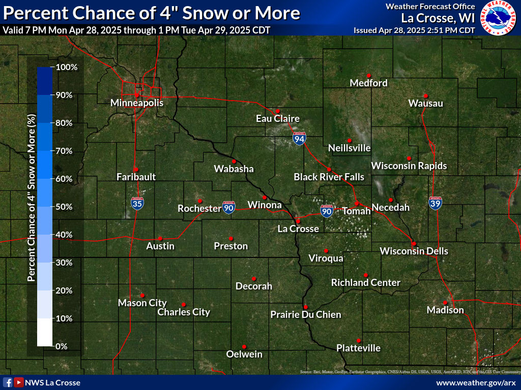
Probabilistic Snowfall Forecasts [link]
 |
 |
 |
| Percent Chance of 2" Snow or More | Percent Chance of 4" Snow or More | Percent Chance of 8" Snow or More |
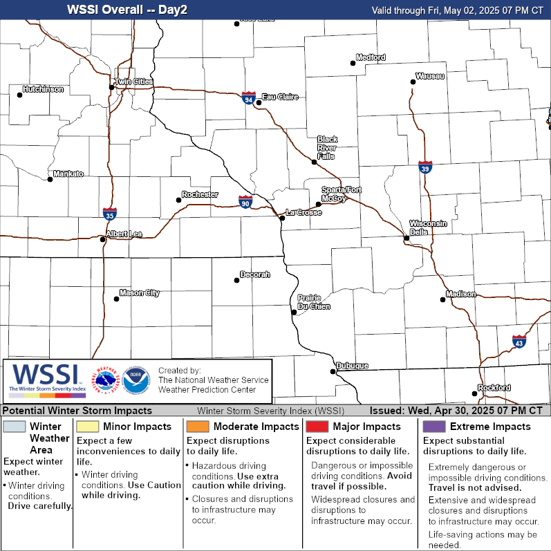
Winter Storm Impacts [link]
 |
 |
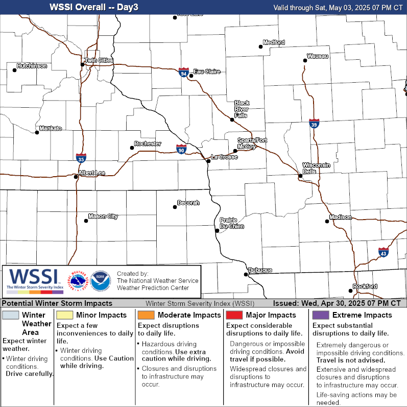 |
| Today/Tonight | Tomorrow | Next Day (Day 3) |
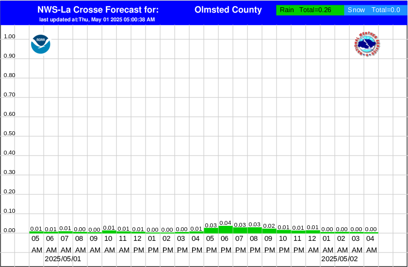
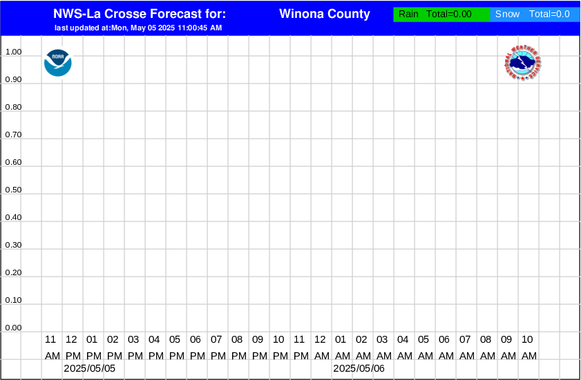
Hourly Snowfall Graphics [link]
 |
 |
 |
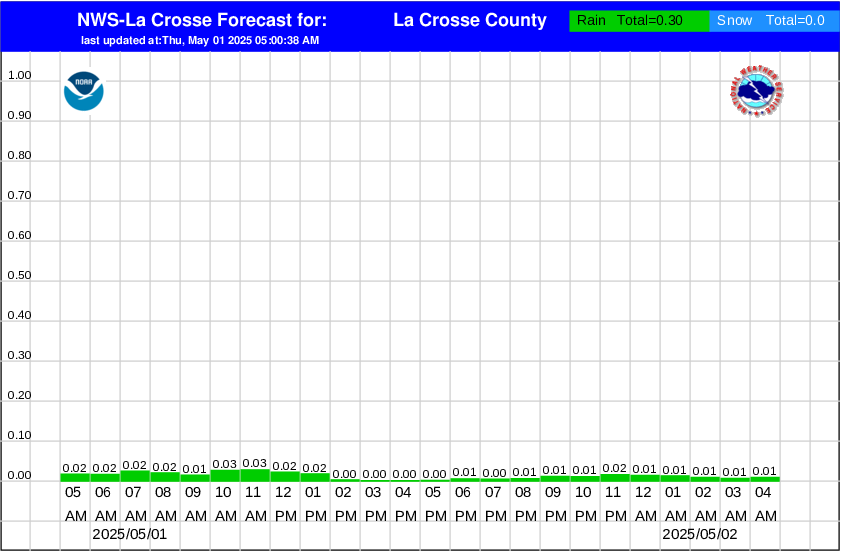 |
| Olmsted County, MN | Winona County, MN | Mower County, MN | La Crosse County, WI |
Snowfall (>4") Probabilities - Days 1-3
 |
 |
 |
| Day 1 Snowfall | Day 2 Snowfall | Day 3 Snowfall |
Ice Accumulation (>0.25") Probabilities - Days 1-3
 |
 |
 |
| Day 1 Ice Accumulation | Day 2 Ice Accumulation | Day 3 Ice Accumulation |
Winter Weather Outlooks (Days 4-7)
 |
 |
 |
 |
| Day 4 Winter Outlook | Day 5 Winter Outlook | Day 6 Winter Outlook | Day 7 Winter Outlook |
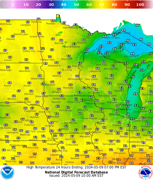
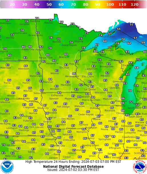
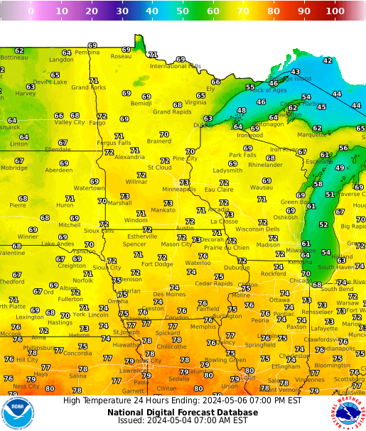
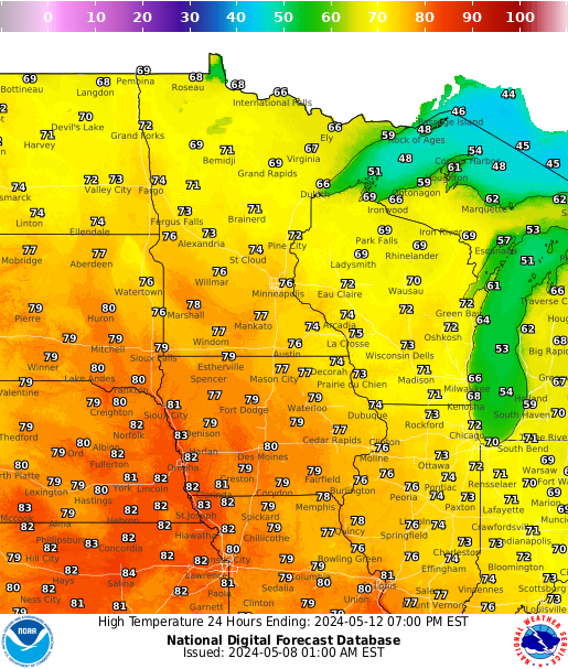
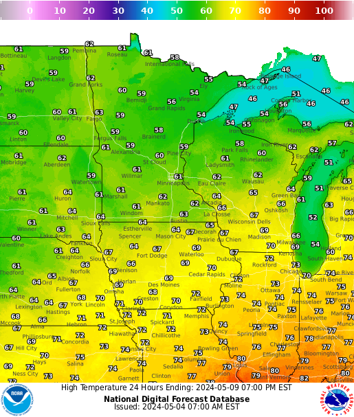
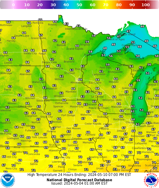
Forecast Highs
 |
 |
 |
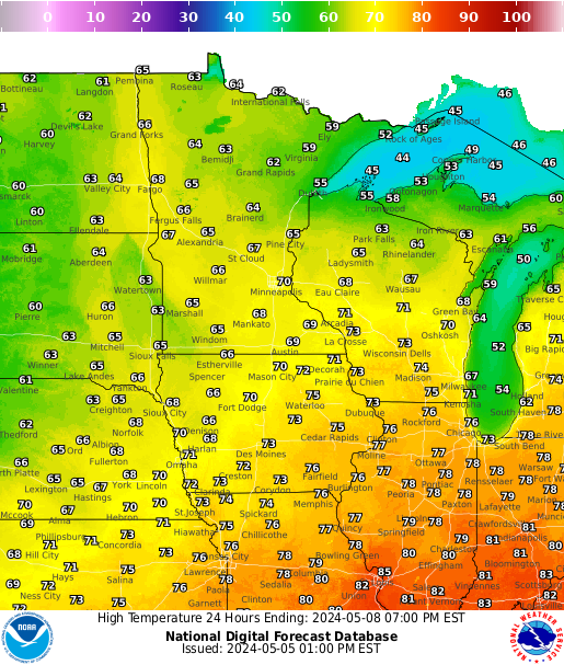 |
| Highs Day 1 | Highs Day 2 | Highs Day 3 | Highs Day 4 |
 |
 |
 |
| Highs Day 5 | Highs Day 6 | Highs Day 7 |
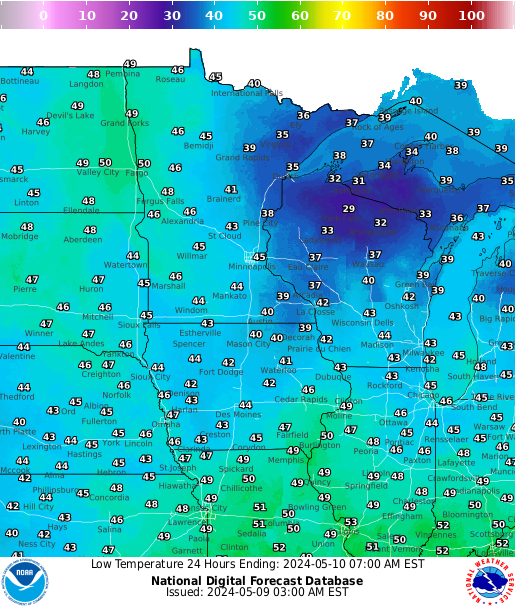
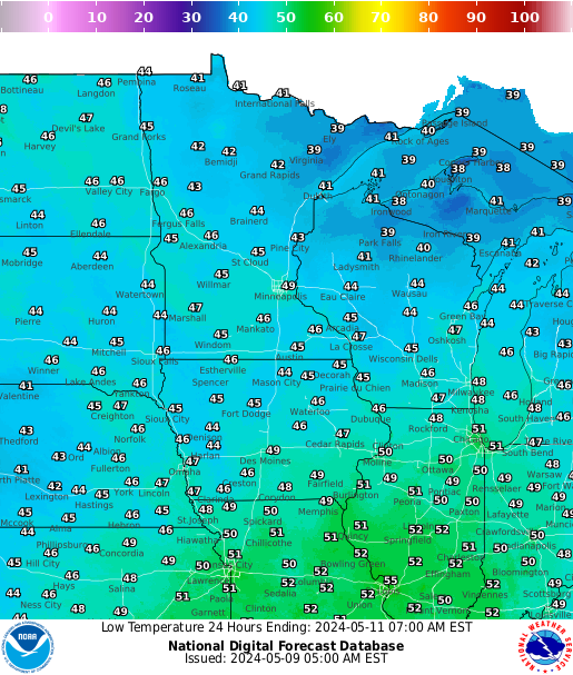
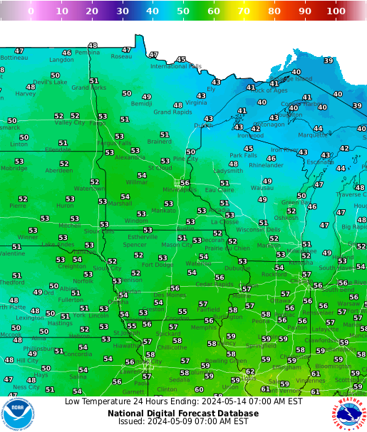
Forecast Lows
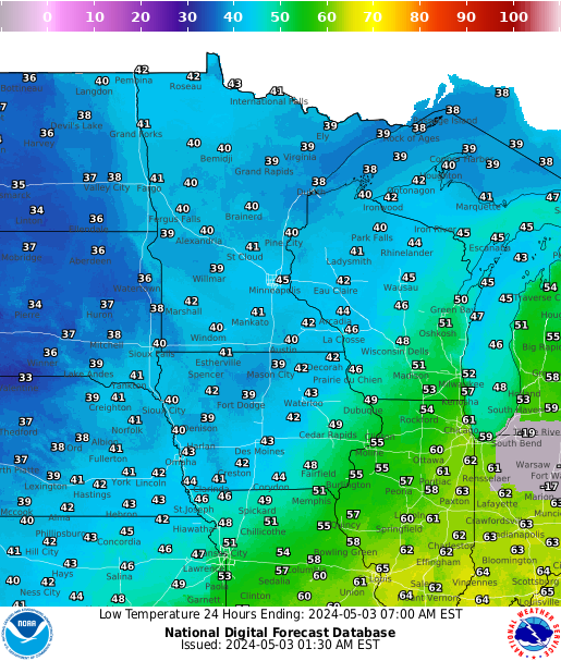 |
 |
 |
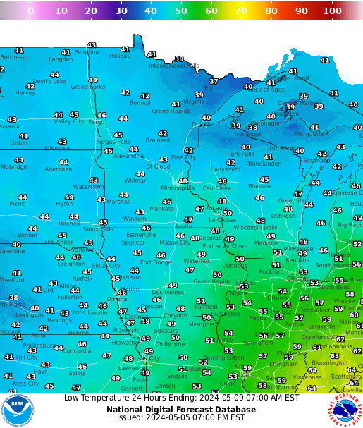 |
| Lows Day 1 | Lows Day 2 | Lows Day 3 | Lows Day 4 |
 |
 |
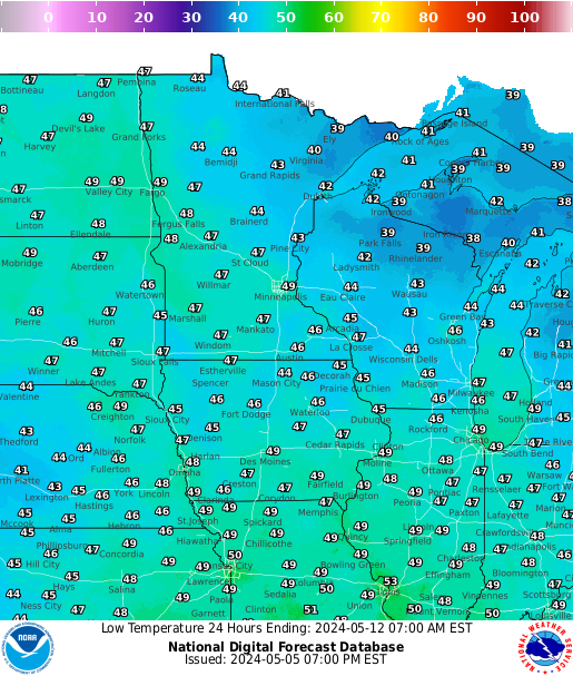 |
| Lows Day 5 | Lows Day 6 | Lows Day 7 |
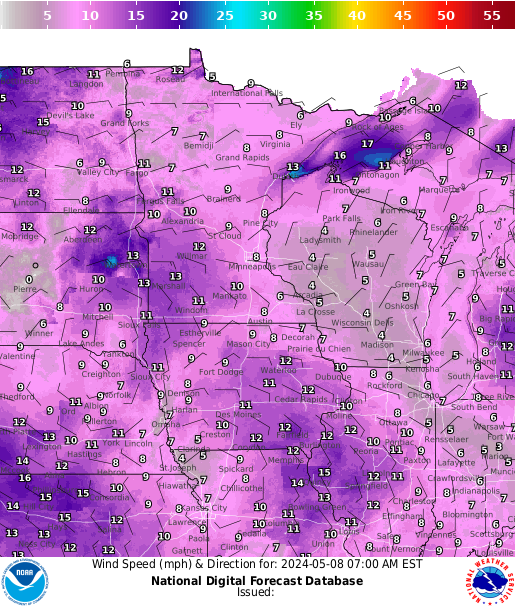
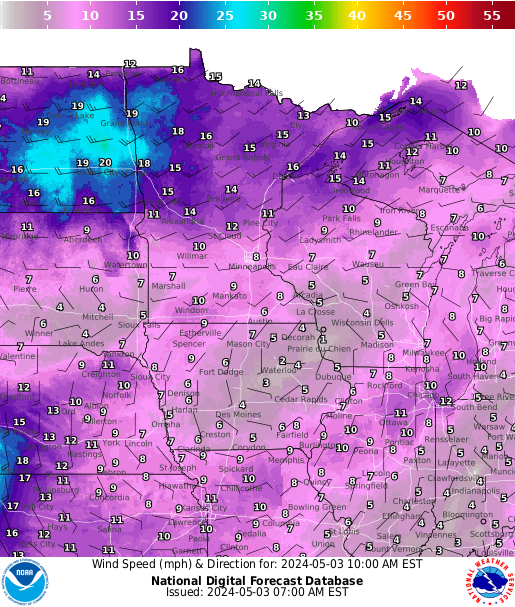
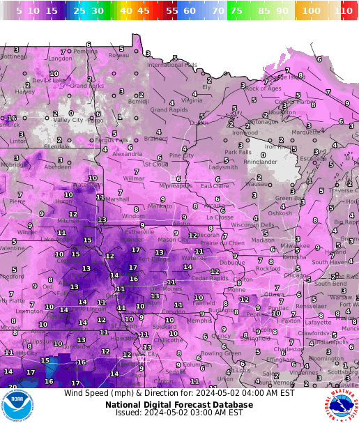
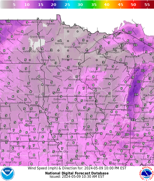
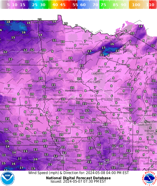
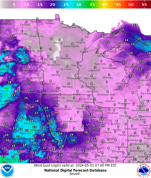
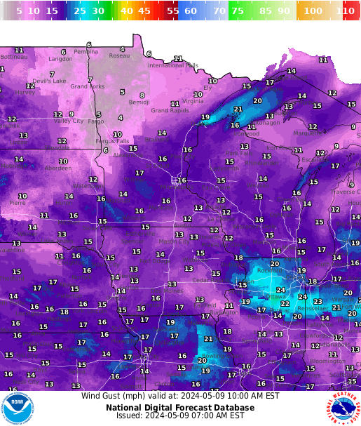
Forecast Winds
 |
 |
 |
 |
 |
| Sustained Winds 3 hr fcst |
Sustained Winds 6 hr fcst |
Sustained Winds 12 hr fcst |
Sustained Winds 18 hr fcst |
Sustained Winds 24 hr fcst |
 |
 |
 |
 |
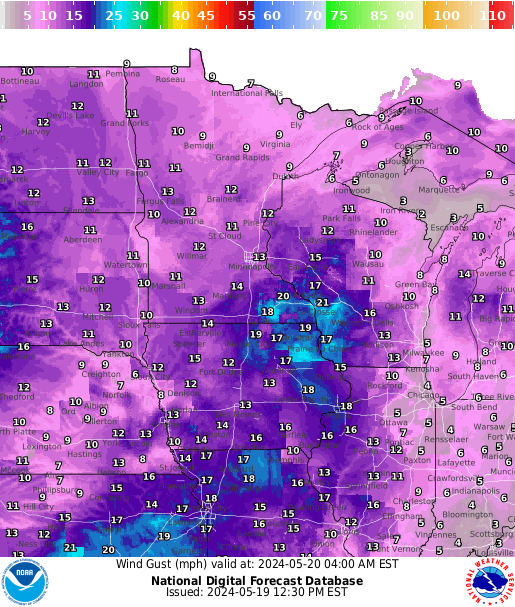 |
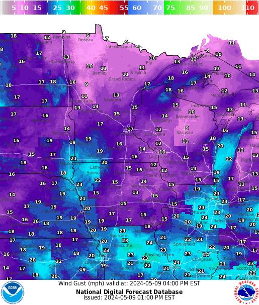
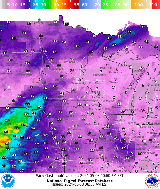
| Wind Gusts 3 hr fcst |
Wind Gusts 6 hr fcst |
Wind Gusts 12 hr fcst |
Wind Gusts 18 hr fcst |
Wind Gusts 24 hr fcst |
River Information
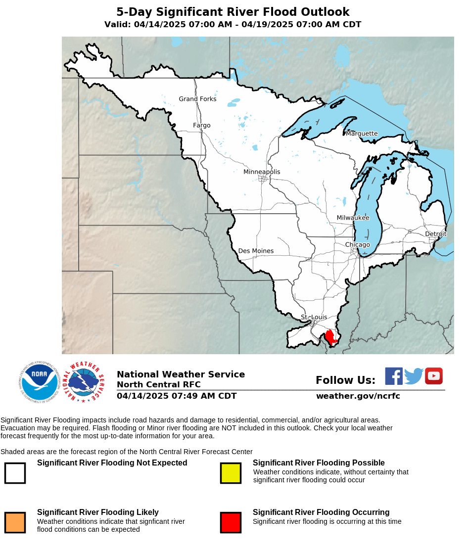 |
 |
 |
| Significant River Flood Outlook |
Current River Gages | NWS La Crosse Flooding Monitor |
Rainfall Information
 |
 |
||
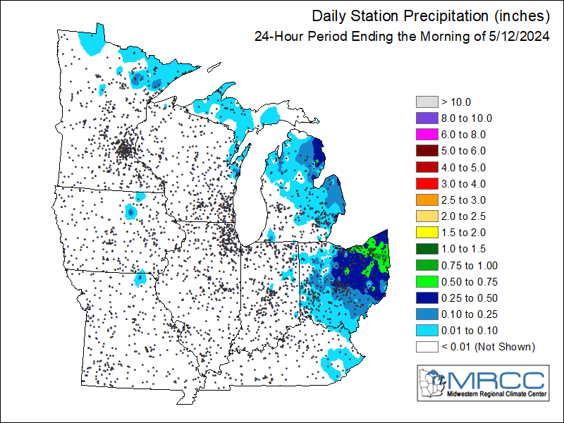
| 1-hour Est.Precip | Total Est. Precip | Regional 24-hr Rainfall | Regional 7-day Rainfall |
Precipitation Forecasts
 |
 |
 |
 |
| Day 1 Precipitation | Day 2 Precipitation | Day 3 Precipitation | Days 4-5 Precipitation |
Rainfall Outlooks
 |
 |
 |
| Day 1 Excessive Rainfall | Day 2 Excessive Rainfall | Day 3 Excessive Rainfall |
Weather Maps
 |
 |
 |
 |
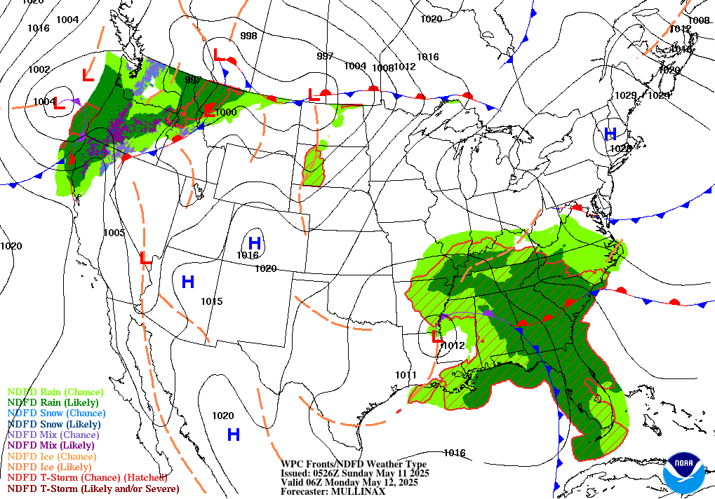
| 6-hr Surface Map | 12-hr Surface Map | 18-hr Surface Map | 24-hr Surface Map |
 |
 |
 |
 |
| 30-hr Surface Map | 36-hr Surface Map | 48-hr Surface Map | 60-hr Surface Map |
Past Weather
 |
 |
||
| Storm Reports Today | Storm Reports Yesterday | Local Storm Reports | Local Snowfall Reports |
 |
 |
| Monthly Avg. Temperature | Monthly Total Precipitation |
Links / Products
 |
Contact your local NWS office for additional details | |


 Follow us on YouTube