


Storm Prediction Center's Fire Weather Outlook
Current Large Wildfire Map |
Incident Management Situation Report Map |

In the Upper Midwest, heavy to excessive rain may bring flash and urban flooding through Wednesday. Scattered severe thunderstorms capable of large hail and damaging wind gusts are possible from the central High Plains into the Upper Midwest Wednesday. Extreme heat is ongoing over the Desert Southwest through Thursday. Read More >
Fire Weather
National Program
Current Large Wildfire Map |
Incident Management Situation Report Map |
US Dept of Commerce
National Oceanic and Atmospheric Administration
National Weather Service
Fire Weather
3833 S. Development Ave
Boise, ID 83705
Comments? Questions? Please Contact Us.
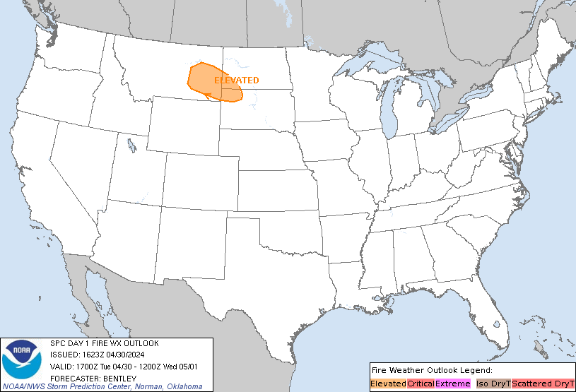
 Today's SPC Outlook
 Tomorrow's SPC Outlook
 Day 3-8 SPC Outlook
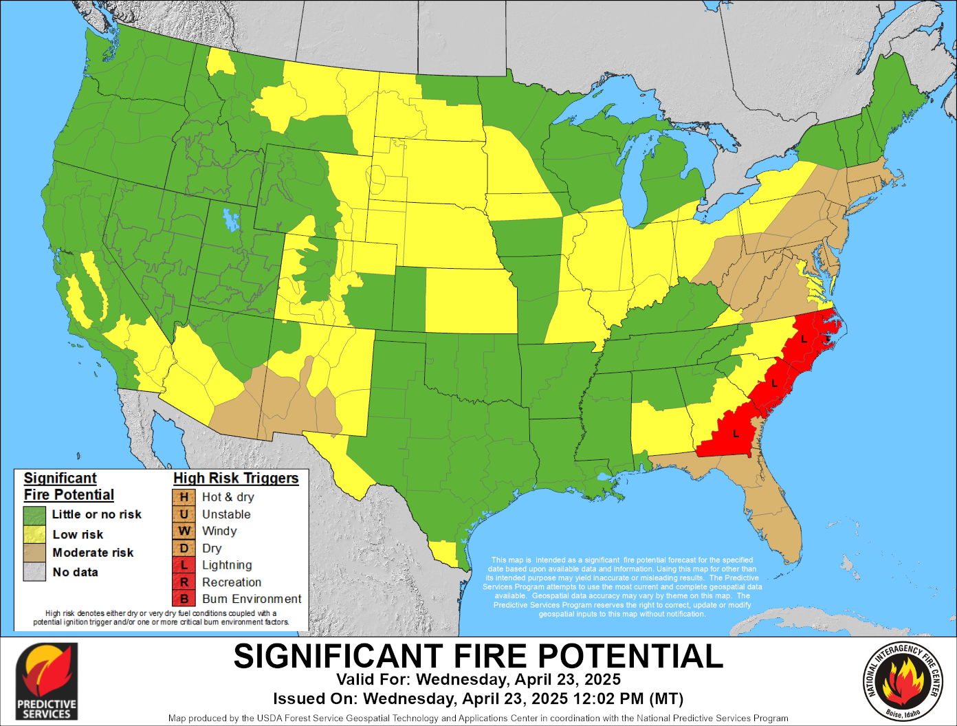
 Current Wildland Fire Potential Outlook
 Next Month's Wildland Fire Potential Outlook
 Extended Wildland Fire Potential Outlook
 Day 3-7 Hazards Outlook
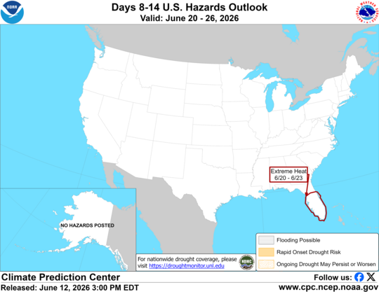 Day 8-14 Hazards Outlook
 Hot-Dry-Windy Index
 U.S. Drought Monitor
 U.S. Monthly Drought Outlook
 U.S. Seasonal Drought Outlook