| Hot Weather Decision Support | |
| Instructions: Select desired Time and Region, then choose a Forecast button to view image | |
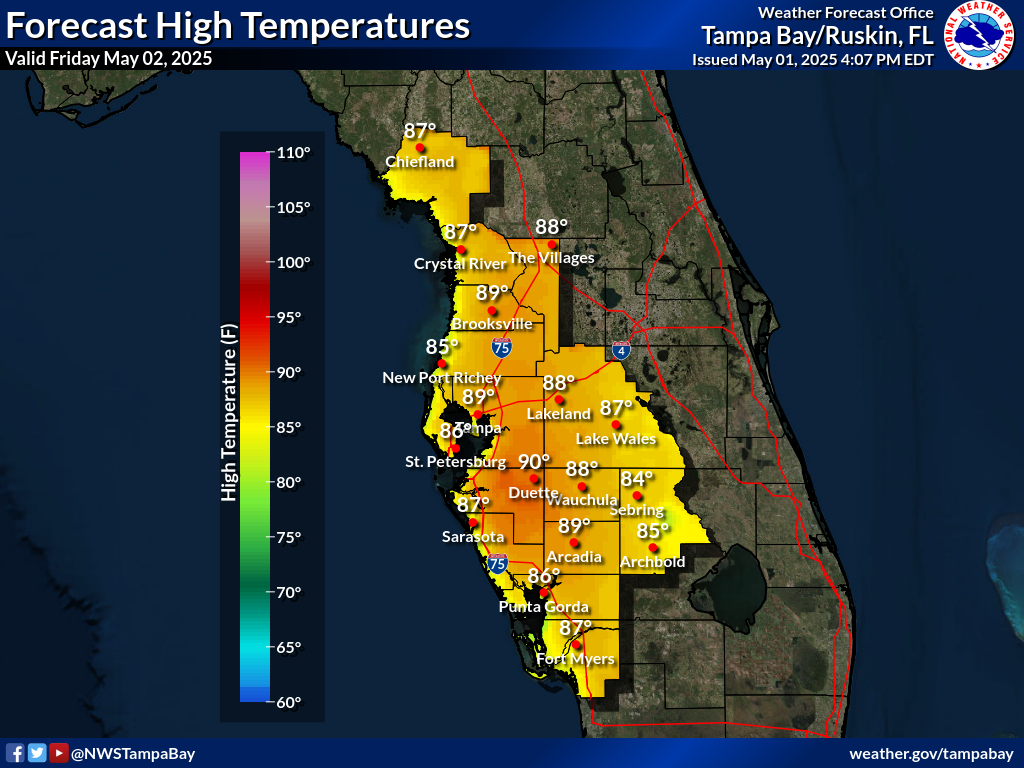
| The images below are the official NWS maximum temperatures, maximum heat index forecasts, and HeatRisk for the next 7 days. This data is determined by NWS forecasters to be the most likely outcome based on evaluation of data from computer models, satellite, radar, and other observations. | |
| |
||||
| Heat Related Warning/Watch/Advisory Criteria | ||||
The NWS Hazard Simplification (Haz Simp) project has led to changes to our hot weather related product suite beginning this season. These changes are designed to simplify the communication of information, improve understanding, and enhance the utility of forecasts and warnings. Detailed information about these changes can be found in the Service Change Notice and the Haz Simp Hot One-Pager. Hot Weather related Warning, Watch, and Advisory statements will be issued by the National Weather Service in Tampa Bay when the following criteria is forecast:
|
||||
| What is the Heat Index? | ||||
The heat index, also known as the apparent temperature, is what the temperature feels like to the human body when relative humidity is combined with the air temperature. In other words, the “feels-like” temperature. This has important considerations for the human body's comfort. | ||||
 |
||||
It surprises many people to learn that the heat index values forecasted and measured are for shady locations. If you are exposed to direct sunlight, the heat index value can be increased by up to 15°F. As shown in the table below, heat indices meeting or exceeding 103°F can lead to dangerous heat disorders with prolonged exposure and/or physical activity in the heat. |
||||
 |
||||
More detailed information, as well as records and average heat index values, can be found within our local Heat Index Statistics web page. |
||||
| What is the NWS HeatRisk? | ||||
The NWS HeatRisk is an experimental color-numeric-based index that provides a forecast risk of heat-related impacts to occur over a 24-hour period. HeatRisk takes into consideration:
heat-sensitive populations
who need to take actions at levels that may be below current NWS heat product levels. A detailed breakdown of each of the categories listed below can be found here.
|
||||
 |
||||
More details and graphics about the HeatRisk can be found on the NWS HeatRisk web site, a 1-Pager is available here, and a detailed breakdown of each of the categories listed above can be found here. |
||||

