| Overview: | ||
Elsa was the earliest 5th named storm on record as of the end of the 2021 hurricane season. Areas along the west coast of Florida experienced as much as 2 to 3 feet of storm surge, and 6 to 10 inches of rain fell across portions of southwest Florida. In southern Sarasota and Charlotte Counties, neighborhoods flooded after weeks of heavy rain was compounded by the additional rainfall associated with Elsa. Eventually, the storm made landfall near Fish Creek (north of Steinhatchee), Taylor County, as a Tropical Storm around 10:30 AM EDT on July 7th. |
||
| Most images on this page can be magnified by clicking, and resized back to original size with a second click. |
||
|
Infrared Satellite
|
Radar Loop July 5-7, 2021
|
|
Elsa History: |
||
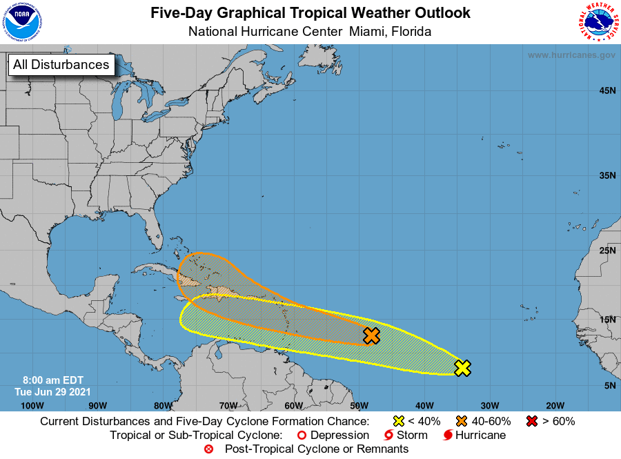
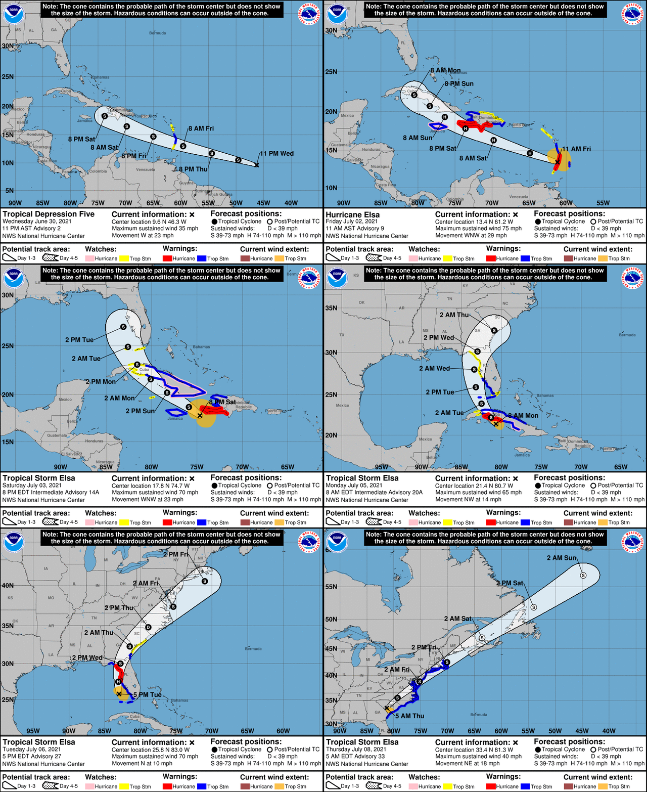
Elsa was an early season category 1 hurricane (on the Saffir-Simpson Hurricane Wind Scale) that formed over the central tropical Atlantic Ocean. Elsa affected many countries including Barbados, St. Lucia, St. Vincent and the Grenadines, Martinique, the Dominican Republic, Haiti, Cuba, and the United States. The hurricane caused around $1 billion in damage along its track and was responsible for 13 direct fatalities. Elsa developed near the Lesser Antilles where it became Tropical Depression Five on June 30th. Elsa briefly became a hurricane on July 2nd while tracking quickly west-northwest across the northern Caribbean Sea. The center of Tropical Storm Elsa moved between Jamaica and Hispanola on July 4th, which is when the first Tropical Storm Watches were issued for West Central and Southwest Florida during the late afternoon hours. Elsa then cut across central Cuba with a northwest motion at a decreased forward speed on July 5th with Tropical Storm Warnings being issued for West Central and Southwest Florida on this day. She emerged into the Florida Straits on the 6th, passing near the Lower Keys, followed by a northward turn paralleling the west coast of Florida. Elsa regained hurricane status on the 6th as it moved north off the west coast of Florida with Hurricane Warnings being issued for much of our area. However, this was short-lived as Elsa decreased in intensity prior to landfall along Taylor County, Florida as a strong, but sheared tropical storm late in the morning on July 7th. Elsa then turned northeast after landfall, moving across north Florida and south Georgia before accelerating along the eastern seaboard where it later became post-tropical on July 9th. The complete analysis of the storm can be found in the National Hurricane Center Tropical Cyclone Report on Hurricane Elsa. |
||
|
|
Rainfall: |
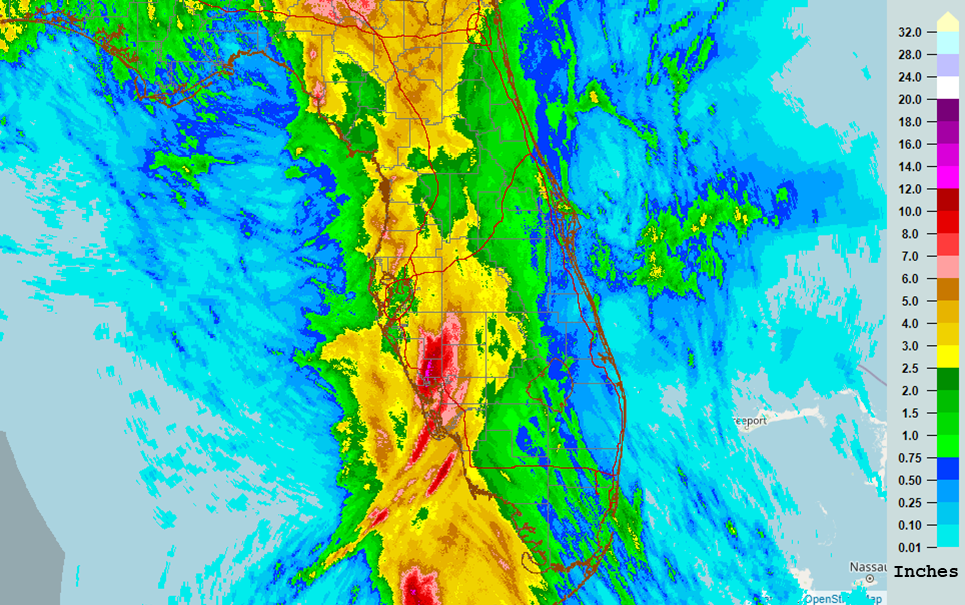
Heavy rainfall was the most impactful hazard that Elsa brought to the region. Portions of Southwest Florida were repeatedly hit with heavy rain bands from Elsa, even as the storm moved away from the area. In the span of a day or so, a narrow corridor received upwards of 10 inches of rainfall. This led to flooding in some area neighborhoods, particularly those in areas with poor drainage and near tributaries leading into Charlotte Harbor. The image below shows the total radar-estimated rainfall for the event. Areas with dark red and purples experienced the highest amount of rainfall for the event. This swath covers a large portion of southwest Florida, and extends into the central interior of the Florida peninsula. These locations experienced anywhere from 6 to 10 inches of rain during the entirety of the event, on top of additional heavy rainfall that had previously occurred. |
|
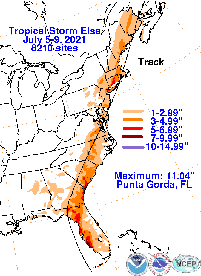
The highest rainfall total associated with Elsa anywhere across the eastern United States occurred in Punta Gorda, with just over 11 inches reported by one rain gauge. |
|
River Flooding: |
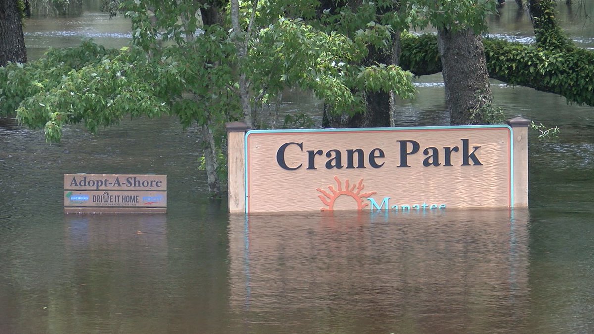
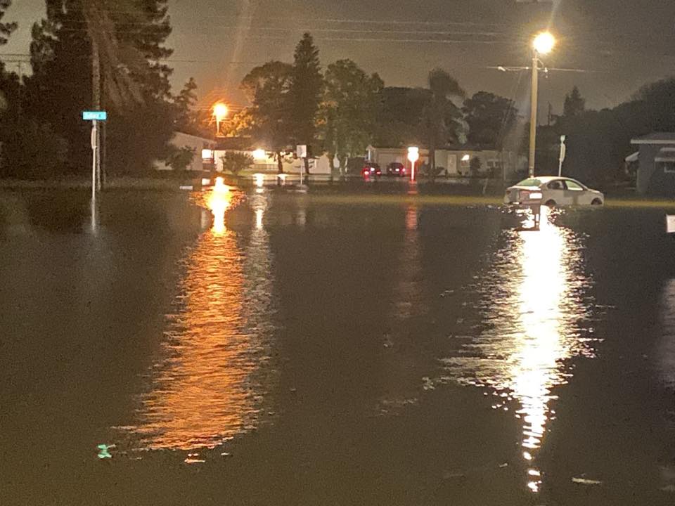
The City of North Port was hit particularly hard by all this rainfall. The Big Slough, a small waterway with multiple offshoots that originates in the wetlands to the north of the city into the Myakka River, and the Myakka River itself were both already experiencing higher-than-normal water levels after recent heavy rains. The amount of rain that fell during Elsa only aggravated this state, causing some neighborhoods nearby to flood. |
|
|
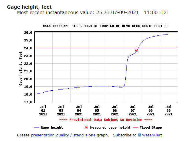
A river gauge maintained by the U.S. Geological Survey (USGS) also captured how rapid the water level rose. With so much rain falling so quickly, water levels jumped over 15 feet in a little over 24 hours, as seen in the graph below. The water had nowhere to go and began to spill over into surrounding communities. It would take several days before water levels would finally recede. |
|
Coastal Flooding: |
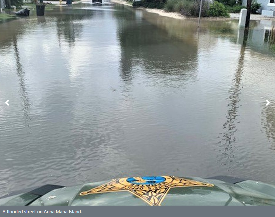
Flooding was not only confined to areas that received heavy rainfall. With onshore winds as Elsa approached, storm surge occurred along coastal areas from around the Tampa Bay Area northward along the Nature Coast with minor coastal flooding in vulnerable locations. The highest recorded values were around 3 feet and caused some flooding, particularly across barrier islands. As the storm trekked northward, the waters quickly receded. |
|
Winds: |
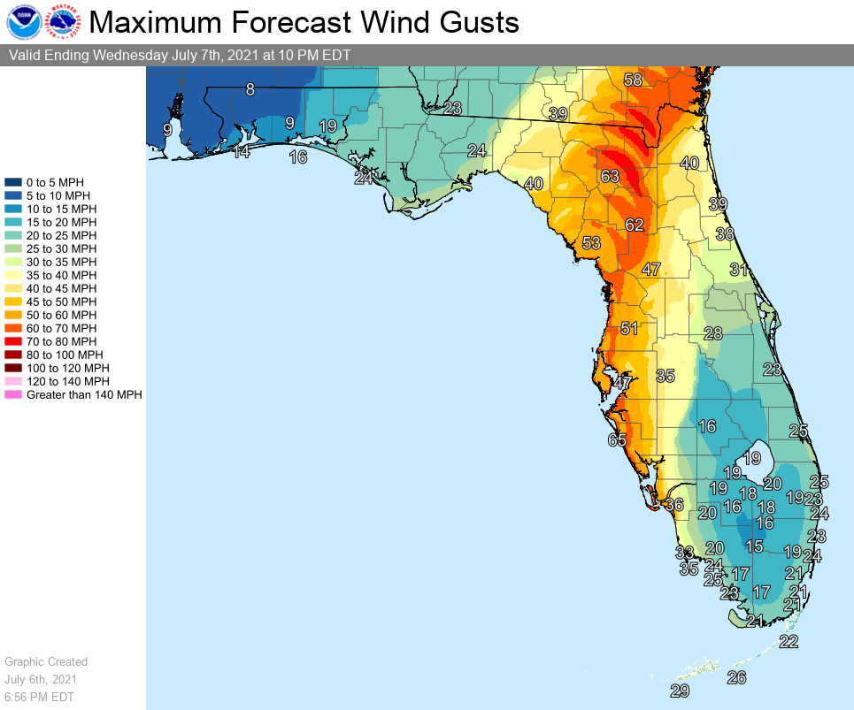
There were also some strong wind gusts associated with Elsa with forecasts of Tropical-storm force gusts expected near the coast and across much of the Nature Coast. |
|
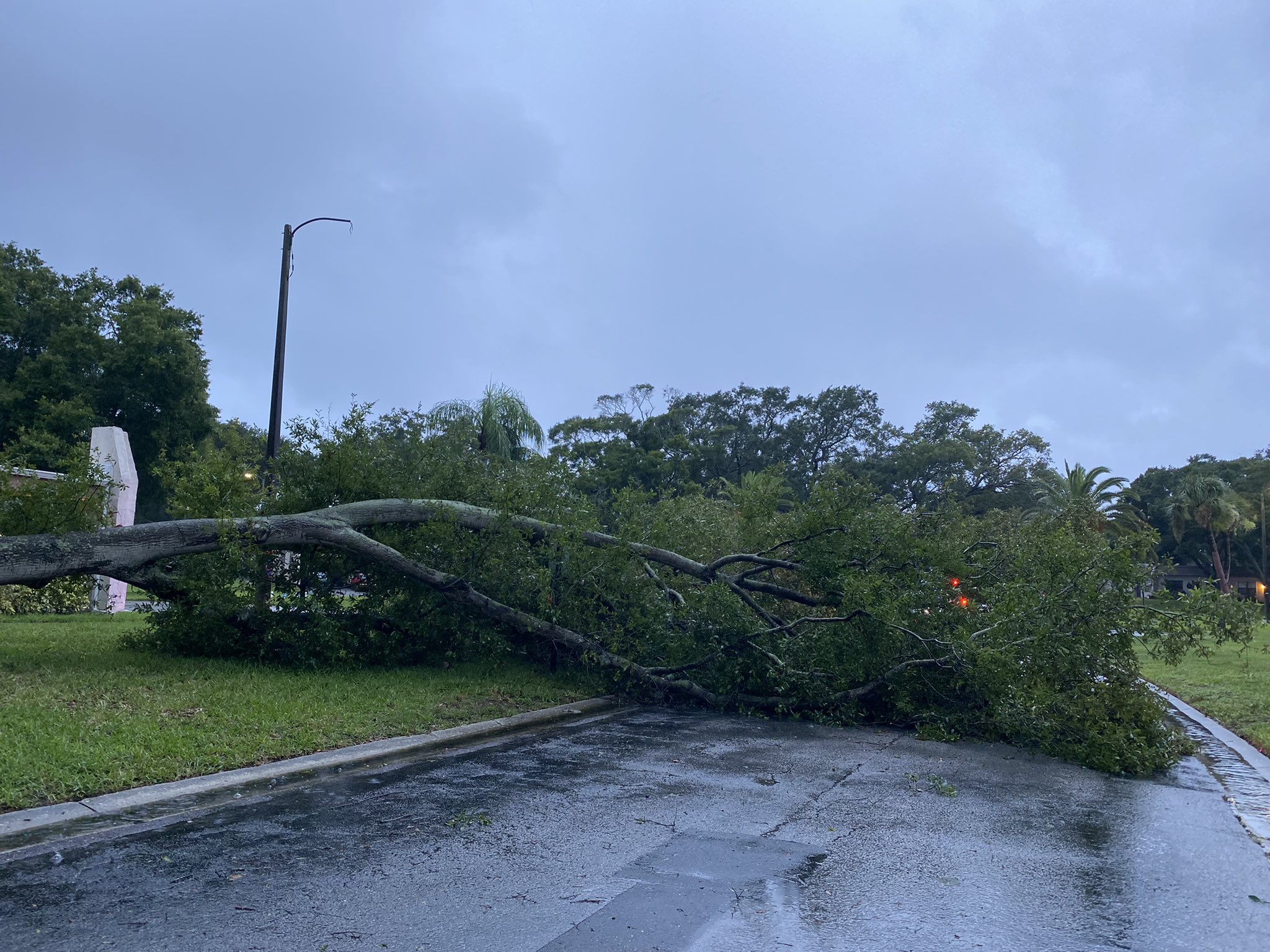
The strongest tropical-storm wind gusts were mostly confined to coastal areas and the northern Nature Coast in the vicinity of where Elsa made landfall. Some of these strong wind gusts did down some trees and knocked out power. |
|