
Lake effect snow will impact the Great Lakes region through the day. Gusty winds will pick up across the Midwest, Northeast and Mid-Atlantic beginning this afternoon following a cold front. Elevated fire weather conditions will persist across the Desert Southwest today, with critical fire weather conditions developing Wednesday and Thursday in the Southern Plains. Read More >
Spaceflight Meteorology Group
National Center
Click image to enlarge
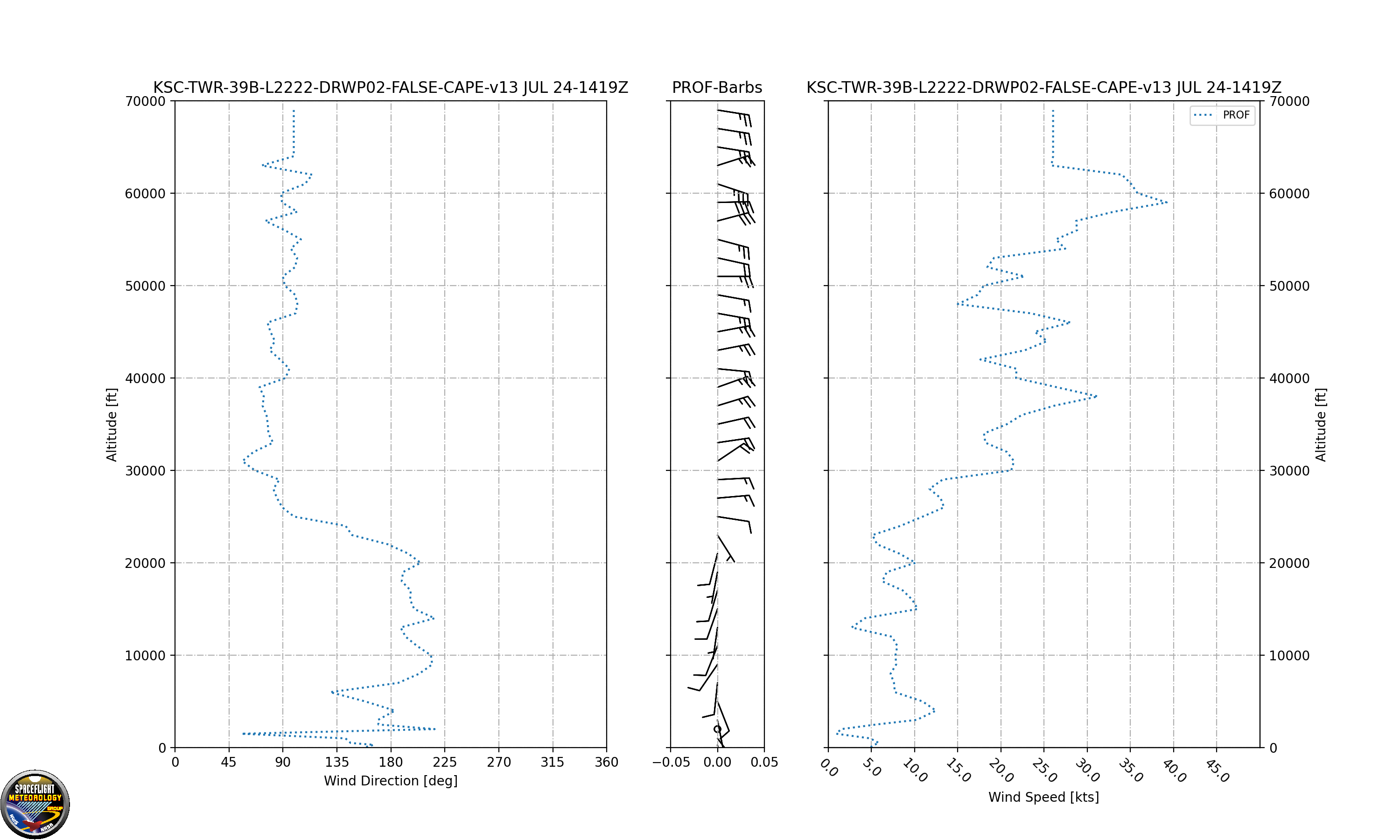
The Simple Unified KSC / USSF Eastern Range Wind Profile combines launch pad or nearby tall tower anemometers with a nearby 915 MHz boundary layer profiler and the KSC 48 MHz Tropospheric Doppler Radar Wind Profiler (TDRWP) to display the distribution of winds with height around the Kennedy Space Center. Depending upon mission profile winds are selected near the ground by the anemometers nearest the launch pad (or in some cases wind tower 313 which is 492 feet tall). Next the closest working boundary layer 915 MHz profiler winds are displayed. Lastly the TDRWP winds are used. This data is considered experimental and may not always be available. Display is not monitored routinely for timeliness or accuracy. Data is provided as a courtesy and not recommended for protection of life or property. Use at your own risk.
US Dept of Commerce
National Oceanic and Atmospheric Administration
National Weather Service
Spaceflight Meteorology Group
Johnson Space Center / WS8
Houston, TX 77058
Comments? Questions? Please Contact Us.

