
Scattered strong to severe thunderstorms may pose a risk for damaging wind gusts over the Carolinas, southeast Virginia, and the Tennessee Valley Sunday afternoon then the northern Plains from late afternoon into Sunday night. Monsoonal thunderstorms may cause locally considerable flash, urban, and small stream flooding in the Southwest U.S. the next few days. Read More >
Spaceflight Meteorology Group
National Center
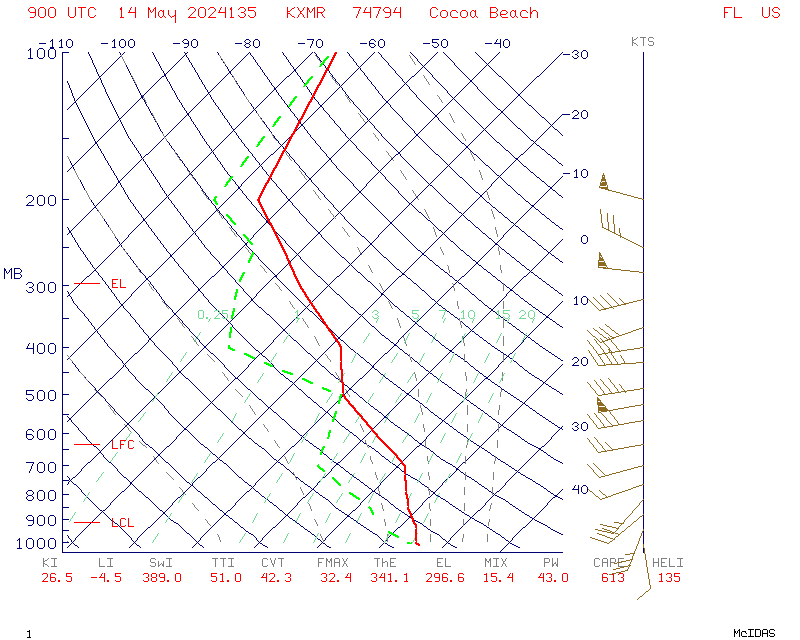
Routine early AM synoptic Skew-T Log P diagram for KXMR (Cape Canaveral, Florida) weather balloon. Mission support rawinsondes released from KXMR may be found with the link or drop down menu.
Y-axis is pressure in millibars. Wind barbs are located to the right hand side of the diagram with speed in knots. Solid red line is temperature in Celcius. Dashed green line is dew point in Celcius.
US Dept of Commerce
National Oceanic and Atmospheric Administration
National Weather Service
Spaceflight Meteorology Group
Johnson Space Center / WS8
Houston, TX 77058
Comments? Questions? Please Contact Us.

