Charleston, WV
Weather Forecast Office
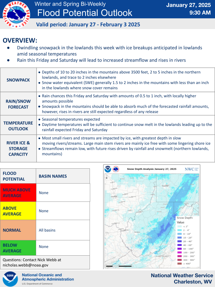
The following is the graphical winter/spring ESF product as seen below. This product is issued when there is a potential of cold season hydrologic hazards. This product will be updated on a bi-weekly or weekly basis while the potential for cold season hazards exist.
Examples of cold season hazards include:
To open in a PDF format Click Here.
Warnings/Hazards
Local Briefing
Report Severe Weather
Winter Storm Severity Index
Hazards Criteria
Heat Risk
Observations
Current Weather Briefing
Observations (List)
Local Radar
Regional Radar
Satellite
Rain Gauge Monitoring
Snowfall Reports
Ice Reports
Local Storm Reports
Public Information Statements
Forecasts
Forecast Discussion
Local Zone Forecast
Graphical Forecasts
Hourly Forecasts
Local Aviation Weather
Local Fire Weather
Winter Weather Forecasts
Probabilistic Rainfall Forecasts
Long Range Outlooks
Rivers and Lakes
River Observations/Forecasts
Ensemble River Guidance
Ensemble Dashboard
River Monitor
Hydrograph Dashboard
River/Lake Summary
US Dept of Commerce
National Oceanic and Atmospheric Administration
National Weather Service
Charleston, WV
1754 Hendrickson Drive
South Charleston, WV 25303
(304) 356-5885
Comments? Questions? Please Contact Us.

