Prior to every flight, pilots should gather all information vital to the nature of the flight. This site is informational in nature and is designed to assist pilots and aircrews for flight planning and weather familiarization. It may be used in conjunction with other preflight information sources needed to satisfy all the requirements of 14 CFR 91.103 and is not to be considered as a sole source of information to meet all preflight action. Pilots can complete their regulatory-compliant preflight briefing by using other automated resources or from Flight Service at www.1800wxbrief.com or by calling 1-800-WX-BRIEF.


.AVIATION /06Z SUNDAY THROUGH THURSDAY/...
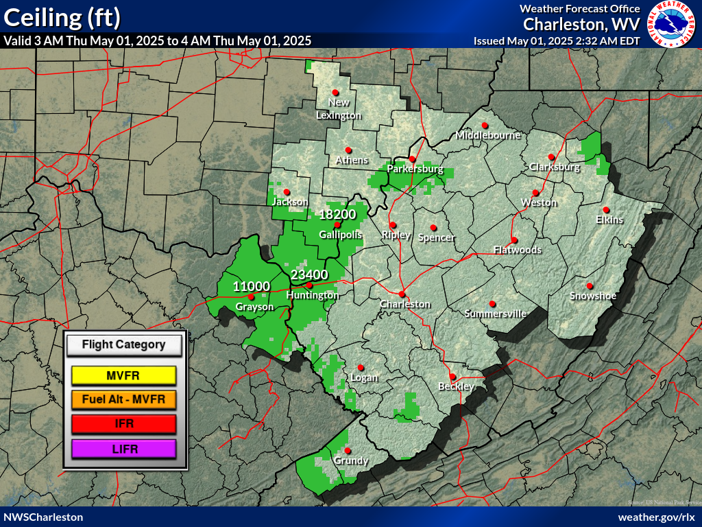
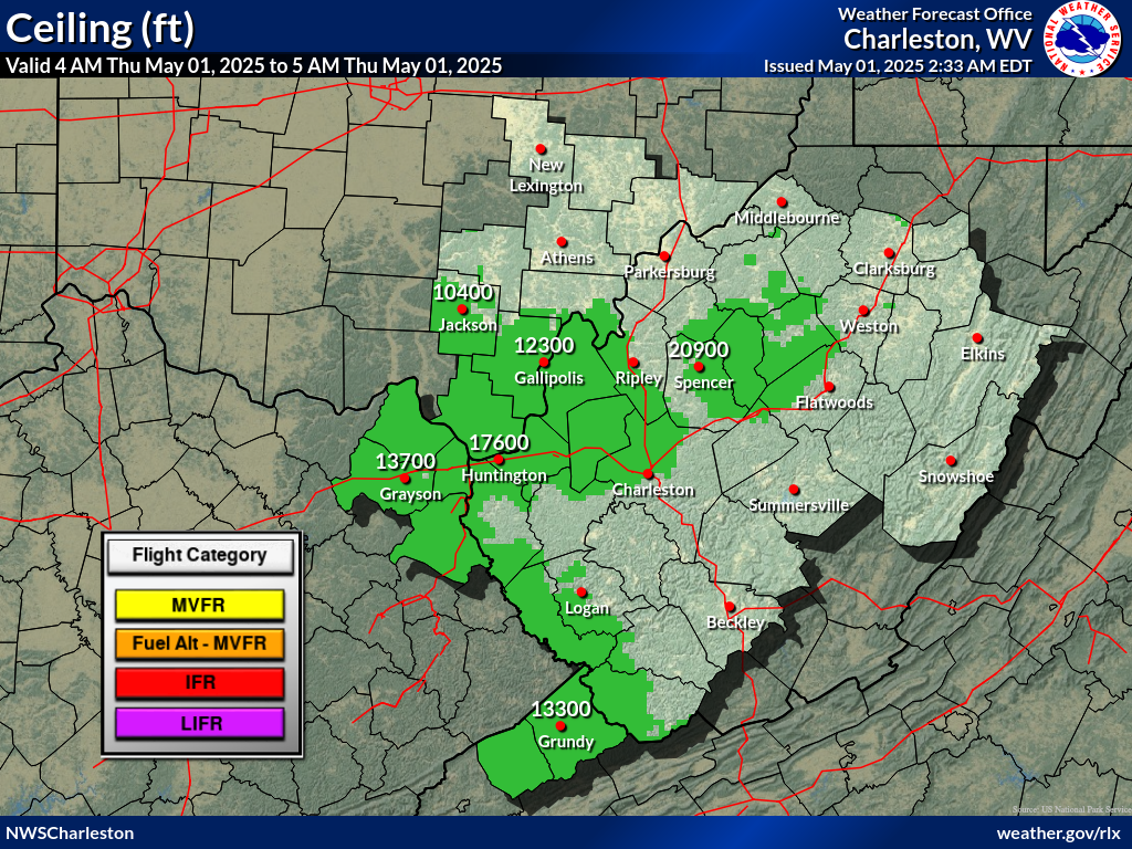
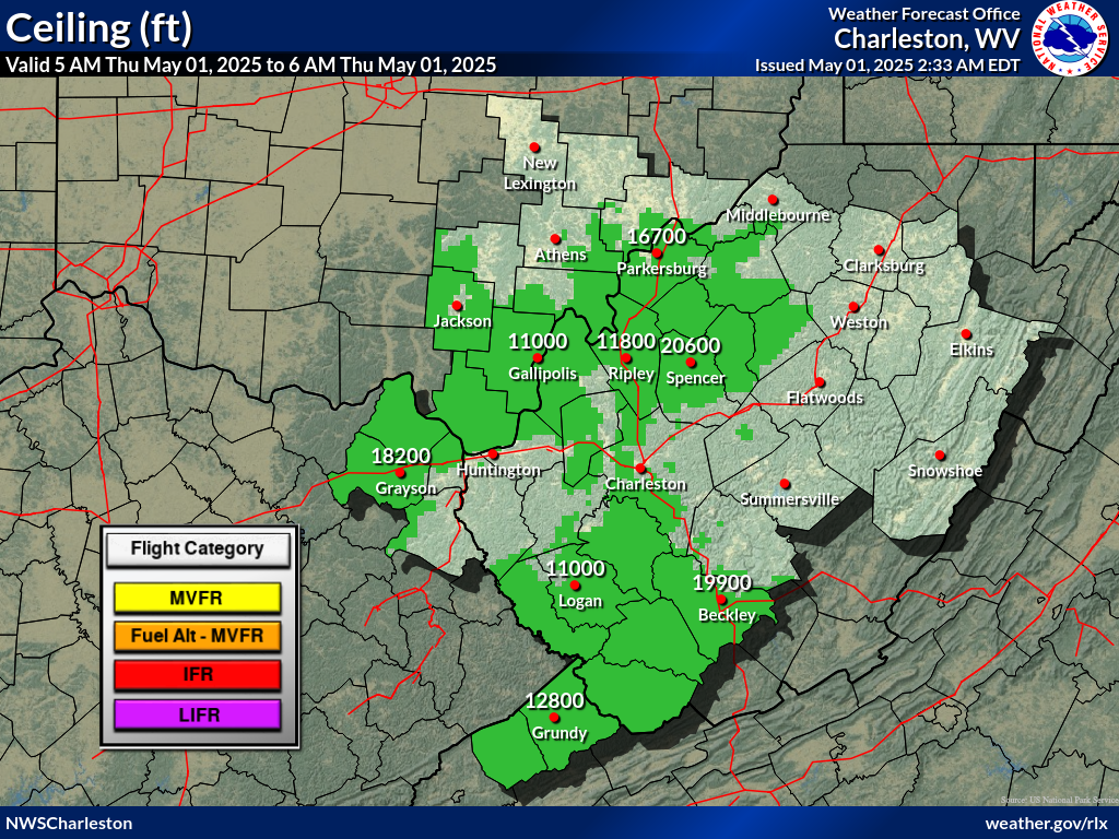
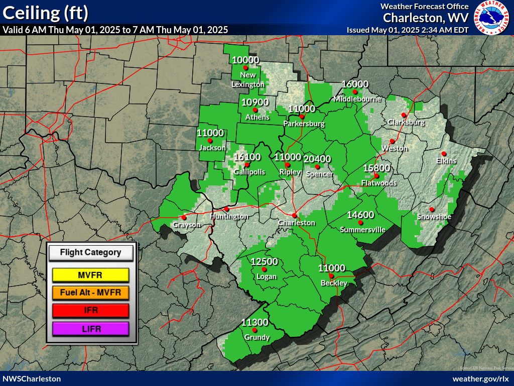
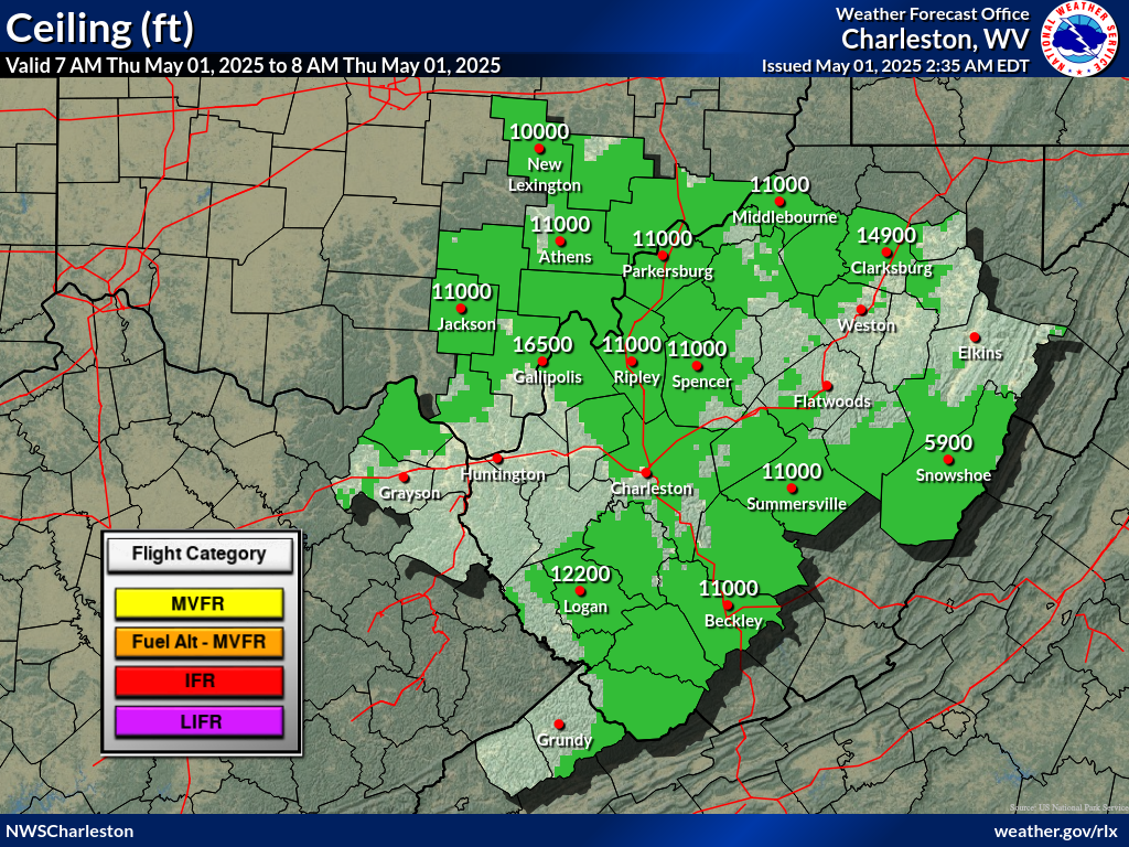
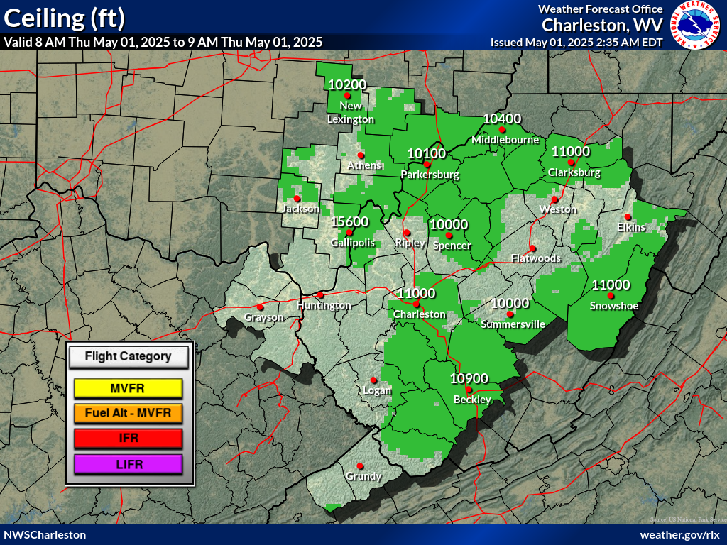
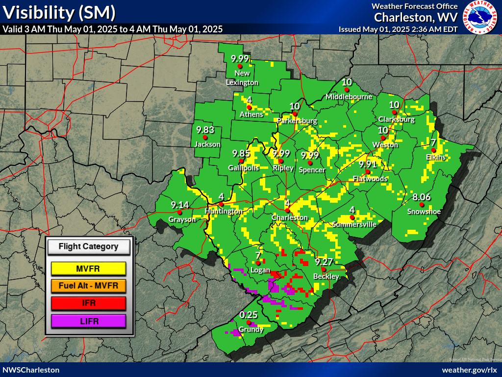
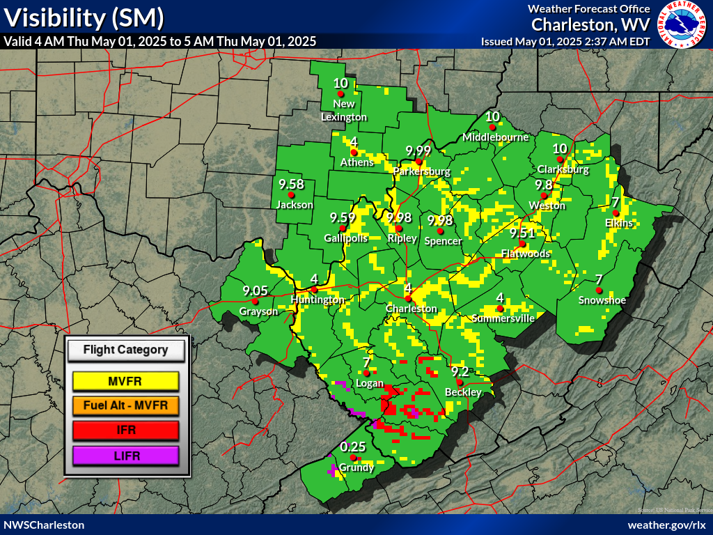
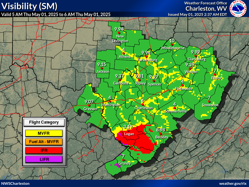
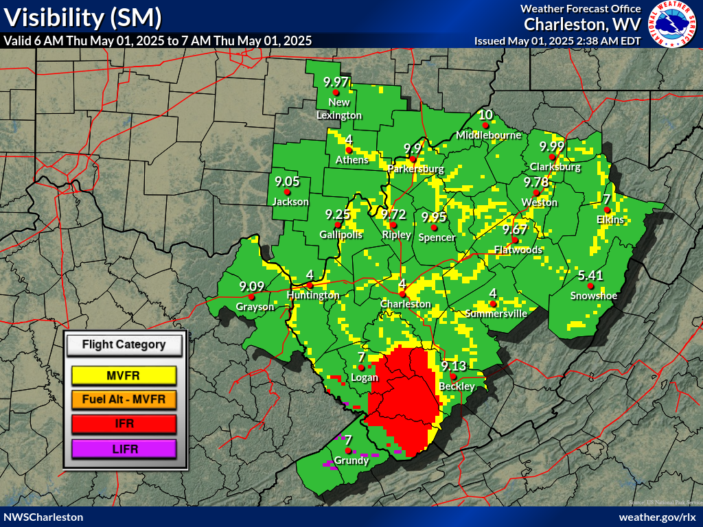
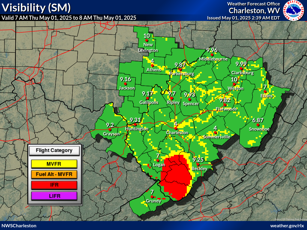
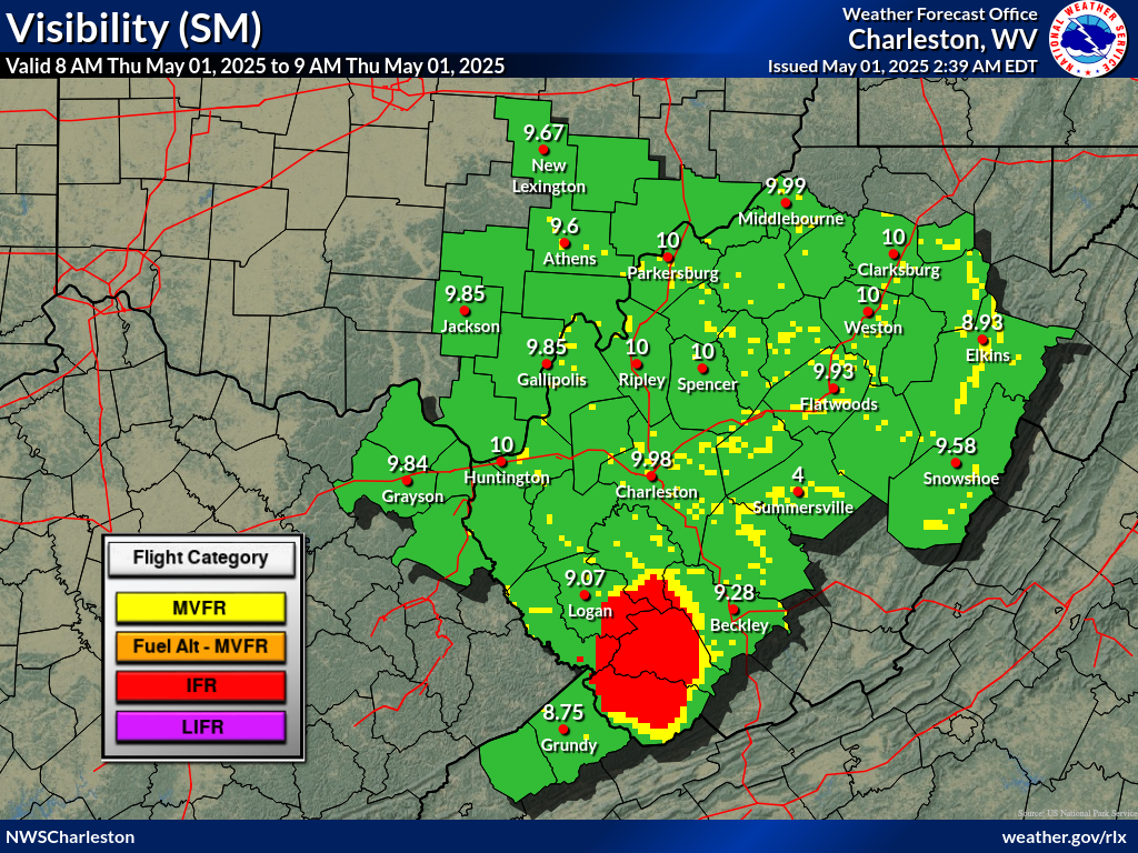
Another round of low stratus and patchy valley fog is possible
this morning provided passing cloud cover and isolated showers
do not intervene. Currently seeing BKN to OVC stratocu
traversing the area with CIGs between 3,000 and 6,500 feet AGL.
There does appear to be some clearing across OH and northern WV.
These areas will stand the chance to see some patchy valley fog
provided they stay clear. This would be for sites PKB and CKB.
Otherwise, low stratus is probable for the mountains impacting
BKW, EKN, and maybe CRW. IFR or lower is possible with any fog
or low stratus formation. VFR conditions are expected to resume
by ~13z. SCT to BKN CIGs between 3,000 and 10,000 feet AGL are
forecast for Sunday.
Winds will be calm to light and variable this morning. They will
then pick up out of the WNW later this morning, but will be
light between 4 and 7 knots. Gusts up to 15 knots across the
higher ridges are possible.
FORECAST CONFIDENCE AND ALTERNATE SCENARIOS THROUGH 06Z MONDAY...
FORECAST CONFIDENCE: LOW until ~13z, HIGH after ~13z
AVIATION FORECAST CONFIDENCE
| Updated: 351 AM EDT Sun Jul 26 2026 |
| UTC | 06 | 07 | 08 | 09 | 10 | 11 | 12 | 13 | 14 | 15 | 16 | 17 |
| EDT | 02 | 03 | 04 | 05 | 06 | 07 | 08 | 09 | 10 | 11 | 12 | 13 |
| CRW | H | M | L | L | L | L | H | M | H | H | H | H |
| HTS | H | M | M | H | M | H | M | M | M | H | H | H |
| BKW | H | H | L | H | M | M | M | M | M | M | H | H |
| EKN | L | L | M | M | M | M | L | M | H | H | H | H |
| PKB | H | M | M | L | L | L | L | H | H | H | H | H |
| CKB | H | L | L | M | L | L | H | H | H | H | H | H |
| 3 AM | 4 AM | 5 AM | 6 AM | 7 AM | 8 AM | |
 |
 |
 |
 |
 |
 |
 |
| 3 AM | 4 AM | 5 AM | 6 AM | 7 AM | 8 AM | |
 |
 |
 |
 |
 |
 |
|
 Airports with TAFs |
  Airports without TAFs
Additional Local Information |
Regional/National Information |

