|
Current Weather Synopsis Dry weather can be expected through Wednesday. After another chilly start this morning, a strong warming trend will commence, and the lower elevations are expected to see daytime highs reaching the upper 80s to lower 90s by Wednesday. The potential for showers and thunderstorms returns late in the work week into the weekend as a cold front approaches, then stalls and wavers over the region.
Links to Latest Forecast Products
Links to Latest Convective Products Weather Watch Clearance Notification
|
|
Storm Prediction Center Convective Outlooks
Day 1
 |
 |
 |
 |
Day 2
 |
 |
 |
 |
|
Click HERE for the latest Day 1 Convective Outlook discussion
Click HERE for the latest Day 2 Convective Outlook discussion |
Additional Information
 |
 |
|
Convective Watches Currently In Effect - Click Here |
Current SPC Mesoscale Discussions - Click Here |
Observed Weather Conditions
Radar
 |
|
|
Regional Radar Loop |
NWS Charleston, WV Radar Loop |
Satellite
 |
 |
 |
|
GeoColor Satellite Image |
Infrared Satellite Image |
Water Vapor Image |
Surface Observations
 |
 |
 |
|
US Surface Analysis |
Mean Sea Level Pressure/Wind |
Surface Observations |
Upper Air Charts
 |
 |
 |
 |
|
850mb Analysis |
700mb Analysis |
500mb Analysis |
300mb Analysis |
Severe Parameters
 |
 |
 |
 |
|
CAPE - 100mb Mixed-Layer |
Bulk Shear - Sfc-6km |
Storm Relative Helicity - Sfc-3km |
Low-Level Lapse Rates |
Latest Forecast Information
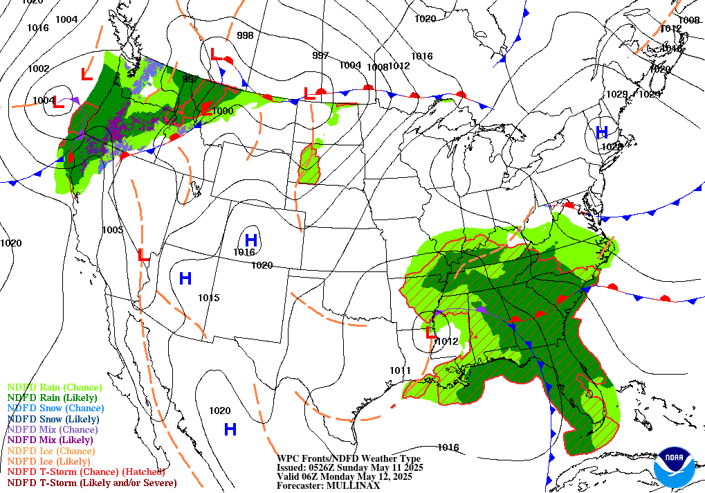
Weather Prediction Center Surface Charts
|
 |
 |
 |
|
Current US Surface Analysis |
6 Hour Forecast |
12 Hour Forecast |
18 Hour Forecast |
 |
 |
 |
 |
|
24 Hour Forecast |
30 Hour Forecast |
42 Hour Forecast |
54 Hour Forecast |
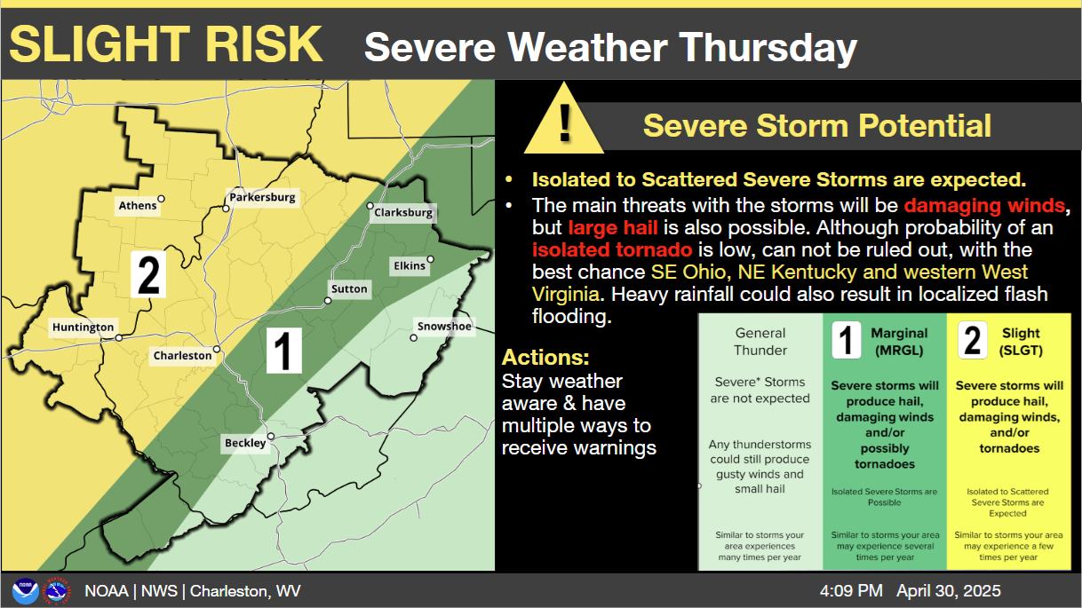
Severe Weather Outlooks
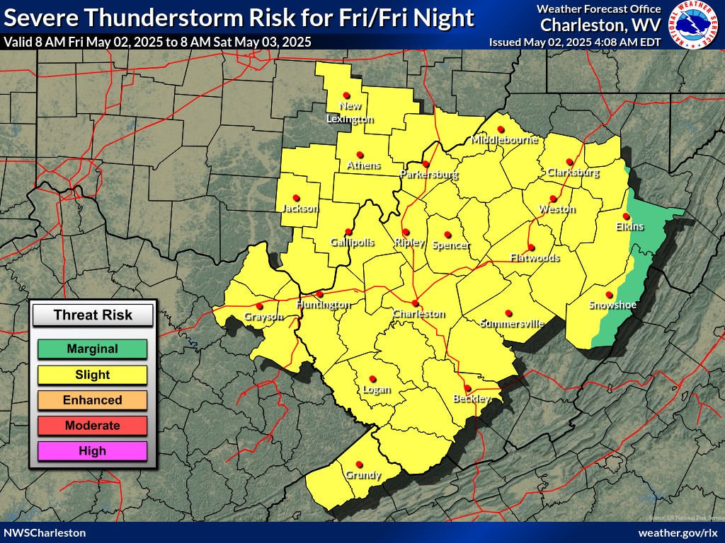 |
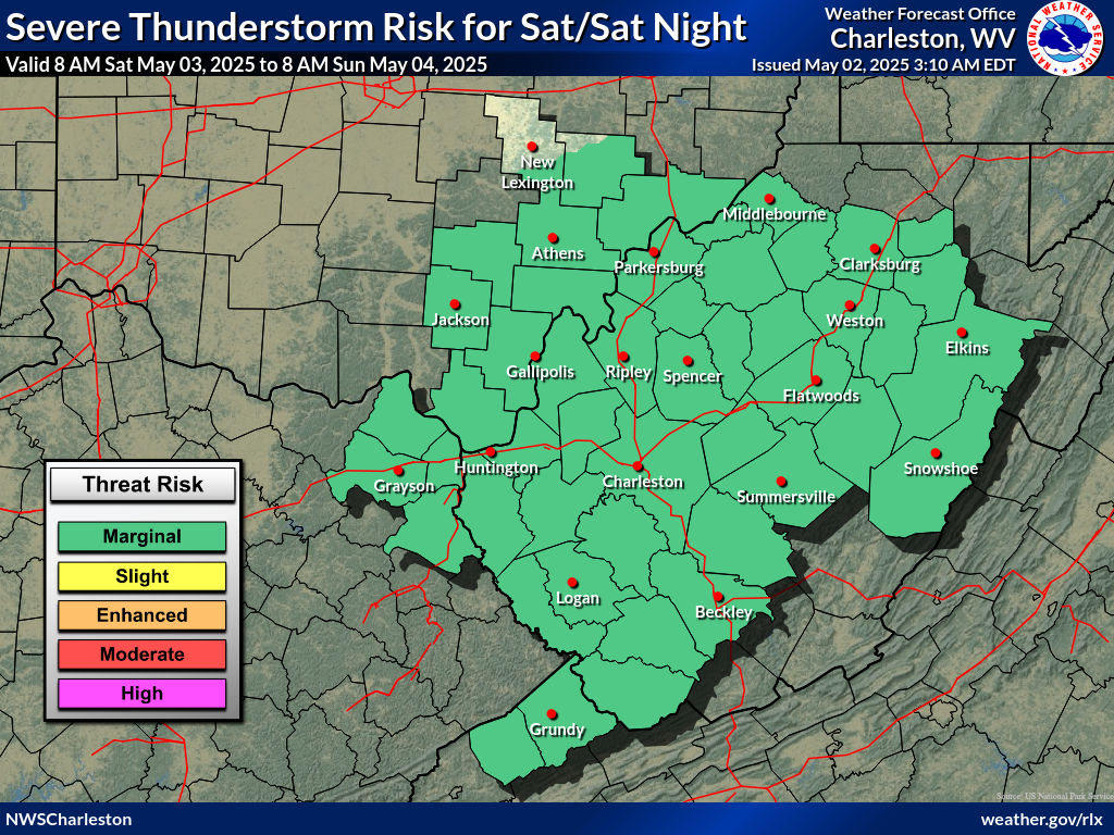 |
Latest Text Products From NWS Charleston
Hazardous Weather Outlook - Click Here
Zone Forecast Product - Click Here
Area Forecast Discussion - Click Here
NWS Charleston Local Storm Reports
|
|
Today's Storm Reports |
Severe Weather Criteria
|
Severe Thunderstorm Warning
Tornado Warning
Special Weather Statement
See NWSI 10-511 WFO Severe Weather Products Specification for additional information. |
Severe Weather Safety Tips
Lightning
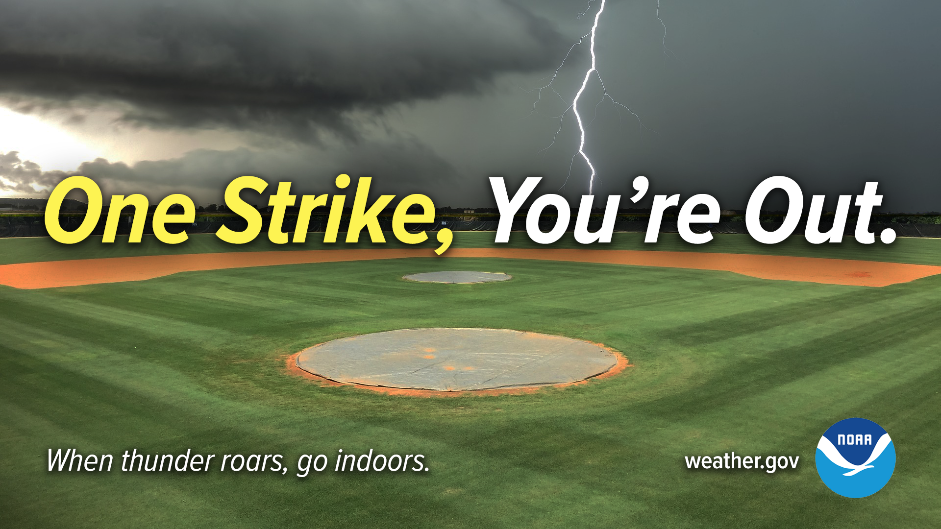 |
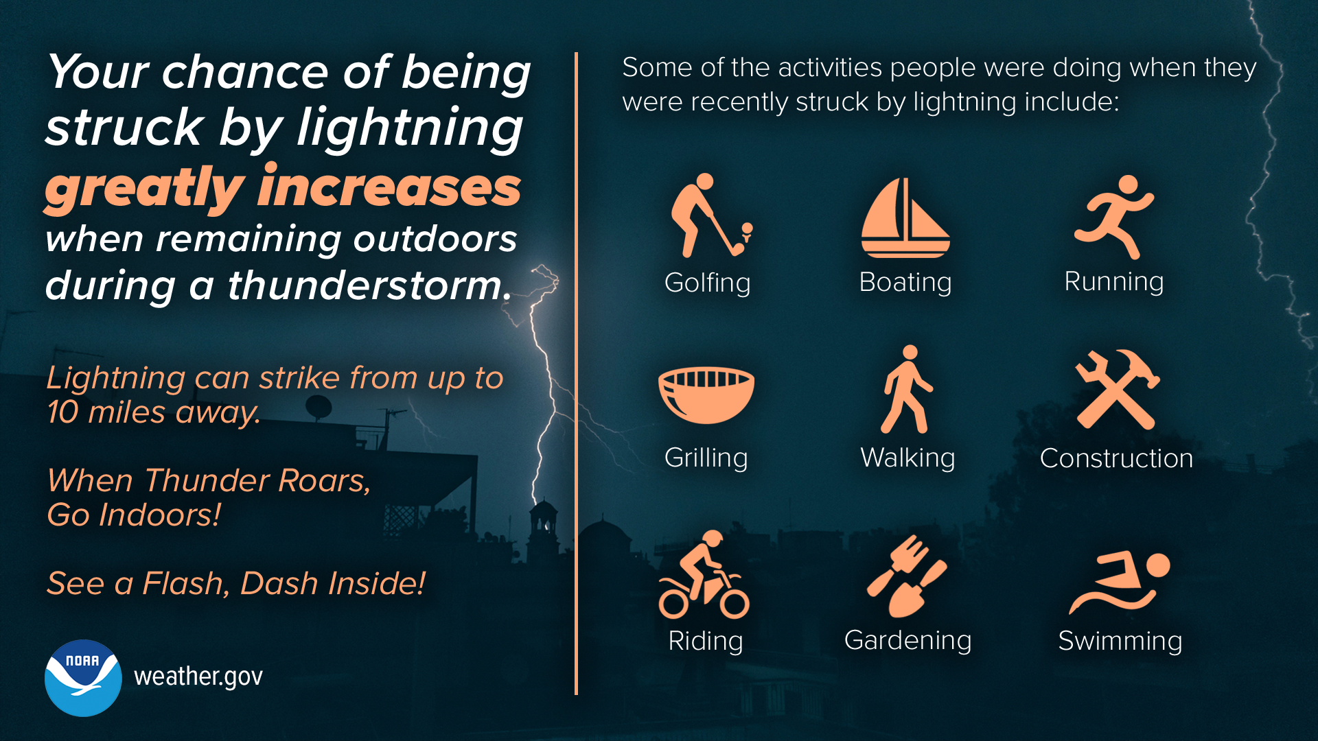 |
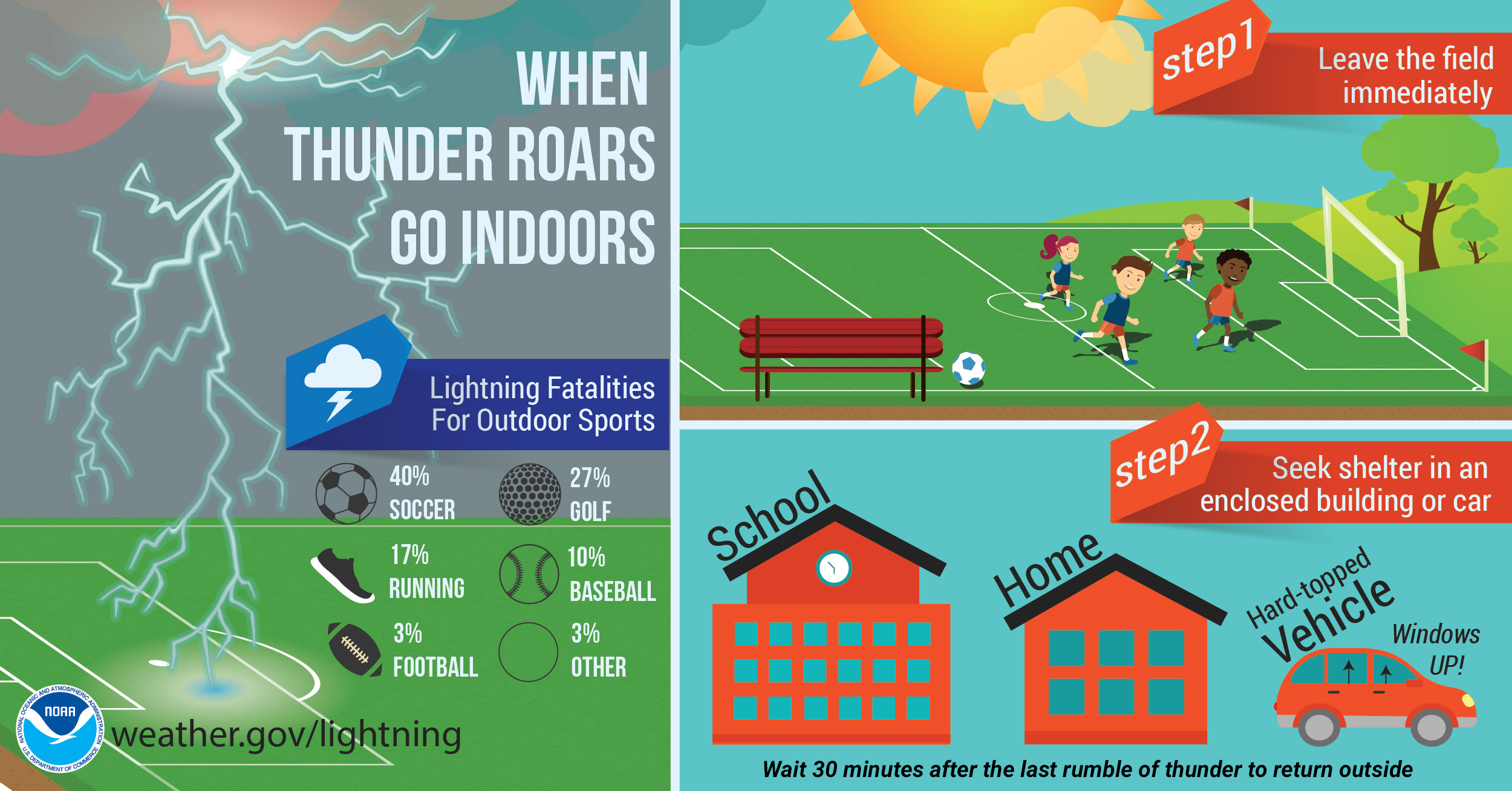 |
Additional Lightning Safety Tips
Strong Wind
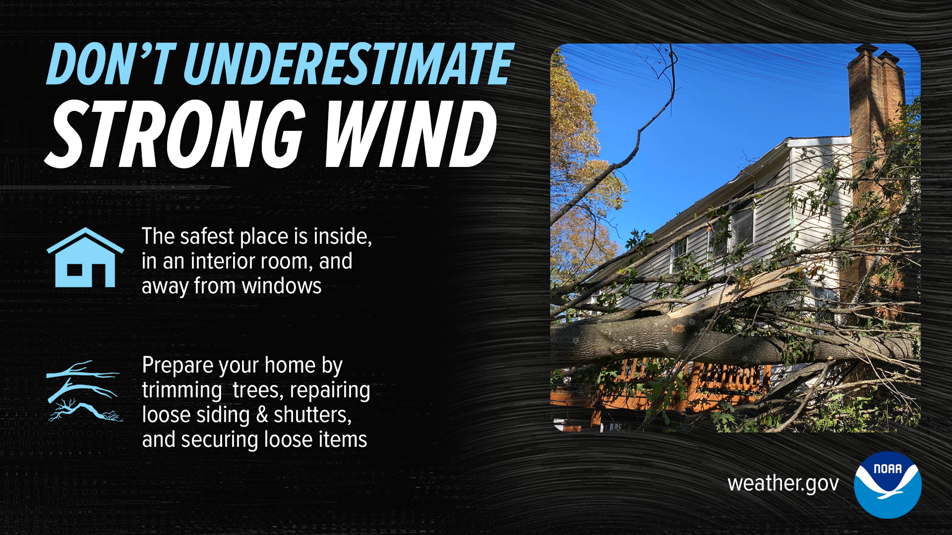 |
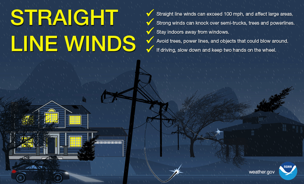 |
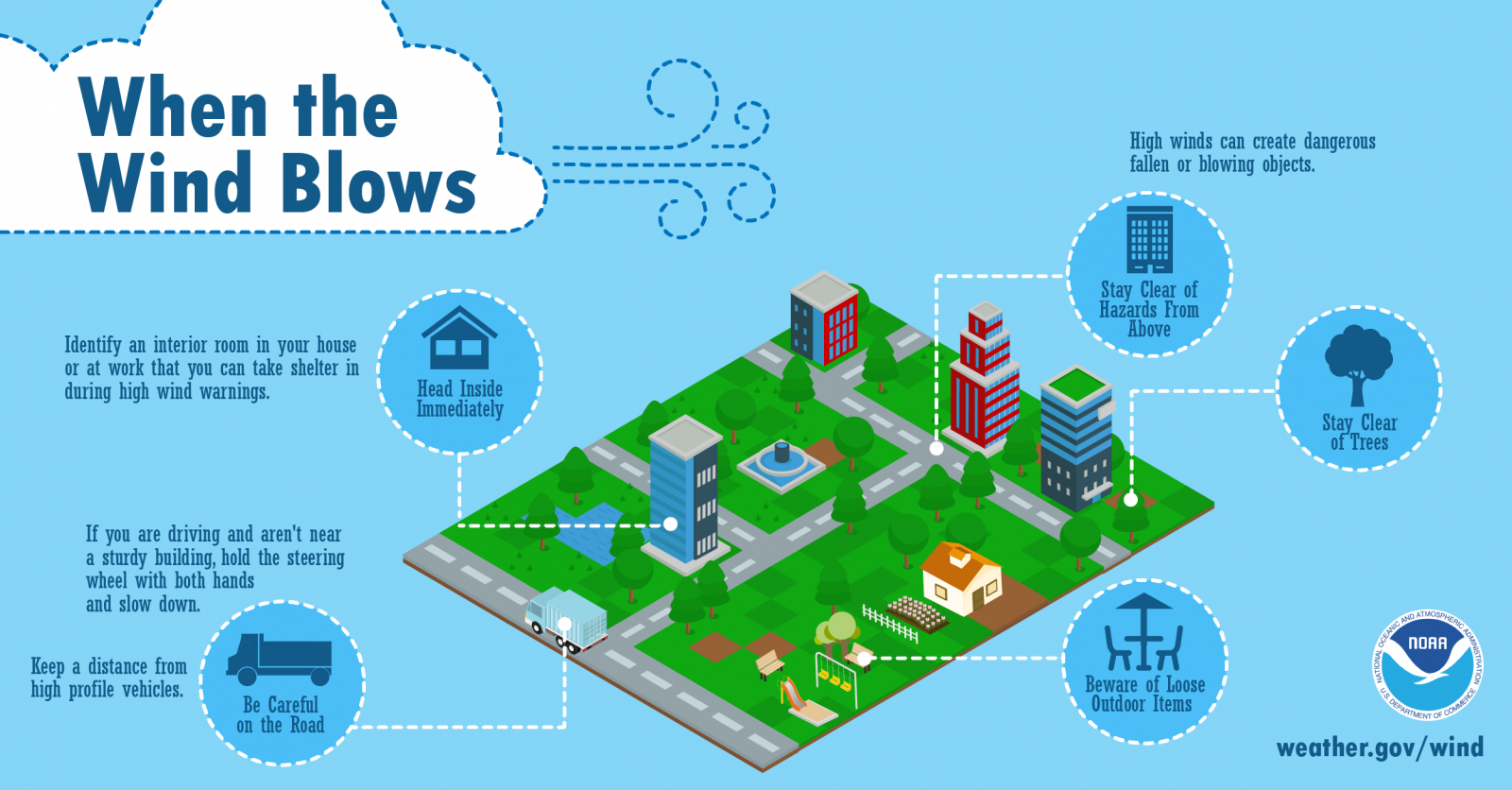 |
Tornado
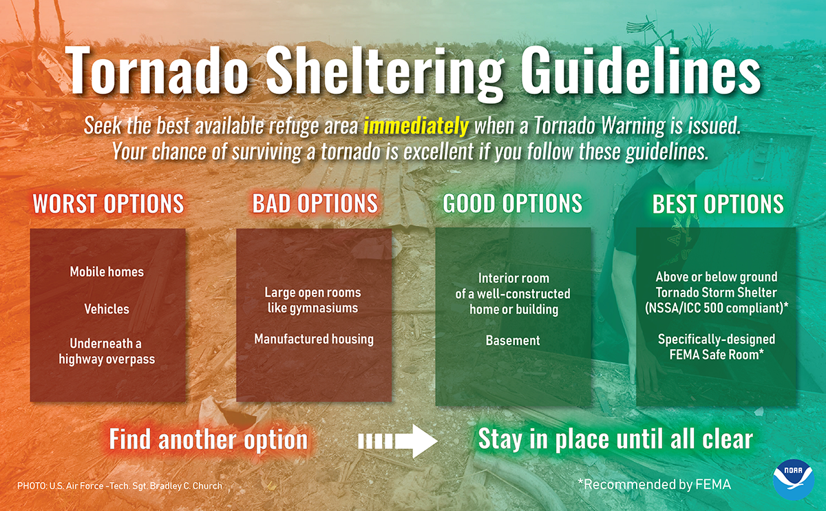 |
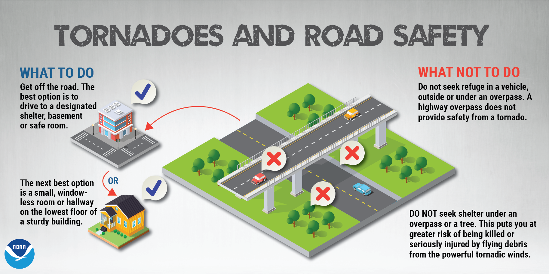 |
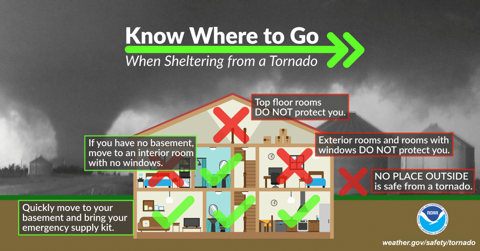 |
Additional Tornado Safety Tips
Miscellaneous Links
Severe Thunderstorm Safety Tips
Storm Prediction Center Home Page
Storm Prediction Center Mesoscale Analysis
Latest Emergency Manager's Briefing