
Rounds of showers and storms are expected today in advance of a cold front. Severe storms are possible this afternoon/evening, with the primary hazard being damaging winds, although some hail and an isolated tornado are also possible. Flash flooding could also occur, with a Flood Watch in effect for much of the area today. Please keep updated on the forecast and have a way to receive warnings. Read More >
Charleston, WV
Weather Forecast Office
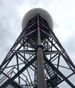 Due to a hardware failure, the KRLX WSR-88D radar has been shut down and will remain off-line until repairs can be made. It is expected to return to service by Friday afternoon.
During the downtime, radar coverage is available from adjacent radar sites including:
Warnings/Hazards
Local Briefing
Report Severe Weather
Winter Storm Severity Index
Hazards Criteria
Heat Risk
Observations
Current Weather Briefing
Observations (List)
Local Radar
Regional Radar
Satellite
Rain Gauge Monitoring
Snowfall Reports
Ice Reports
Local Storm Reports
Public Information Statements
Forecasts
Forecast Discussion
Local Zone Forecast
Graphical Forecasts
Hourly Forecasts
Local Aviation Weather
Local Fire Weather
Winter Weather Forecasts
Probabilistic Rainfall Forecasts
Long Range Outlooks
Rivers and Lakes
River Observations/Forecasts
Ensemble River Guidance
Ensemble Dashboard
River Monitor
Hydrograph Dashboard
River/Lake Summary
US Dept of Commerce
National Oceanic and Atmospheric Administration
National Weather Service
Charleston, WV
1754 Hendrickson Drive
South Charleston, WV 25303
(304) 356-5885
Comments? Questions? Please Contact Us.

