Overview
|
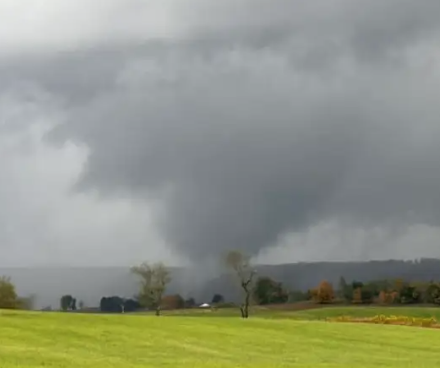
A tornado of unknown intensity (due to lack of damage) occurred in Pocahontas County (WV) on the evening of September 25, 2024 during the beginning of a Predecessor Rain Event (PRE) that was associated with Hurricane Helene as it moved northward in the Gulf of America. This is the first documented tornado to occur in Pocahontas County. Please note that all images can be expanded by clicking on them.
Public Information Statement
National Weather Service Charleston WV
1220 PM EDT Mon Sep 30 2024
...NWS Damage Survey for 09/25/24 Tornado Event...
...Hillsboro Tornado...
Rating: EFU
Estimated Peak Wind: Unknown
Path Length /statute/: 2.21 miles
Path Width /maximum/: Unknown
Fatalities: 0
Injuries: 0
Start Date: 09/25/2024
Start Time: 06:11 PM EDT
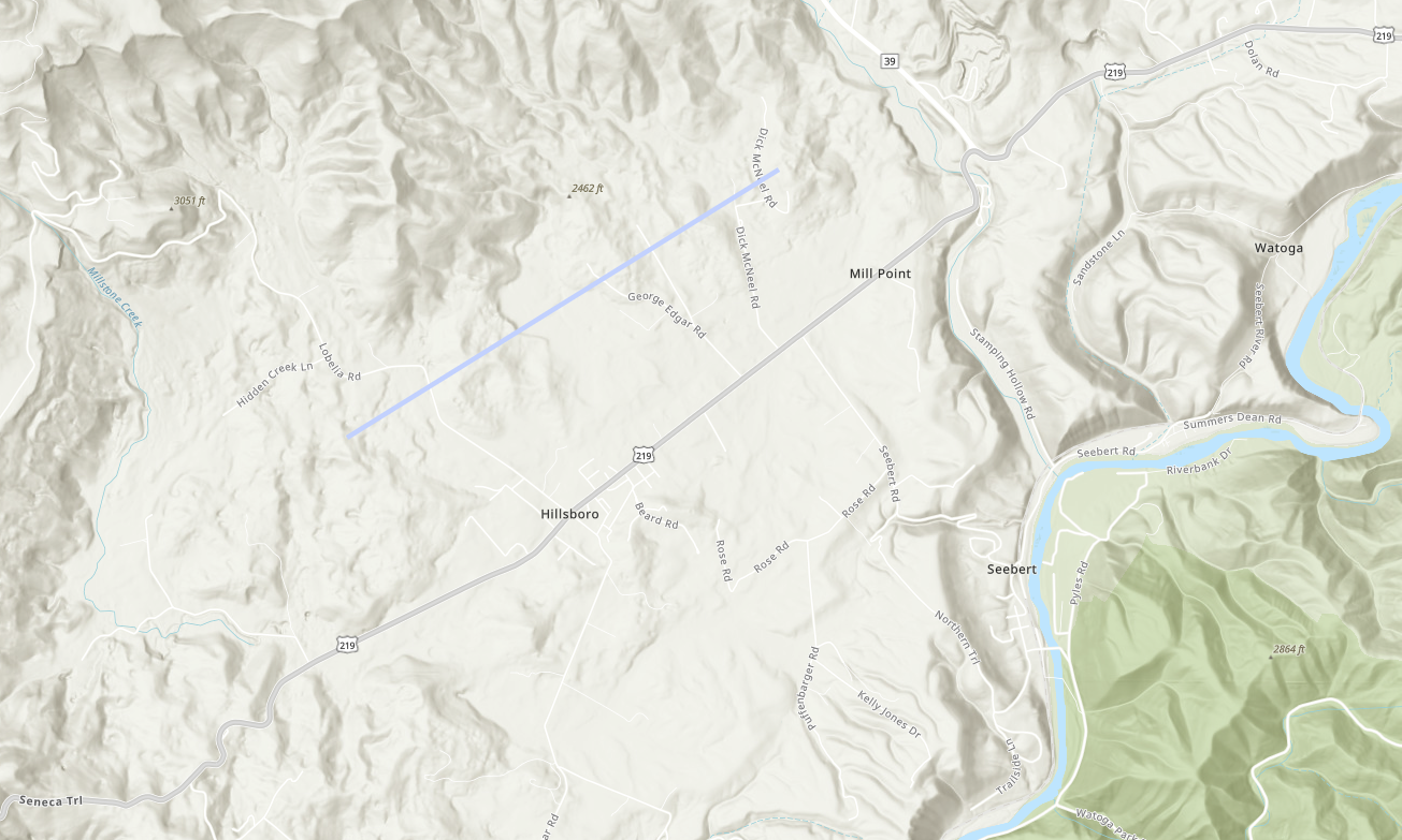
Start Location: 1 W Hillsboro / Pocahontas County / WV
Start Lat/Lon: 38.1402 / -80.2309
End Date: 09/25/2024
End Time: 06:16 PM EDT
End Location: 2 NNE Hillsboro / Pocahontas County / WV
End Lat/Lon: 38.157 / -80.1964
Survey Summary:
Tornado, verified by video and numerous pictures, occurred just
west of Lobelia Rd near Hillsboro, then tracked northeastward,
lifting near Dick McNeel Rd. The tornado tracked over pastureland
with no visible damage.
Thanks to Pocahontas County Emergency Management and Hillsboro
Mayor for reconstructing the path of this tornado based off of
eyewitness accounts and for surveying the area for possible
damage.
This is the first documented tornado to occur in Pocahontas
County.
&&
EF Scale: The Enhanced Fujita Scale classifies tornadoes into the
following categories:
EF0.....65 to 85 mph
EF1.....86 to 110 mph
EF2.....111 to 135 mph
EF3.....136 to 165 mph
EF4.....166 to 200 mph
EF5.....>200 mph
NOTE:
The information in this statement is preliminary and subject to
change pending final review of the event and publication in
NWS Storm Data.
$$
|
|
 |
 |
|
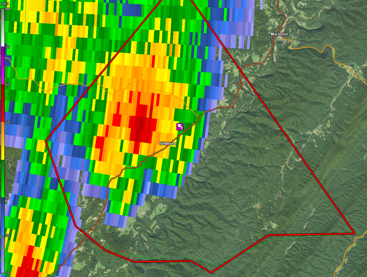
0.5° Base Reflectivity from KRLX at 6:11 PM, which is right as the tornado was touching down. The tornado LSR in these images corresponds with the end of the tornado track, while in reality it touched down ~ 2 miles to the southwest. (Radar image courtesy of GR2Analyst) |
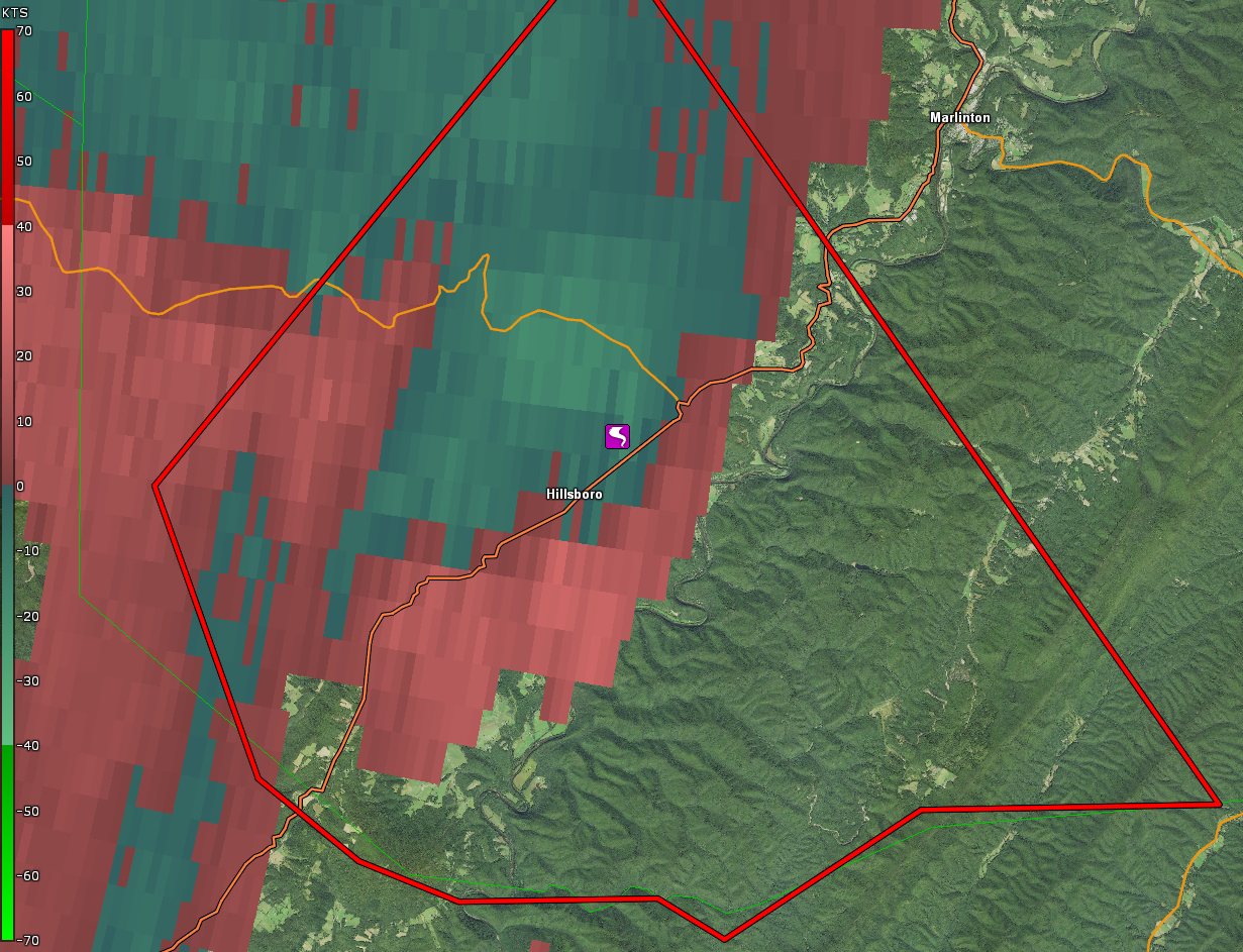
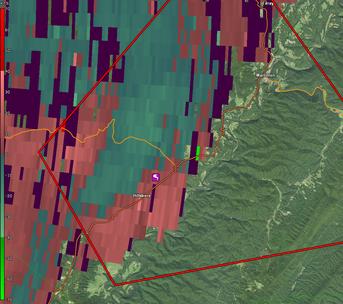
0.5° Storm-Relative Velocity from KRLX at 6:11 PM, which is right as the tornado was touching down. Given the significant distance from the radar, resolving the rotational signature from the tornado becomes more difficult given beam width and height above ground (in this case > 6,000 feet above ground level near Hillsboro) being greater. Thus, if this same storm were at a much closer distance to the radar, the rotational signature would be more well defined/resolved. This makes warning at greater distances from the radar more difficult. (Radar image courtesy of GR2Analyst) |
 |
 |
|
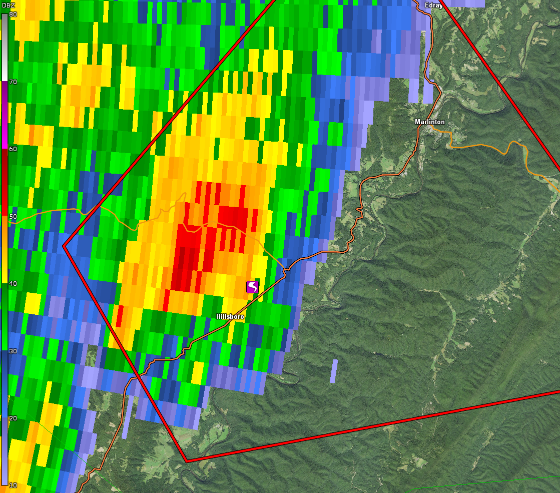
0.5° Base Reflectivity from KRLX at 6:14 PM, corresponding to when the tornado was on the ground. (Radar image courtesy of GR2Analyst) |
0.5° Storm-Relative Velocity from KRLX at 6:14 PM, corresponding to when the tornado was on the ground. (Radar image courtesy of GR2Analyst) |
 |
 |
|
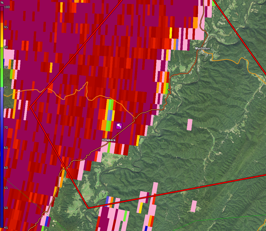
0.5° Correlation Coefficient from KRLX at 6:20 PM, corresponding to a few minutes after the tornado lifted. Notice the lower CC values just north of the tornado track, potentially indicating a concentrated cluster of different sized particles lofted into the air by the tornado before it lifted, which in this case would have likely been grass given the tornado tracked through pastureland. (Radar image courtesy of GR2Analyst) |
Track Map for the Hillsboro Tornado in SW Pocahontas County |


.png)
.png)