Event Summary
|
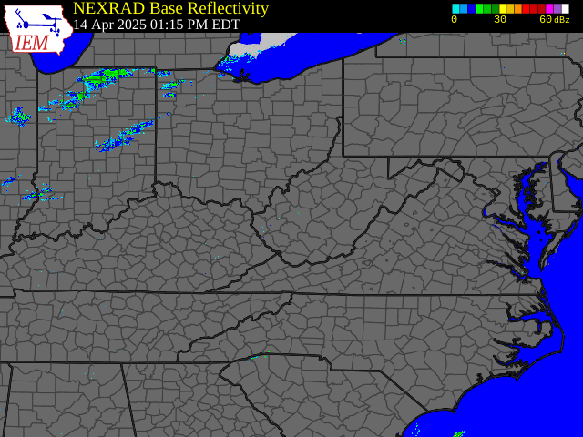
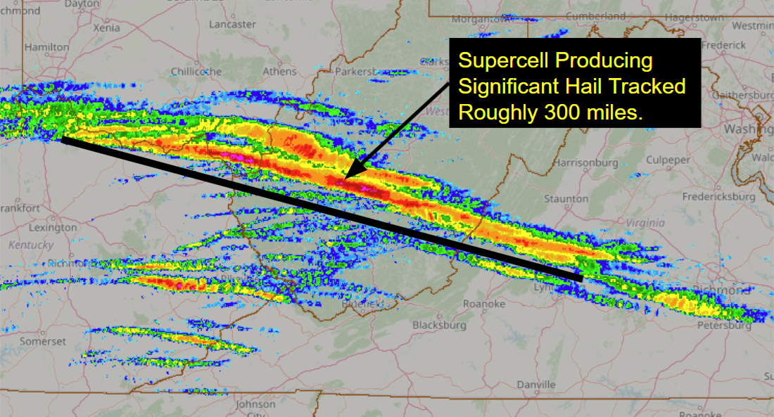
Thunderstorms that developed in advance of a cold front near the tri-state area of Indiana/Kentucky/Ohio during the afternoon of Monday, April 14th would quickly shift east towards the NWS Charleston County Warning Area (CWA), strengthening into supercells as they did so. These supercells would track east-southeast across the forecast area from northeast Kentucky and far southern Ohio, through the Charleston, West Virginia metro area, and eventually even east of the mountains into Virginia. While some sporadic wind damage was noted along the path of these storms, the main point of note was the hail that was produced, particularly with the initial supercell that moved across the area. It produced a hail swath (track) that began west of the CWA, continued through the CWA, and even extended well east-southeast of it. Many reports of golf ball-sized hail were received, with even reports of significant hail (2 inches or greater) in some cases. This large hail resulted in damage to vehicles and even structures. Additional storms would develop throughout the evening following the first wave, some of which would also become severe, but overall would remain less intense than the supercells that moved through during the late afternoon and early evening hours. Please click on the tabs below for more detailed information about this event. Please note that all images/loops can be expanded by clicking on them. |
Radar loop courtesy of Iowa Environmental Mesonet (IEM)
Image courtesy of NOAA National Severe Storms Laboratory (NSSL) |
Text Summary of April 14th Hail Reports
Public Information Statement
National Weather Service Charleston WV
1010 AM EDT Wed Apr 16 2025

..................HAIL REPORTS FROM MONDAY, APRIL 14TH..................

Location                     Size      Time/Date       Provider

...Kentucky...

...Greenup County...
7 S South Shore              1.00 in   0424 PM 04/14   Public
6 NNW Greenup                0.70 in   0430 PM 04/14   Public
Raceland                     0.70 in   0624 PM 04/14   Amateur Radio

...Ohio...

...Lawrence County...
7 E Lake Vesuvius            3.00 in   0449 PM 04/14   Public
3 ENE Hanging Rock           1.75 in   0441 PM 04/14   Public
5 SSE Lake Vesuvius          1.75 in   0447 PM 04/14   Public
Athalia                      1.75 in   0502 PM 04/14   911 Call Center
5 WNW Athalia                1.50 in   0458 PM 04/14   Public
5 ESE Lake Vesuvius          1.00 in   0449 PM 04/14   Public
3 NNE Proctorville           0.50 in   0642 PM 04/14   Public

...Virginia...

...Buchanan County...
1 NNW Hurley                 1.25 in   0945 PM 04/14   Public

...West Virginia...

...Cabell County...
10 NNE Pea Ridge             2.25 in   0504 PM 04/14   Public
7 N Pea Ridge                2.00 in   0504 PM 04/14   Public
11 N Pea Ridge               1.25 in   0503 PM 04/14   Public
6 N Pea Ridge                1.25 in   0505 PM 04/14   Public
2 SSE Barboursville          1.25 in   0733 PM 04/14   Public
5 NNE Pea Ridge              0.75 in   0729 PM 04/14   Public

...Clay County...
10 SSW Clay                  1.75 in   0607 PM 04/14   Public
9 ESE Clay                   0.50 in   0701 PM 04/14   Public

...Kanawha County...
Charleston                   1.75 in   0542 PM 04/14   Public
Cross Lanes                  1.50 in   0537 PM 04/14   Public
2 N Charleston               1.50 in   0542 PM 04/14   Public
3 WSW Pinch                  1.50 in   0550 PM 04/14   Trained Spotter
2 SW Nitro                   1.25 in   0754 PM 04/14   Public
1 ENE Cross Lanes            1.00 in   0532 PM 04/14   Public
1 W Nitro                    1.00 in   0533 PM 04/14   Public
4 NE Charleston              1.00 in   0543 PM 04/14   Public
2 NNE Charleston             1.00 in   0544 PM 04/14   Public
Pinch                        1.00 in   0549 PM 04/14   Trained Spotter
1 WSW Pinch                  0.75 in   0641 PM 04/14   Public
2 E Charleston               0.50 in   0545 PM 04/14   Public
1 SW Elkview                 0.50 in   0547 PM 04/14   Public
1 SW Elkview                 0.50 in   0550 PM 04/14   Public
1 WNW Elkview                0.50 in   0551 PM 04/14   Public
2 N Clendenin                0.50 in   0637 PM 04/14   Public
Marmet                       0.50 in   0921 PM 04/14   Public

...Lincoln County...
3 SW Alum Creek              1.00 in   0915 PM 04/14   Public

...Mason County...
7 SW Buffalo                 1.00 in   0658 PM 04/14   Trained Spotter

...Nicholas County...
4 S Summersville             2.25 in   0627 PM 04/14   Public
5 NNE Gauley Bridge          1.75 in   0608 PM 04/14   Public
4 S Summersville             1.75 in   0624 PM 04/14   Public
9 NNE Ansted                 1.50 in   0613 PM 04/14   Public
Craigsville                  1.25 in   0723 PM 04/14   Broadcast Media
6 S Summersville             1.00 in   0629 PM 04/14   Public
1 NE Craigsville             1.00 in   0720 PM 04/14   Trained Spotter
2 NNE Summersville           1.00 in   0759 PM 04/14   Public
1 NNE Summersville           1.00 in   0800 PM 04/14   Public
2 W Richwood                 0.50 in   0642 PM 04/14   Public
2 W Richwood                 0.50 in   0814 PM 04/14   Trained Spotter

...Pocahontas County...
3 WNW Hillsboro              1.50 in   0705 PM 04/14   911 Call Center
4 WSW Hillsboro              1.00 in   0705 PM 04/14   Public
7 S Marlinton                0.75 in   0713 PM 04/14   Trained Spotter

...Putnam County...
2 ENE Hurricane              2.00 in   0527 PM 04/14   NWS Employee
Hurricane                    1.75 in   0521 PM 04/14   Public
2 ENE Hurricane              1.75 in   0524 PM 04/14   Public
1 W Teays Valley             1.75 in   0526 PM 04/14   Trained Spotter
2 E Teays Valley             1.75 in   0531 PM 04/14   Public
Poca                         1.75 in   0533 PM 04/14   Public
1 W Teays Valley             1.50 in   0523 PM 04/14   Public
1 W Teays Valley             1.50 in   0526 PM 04/14   Public
6 SW Kenna                   1.25 in   0614 PM 04/14   Public
2 SSW Hurricane              0.75 in   0742 PM 04/14   Public

...Wayne County...
2 NNE Wayne                  1.00 in   0841 PM 04/14   Public

...Webster County...
8 NNW Cowen                  1.00 in   0715 PM 04/14   Public
5 SE Camden on Gauley        1.00 in   0726 PM 04/14   Amateur Radio

&&
Text Summary of April 14th Wind Damage/Gust Reports
Preliminary Local Storm Report...Summary
National Weather Service Charleston WV
1033 AM EDT Wed Apr 16 2025

...........WIND DAMAGE/GUST REPORTS FROM MONDAY, APRIL 14TH...........

..TIME...   ...EVENT...      ...CITY LOCATION...     ...LAT.LON...
..DATE...   ....MAG....      ..COUNTY LOCATION..ST.. ...SOURCE....
            ..REMARKS..

0438 PM     Tstm Wnd Dmg     1 ESE Worthington       38.55N 82.72W
04/14/2025                   Greenup            KY   911 Call Center

            Trees down. Time estimated based on radar.

0440 PM     Tstm Wnd Dmg     1 W Worthington         38.55N 82.75W
04/14/2025                   Greenup            KY   911 Call Center

            Trees down. Time estimated based on radar.

0440 PM     Tstm Wnd Dmg     1 NE Raceland           38.54N 82.73W
04/14/2025                   Greenup            KY   911 Call Center

            Trees down. Time estimated based on radar.

0532 PM     Tstm Wnd Dmg     Saint Albans            38.38N 81.82W
04/14/2025                   Kanawha            WV   NWS Employee

            Tree down across roadway. Time estimated
            based on radar.

0544 PM     Tstm Wnd Gst     3 NE Charleston         38.38N 81.58W
04/14/2025  M52 MPH          Kanawha            WV   ASOS

            ASOS station KCRW Charleston Airport.

0547 PM     Tstm Wnd Dmg     8 S Gallipolis          38.70N 82.19W
04/14/2025                   Gallia             OH   Emergency Mngr

            Tree and structural damage with power poles
            knocked down along Rt 7.

0549 PM     Tstm Wnd Dmg     5 SSW Gallipolis        38.75N 82.23W
04/14/2025                   Gallia             OH   911 Call Center

            Tree reported down on Orchard Hill Road.

0549 PM     Tstm Wnd Dmg     5 SSW Gallipolis        38.75N 82.22W
04/14/2025                   Gallia             OH   911 Call Center

            Large tree reported down on Shoestring Ridge
            Road.

0549 PM     Tstm Wnd Dmg     5 SSW Gallipolis        38.75N 82.22W
04/14/2025                   Gallia             OH   911 Call Center

            Large tree reported down on Shoestring Ridge
            Road. Time estimated by radar.

0557 PM     Tstm Wnd Dmg     1 SE Mineral Wells      39.16N 81.49W
04/14/2025                   Wood               WV   911 Call Center

            Large tree down across roadway. Time
            estimated based on radar.

0559 PM     Tstm Wnd Dmg     5 NNE Elizabeth         39.13N 81.38W
04/14/2025                   Wirt               WV   911 Call Center

            Tree down in yard. Brought power lines down
            as well.

0604 PM     Tstm Wnd Dmg     6 SE Ravenswood         38.90N 81.68W
04/14/2025                   Jackson            WV   911 Call Center

            Tree down. Time estimated based on radar.

0606 PM     Tstm Wnd Dmg     Buffalo                 38.62N 81.98W
04/14/2025                   Putnam             WV   911 Call Center

            Tree down blocking portion of the road. Time
            estimated based on radar.

0608 PM     Tstm Wnd Dmg     Ravenswood              38.96N 81.77W
04/14/2025                   Jackson            WV   911 Call Center

            Tree down blocking the roadway. Time
            estimated based on radar.

0610 PM     Tstm Wnd Dmg     1 WSW Wurtland          38.54N 82.79W
04/14/2025                   Greenup            KY   911 Call Center

            Trees down, with one clipping corner of the
            house. Times estimated based on radar.

0612 PM     Tstm Wnd Dmg     4 SE South Shore        38.68N 82.92W
04/14/2025                   Greenup            KY   Public

            Two trees across the road. Time estimated
            based on radar.

0612 PM     Tstm Wnd Dmg     5 ENE Buffalo           38.66N 81.90W
04/14/2025                   Putnam             WV   911 Call Center

            Tree down. Time estimated based on radar.

0614 PM     Tstm Wnd Dmg     7 NE Ripley             38.89N 81.61W
04/14/2025                   Jackson            WV   911 Call Center

            Large tree down with branches down as well.
            The large tree took down powerlines.

0618 PM     Tstm Wnd Dmg     4 N Bancroft            38.57N 81.83W
04/14/2025                   Putnam             WV   911 Call Center

            Tree down.

0620 PM     Tstm Wnd Dmg     5 SSE Kenna             38.61N 81.63W
04/14/2025                   Jackson            WV   Public

            Reports of numerous trees down on Highland
            Farms Rd.

0622 PM     Tstm Wnd Dmg     5 WNW Sissonville       38.54N 81.74W
04/14/2025                   Kanawha            WV   Utility Company

            Tree damage resulting in 176 customers
            without power.

0630 PM     Tstm Wnd Dmg     3 SSE Kenna             38.64N 81.64W
04/14/2025                   Jackson            WV   911 Call Center

            Tree down.

0655 PM     Tstm Wnd Dmg     3 W Clay                38.46N 81.14W
04/14/2025                   Clay               WV   Utility Company

            Tree damage resulting in 97 customers
            without power. Time is estimated by radar.

0703 PM     Tstm Wnd Dmg     5 NNW Gassaway          38.74N 80.82W
04/14/2025                   Braxton            WV   Utility Company

            Tree damage resulting in 75 customers
            without power. Time is estimated by radar.

0712 PM     Tstm Wnd Dmg     2 NNE Buffalo           38.64N 81.96W
04/14/2025                   Putnam             WV   911 Call Center

            Tree down. Time estimated based on radar.

0715 PM     Tstm Wnd Gst     2 S Flatwoods           38.69N 80.65W
04/14/2025  M47 MPH          Braxton            WV   AWOS

            AWOS station K48I 2 S Flatwoods.

0715 PM     Tstm Wnd Gst     2 WNW Buckhannon        39.00N 80.27W
04/14/2025  M47 MPH          Upshur             WV   AWOS

            AWOS station KW22 Buckhannon Airport.

0716 PM     Tstm Wnd Dmg     2 W Poca                38.47N 81.85W
04/14/2025                   Putnam             WV   911 Call Center

            Tree down. Time based on radar.

0730 PM     Tstm Wnd Gst     5 W Rock Cave           38.84N 80.44W
04/14/2025  M49 MPH          Lewis              WV   Mesonet

            Mesonet station BEKW2 Bee Knob S.

0755 PM     Tstm Wnd Gst     Mill Creek              38.73N 79.98W
04/14/2025  M46 MPH          Randolph           WV   Mesonet

            Mesonet station EW2964 Mill Creek.

0820 PM     Tstm Wnd Dmg     8 NW Glen Daniel        37.85N 81.45W
04/14/2025                   Raleigh            WV   911 Call Center

            Multiple trees down along Rock Creek Rd.
            Time is estimated by radar.

0850 PM     Tstm Wnd Dmg     6 W Pineville           37.60N 81.64W
04/14/2025                   Wyoming            WV   911 Call Center

            Two large trees down along Stonecoal Ave.
            Time estimated by radar.

0915 PM     Tstm Wnd Dmg     3 SW Alum Creek         38.25N 81.88W
04/14/2025                   Lincoln            WV   911 Call Center

            Numerous trees and power lines down along
            McCorkle Rd.

0940 PM     Tstm Wnd Dmg     Chapmanville            37.98N 82.02W
04/14/2025                   Logan              WV   911 Call Center

            Trees down near Crawley Creek Rd. Time
            estimated by radar.

&&
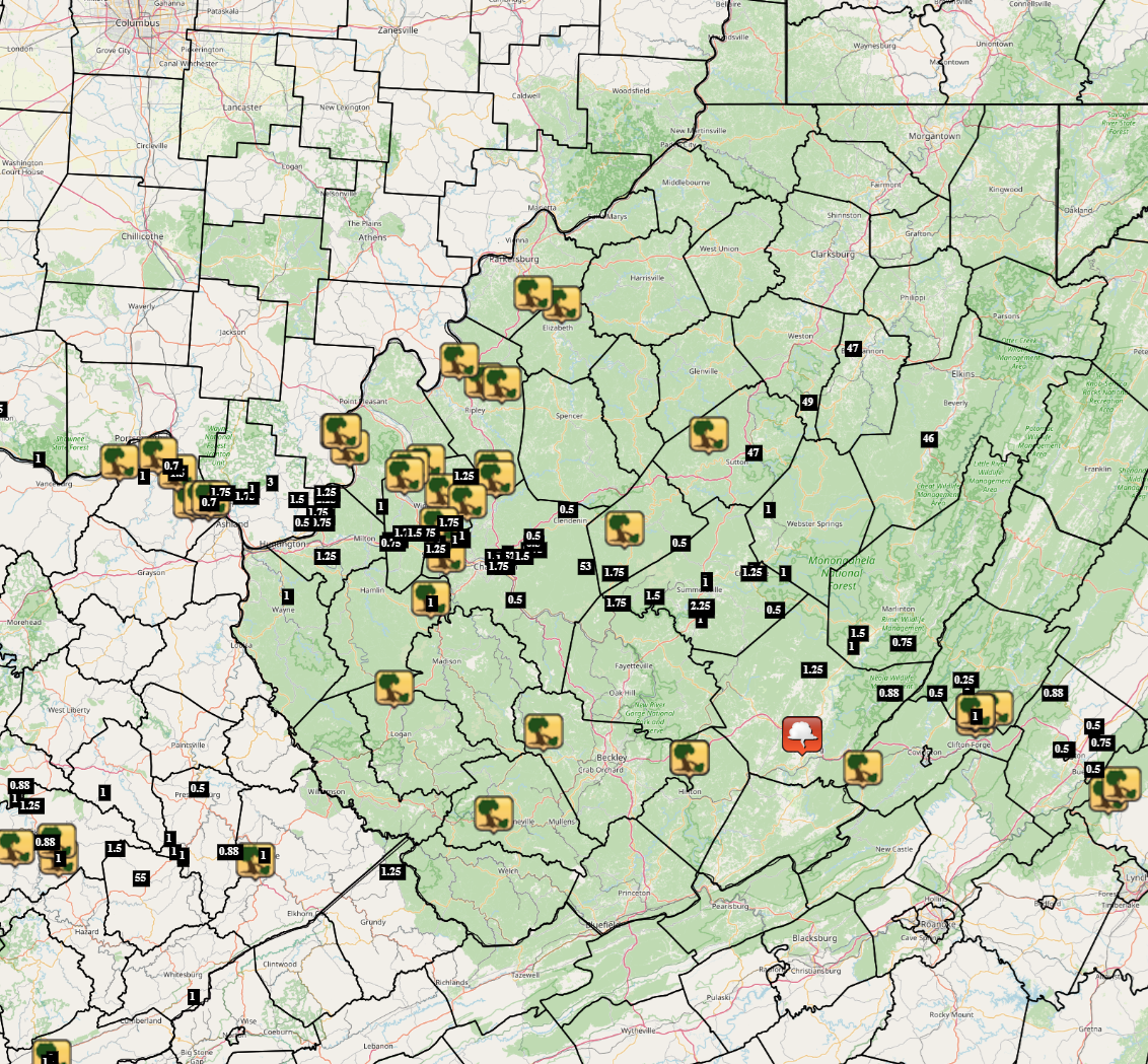
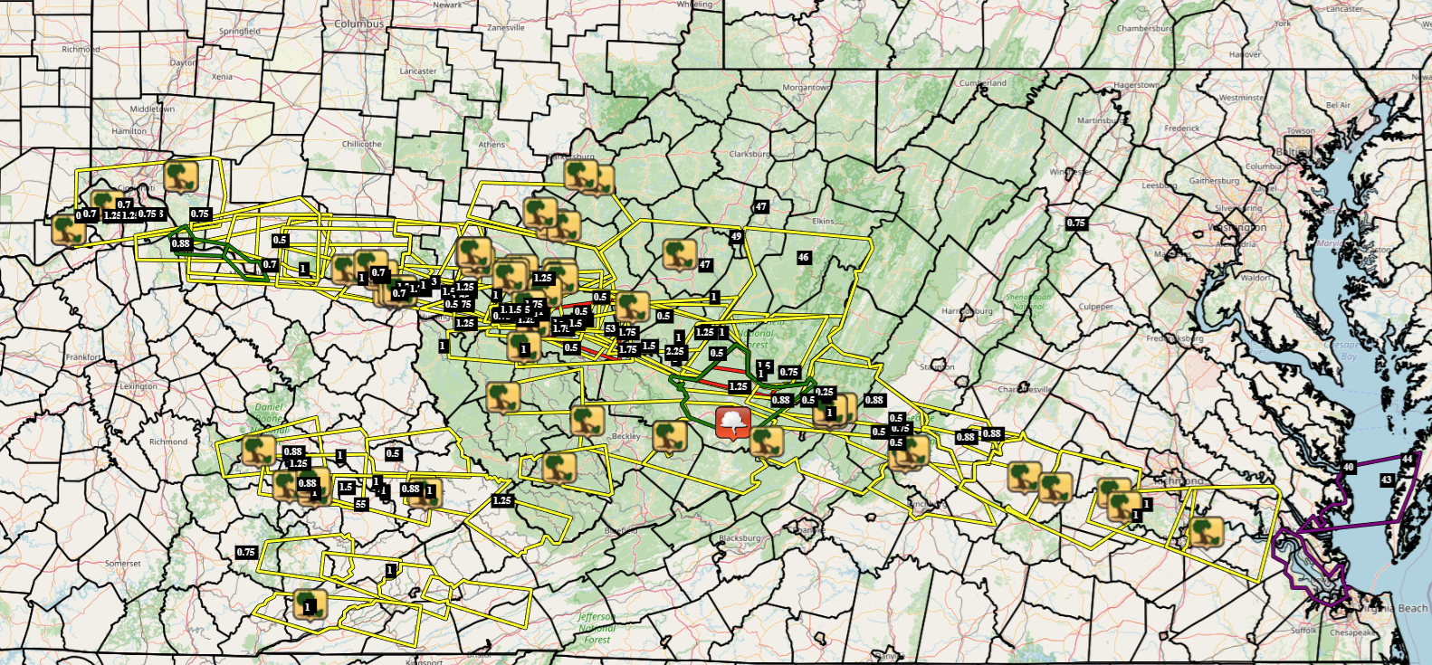
Map of April 14th Local Storm Reports
|
|
Please note that in the map above the tree symbol represents wind damage reports, the black text boxes represent either hail reports or wind gusts reports, while the cloud image represents a funnel cloud report.
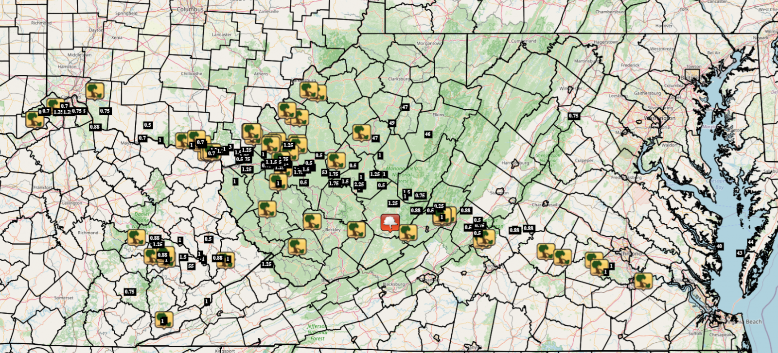
Map of April 14th Regional Storm Reports
|
|
Please note that in the map above the tree symbol represents wind damage reports, the black text boxes represent either hail reports or wind gusts reports, while the cloud image represents a funnel cloud report.
Map of April 14th Regional Storm Reports with Warnings Overlaid
|
|
Please note that in the map above the tree symbol represents wind damage reports, the black text boxes represent either hail reports or wind gusts reports, while the cloud image represents a funnel cloud report. Yellow polygons represent Severe Thunderstorm Warnings, red polygons represent Tornado Warnings, and green polygons represents Flood Warning or Advisory.
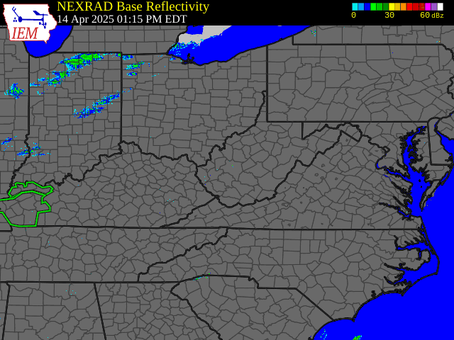
April 14th Time Synchronized Local/Regional Radar Loops
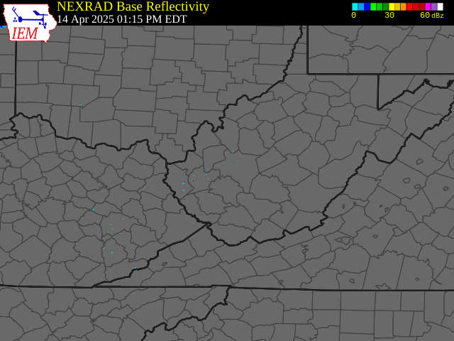 |
 |
|
April 14th Local Radar Loop (w/ Warnings Overlaid: Yellow - Severe Thunderstorm, Red - Tornado, Green - Flood) Radar loop courtesy of Iowa Environmental Mesonet (IEM) |
April 14th Regional Radar Loop (w/ Warnings Overlaid: Yellow - Severe Thunderstorm, Red - Tornado, Green - Flood) Radar loop courtesy of Iowa Environmental Mesonet (IEM) |
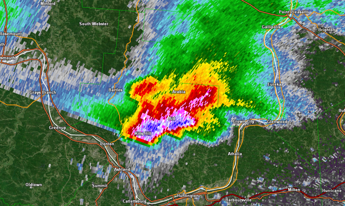
Radar Images Time Synchronized With When Some of the Largest Hail Fell
 |
 |
|
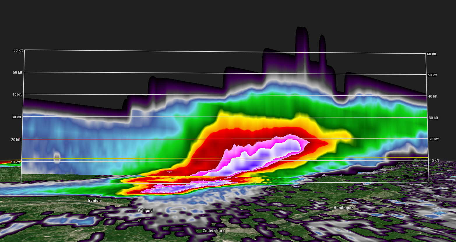
0.5 Degree Base Reflectivity from KRLX at 4:46 PM when the supercell was over Lawrence County, OH. Maximum reflectivity in this image is over 75 dBZ! Radar image courtesy of GR2Analyst |
A Cross-Section of the Base Reflectivity Image at 4:46 PM (left). This Cross-Section runs west-northwest (Left) to east-southeast (Right) and shows > 60 dBZ above 20,000 ft AGL (above ground level). The freezing level at this time was 12,000-13,000 ft AGL. Cross-Section image courtesy of GR2Analyst |
 |
 |
|
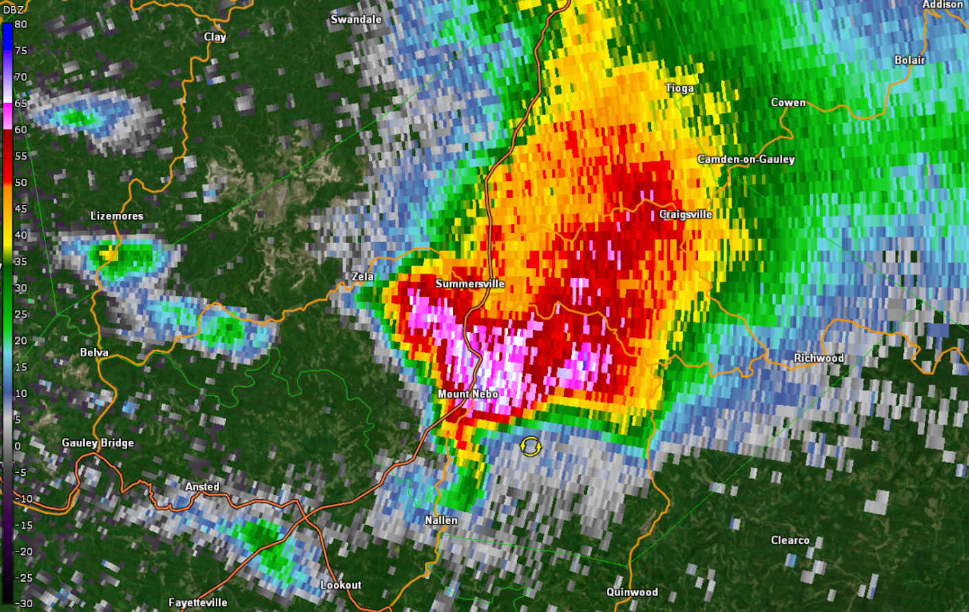
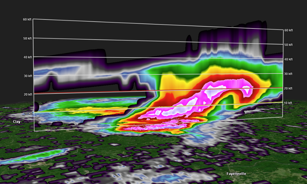
0.5 Degree Base Reflectivity from KRLX at 6:24 PM when the supercell was over Nicholas County, WV. Maximum reflectivity in this image is ~ 73 dBZ! Radar image courtesy of GR2Analyst |
A Cross-Section of the Base Reflectivity Image at 6:24 PM (left). This Cross-Section runs west-northwest (Left) to east-southeast (Right) and shows > 60 dBZ above 25,000 ft AGL (above ground level). The freezing level at this time was 12,000-13,000 ft AGL. Cross-Section image courtesy of GR2Analyst |
April 14th Time Synchronized Regional Satellite Loops
 |
 |
|
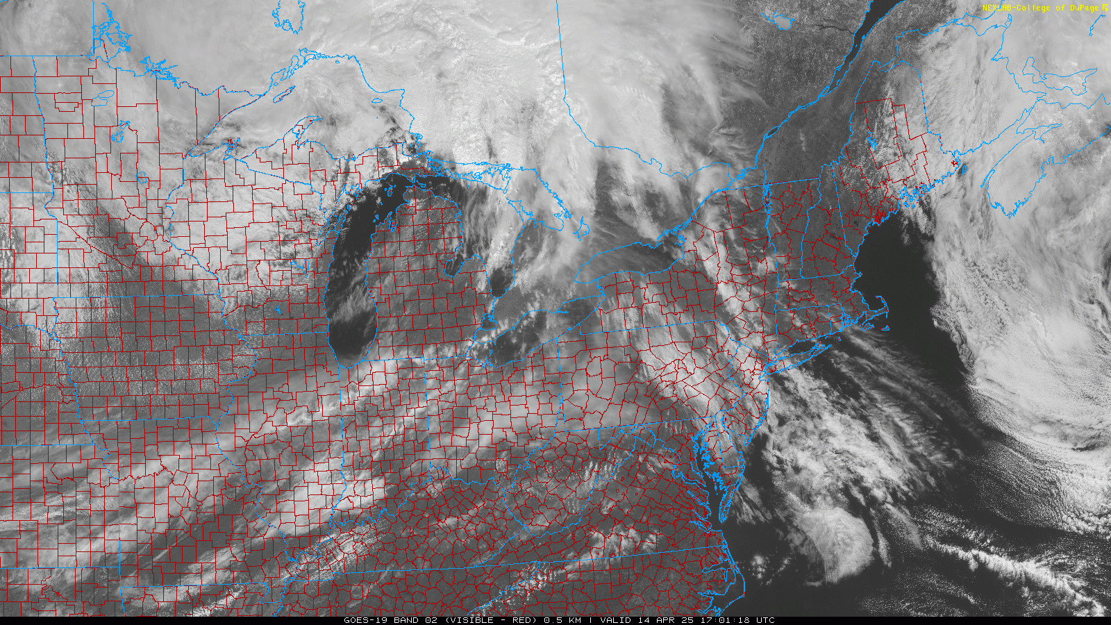
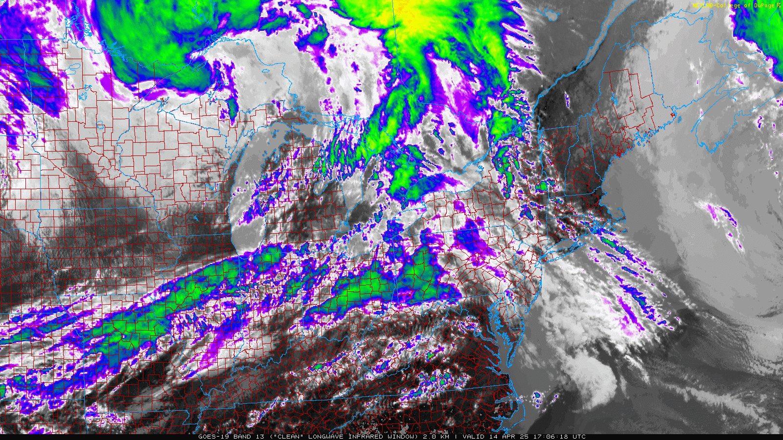
April 14th Visible Loop (GOES-16) Satellite loop courtesy of NEXLAB - College of Dupage |
April 14th Infrared Loop (GOES-16) Satellite loop courtesy of NEXLAB - College of Dupage |
April 14th Surface/Upper Air Maps and Severe Weather Parameters
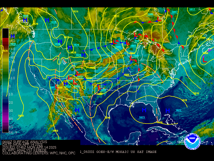
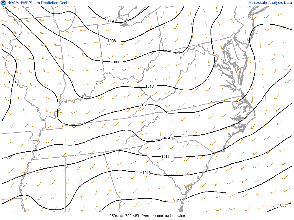
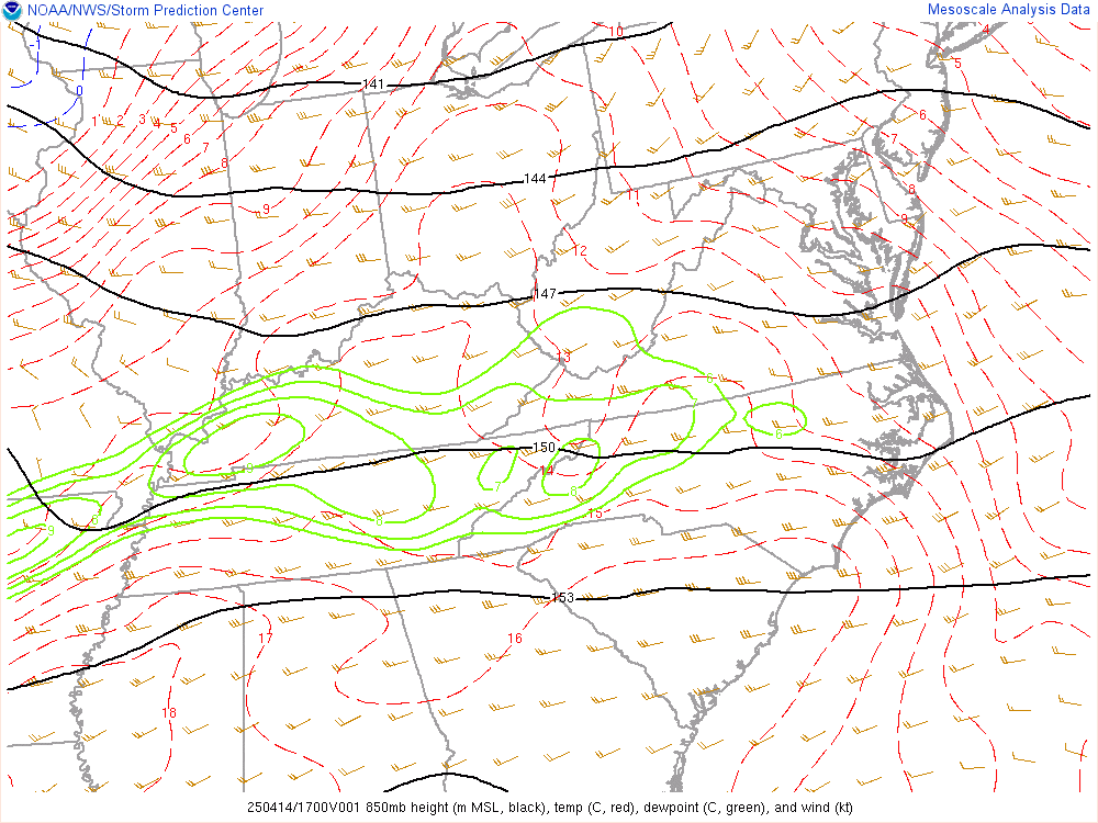
The regional loops below run from 1 PM April 14th until 12 AM April 15th at 1-hr intervals and are time synchronized. The infrared satellite loop w/ surface analysis overlay runs from 2 AM April 14th until 2 AM April 15th and is at 3-hr intervals. All loops are in Coordinated Universal Time (UTC or Z), which is a 4-hr offset from EDT (for example - 1200Z is equivalent to 8 AM EDT).
 |
 |
 |
|
Infrared Satellite w/ Surface Analysis Overlay Loop Credit: Weather Prediction Center |
Mean Sea Level Pressure and Surface Wind Loop Credit: Storm Prediction Center |
850 mb Analysis Loop Credit: Storm Prediction Center |
 |
 |
 |
|
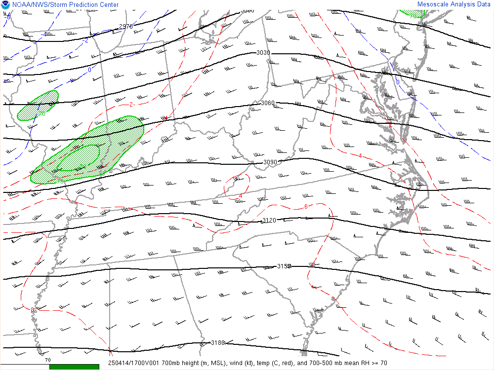
700 mb Analysis Loop Credit: Storm Prediction Center |
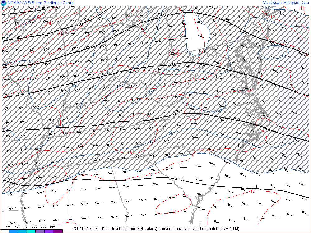
500 mb Analysis Loop Credit: Storm Prediction Center |
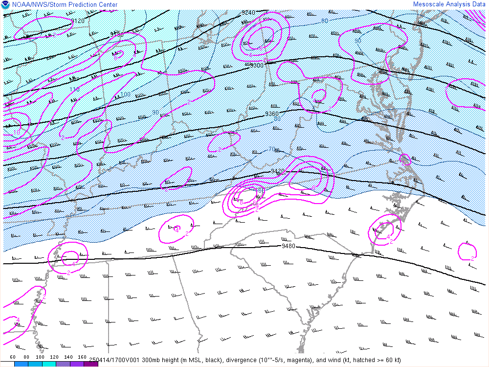
300 mb Analysis Loop Credit: Storm Prediction Center |
 |
 |
 |
|
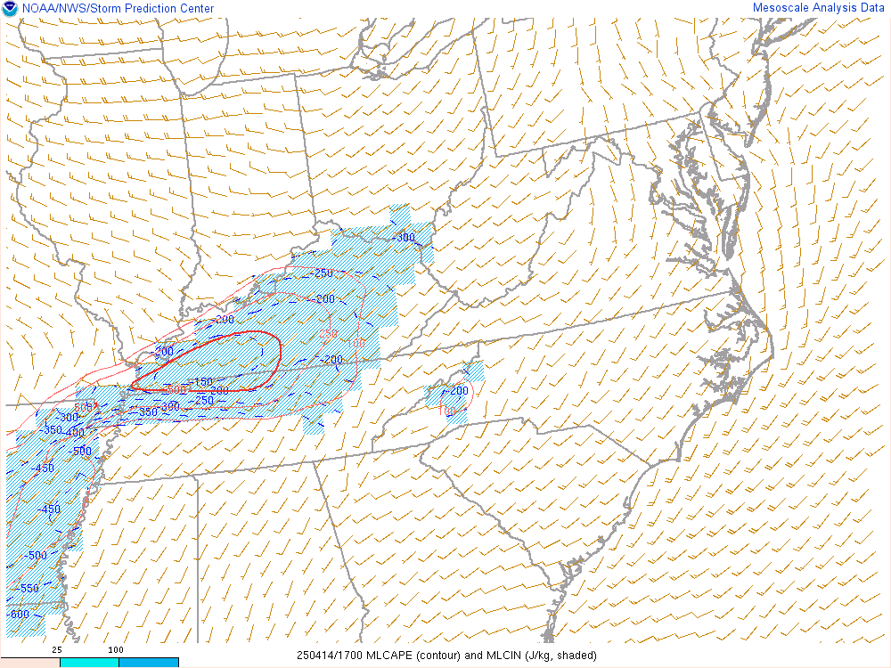
CAPE - 100mb Mixed-Layer Loop Credit: Storm Prediction Center |
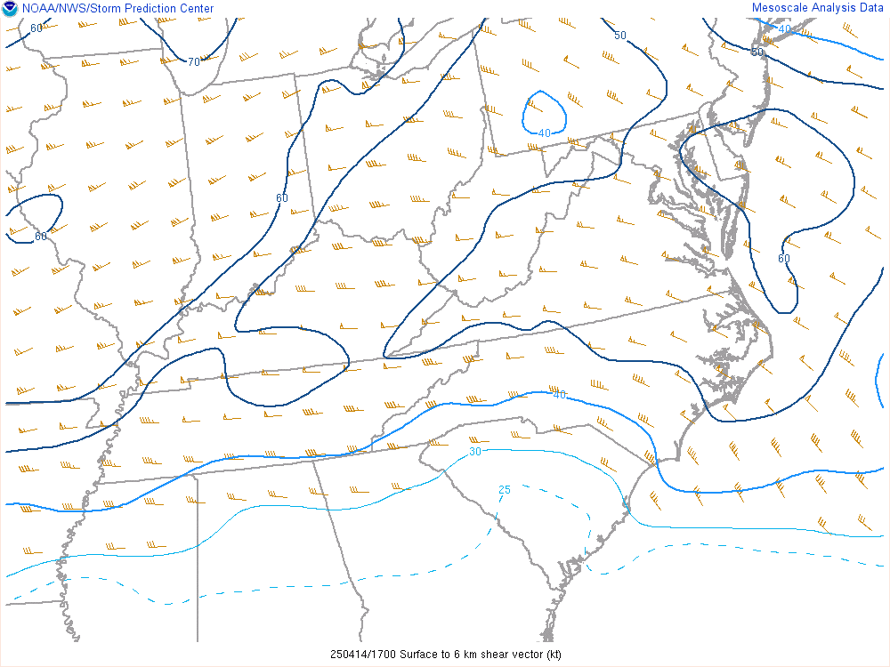
Bulk Shear - Sfc-6km Loop Credit: Storm Prediction Center |
Storm Relative Helicity - Sfc-3km Loop Credit: Storm Prediction Center |
 |
Media use of NWS Web News Stories is encouraged! Please acknowledge the NWS as the source of any news information accessed from this site. |
|