|
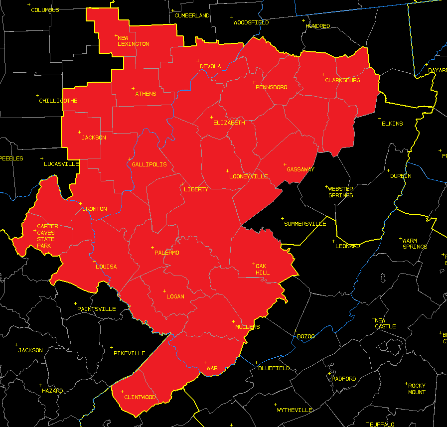
After consulting with neighboring National Weather Service offices, the NWS office in Charleston WV has expanded the start of the Spring Frost/Freeze program to include much of our forecast area. Some tender vegetation has emerged and the growing season has begun, leaving crops and gardens vulnerable to frost and freeze damage. We will issue Frost Advisories, Freeze Watches and Freeze Warnings, as needed, until the growing season ends in the fall. Please see the image (right) for an illustration of where the NWS Charleston spring growing season is active (highlighted in red). All images can be enlarged by clicking on them. |
|
 |
 |
 |
|
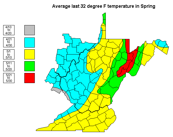
The above image shows the date on or after which the last 32 degree temperature will occur in 50 percent of the years. In other words, this map represents the average date of the start of the growing season. |
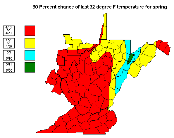
The above image shows the date on or after which the last 32 degree temperature will occur in 90 percent of the years. In other words, the last freezing temperature almost always occurs on or after these dates. |
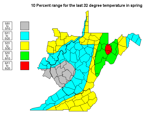
The above image shows the date on or after which the last 32 degree temperature will occur in 10 percent of the years. This would represent an unusually late start to the growing season across the region. |
 |
Media use of NWS Web News Stories is encouraged! Please acknowledge the NWS as the source of any news information accessed from this site. |
|