Event Summary
|
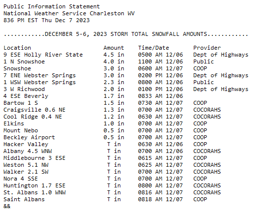
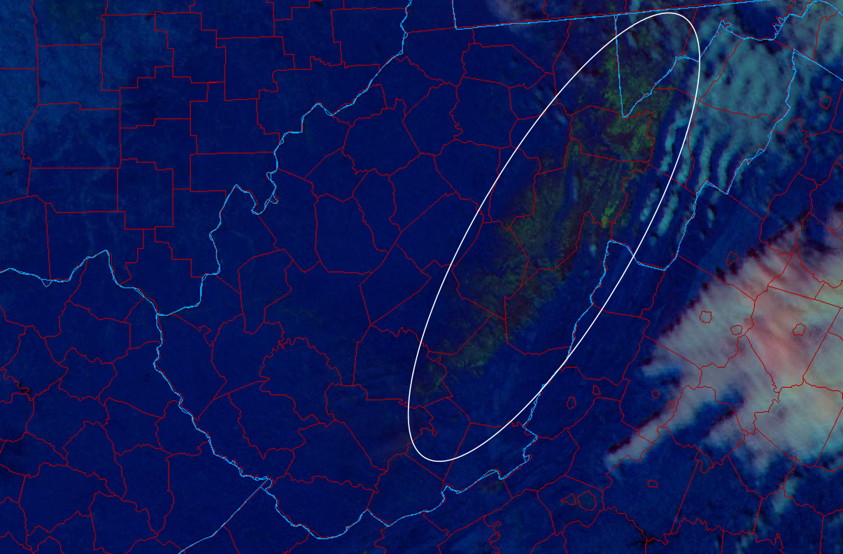
An Alberta Clipper crossed through the region late on Tuesday, December 5th. While precipitation would begin as rain across most locations outside of the mountains, a transition to snow showers would occur throughout Tuesday evening/night for all of the higher terrain as the system moved south of the region, with northwest flow and associated cold advection overtaking the area. Snow showers would continue at times throughout Wednesday courtesy of upslope flow, but would generally be on the lighter side by Wednesday afternoon/evening. Snowfall amounts of 1-4"+ were reported across the higher terrain of West Virginia in the NWS Charleston forecast area, with the highest amounts generally above 3,000 feet. While snow showers were observed across portions of the lowlands on Wednesday, no accumulation was noted. Storm total snowfall amounts can be seen in the top image. The bottom is a Day Cloud Phase Distinction RGB image from GOES-16 at 1:06 PM, December 7th, 2023 highlighting snow cover (in shades of green) across the higher elevations of the West Virginia mountains. This gives a good depiction of where accumulating snow fell with this event. Image Source: NEXLAB - College of Dupage Both images can be enlarged by clicking on them. |
|
 |
Media use of NWS Web News Stories is encouraged! Please acknowledge the NWS as the source of any news information accessed from this site. |
|