Event Summary
|
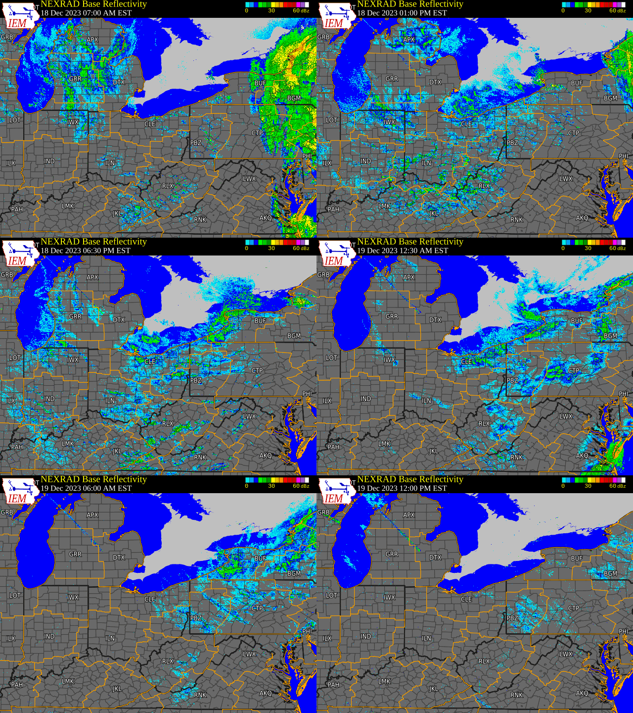
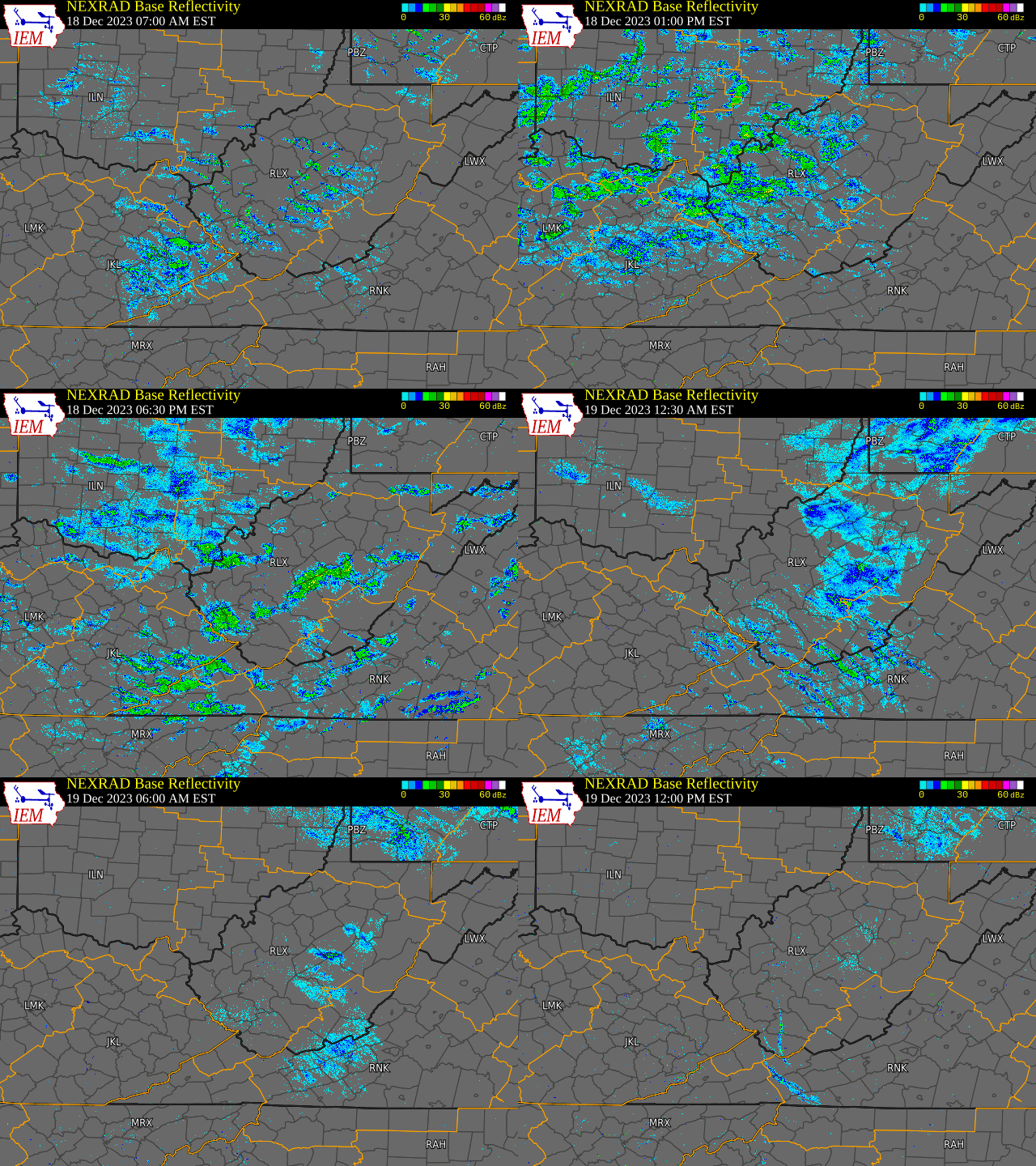
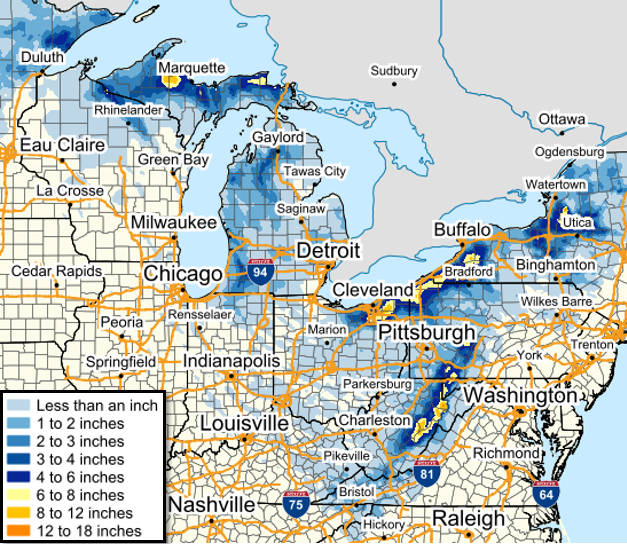
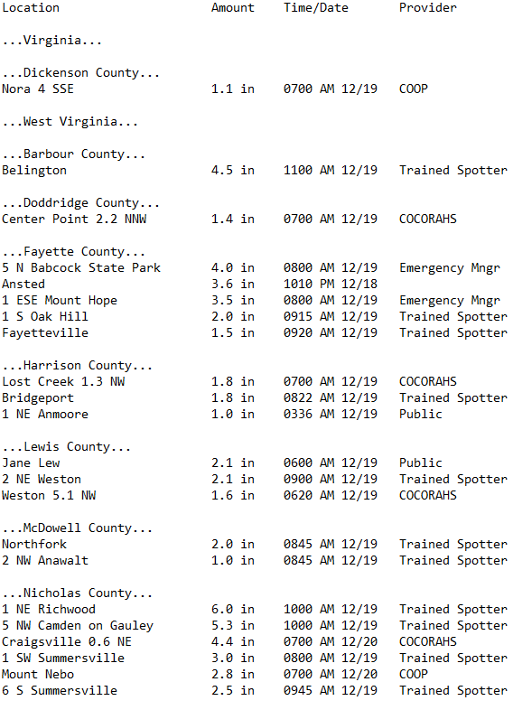
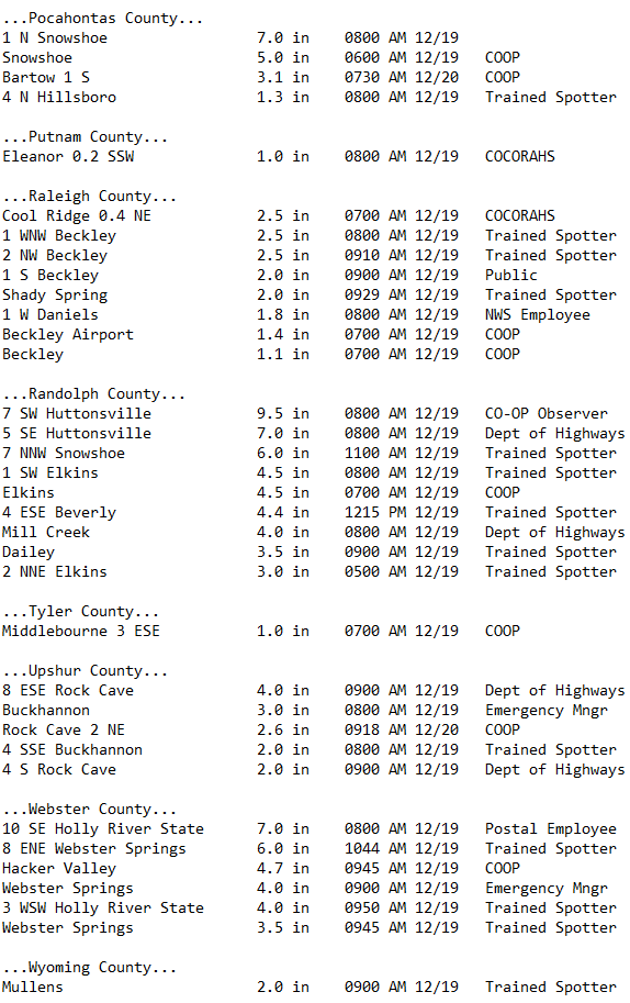
Snow showers occurred across the region on December 18-19, 2023, courtesy of a vigorous shortwave trough moving through the area and moisture from the Great Lakes. Snow would begin across the higher terrain throughout the morning of Monday, December 18th, with the lowlands transitioning from rain to snow during the late morning and afternoon hours. Activity would continue into the night, with snow showers becoming more confined to locations in/near the higher terrain by early Tuesday morning, with just remnant flurries across the mountains by the early afternoon hours. Gusty conditions would accompany the snow during this event across the higher elevations, with well below normal temperatures building in area-wide on Tuesday by the conclusion of the event. Temperatures on Tuesday and Tuesday night would range from ~ 10-15 degrees below normal across the region. Snowfall amounts across the lowlands were on the low side (generally 2" or less) as precipitation took longer to transition from rain to snow, with marginal air/ground temperatures also detracting from snowfall accumulations thereafter. Upslope flow and colder temperatures across the higher terrain would result in significantly greater amounts there. Totals in excess of 5" were reported across the higher mountainous terrain, with 2-4"+ across the surrounding lower mountain elevations. All images and loops can be expanded by clicking on them. |
|
December 18-19 Time Synchronized Radar Loops
 |
 |
|
Regional Radar Loop Radar loop courtesy of Iowa Environmental Mesonet (IEM) |
Local Radar Loop Radar loop courtesy of Iowa Environmental Mesonet (IEM) |
Regional Snowfall Totals and Local Satellite Image
 |
 |
|
Regional Snowfall Totals |
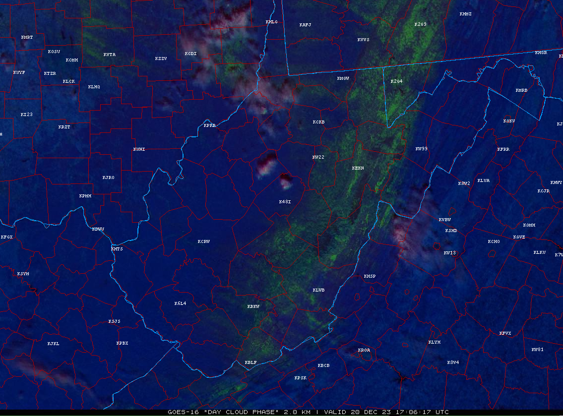
Day Cloud Phase Distinction RGB image from GOES-16 at 12:06 PM, December 20th, 2023 highlighting snow cover (in shades of green) from the event across the higher elevations Satellite image courtesy of NEXLAB - College of Dupage |
December 18-19 Storm Total Snowfall Amounts (1" and greater)
 |
Media use of NWS Web News Stories is encouraged! Please acknowledge the NWS as the source of any news information accessed from this site. |
 |