Flash Flood Safety PDF
There are several kinds of floods. The "traditional" flood results from days of heavy rain and/or melting snow, with rivers gradually rising and going over their banks. These can usually be predicted with considerable accuracy, providing adequate warnings that result in saving lives and reducing loss of property.
Flash floods are a different matter. They usually result from rapidly changing weather situations, such as the sudden development of an intense local storm over the drainage basin of a small stream or river. Rivers can rise way above flood stage in a matter of hours if not minutes. However, not all flash floods are caused directly by heavy rain. Ice and log jams can suddenly let loose huge torrents of water. Natural or constructed dams can collapse due to earthquakes or mudslides.
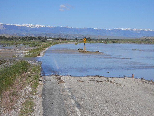
Why do so many people die in flash floods? Aside from the factor of surprise (many people are caught sleeping), people just don't appreciate the power of moving water. Even six inches of fast-moving flood water can knock you off your feet. Most automobiles will float and can be swept away in only two feet of water. Never try to walk, swim, or drive through the swift currents of a flash flood. Nearly half of all U.S. flash flood fatalities are auto related. Never attempt to drive over a flooded road. The depth of water is not always obvious. Also, the road bed may have been washed out under water. Dry creek beds can go from dusty bone dry to a ten-foot-deep torrent of water within a minute as the thunderstorm rains drain down from surrounding higher terrain.
 Many vehicle-related fatalities are preventable, but too many people continue to drive around the barriers that warn you the road is flooded. Whether you are driving or walking, if you come to a flooded road, Turn Around Don't Drown. You will not know the depth of the water nor will you know the condition of the road under the water. Click the TADD barricade image at left to visit the Turn Around Don't Drown Homepage. Check out the video below to see the dangers of driving across flooded roads.
|
| Turn Around Don't Drown Video |
In recent memory, one of most devastating flash floods to affect western and central Wyoming occurred in Kaycee on August 27, 2002. This flash flood was caused by thunderstorm rainfall of 6+ inches near this small town in Johnson County, Wyoming. To increase warning reception a NOAA Weather Radio was installed near Kaycee to commemorate the one year anniversary.
Flood and Flash Flood Terminology:
- FLASH FLOOD OR FLOOD WATCH: Flash flooding or flooding is possible within the designated WATCH area--Be alert to signs of flash flooding and be ready to evacuate on a moment's notice.
- FLASH FLOOD OR FLOOD WARNING: Flash flooding or flooding has been reported or is imminent, act quickly to save yourself. You may have only SECONDS!
- URBAN AND SMALL STREAM FLOOD ADVISORY: Flooding of small streams, streets, and low-lying areas, such as railroad underpasses and urban storm drains, is occurring. The Flood Statement will be used to issue this advisory.
- FLASH FLOOD OR FLOOD STATEMENT: Follow-up information regarding a flash flood/flood event.
The rule for being safe in a flooding situation is simple:
HEAD FOR HIGHER GROUND AND STAY AWAY FROM FLOOD WATERS!
NOAA Weather Radio All-Hazards is the quickest way to get notification of severe weather that may be affecting you. With changing technologies, there are also many other ways to receive weather information. Here are some of the ways you can keep up to date with the latest weather watches and warnings.
NOAA Weather Radio All-Hazards - Popular Features
 Tone Alarm: Most warnings and many watch messages are broadcast with a tone alarm. The tone will activate all the weather radio receivers which are equipped to receive it, even if the audio is turned off. This is especially useful for warnings which occur during the night when most people are asleep.
SAME: Specific Area Message Encoding (SAME) allows a user to specify the particular area for which you wish to receive alerts. This minimizes the number of "false alarms" for events which might not be impacting your area.
Selectable Alerting of Events: Some receivers allow a user to turn off the alarm for certain events which might not be important to you.
Battery Backup: Since power outages often occur during storms, having a receiver with battery backup can be crucial.
 External Antenna Jack: While most receivers come with a whip antenna which can usually be extended out from the unit, a user may need an external antenna to get a good reception. Some receivers come with an external antenna jack (normally in the back of the unit) which will allow a user to connect to a larger antenna (indoors or outdoors).
Strobe Light: A strobe light accessory provides a visual alert. It's ideal for the hearing-impaired and for use in noisy production environments like metal working facilities to alert personnel of a warning.
Other Sources
Internet: The National Weather Service's webpage at weather.gov allows you a fast and easy look at where the hazards are occurring for the current day. To find out information for your local area, just click on the map in your general area.
Broadcast TV and Radio Stations: Most local radio and television stations across the state automatically receive hazardous watches and warnings and help disseminate that information over the air. They have local knowledge and want to be able to provide their viewers and listeners with the best information they can.
Wireless / Cell Phone technologies: Many cell phone providers are including an option of getting warnings on your cell phone through text messaging or other means. Check with your provider to see if they offer a service like this. There are also some NWS programs that allow you to get alerts on your mobile device. For more information see: www.srh.noaa.gov/cte.htm
Weather Radio Sites Across The Region
Areas displayed in white indicate the best signal coverage.

Surrounding States Coverage Maps: Colorado | Utah | Idaho | Montana | South Dakota | Nebraska
All Frequencies in MHz
Wyoming
Afton
Casper
Cheyenne
Cody
Dubois
Evanston
Gillette
Glendo
Grant Village
Jackson
Kaycee
Kemmerer
Lander
Mammoth
Newcastle
Pinedale
Rawlins
Rock Springs
Sheridan
Thermopolis
Worland |
162.425
162.400
162.550
162.400
162.450
162.450
162.500
162.450
162.450
162.525
162.550
162.525
162.475
162.425
162.475
162.500
162.425
162.550
162.475
162.500
162.525 |
Montana
Baker
Belgian Hill
Billings
Bozeman
Broadus
Browning
Butte
Circle
Dillon
Forsyth
Glasgow
Glendive
Glentana
Great Falls
Hardin
Havre
Helena
Jordan
Kalispell
Lewistown
Livingston
Malta
Miles City
Missoula
Plentywood
Poplar
Ryegate
Scobey
Winnett |
162.550
162.500
162.550
162.500
162.425
162.525
162.550
162.550
162.475
162.525
162.400
162.475
162.525
162.550
162.450
162.400
162.400
162.500
162.550
162.500
162.525
162.475
162.400
162.400
162.475
162.425
162.450
162.450
162.400 |
Colorado
Ft Collins
Greeley
Sterling
Mead/Longmont
Grand Junction
Idaho
Bonners Ferry
Driggs
Pocatello
Salmon
Relay Ridge
South Dakota
Lead
Hot Springs
Nebraska
Chadron
Scottsbluff
Utah
Bear Lake
Logan
|
162.450
162.400
162.400
162.475
162.550
162.500
162.450
162.550
162.500
162.450
162.525
162.425
162.525
162.475
162.500
162.400
|
Additional Information
NWS Weather Radio Home Page
StormReady
For additional information, contact your local NWS office: