Virtual Tour Navigation: Go Back | Go Forward | Tour Directory
Page: 1 2 3 4 5 6 7 8 9 10 11 12 13 14 15 16 17 18
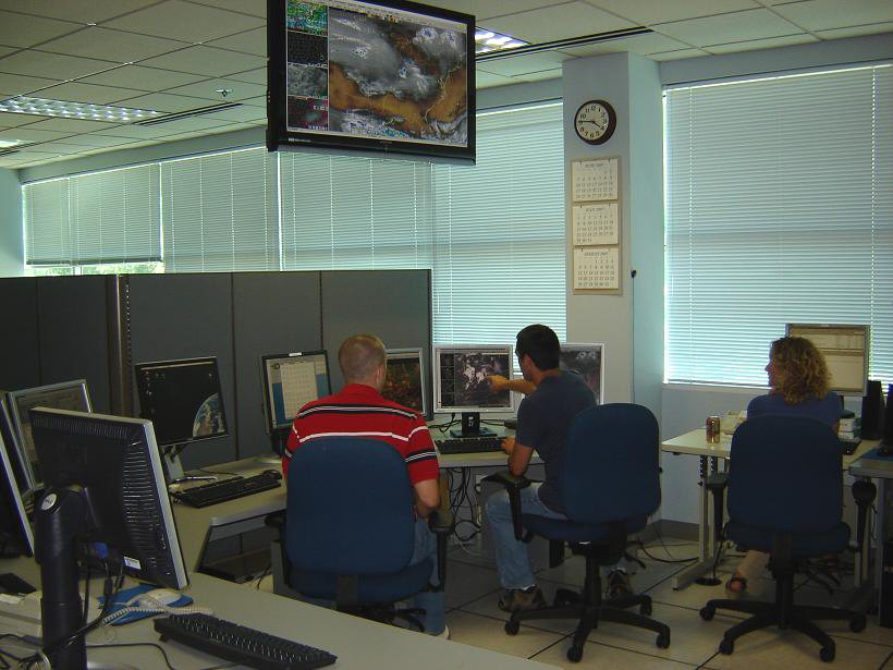
The operations area is the heart of the NWS forecast office. This is where the meteorologists conduct analysis, produce the forecasts, issue the watches and warnings, and much more.

There are always at least two forecasters on duty in the operations area. These forecasters are present 24 hours a day, 7 days a week, 365 days a year. Depending upon the expected weather during the next 7 days, forecasters can divide the workload in a variety of ways. Typically though, one forecaster will focus on the "short term" which will vary in length but will generally be the first 24 to 48 hours and the other forecaster will be responsible for the longer term beyond. The forecasters will work together to create the regular 7 day forecast that includes sky condition, temperature, wind, and the chance of precipitation that most folks are familiar with. The forecasters will also compose a technical Area Forecast Discussion, the Hazardous Weather Outlook, and any non-routine products that are necessary to alert the public to hazardous weather. Some of the most common products of this type include flood watches and warnings, winter storm watches and warnings, freeze warnings, heat advisories, and dense fog advisories.
In addition the forecasters will also be responsible for forecast products that are tailored to specific user groups. For example, he/she will write a set of coded products intended for use by airports, pilots and others associated with the aviation industry called TAF's. The forecasters will also prepare a routine Fire Weather Forecasts and issue spot forecasts on demand to help foresters with prescribed burns or wild fires.
Other staff members will be present in the operations area during much of the day. These staff members have a variety of responsibilities including data collection and quality control of hydrometeorological data, issuing any necessary river flood warnings or statements, and ensuring that the NOAA Weather Radio All Hazards broadcast is running properly. A computer system called the Broadcast Message Handler (BMH) translates text products into a computer-generated voice that is broadcast over the weather radio. During active or severe weather, the operational staff may be tasked with updating or creating forecasts, collecting ground truth or spotter reports for verification, and issuing some warning products.
A variety of other activities occur in the operations, especially during active or severe weather. Ham radio operators from Skywarn, which is a National Weather Service program of trained volunteer severe weather spotters, may be present at the Ham radio console relaying storm reports. Staff members may also be providing briefings to the local media, emergency managers, spotters, and other decision makers.
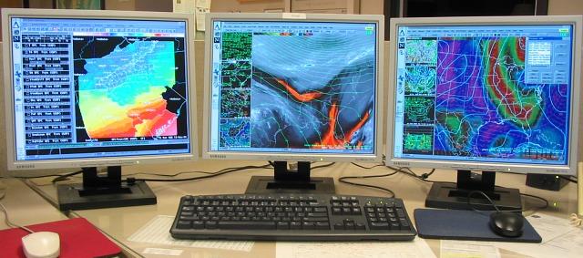
 The primary computer system we use to prepare our forecasts is called the Advanced Weather Interactive Processing System, or AWIPS. This state-of-the-art computer hardware and software allow forecasters to view many different types of meteorological data on one system. Each AWIPS workstation consists of three graphics monitors and one text workstation. There are six AWIPS workstations in our office.
The graphics monitors are capable of displaying up to 20 different windows, each containing its own display of weather information. Forecasters interrogate radar and satellite imagery, lightning data, upper air data generated by weather balloons, observed surface weather, and a plethora of numerical model data. These fields can be looped, zoomed, and even overlaid on one another. Prior to AWIPS, forecasters had to use several different machines to view all of these different types of data. The text workstation is used to prepare and disseminate forecast and warning products as well as to look at various text products such as weather discussions.