Virtual Tour Navigation: Go Back | Go Forward | Tour Directory
Page: 1 2 3 4 5 6 7 8 9 10 11 12 13 14 15 16 17 18
The NWS issues a comprehensive package of forecast products to support a variety of users twice a day. In addition, a late morning and evening update are typically issued. Additional updates are produced as conditions warrant. Although text forecasts have been the primary means of product dissemination for many years, the NWS has converted many of its forecast products to a digital, gridded format. Each of the 123 NWS Weather Forecast Offices send their gridded forecasts to a national server to be compiled in the National Digital Forecast Database (NDFD). The NDFD is a national gridded forecast database of sensible weather elements including maximum and minimum temperature, humidity, cloud cover, probability of precipitation, weather type, wind direction, and wind speed produced by local forecast offices. Most of the primary forecast products issued by the NWS including those for the public, fire weather, and marine users originate via the gridded forecast database.
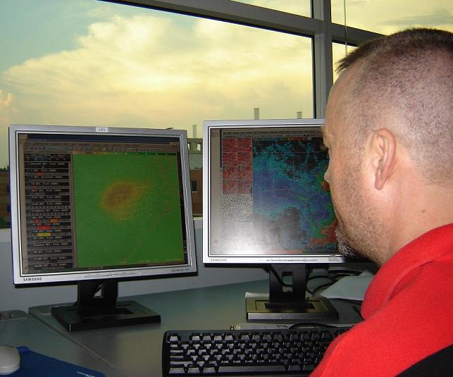
Once a meteorologist has thoroughly reviewed the current weather situation and has conceptualized the forecast, it is time to make the forecast. Forecasters will write an Area Forecast Discussion (AFD) which is a narrative text product that explains the meteorological reasoning behind the forecast. The AFD was originally intended as a coordination tool between adjacent forecast offices but it has also evolved into a communication tool for our users including local meteorologists, the media, emergency managers, spotters, and the public.
Forecasters use a program called GFE (Graphical Forecast Editor) to create the forecast. GFE allows the forecaster to draw "grids" of the expected weather conditions for various forecast parameters including high and low temperatures, relative humidity, wind, sky cover, probability of precipitation, and weather type. Data from computer models and current observations are used to assist this process. The forecast parameters are stored in a local database. The database is then shared among neighboring offices which allows forecasters to collaborate with their neighbors, to make sure there are no drastic changes across NWS coverage areas.
Once the forecasters have created the gridded forecasts in their local database and the forecast has been collaborated and quality controlled, the forecast is then placed in the official database. Formatters within the GFE program are used to create text products from the official database. Some of the text products generated from the formatters include the Zone Forecast Product (ZFP), Area Forecast Matrix (AFM), and Point Forecast Matrix (PFM). The text products are then transmitted to the public, media, emergency managers, and other users.
 Other programs create graphical images from the official database for display on the local NWS websites. Finally, the official database is then transmitted to the NDFD where it is mosaiced with the official database from other NWS offices to form the NDFD.
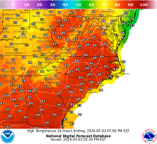
The image to the right is the current forecast high temperature for the first day of the current forecast across the Mid Atlantic region from the NDFD. The same data can also be viewed in detail across the NWS Raleigh CWA. Additional details on the National Digital Forecast Database (NDFD) are available at https://digital.weather.gov/.


 Heat Safety
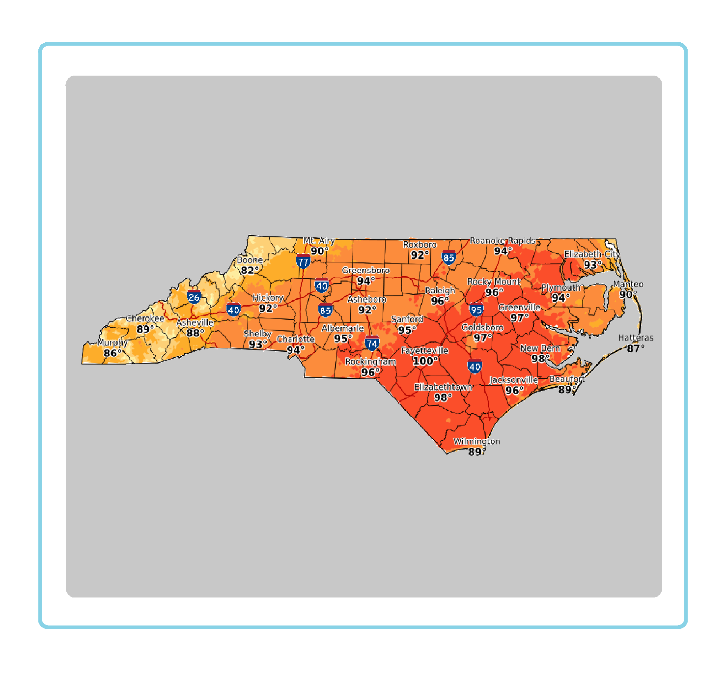 Statewide Maps
 Forecaster Discussion
 Current Condtions